Map of Bidden Road
| Postcodes | ||
|---|---|---|
| Icon | Postcodes for Bidden Road | |
| Walking Distances | ||
| Distance Info | Green Circle = 10 Minutes Walk (800 metres) | |
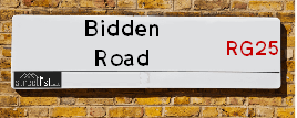
About Bidden Road
Bidden Road is a street located in the village of Little Hoddington and near the village of Little Hoddington. The street has a length of approximately 4,332 metres.
Bidden Road is located within the Hart District and Basingstoke and Deane District (B) Council's jurisdiction. They provide various services, like refuse collection, and manage council tax collection. It's situated in the South East region of the UK.
Bidden Road has been assigned the Unique Street Reference Numbers of 16708340, 2100163 and 2107761 in the National Street Gazetteer.
Bidden Road is located within the county of Hampshire, situated in the South East region of the UK. It's 41.72 miles South West from central London., 4.72 miles East from Basingstoke, 14.75 miles South from Reading and 17.71 miles West from Guildford.

Do you know why this road is called Bidden Road?
What's it like to live here?
Ask the community a question about Bidden Road.
Do you have any questions, memories to share or know any facts about Bidden Road? We'd love to know more.
Also on streetlist.co.uk, can you help?
Eldroth Road
15th April 2024
I wondered if anyone has any old pictures of Wenning Bank House in the 1940’s and also Lane Side before of the same era .. we visited today with my Mum in law as she used to live at both these properties. Also any photos of the schools around that time .. thank you.
Can You Help?Napps Way
15th April 2024
Why is the road called Napps Way (belonging to Napp, but minus an
apostrophe as is usual with such nomenclature)? Moreover, who or
what is, or was, “Napp” in the respective, possessive case?
Several years ago, I met an elderly man (probably in his late-eighties)
who lives on Bentham Drive, Liverpool 16, and during a conversation
with him whilst in a Northwest Passenger Transport Ambulance on the
way to the former RLUH (Royal Liverpool University Hospital), he told
me that he could remember (when he was a boy, living in Childwall,
Liverpool 16) that, “Where Napps Way is now, during WW2, there was
a two-man gun emplacement on the, then, open land to protect the
railway line passing over Childwall Valley Road - next to the railway
bridge - when suddenly, as they were loading a live “shell” into the gun’s
breach, the aforementioned “shell” accidentally exploded in the gun’s
breach killing both of the two soldiers, that had been manning the gun,
instantly! (Very sad, of course, but could - perhaps - two ghosts relating
to those two, very unfortunately and prematurely-killed soldiers have
haunted that place of their deaths ever since - and have any residents
of Napps Way - formerly and in its latest incarnation - seen two, WW2
(uniformed) soldiers unexpectedly appear in or near their homes?)
Mauritius Road
15th April 2024
Why is Mauritius Road so called, since when and by whom? Does Greenwich have any particular links with Mauritius? Very interested to know. 🤞🏼
Can You Help?Estate Agents near Bidden Road
| Name | Address | Website |
|---|---|---|
| McCarthy Holden | 95 High Street, Odiham, RG29 1LA | Visit Website |
| Strutt & Parker | 82 High Street, Odiham, Hampshire, RG29 1LP | Visit Website |
| Bridges Estate Agents | 3 Fairholme Parade Station Road Hook RG27 9HE | Visit Website |
Hotels near Bidden Road
Budget Hotels near Bidden Road
| Budget Hotel Name | Distance (miles) |
|---|---|
| 1: Name:Premier Inn Basingstoke Town Centre Address:Victoria Street Telephone: Visit Site |
4.91 |
| 2: Name:Travelodge Basingstoke Address:Stag & Hounds, Winchester Rd, Basingstoke, RG22 6HN Telephone:0871 984 6009 Visit Site |
5.84 |
| 3: Name:Premier Inn Basingstoke West Churchill Way Address:Basingstoke Leisure Park Telephone: Visit Site |
6.27 |
| 4: Name:Days Inn Hotel Fleet Address:Welcome Break Service Area, M3 Motorway, Hartley Wintney Telephone: Visit Site |
6.48 |
| 5: Name:Premier Inn Fleet Address:7-11 Fleet Road Telephone: Visit Site |
7.11 |
Location Details
| Bidden Road | |
|---|---|

| |
| Latitude | 51.241704 |
| Longitude | -0.979560 |
| OS Easting (X): | 471223 |
| OS Northing (Y): | 149721 |
| OS Grid Reference: | SU712497 |
Ordnance Survey Maps for Bidden Road
If you purchase a map through the links below, we may earn an affiliate commission.
| Map Series | link | Ordnance Survey |
| Explorer 1:25,000 144 Basingstoke, Alton and Whitchurch | Check Price on Amazon | Buy Direct from the Ordnance Survey |
| Landranger 1:50,000 186 Aldershot & Guildford | Check Price on Amazon | Buy Direct from the Ordnance Survey |
Neighbourhood Policing |
| Police Force: Hampshire |
 View Neighbourhood Crime and Policing View Neighbourhood Crime and Policing |
| Find a Local Neighbourhood Watch Scheme |
Frequently asked Questions for Bidden Road
What Council (Local Authority) is Bidden Road in?
Bidden Road is located within the local authority area of Basingstoke and Deane Council which is a District Council.
What Parish Council is Bidden Road in?
Bidden Road is located within the area of Upton Grey Parish Council.
What Electoral Ward is Bidden Road in?
Bidden Road is located within the ward of Basing & Upton Grey.
What County is Bidden Road in?
Bidden Road is located within the ceremonial county of Hampshire.
What Constituency is Bidden Road in?
Bidden Road is located within the constituency of North East Hampshire.
What Part of the UK is Bidden Road in?
Bidden Road is located within the South East (England) region of the United Kingdom.
What County Council area is Bidden Road in?
Bidden Road is located within the Hampshire Council area.
What Police Force area is Bidden Road in?
Bidden Road is located within the Hampshire Police area.
Roads that have a Junction with Bidden Road
| Street | Junction Type |
|---|---|
| Little Hoddington Close | junction |
| Meadowside | junction |
| Ford Lane | junction |
| Ford Lane | junction |
| Deptford Lane | junction |
| West Street | junction |
Sunset and Sunrise times for Bidden Road
| Sunrise | 05:57 |
|---|---|
| Sunset | 20:08 |
Latest Weather Conditions for Bidden Road
| Observed at Weather Station: | Odiham 19 April 2024 at 05:00 (1.56 miles away) |
|---|---|
| Current Weather: | Overcast |
| Temperature and Humidity: | 9.5°C (85.4%) |
| Wind Direction and Speed: | W (14 mph) |
Population Statistics
| ONS Area Code | E00114705 & E00114703 |
|---|---|
| ONS Area Name | Ageing in Suburbia & Established Farming Communities |
| Average Age | 45.50 |
| Area Population | 1329.00 |
| Male Population | 665.00 (50%) |
| Female Population | 664.00 (50%) |
| LSOA Code: | E01022562 |
|---|---|
| LSOA Name: | Basingstoke and Deane 017E |
| SOA Code: | 2b |
| SOA Name: | |
| MSOA Code: | E02004691 |
| MSOA Name: | Basingstoke and Deane 017 |
Nearest Supermarkets
| Tesco Hook Superstore |
|---|
| Station Rd, Hook, RG27 9JE |
| 0345 677 9352 |
| Distance: 2.74 Miles |
| Directions from Bidden Road to Tesco Hook Superstore |
| Tesco Chineham Lychpit Express |
|---|
| Lychpit Local Centre, Chineham, Basingstoke, RG24 8TF |
| 0345 026 9191 |
| Distance: 4.15 Miles |
| Directions from Bidden Road to Tesco Chineham Lychpit Express |
| Tesco Basingstoke Superstore |
|---|
| District Shopping Centre, Chineham, Basingstoke, RG24 8BE |
| 0345 677 9039 |
| Distance: 4.49 Miles |
| Directions from Bidden Road to Tesco Basingstoke Superstore |
| Iceland Chineham |
|---|
| Store B Chineham Centre, Basingstoke, Hampshire, RG24 8BQ |
| 01256321723 |
| Distance: 4.54 Miles |
| Directions from Bidden Road to Iceland Chineham |
Telephone Information
| Area Code |
|---|
| Area Code: 01256 - Basingstoke |
| Area Code: 01420 - Alton |
Broadband Information
| Speed | Average Speed | Median Speed | Maximum Speed | Next-generation access (NGA) | Number of Connections |
|---|---|---|---|---|---|
| Less than 2 Mbps | 2.9 | 2.8 | 5.3 | N | 5 |
Local Government
| Local Council Details |
|---|
| Within the area of Basingstoke and Deane |
| Visit the Council's Website |
| Civic Offices, London Road, Basingstoke, Hampshire &RG21 4AH |
| Send email |
| Telephone Number: 01256 844 844 |
| Local Member of Parliament |
|---|
| Within the Westminster Parliamentary Constituency of North East Hampshire |
| The Member of Parliament is Ranil Jayawardena |
| Details for the MP Ranil Jayawardena on parliament.uk |
| Details for the MP Ranil Jayawardena on theyworkforyou.com |
| In the 2019 General Election Ranil Jayawardena won with a majority of 20,211 the result was Con hold. The total electorate was 78,954 |
| Wards, Parish Councils and County Councils |
|---|
| Ward: Basing & Upton Grey Ward |
| Ceremonial County: Hampshire |
Nearest Schools
| Name | Address | Postcode | Telephone | Type | Distance (Km) |
|---|
Data accessed from gov.scot 08-08-2019
Nearest Hospitals
| Name | Address | Postcode | Distance | Map |
|---|
Nearest Dentists
Dentists near Bidden Road
| Name | Address | Postcode | Distance | Map |
|---|
Nearest GP Surgeries
Doctors near Bidden Road
ODIHAM HEALTH CENTRE
Address: DEER PARK VIEW, ODIHAM, HOOK, HAMPSHIRE, RG29 1JY
Distance: 1.89 miles
Contact: tel: 01256 702371
OLD BASING SURGERY
Address: 2 LINDEN COURT, LINDEN AVENUE, OLD BASING, BASINGSTOKE, HAMPSHIRE, RG24 7HS
Distance: 3.16 miles
Contact: :
HOOK SURGERY
Address: READING ROAD, HOOK, HAMPSHIRE, RG27 9ED
Distance: 3.17 miles
Contact: :
ODIHAM AND OLD BASING HEALTH CENTRES - COVID LOCAL VACCINATION SERVICE 2
Address: MANOR DRIVE, CHINEHAM, BASINGSTOKE, RG24 7AE
Distance: 3.51 miles
Contact: :
OLD BASING SURGERY (MANOR LANE)
Address: MANOR LANE, OLD BASING, BASINGSTOKE, HAMPSHIRE, RG24 7DG
Distance: 3.54 miles
Contact: :
LYCHPIT SURGERY
Address: GREAT BINFIELDS ROAD, LYCHPIT, BASINGSTOKE, HAMPSHIRE, RG24 8TF
Distance: 4.13 miles
Contact: tel: 01256 469677
Nearest Dispensing Chemists
Pharmacies near Bidden Road
| Name | Address | Postcode | Telephone | Map | Distance in Km |
|---|
Nearest Opticians
Opticians near Bidden Road
BROWN AND WHITE OPTICIANS LTD (HOOK)
Address: BOURNE HOUSE, LONDON ROAD, HOOK, HAMPSHIRE, RG27 9DJ
Distance: 2.91 miles
Contact: :
BASINGSTOKE
Address: DISTRICT SHOPPING CENTRE, CHINEHAM, BASINGSTOKE, HAMPSHIRE, RG24 8BE
Distance: 4.49 miles
Contact: :
CHINEHAM CENTRE OPTICIANS
Address: 17 CHINEHAM SHOPPING CENTRE, CHINEHAM, BASINGSTOKE, HAMPSHIRE, RG24 8BQ
Distance: 4.54 miles
Contact: :
SPECCIES - THE SPECS WAREHOUSE (BERESFORD CENTRE)
Address: 9 THE BERESFORD CENTRE, WADE ROAD, BASINGSTOKE, HAMPSHIRE, RG24 8FA
Distance: 4.57 miles
Contact: :
BUYSPECS DIRECT (BASINGSTOKE)
Address: YARD HOUSE, MAY PLACE, BASINGSTOKE, HAMPSHIRE, RG21 7NX
Distance: 4.81 miles
Contact: :
LEIGHTONS OPTICIANS (BASINGSTOKE)
Address: 9-11 CHURCH STREET, BASINGSTOKE, HAMPSHIRE, RG21 7QG
Distance: 4.90 miles
Contact: :
Transport
Nearest Rail Stations
Hook Station is 2.76 miles away.
Address: Hook station, Station Approach / Road, Hook, Hampshire, RG27 9HS
Hook is situated on the South Western Main Line and is managed by South Western Railway.
Hook Station is staffed on a part time basis.
Winchfield Station is 4.33 miles away.
Address: Winchfield station, Station Road, Winchfield, Hampshire, RG27 8BX
Winchfield is situated on the South Western Main Line and is managed by South Western Railway.
Winchfield Station is staffed on a part time basis.