Map of Birmingham Road
| Postcodes | ||
|---|---|---|
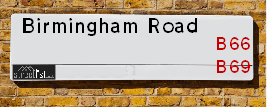
| Icon | Postcodes for Birmingham Road | |
| Walking Distances | ||
| Distance Info | Green Circle = 10 Minutes Walk (800 metres) | |
About Birmingham Road
Birmingham Road is a street located in the town of Oldbury. The street has a length of approximately 1,006 metres.
Birmingham Road is located within the Sandwell District (B) Council's jurisdiction. They provide various services, like refuse collection, and manage council tax collection. It's situated in the West Midlands region of the UK.
Birmingham Road has been assigned the Unique Street Reference Number of 33605320 and 33680020 in the National Street Gazetteer.
Birmingham Road is located within the county of West Midlands, situated in the West Midlands region of the UK. It's 106.5 miles North West from central London., 4.62 miles West from Birmingham, 21.9 miles West from Coventry and 23.28 miles North East from Worcester.

Do you know why this road is called Birmingham Road?
What's it like to live here?
Ask the community a question about Birmingham Road.
Do you have any questions, memories to share or know any facts about Birmingham Road? We'd love to know more.
Also on streetlist.co.uk, can you help?
Eldroth Road
15th April 2024
I wondered if anyone has any old pictures of Wenning Bank House in the 1940’s and also Lane Side before of the same era .. we visited today with my Mum in law as she used to live at both these properties. Also any photos of the schools around that time .. thank you.
Can You Help?Napps Way
15th April 2024
Why is the road called Napps Way (belonging to Napp, but minus an
apostrophe as is usual with such nomenclature)? Moreover, who or
what is, or was, “Napp” in the respective, possessive case?
Several years ago, I met an elderly man (probably in his late-eighties)
who lives on Bentham Drive, Liverpool 16, and during a conversation
with him whilst in a Northwest Passenger Transport Ambulance on the
way to the former RLUH (Royal Liverpool University Hospital), he told
me that he could remember (when he was a boy, living in Childwall,
Liverpool 16) that, “Where Napps Way is now, during WW2, there was
a two-man gun emplacement on the, then, open land to protect the
railway line passing over Childwall Valley Road - next to the railway
bridge - when suddenly, as they were loading a live “shell” into the gun’s
breach, the aforementioned “shell” accidentally exploded in the gun’s
breach killing both of the two soldiers, that had been manning the gun,
instantly! (Very sad, of course, but could - perhaps - two ghosts relating
to those two, very unfortunately and prematurely-killed soldiers have
haunted that place of their deaths ever since - and have any residents
of Napps Way - formerly and in its latest incarnation - seen two, WW2
(uniformed) soldiers unexpectedly appear in or near their homes?)
Mauritius Road
15th April 2024
Why is Mauritius Road so called, since when and by whom? Does Greenwich have any particular links with Mauritius? Very interested to know. 🤞🏼
Can You Help?Estate Agents near Birmingham Road
| Name | Address | Website |
|---|---|---|
| Connells | 70-76 Birmingham Street, Oldbury, B69 4EB | Visit Website |
| Connells Lettings | 70/76 Birmingham Street, Oldbury, B69 4EB | Visit Website |
| Love Your Postcode� | 86 Birmingham Street Oldbury B69 4EB | Visit Website |
We have found 7 postcodes for Birmingham Road
Hotels near Birmingham Road
Budget Hotels near Birmingham Road
| Budget Hotel Name | Distance (miles) |
|---|---|
| 1: Name:Holiday Inn Express Birmingham Oldbury M5, Jct.2 Address:Birchley Park, Oldbury Telephone: Visit Site |
0.95 |
| 2: Name:Premier Inn West Bromwich Central Address:144 High Street Telephone: Visit Site |
1.06 |
| 3: Name:Travelodge Birmingham Oldbury Address:Wolverhampton Rd, Oldbury, B69 2BH Telephone:0871 984 6095 Visit Site |
1.13 |
| 4: Name:Premier Inn Birmingham Oldbury M5 Jct2 Address:Wolverhampton Road Telephone: Visit Site |
1.18 |
| 5: Name:Premier Inn West Bromwich Town Centre New Square Address:Congregation Way Telephone: Visit Site |
1.45 |
Location Details
| Birmingham Road | |
|---|---|

| |
| Latitude | 52.502445 |
| Longitude | -2.004045 |
| OS Easting (X): | 399725 |
| OS Northing (Y): | 289434 |
| OS Grid Reference: | SO997894 |
Ordnance Survey Maps for Birmingham Road
If you purchase a map through the links below, we may earn an affiliate commission.
| Map Series | link | Ordnance Survey |
| Explorer 1:25,000 219 Wolverhampton and Dudley, Stourbridge and Kidderminster | Check Price on Amazon | |
| Landranger 1:50,000 139 Birmingham and Wolverhampton | Check Price on Amazon |
Neighbourhood Policing |
| Police Force: West Midlands |
 View Neighbourhood Crime and Policing View Neighbourhood Crime and Policing |
| Find a Local Neighbourhood Watch Scheme |
Frequently asked Questions for Birmingham Road
What Council (Local Authority) is Birmingham Road in?
Birmingham Road is located within the local authority area of Sandwell Council which is a Metropolitan District.
What Parish Council is Birmingham Road in?
Birmingham Road is in an unparished area.
What Electoral Ward is Birmingham Road in?
Birmingham Road is located within the ward of Oldbury.
What County is Birmingham Road in?
Birmingham Road is located within the ceremonial county of West Midlands.
What Constituency is Birmingham Road in?
Birmingham Road is located within the constituency of West Bromwich West.
What Part of the UK is Birmingham Road in?
Birmingham Road is located within the West Midlands (England) region of the United Kingdom.
What County Council area is Birmingham Road in?
Birmingham Road is located within the West Midlands Council area.
What Police Force area is Birmingham Road in?
Birmingham Road is located within the West Midlands Police area.
Roads that have a Junction with Birmingham Road
| Street | Junction Type |
|---|---|
| Oldbury Ring Way (A457) | junction |
| Broadwell Road | junction |
| Bridge Street | junction |
| Blakeley Hall Road | junction |
| Pope's Lane | junction |
| Rood End Road | roundabout |
| Beresford Road | junction |
| Oldbury Road (A457) | junction |
Sunset and Sunrise times for Birmingham Road
| Sunrise | 05:58 |
|---|---|
| Sunset | 20:15 |
Latest Weather Conditions for Birmingham Road
| Observed at Weather Station: | Coleshill 19 April 2024 at 08:00 (13.35 miles away) |
|---|---|
| Current Weather: | Drizzle |
| Temperature and Humidity: | 9.0°C (90.9%) |
| Wind Direction and Speed: | WNW (9 mph) |
Population Statistics
| ONS Area Code | E00050663, E00050667 & E00050671 |
|---|---|
| ONS Area Name | Pakistani Communities & Asian Terraces and Flats |
| Average Age | 38.19 & 32.33 |
| Area Population | 1895.00 & 1729.00 |
| Male Population | 952.00 & 890.00 (51%) |
| Female Population | 943.00 & 839.00 (49%) |
| Benefit Claimants | 85 & 54 (4%) |
| LSOA Code: | E01010017 &E01010019 |
|---|---|
| LSOA Name: | Sandwell 024A &Sandwell 024B |
| SOA Code: | 7a &7b |
| SOA Name: | |
| MSOA Code: | E02002066 |
| MSOA Name: | Sandwell 024 |
Nearest Supermarkets
| Sainsburys Oldbury |
|---|
| Freeth Street, Oldbury, England, B69 3DB |
| 0121 6237070 |
| Distance: 0.6 Miles |
| Directions from Birmingham Road to Sainsburys Oldbury |
| Iceland Oldbury Food Warehouse |
|---|
| UNIT 9, OLDBURY GREEN RETAIL PARK, OLDBURY, WEST MIDLANDS, B69 3DD |
| 01215446391 |
| Distance: 0.73 Miles |
| Directions from Birmingham Road to Iceland Oldbury Food Warehouse |
| Asda Oldbury |
|---|
| Wolverhampton Road, Oldbury, B69 4PU |
| 0121 569 7300 |
| Distance: 1.07 Miles |
| Directions from Birmingham Road to Asda Oldbury |
| Iceland West Bromwich |
|---|
| 21/21a Kings Square, Sandwell Centre, West Bromwich, B70 7NN |
| 01215257475 |
| Distance: 1.13 Miles |
| Directions from Birmingham Road to Iceland West Bromwich |
Telephone Information
| Area Code |
|---|
| Area Code: 01384 - Dudley |
| Area Code: 0121 - Birmingham |
| Area Code: 01922 - Walsall |
| Area Code: 01902 - Wolverhampton |
Broadband Information
| Speed | Average Speed | Median Speed | Maximum Speed | Next-generation access (NGA) | Number of Connections |
|---|---|---|---|---|---|
| Greater than 2 Mbps | 18.1 | 19 | 24.4 | N | 8 |
Local Government
| Local Council Details |
|---|
| Within the area of Sandwell |
| Visit the Council's Website |
| Sandwell Council House, PO Box 2374, Oldbury, West Midlands &B69 3DE |
| Send email |
| Telephone Number: 0845 358 2200 |
| Local Member of Parliament |
|---|
| Within the Westminster Parliamentary Constituency of West Bromwich West |
| The Member of Parliament is Shaun Bailey |
| Details for the MP Shaun Bailey on parliament.uk |
| Details for the MP Shaun Bailey on theyworkforyou.com |
| In the 2019 General Election Shaun Bailey won with a majority of 3,799 the result was Con gain from Lab Coop. The total electorate was 64,517 |
| Wards, Parish Councils and County Councils |
|---|
| Ward: Oldbury Ward |
| Ceremonial County: West Midlands |
Nearest Schools
| Name | Address | Postcode | Telephone | Type | Distance (Km) |
|---|
Data accessed from gov.scot 08-08-2019
Nearest Hospitals
| Name | Address | Postcode | Distance | Map |
|---|
Nearest Dentists
Dentists near Birmingham Road
| Name | Address | Postcode | Distance | Map |
|---|
Nearest GP Surgeries
Doctors near Birmingham Road
OLDBURY HEALTH CENTRE
Address: ALBERT STREET, OLDBURY, WEST MIDLANDS, B69 4DE
Distance: 0.43 miles
Contact: tel: 0121 5431266
DR ANDREOU & PARTNERS - COVID LOCAL VACCINATION SERVICE
Address: ALBERT STREET, OLDBURY, B69 4DE
Distance: 0.43 miles
Contact: :
ROOD END MEDICAL PRACTICE
Address: 182-184 VICARAGE ROAD, OLDBURY, WEST MIDLANDS, B68 8JB
Distance: 0.61 miles
Contact: tel: 0121 5448666
ST PAUL'S MEDICAL PRACTICE
Address: 222 ST. PAULS ROAD, SMETHWICK, WEST MIDLANDS, B66 1HB
Distance: 0.66 miles
Contact: tel: 0121 5580431
LODGE ROAD SURGERY
Address: LODGE ROAD, WARLEY, SMETHWICK, WEST MIDLANDS, B67 7LU
Distance: 0.85 miles
Contact: tel: 0121 5580499
DR SINGH M
Address: 1 CAMBRIDGE STREET, WEST BROMWICH, WEST MIDLANDS, B70 8HQ
Distance: 0.87 miles
Contact: tel: 0121 5259257
Nearest Dispensing Chemists
Pharmacies near Birmingham Road
| Name | Address | Postcode | Telephone | Map | Distance in Km |
|---|
Nearest Opticians
Opticians near Birmingham Road
C. CACOULLIS OPTICIANS - OLDBURY
Address: 31 BIRMINGHAM STREET, OLDBURY, WEST MIDLANDS, B69 4DY
Distance: 0.42 miles
Contact: :
THE RIGHT VISION OPHTHALMIC OPTICIANS
Address: 34 BIRMINGHAM STREET, OLDBURY, WEST MIDLANDS, B69 4DS
Distance: 0.46 miles
Contact: :
SCRIVENS OPTICIANS (OLDBURY)
Address: 9 BIRMINGHAM STREET, OLDBURY, WEST MIDLANDS, B69 4DT
Distance: 0.49 miles
Contact: :
MASTERS OPTICIANS
Address: 182 - 184 VICARAGE ROAD, OLDBURY, WEST MIDLANDS, B68 8JB
Distance: 0.61 miles
Contact: :
VISION BIRMINGHAM
Address: THE BANK BUILDINGS, LANGLEY HIGH STREET, OLDBURY, WEST MIDLANDS, B69 4SN
Distance: 0.86 miles
Contact: :
ATTEWELL OPTICIANS - HIGH STREET
Address: 100 HIGH STREET, WEST BROMWICH, WEST MIDLANDS, B70 6JW
Distance: 1.09 miles
Contact: :
Transport
Nearest Rail Stations
Sandwell & Dudley Station is 0.54 miles away.
Address: Sandwell & Dudley station, Bromford Road, West Bromwich, West Midlands, B70 7JD
Sandwell & Dudley is situated on the Rugby�Birmingham�Stafford line|West Coast Main Line.
Sandwell & Dudley Station is staffed on a full time basis.
Directions from Birmingham Road to Sandwell & Dudley Rail Station
Langley Green Station is 0.59 miles away.
Address: Langley Green station, Western Road, Langley Green, West Midlands, B69 4LZ
Langley Green is situated on the Birmingham to Worcester via Kidderminster line.
Langley Green Station is staffed on a part time basis.
Directions from Birmingham Road to Langley Green Rail Station