Map of Burnley Road
| Postcodes | ||
|---|---|---|
| Icon | Postcodes for Burnley Road | |
| Walking Distances | ||
| Distance Info | Green Circle = 10 Minutes Walk (800 metres) | |
About Burnley Road
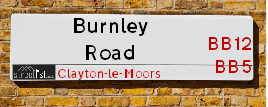
Burnley Road is a street located in the village of Altham and near the village of Altham and in the town of Clayton-le-Moors and near the town of Clayton-le-Moors. The street has a length of approximately 3,902 metres.
Burnley Road is located within the Hyndburn District (B) and Ribble Valley District (B) Council's jurisdiction. They provide various services, like refuse collection, and manage council tax collection. It's situated in the North West region of the UK.
Burnley Road has been assigned the Unique Street Reference Numbers of 17903157, 17902947 and 31801920 in the National Street Gazetteer.
Burnley Road is located within the county of Lancashire, situated in the North West region of the UK. It's 184.11 miles North West from central London., 21.62 miles North from Manchester, 25.42 miles South East from Lancaster and 33.57 miles West from Leeds.

Do you know why this road is called Burnley Road?
What's it like to live here?
Ask the community a question about Burnley Road.
Do you have any questions, memories to share or know any facts about Burnley Road? We'd love to know more.
Also on streetlist.co.uk, can you help?
Eldroth Road
15th April 2024
I wondered if anyone has any old pictures of Wenning Bank House in the 1940’s and also Lane Side before of the same era .. we visited today with my Mum in law as she used to live at both these properties. Also any photos of the schools around that time .. thank you.
Can You Help?Napps Way
15th April 2024
Why is the road called Napps Way (belonging to Napp, but minus an
apostrophe as is usual with such nomenclature)? Moreover, who or
what is, or was, “Napp” in the respective, possessive case?
Several years ago, I met an elderly man (probably in his late-eighties)
who lives on Bentham Drive, Liverpool 16, and during a conversation
with him whilst in a Northwest Passenger Transport Ambulance on the
way to the former RLUH (Royal Liverpool University Hospital), he told
me that he could remember (when he was a boy, living in Childwall,
Liverpool 16) that, “Where Napps Way is now, during WW2, there was
a two-man gun emplacement on the, then, open land to protect the
railway line passing over Childwall Valley Road - next to the railway
bridge - when suddenly, as they were loading a live “shell” into the gun’s
breach, the aforementioned “shell” accidentally exploded in the gun’s
breach killing both of the two soldiers, that had been manning the gun,
instantly! (Very sad, of course, but could - perhaps - two ghosts relating
to those two, very unfortunately and prematurely-killed soldiers have
haunted that place of their deaths ever since - and have any residents
of Napps Way - formerly and in its latest incarnation - seen two, WW2
(uniformed) soldiers unexpectedly appear in or near their homes?)
Mauritius Road
15th April 2024
Why is Mauritius Road so called, since when and by whom? Does Greenwich have any particular links with Mauritius? Very interested to know. 🤞🏼
Can You Help?Estate Agents near Burnley Road
| Name | Address | Website |
|---|---|---|
| McDermott Residential Lettings | Jupiter House, 1 Mercury Rise, Altham Business Park, Altham BB5 5BY | Visit Website |
| H2Homes Lettings And Property Services Ltd | 1-2 Barnes Square, Clayton Le Moors, BB5 5NX | Visit Website |
| Pendle Hill Properties | 154 Whalley Road, Read Lancashire BB12 7PN | Visit Website |
We have found 16 postcodes for Burnley Road
Hotels near Burnley Road
Budget Hotels near Burnley Road
| Budget Hotel Name | Distance (miles) |
|---|---|
| 1: Name:Travelodge Burnley Address:Barracks Rd, Burnley, BB11 4SB Telephone:0871 984 6125 Visit Site |
4.17 |
| 2: Name:Holiday Inn Express Burnley M65 Jct 10 Address:55 Pendle Way Telephone: Visit Site |
4.38 |
| 3: Name:Premier Inn Burnley Address:Queen Victoria Road Telephone: Visit Site |
5.33 |
| 4: Name:Premier Inn Blackburn South M65 J4 Address:Off Eccleshill Road Telephone: Visit Site |
6.42 |
| 5: Name:Travelodge Blackburn M65 Address:Darwen Motorway Service Area, Commercial Rd, M65 Motorway, Blackburn with Darwen, Darwen, BB3 0AT Telephone:0871 984 6122 Visit Site |
6.81 |
Location Details
| Burnley Road | |
|---|---|

| |
| Latitude | 53.784004 |
| Longitude | -2.362222 |
| OS Easting (X): | 376136 |
| OS Northing (Y): | 432049 |
| OS Grid Reference: | SD761320 |
Ordnance Survey Maps for Burnley Road
If you purchase a map through the links below, we may earn an affiliate commission.
| Map Series | link | Ordnance Survey |
| Explorer 1:25,000 287 West Pennine Moors - Blackburn, Darwen and Accrington | Check Price on Amazon | |
| Explorer 1:25,000 ol21 South Pennines | Check Price on Amazon | Buy Direct from the Ordnance Survey |
| Landranger 1:50,000 103 Blackburn & Burnley | Check Price on Amazon | Buy Direct from the Ordnance Survey |
Neighbourhood Policing |
| Police Force: Lancashire |
 View Neighbourhood Crime and Policing View Neighbourhood Crime and Policing |
| Find a Local Neighbourhood Watch Scheme |
Frequently asked Questions for Burnley Road
What Council (Local Authority) is Burnley Road in?
Burnley Road is located within the local authority area of Ribble Valley &Hyndburn Council which is a District Council.
What Parish Council is Burnley Road in?
Burnley Road is located within the area of Simonstone & Altham Parish Council.
What Electoral Ward is Burnley Road in?
Burnley Road is located within the ward of East Whalley, Read & Simonstone &Altham.
What County is Burnley Road in?
Burnley Road is located within the ceremonial county of Lancashire.
What Constituency is Burnley Road in?
Burnley Road is located within the constituency of Ribble Valley &Hyndburn.
What Part of the UK is Burnley Road in?
Burnley Road is located within the North West (England) region of the United Kingdom.
What County Council area is Burnley Road in?
Burnley Road is located within the Lancashire Council area.
What Police Force area is Burnley Road in?
Burnley Road is located within the Lancashire Police area.
Roads that have a Junction with Burnley Road
| Street | Junction Type |
|---|---|
| Whalley Road (A680) | junction |
| Well Field | junction |
| Mount Street | junction |
| Gordon Street | junction |
| Bold Venture Way | roundabout |
| Simonstone Lane | junction |
| Altham Lane | junction |
| Canal Way | junction |
| Bell Lane | junction |
| Moorfield Way | roundabout |
Sunset and Sunrise times for Burnley Road
| Sunrise | 05:58 |
|---|---|
| Sunset | 20:18 |
Latest Weather Conditions for Burnley Road
| Observed at Weather Station: | Stonyhurst 18 April 2024 at 14:00 (6.25 miles away) |
|---|---|
| Current Weather: | Clear night |
| Temperature and Humidity: | 7.7°C (90.9%) |
| Wind Direction and Speed: | (0 mph) |
Population Statistics
| ONS Area Code | E00128615, E00171918, E00127062 & E00127050 |
|---|---|
| ONS Area Name | Rural White-Collar Workers, Industrious Transitions & Older Workers and Retirement |
| Average Age | 42.52, 33.63 & 41.34 |
| Area Population | 1402.00, 2299.00 & 1455.00 |
| Male Population | 677.00, 1147.00 & 690.00 (49%) |
| Female Population | 725.00, 1152.00 & 765.00 (51%) |
| Benefit Claimants | 9, 18 & 26 (1%) |
| LSOA Code: | E01025340, E01025033 &E01025032 |
|---|---|
| LSOA Name: | Ribble Valley 005B, Hyndburn 002B &Hyndburn 002A |
| SOA Code: | 2b, 8c &5a |
| SOA Name: | |
| MSOA Code: | E02005274 &E02005213 |
| MSOA Name: | Ribble Valley 005 &Hyndburn 002 |
Nearest Supermarkets
| Tesco Great Harwood Superstore |
|---|
| Queen St, Great Harwood, BB6 7AT |
| 0345 671 9430 |
| Distance: 1.55 Miles |
| Directions from Burnley Road to Tesco Great Harwood Superstore |
| Morrisons Great Harwood |
|---|
| Queen Street, Great Harwood, Blackburn BB6 7AL |
| 01254 886274 |
| Distance: 1.69 Miles |
| Directions from Burnley Road to Morrisons Great Harwood |
| Asda Accrington |
|---|
| Hyndburn Road, Accrington, BB5 1PY |
| 01254 301111 |
| Distance: 1.95 Miles |
| Directions from Burnley Road to Asda Accrington |
| Iceland Accrington |
|---|
| Unit 28 Arndale Centre, Accrington, Lancashire, BB5 1EX |
| 01254398417 |
| Distance: 2.05 Miles |
| Directions from Burnley Road to Iceland Accrington |
Telephone Information
| Area Code |
|---|
| Area Code: 01282 - Burnley |
| Area Code: 01254 - Blackburn |
| Area Code: 01200 - Clitheroe |
Broadband Information
| Speed | Average Speed | Median Speed | Maximum Speed | Next-generation access (NGA) | Number of Connections |
|---|---|---|---|---|---|
| Less than 2 Mbps | 3.2 | 3.3 | 4.7 | Y | 7 |
Local Government
| Local Council Details |
|---|
| Within the area of Ribble Valley &Hyndburn |
| Visit the Council's Website |
| Visit the Council's Website |
| Council Offices, Church Walk, Clitheroe, Lancashire, BB7 2RA, Scaitcliffe House, Ormerod Street, Accrington, Lancashire &BB5 0PF |
| Send email |
| Telephone Number: 01200 425111 &01254 388 111 |
| Local Member of Parliament |
|---|
| Within the Westminster Parliamentary Constituency of Ribble Valley &Hyndburn |
| The Member of Parliament is Nigel Evans &Sara Britcliffe |
| Details for the MP Nigel Evans &Sara Britcliffe on parliament.uk |
| Details for the MP Nigel Evans &Sara Britcliffe on theyworkforyou.com |
| In the 2019 General Election Nigel Evans &Sara Britcliffe won with a majority of 18,439 the result was Con hold &Con gain from Lab. The total electorate was 79,247 |
| Wards, Parish Councils and County Councils |
|---|
| Ward: East Whalley, Read & Simonstone &Altham Ward |
| Ceremonial County: Lancashire |
Nearest Schools
| Name | Address | Postcode | Telephone | Type | Distance (Km) |
|---|
Data accessed from gov.scot 08-08-2019
Nearest Hospitals
| Name | Address | Postcode | Distance | Map |
|---|
Nearest Dentists
Dentists near Burnley Road
| Name | Address | Postcode | Distance | Map |
|---|
Nearest GP Surgeries
Doctors near Burnley Road
THE CLAYTON MEDICAL CTR.
Address: WELLINGTON STREET, CLAYTON LE MOORS, ACCRINGTON, LANCASHIRE, BB5 5HU
Distance: 1.11 miles
Contact: tel: 0844 4771761
PWE ACCRINGTON VICTORIA
Address: ACCRINGTON VICTORIA HOSPITAL, HAYWOOD ROAD, ACCRINGTON, LANCASHIRE, BB5 6AS
Distance: 1.70 miles
Contact: tel: 01254 770480
GREAT HARWOOD HEALTH CENTRE
Address: WATER STREET, GREAT HARWOOD, BLACKBURN, LANCASHIRE, BB6 7QR
Distance: 1.72 miles
Contact: :
THE WEAVERS PRACTICE (GREAT HARWOOD HEALTH CENTRE)
Address: GREAT HARWOOD HEALTH CENTRE, WATER STREET, GREAT HARWOOD, BLACKBURN, LANCASHIRE, BB6 7QR
Distance: 1.72 miles
Contact: :
GREAT HARWOOD MEDICAL GROUP
Address: GREAT HARWOOD HEALTH CENTRE, WATER STREET, GREAT HARWOOD, BLACKBURN, LANCASHIRE, BB6 7QR
Distance: 1.72 miles
Contact: tel: 01254 617570
KING STREET MEDICAL CTR
Address: 43 KING STREET, ACCRINGTON, LANCASHIRE, BB5 1QE
Distance: 2.10 miles
Contact: tel: 01254 617664
Nearest Dispensing Chemists
Pharmacies near Burnley Road
| Name | Address | Postcode | Telephone | Map | Distance in Km |
|---|
Nearest Opticians
Opticians near Burnley Road
OPTICAL DIRECT CLM LTD
Address: LONGTON HOUSE, BURNLEY ROAD, CLAYTON LE MOORS, ACCRINGTON, LANCASHIRE, BB5 5TW
Distance: 0.98 miles
Contact: :
EYES OF HARWOOD
Address: 76 QUEEN STREET, GREAT HARWOOD, BLACKBURN, LANCASHIRE, BB6 7AL
Distance: 1.69 miles
Contact: :
PAUL NUTTALL OPTOMETRISTS (GREAT HARWOOD)
Address: 49 BLACKBURN ROAD, GREAT HARWOOD, BLACKBURN, LANCASHIRE, BB6 7DF
Distance: 1.90 miles
Contact: :
CHEC ACCRINGTON
Address: CASTLE HOUSE, EASTGATE, ACCRINGTON, LANCASHIRE, BB5 6EU
Distance: 1.96 miles
Contact: :
PUREVISION LTD
Address: 42 BROADWAY, ACCRINGTON, LANCASHIRE, BB5 1EW
Distance: 2.06 miles
Contact: :
BOOTS OPTICIANS (ACCRINGTON)
Address: UNIT 14, ARNDALE SHOPPING CENTRE, ACCRINGTON, LANCASHIRE, BB5 1PL
Distance: 2.08 miles
Contact: :
Transport
Nearest Rail Stations
Huncoat Station is 1.06 miles away.
Address: Huncoat station, Station Road, Huncoat, Lancashire, BB5 6LT
Huncoat is situated on the East Lancashire line and is managed by Northern.
Huncoat Station is an unstaffed station.
Hapton Station is 1.87 miles away.
Address: Hapton station, Manchester Road, Hapton, Lancashire, BB12 7LG
Hapton is situated on the East Lancashire line and is managed by Northern.
Hapton Station is an unstaffed station.