Map of Charteris Road
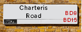
| Postcodes | ||
|---|---|---|
| Icon | Postcodes for Charteris Road | |
| Walking Distances | ||
| Distance Info | Green Circle = 10 Minutes Walk (800 metres) | |
About Charteris Road
Charteris Road is a street located in the city of Bradford. The street has a length of approximately 767 metres.
Charteris Road is located within the Bradford District (B) Council's jurisdiction. They provide various services, like refuse collection, and manage council tax collection. It's situated in the Yorkshire and The Humber region of the UK.
Charteris Road has been assigned the Unique Street Reference Number of 7717290 in the National Street Gazetteer.
Charteris Road is located within the county of West Yorkshire, situated in the Yorkshire and The Humber region of the UK. It's 174.13 miles North West from central London., 11.07 miles West from Leeds, 28.16 miles North East from Manchester and 31.97 miles North West from Sheffield.

Do you know why this road is called Charteris Road?
What's it like to live here?
Ask the community a question about Charteris Road.
Do you have any questions, memories to share or know any facts about Charteris Road? We'd love to know more.
Also on streetlist.co.uk, can you help?
Eldroth Road
15th April 2024
I wondered if anyone has any old pictures of Wenning Bank House in the 1940’s and also Lane Side before of the same era .. we visited today with my Mum in law as she used to live at both these properties. Also any photos of the schools around that time .. thank you.
Can You Help?Napps Way
15th April 2024
Why is the road called Napps Way (belonging to Napp, but minus an
apostrophe as is usual with such nomenclature)? Moreover, who or
what is, or was, “Napp” in the respective, possessive case?
Several years ago, I met an elderly man (probably in his late-eighties)
who lives on Bentham Drive, Liverpool 16, and during a conversation
with him whilst in a Northwest Passenger Transport Ambulance on the
way to the former RLUH (Royal Liverpool University Hospital), he told
me that he could remember (when he was a boy, living in Childwall,
Liverpool 16) that, “Where Napps Way is now, during WW2, there was
a two-man gun emplacement on the, then, open land to protect the
railway line passing over Childwall Valley Road - next to the railway
bridge - when suddenly, as they were loading a live “shell” into the gun’s
breach, the aforementioned “shell” accidentally exploded in the gun’s
breach killing both of the two soldiers, that had been manning the gun,
instantly! (Very sad, of course, but could - perhaps - two ghosts relating
to those two, very unfortunately and prematurely-killed soldiers have
haunted that place of their deaths ever since - and have any residents
of Napps Way - formerly and in its latest incarnation - seen two, WW2
(uniformed) soldiers unexpectedly appear in or near their homes?)
Mauritius Road
15th April 2024
Why is Mauritius Road so called, since when and by whom? Does Greenwich have any particular links with Mauritius? Very interested to know. 🤞🏼
Can You Help?Estate Agents near Charteris Road
| Name | Address | Website |
|---|---|---|
| Whitney's | 11 Green End Clayton Bradford BD14 6BA | |
| Dinsdales Estates | 519-521 Thornton Road, Bradford, BD8 9RB | Visit Website |
| Hometime Property Management | 20 Willow Street, Bradford,BD8 9NJ |
Location Details
| Charteris Road | |
|---|---|

| |
| Latitude | 53.796191 |
| Longitude | -1.812979 |
| OS Easting (X): | 412317 |
| OS Northing (Y): | 433360 |
| OS Grid Reference: | SE123334 |
Ordnance Survey Maps for Charteris Road
If you purchase a map through the links below, we may earn an affiliate commission.
| Map Series | link | Ordnance Survey |
| Explorer 1:25,000 288 Bradford and Huddersfield | Check Price on Amazon | Buy Direct from the Ordnance Survey |
| Landranger 1:50,000 104 Leeds & Bradford | Check Price on Amazon | Buy Direct from the Ordnance Survey |
Neighbourhood Policing |
| Police Force: West Yorkshire |
 View Neighbourhood Crime and Policing View Neighbourhood Crime and Policing |
| Find a Local Neighbourhood Watch Scheme |
Frequently asked Questions for Charteris Road
What Council (Local Authority) is Charteris Road in?
Charteris Road is located within the local authority area of Bradford Council which is a Metropolitan District.
What Parish Council is Charteris Road in?
Charteris Road is in an unparished area.
What Electoral Ward is Charteris Road in?
Charteris Road is located within the ward of Clayton and Fairweather Green.
What County is Charteris Road in?
Charteris Road is located within the ceremonial county of West Yorkshire.
What Constituency is Charteris Road in?
Charteris Road is located within the constituency of Bradford West.
What Part of the UK is Charteris Road in?
Charteris Road is located within the Yorkshire and The Humber region of the United Kingdom.
What County Council area is Charteris Road in?
Charteris Road is located within the West Yorkshire Council area.
What Police Force area is Charteris Road in?
Charteris Road is located within the West Yorkshire Police area.
Roads that have a Junction with Charteris Road
| Street | Junction Type |
|---|---|
| Bedivere Road | junction |
| Rhodesway | junction |
| Arthur Avenue | junction |
| Merlin Grove | junction |
| The Square | junction |
| The Square | junction |
| Kingfisher Grove | junction |
| Sandpiper Mews | junction |
| Chaffinch Road | junction |
| Sheldrake Avenue | junction |
| Bell Dean Road | junction |
Sunset and Sunrise times for Charteris Road
| Sunrise | 05:40 |
|---|---|
| Sunset | 20:29 |
Latest Weather Conditions for Charteris Road
| Observed at Weather Station: | Bingley Samos 25 April 2024 at 11:00 (2.36 miles away) |
|---|---|
| Current Weather: | Overcast |
| Temperature and Humidity: | 4.4°C (78.4%) |
| Wind Direction and Speed: | NE (8 mph) |
Population Statistics
| ONS Area Code | E00053676, E00053680, E00053670, E00053678 & E00053641 |
|---|---|
| ONS Area Name | Private Renting Young Families & Pakistani Communities |
| Average Age | 31.66, 40.50 & 34.24 |
| Area Population | 1338.00, 1727.00 & 1544.00 |
| Male Population | 654.00, 830.00 & 713.00 (48%) |
| Female Population | 684.00, 897.00 & 831.00 (52%) |
| Benefit Claimants | 101, 59 & 57 (5%) |
| LSOA Code: | E01010632, E01010628 &E01010631 |
|---|---|
| LSOA Name: | Bradford 040E, Bradford 040A &Bradford 040D |
| SOA Code: | 7a |
| SOA Name: | |
| MSOA Code: | E02002222 |
| MSOA Name: | Bradford 040 |
Nearest Supermarkets
| Tesco Leaventhorpe Esso Express |
|---|
| Thornton Rd, Thornton, Bradford, BD13 3DG |
| 0345 674 6387 |
| Distance: 0.72 Miles |
| Directions from Charteris Road to Tesco Leaventhorpe Esso Express |
| Asda Bradford Cemetery Road |
|---|
| Cemetery Road, Lidget Green, Bradford, BD7 2QX |
| 01274 476230 |
| Distance: 0.97 Miles |
| Directions from Charteris Road to Asda Bradford Cemetery Road |
| Morrisons Bradford - Victoria |
|---|
| Victoria Shopping Centre, Young Street, Bradford BD8 9BN |
| 01274 498218 |
| Distance: 1.03 Miles |
| Directions from Charteris Road to Morrisons Bradford - Victoria |
| Tesco Heaton Haworth Rd Express |
|---|
| 204-206 Haworth Rd, Heaton, Bradford, BD9 6NJ |
| 0345 671 9259 |
| Distance: 1.39 Miles |
| Directions from Charteris Road to Tesco Heaton Haworth Rd Express |
Telephone Information
| Area Code |
|---|
| Area Code: 01274 - Bradford |
| Area Code: 01422 - Halifax |
| Area Code: 01535 - Keighley |
| Area Code: 01943 - Guiseley |
Broadband Information
| Speed | Average Speed | Median Speed | Maximum Speed | Next-generation access (NGA) | Number of Connections |
|---|---|---|---|---|---|
| Less than 2 Mbps | 15.5 | 4.8 | >=30 | Y | 17 |
Local Government
| Local Council Details |
|---|
| Within the area of Bradford |
| Visit the Council's Website |
| City Hall, Centenary Square, Bradford &BD1 1HY |
| Telephone Number: 01274 432111 |
| Local Member of Parliament |
|---|
| Within the Westminster Parliamentary Constituency of Bradford West |
| The Member of Parliament is Naz Shah |
| Details for the MP Naz Shah on parliament.uk |
| Details for the MP Naz Shah on theyworkforyou.com |
| In the 2019 General Election Naz Shah won with a majority of 27,019 the result was Lab hold. The total electorate was 70,694 |
| Wards, Parish Councils and County Councils |
|---|
| Ward: Clayton and Fairweather Green Ward |
| Ceremonial County: West Yorkshire |
Nearest Schools
England Primary Schools
Iqra Primary Academy
Address: Iqra Primary Academy, Drummond Road, Bradford, West Yorkshire, BD8 8DA
Distance: 1.73 miles
Contact: 01274773350
Iqra Community Primary School
Address: Iqra Community Primary School, Drummond Road, Bradford, West Yorkshire, BD8 8DA
Distance: 1.73 miles
Contact:
Miriam Lord Community Primary School
Address: Miriam Lord Community Primary School, Bavaria Place, Manningham, Bradford, West Yorkshire, BD8 8RG
Distance: 1.68 miles
Contact:
Lidget Green Primary School
Address: Lidget Green Primary School, Birks Fold, Lidget Green, Bradford, West Yorkshire, BD7 2QN
Distance: 0.80 miles
Contact:
Whetley Academy
Address: Whetley Academy, Whetley Lane, Girlington, Bradford, West Yorkshire, BD8 9HZ
Distance: 1.28 miles
Contact: 01274422041
St Philip's CofE Primary School
Address: St Philip's CofE Primary School, Whitby Terrace, Girlington, Bradford, West Yorkshire, BD8 9JL
Distance: 1.29 miles
Contact: 01274546496
Lister Primary School
Address: Lister Primary School, Scotchman Road, Manningham, Bradford, West Yorkshire, BD9 5AT
Distance: 1.47 miles
Contact:
St Cuthbert and The First Martyrs' Catholic Primary School
Address: St Cuthbert and The First Martyrs' Catholic Primary School, Scotchman Road, Heaton, Bradford, West Yorkshire, BD9 5AT
Distance: 1.47 miles
Contact:
Girlington Primary School
Address: Girlington Primary School, Girlington Road, Bradford, West Yorkshire, BD8 9NR
Distance: 1.13 miles
Contact: 01274493543
Lilycroft Primary School
Address: Lilycroft Primary School, Lilycroft Road, Manningham, Bradford, West Yorkshire, BD9 5AD
Distance: 1.52 miles
Contact: 01274543357
Lilycroft Primary School
Address: Lilycroft Primary School, Lilycroft Road, Manningham, Bradford, West Yorkshire, BD9 5AD
Distance: 1.52 miles
Contact:
Margaret McMillan Primary School
Address: Margaret McMillan Primary School, Scotchman Road, Heaton, Margaret McMillan Primary School, Bradford, West Yorkshire, BD9 5DF
Distance: 1.40 miles
Contact: 01274495934
Margaret McMillan Primary School
Address: Margaret McMillan Primary School, Scotchman Road, Heaton, Bradford, West Yorkshire, BD9 5DF
Distance: 1.40 miles
Contact:
St William's Catholic Primary School
Address: St William's Catholic Primary School, Young Street, Bradford, West Yorkshire, BD8 9RG
Distance: 1.02 miles
Contact:
Crossley Hall Primary School
Address: Crossley Hall Primary School, Thornton Road, Bradford, West Yorkshire, BD8 0HJ
Distance: 0.56 miles
Contact:
St Matthew's Catholic Primary School
Address: St Matthew's Catholic Primary School, Saffron Drive, Allerton, Bradford, West Yorkshire, BD15 7NE
Distance: 0.41 miles
Contact:
The Academy At St. James
Address: The Academy At St. James, Chelwood Drive, Allerton, Bradford, West Yorkshire, BD15 7YD
Distance: 0.56 miles
Contact: 01274777095
St James' Church Primary School
Address: St James' Church Primary School, Chelwood Drive, Allerton, Bradford, West Yorkshire, BD15 7YD
Distance: 0.56 miles
Contact:
Ley Top Primary School
Address: Ley Top Primary School, Avenel Road, Allerton, Bradford, West Yorkshire, BD15 7PQ
Distance: 0.53 miles
Contact: 01274541554
Heaton Primary School
Address: Heaton Primary School, Haworth Road, Bradford, West Yorkshire, BD9 6LL
Distance: 1.41 miles
Contact:
Beckfoot Allerton Primary School and Nursery
Address: Beckfoot Allerton Primary School and Nursery, Garforth Street, Allerton, Bradford, West Yorkshire, BD15 7HB
Distance: 0.69 miles
Contact: 01274541587
Allerton Primary School
Address: Allerton Primary School, Garforth Street, Allerton, Bradford, West Yorkshire, BD15 7HB
Distance: 0.69 miles
Contact:
Thornton Primary School
Address: Thornton Primary School, Thornton Road, Thornton, Bradford, West Yorkshire, BD13 3NN
Distance: 1.77 miles
Contact: 01274833839
Thornton Primary School
Address: Thornton Primary School, Thornton Road, Thornton, Bradford, West Yorkshire, BD13 3NN
Distance: 1.77 miles
Contact:
Beckfoot Heaton Primary
Address: Beckfoot Heaton Primary, Haworth Road, Bradford, West Yorkshire, BD9 6LL
Distance: 1.41 miles
Contact: 01274363070
England Secondary Schools
Dixons Kings Academy
Address: Dixons Kings Academy, Northside Road, Bradford, West Yorkshire, BD7 2AN
Distance: 1.07 miles
Contact: 01274089910
Bradford Girls' Grammar School
Address: Bradford Girls' Grammar School, Squire Lane, Bradford, West Yorkshire, BD9 6RB
Distance: 0.86 miles
Contact: 01274545395
Dixons Allerton Academy
Address: Dixons Allerton Academy, Rhodesway, Bradford, West Yorkshire, BD8 0DH
Distance: 0.25 miles
Contact: 01274089890
Beckfoot Thornton
Address: Beckfoot Thornton, Leaventhorpe Lane, Thornton, Bradford, West Yorkshire, BD13 3BH
Distance: 0.48 miles
Contact: 01274881082
Thornton Grammar School
Address: Thornton Grammar School, Leaventhorpe Lane, Thornton, Bradford, West Yorkshire, BD13 3BH
Distance: 0.48 miles
Contact:
Beckfoot Upper Heaton
Address: Beckfoot Upper Heaton, Thorn Lane, Heaton, Bradford, West Yorkshire, BD9 6AL
Distance: 1.48 miles
Contact: 01274493533
Nearest Hospitals
| Name | Address | Postcode | Distance | Map |
|---|
Nearest Dentists
Dentists near Charteris Road
| Name | Address | Postcode | Distance | Map |
|---|
Nearest GP Surgeries
Doctors near Charteris Road
DR VE WILSON
Address: LOWER GRANGE MEDICAL CENTRE, 33 BARNBY AVENUE, BRADFORD, WEST YORKSHIRE, BD8 0QN
Distance: 0.02 miles
Contact: tel: 01274 881646
HOLLINS HEALTH & WELLBEING - ALLERTON
Address: ALLERTON HEALTH CENTRE, BELL DEAN ROAD, ALLERTON, BRADFORD, WEST YORKSHIRE, BD15 7WA
Distance: 0.55 miles
Contact: :
PHOENIX MEDICAL PRACTICE
Address: ALLERTON HEALTH CENTRE, BELL DEAN ROAD, ALLERTON, BRADFORD, WEST YORKSHIRE, BD15 7WA
Distance: 0.55 miles
Contact: tel: 08444 773615
MANOR MEDICAL PRACTICE
Address: GIRLINGTON HEALTH CENTRE, 195 GIRLINGTON ROAD, BRADFORD, BD8 9PB
Distance: 1.12 miles
Contact: tel: 01274 484111
KENSINGTON PARTNERSHIP
Address: WHITEFIELD PLACE, GIRLINGTON, BRADFORD, WEST YORKSHIRE, BD8 9LB
Distance: 1.17 miles
Contact: tel: 01274 499209
DR IA GILKAR & PARTNERS
Address: KENSINGTON STREET HEALTH CENTRE, WHITEFIELD PLACE, BRADFORD, WEST YORKSHIRE, BD8 9LB
Distance: 1.17 miles
Contact: tel: 01274 496433
Nearest Dispensing Chemists
Pharmacies near Charteris Road
| Name | Address | Postcode | Telephone | Map | Distance in Km |
|---|
Nearest Opticians
Opticians near Charteris Road
MYVISION OPTICIANS LTD
Address: 336 ALLERTON ROAD, ALLERTON, BRADFORD, BD15 7BN
Distance: 0.75 miles
Contact: :
SPECSAVERS (GIRLINGTON, BRADFORD)
Address: UNIT 12, MORRISONS SUPERMARKET, VICTORIA SHOPPING CENTRE, THORNTON ROAD, BRADFORD, WEST YORKSHIRE, BD8 9BN
Distance: 1.01 miles
Contact: :
PREMIER VISION VICTORIA
Address: INSIDE MORRISONS SUPERMARKET, VICTORIA CENTRE, THORNTON ROAD, BRADFORD, BD8 9BN
Distance: 1.01 miles
Contact: :
EYEDEAL OPTICAL (YORKSHIRE) LTD
Address: 45 DUCKWORTH LANE, BRADFORD, WEST YORKSHIRE, BD9 5ET
Distance: 1.15 miles
Contact: :
CROSSROADS OPTICIANS
Address: 54 DUCKWORTH LANE, BRADFORD, WEST YORKSHIRE, BD9 5HB
Distance: 1.16 miles
Contact: :
K S OPTICIAN
Address: 35 BECKSIDE ROAD, LIDGET GREEN, BRADFORD, WEST YORKSHIRE, BD7 2JL
Distance: 1.18 miles
Contact: :
Transport
Nearest Rail Stations
Frizinghall Station is 2.42 miles away.
Address: Frizinghall station, Frizinghall Road, Frizinghall, West Yorkshire, BD9 4LD
Frizinghall is situated on the Wharfedale Line|Leeds to Bradford lines and is managed by Northern.
Frizinghall Station is an unstaffed station.
Bradford Forster Square Station is 2.45 miles away.
Address: Bradford Forster Square station, Forster Square, Bradford, West Yorkshire, BD1 4HY
Bradford Forster Square is situated on the Wharfedale Line|Leeds to Bradford lines and is managed by Northern.
Bradford Forster Square Station is staffed on a part time basis.
Directions from Charteris Road to Bradford Forster Square Rail Station