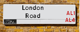
Map of London Road
| Postcodes | ||
|---|---|---|
| Icon | Postcodes for London Road | |
| Walking Distances | ||
| Distance Info | Green Circle = 10 Minutes Walk (800 metres) | |
About London Road
London Road is a street located in the village of London Colney and in the city of St Albans. The street has a length of approximately 3,891 metres.
London Road is located within the St. Albans District (B) Council's jurisdiction. They provide various services, like refuse collection, and manage council tax collection. It's situated in the East of England region of the UK.
London Road has been assigned the Unique Street Reference Number of 37310432 in the National Street Gazetteer.
London Road is located within the county of Hertfordshire, situated in the East of England region of the UK. It's 18.96 miles North West from central London., 1.1 miles South East from St Albans, 10.4 miles South East from Luton and 21.73 miles East from Aylesbury.

Do you know why this road is called London Road?
What's it like to live here?
Ask the community a question about London Road.
Do you have any questions, memories to share or know any facts about London Road? We'd love to know more.
Also on streetlist.co.uk, can you help?
Eldroth Road
15th April 2024
I wondered if anyone has any old pictures of Wenning Bank House in the 1940’s and also Lane Side before of the same era .. we visited today with my Mum in law as she used to live at both these properties. Also any photos of the schools around that time .. thank you.
Can You Help?Napps Way
15th April 2024
Why is the road called Napps Way (belonging to Napp, but minus an
apostrophe as is usual with such nomenclature)? Moreover, who or
what is, or was, “Napp” in the respective, possessive case?
Several years ago, I met an elderly man (probably in his late-eighties)
who lives on Bentham Drive, Liverpool 16, and during a conversation
with him whilst in a Northwest Passenger Transport Ambulance on the
way to the former RLUH (Royal Liverpool University Hospital), he told
me that he could remember (when he was a boy, living in Childwall,
Liverpool 16) that, “Where Napps Way is now, during WW2, there was
a two-man gun emplacement on the, then, open land to protect the
railway line passing over Childwall Valley Road - next to the railway
bridge - when suddenly, as they were loading a live “shell” into the gun’s
breach, the aforementioned “shell” accidentally exploded in the gun’s
breach killing both of the two soldiers, that had been manning the gun,
instantly! (Very sad, of course, but could - perhaps - two ghosts relating
to those two, very unfortunately and prematurely-killed soldiers have
haunted that place of their deaths ever since - and have any residents
of Napps Way - formerly and in its latest incarnation - seen two, WW2
(uniformed) soldiers unexpectedly appear in or near their homes?)
Mauritius Road
15th April 2024
Why is Mauritius Road so called, since when and by whom? Does Greenwich have any particular links with Mauritius? Very interested to know. 🤞🏼
Can You Help?Estate Agents near London Road
| Name | Address | Website |
|---|---|---|
| Osprey Homes | London Road, St. Albans, AL1 1JQ | Visit Website |
| Crest Nicholson | Grosvenor Road, St. Albans, AL1 3AE | Visit Website |
| Aubrey & Finn | 107 Victoria Street St. Albans AL1 3TJ |
We have found 38 postcodes for London Road
Location Details
| London Road | |
|---|---|

| |
| Latitude | 51.740624 |
| Longitude | -0.319204 |
| OS Easting (X): | 516038 |
| OS Northing (Y): | 206044 |
| OS Grid Reference: | TL160060 |
Neighbourhood Policing |
| Police Force: Hertfordshire |
 View Neighbourhood Crime and Policing View Neighbourhood Crime and Policing |
| Find a Local Neighbourhood Watch Scheme |
Frequently asked Questions for London Road
What Council (Local Authority) is London Road in?
London Road is located within the local authority area of St Albans Council which is a District Council.
What Parish Council is London Road in?
London Road is in an unparished area.
What Electoral Ward is London Road in?
London Road is located within the ward of Cunningham, Sopwell &St Peters.
What County is London Road in?
London Road is located within the ceremonial county of Hertfordshire.
What Constituency is London Road in?
London Road is located within the constituency of St Albans.
What Part of the UK is London Road in?
London Road is located within the East of England region of the United Kingdom.
What County Council area is London Road in?
London Road is located within the Hertfordshire Council area.
What Police Force area is London Road in?
London Road is located within the Hertfordshire Police area.
Roads that have a Junction with London Road
| Street | Junction Type |
|---|---|
| Whitecroft | junction |
| St Andrews Drive | junction |
| Drakes Drive | junction |
| Drakes Drive | junction |
| Drakes Drive | junction |
| Drakes Drive | junction |
| Mile House Lane | junction |
| St Vincent Drive | junction |
| Kensington Close | junction |
| Stuart Place | junction |
| Magnolia Gardens | junction |
| Wain Close | junction |
| Duncan Court | junction |
| Cunningham Hill Road | junction |
| Cunningham Avenue | junction |
| Colindale Avenue | junction |
| Approach Road | junction |
| Old London Road | junction |
| Black Cut | junction |
| Alma Road (B6424) | junction |
| Alma Cut | junction |
| Lattimore Road | junction |
| Watson's Walk | junction |
| Keyfield Terrace | junction |
| Holywell Hill (A5183) | junction |
| Highfield Park Drive | roundabout |
| Birklands Park | junction |
| Birklands Park | pseudo node |
| Birklands Lane | junction |
| Nightingale Lane | junction |
| North Orbital Road (A414) | roundabout |
Sunset and Sunrise times for London Road
| Sunrise | 05:44 |
|---|---|
| Sunset | 20:14 |
Latest Weather Conditions for London Road
| Observed at Weather Station: | Rothamsted 23 April 2024 at 07:00 (4.89 miles away) |
|---|---|
| Current Weather: | Clear night |
| Temperature and Humidity: | 6.0°C (91.9%) |
| Wind Direction and Speed: | (0 mph) |
Population Statistics
| ONS Area Code | E00120279, E00120260, E00120543, E00120276, E00120264, E00120267, E00120481, E00120482, E00120477, E00120493, E00120491, E00120496, E00120492, E00120495, E00120272 & E00120275 |
|---|---|
| ONS Area Name | Multi-Ethnic Professionals with Families, Delayed Retirement, Communal Retirement, Urban Cultural Mix, Highly-Qualified Quaternary Workers, Families in Terraces and Flats & Commuters with Young Families |
| Average Age | 43.97, 39.80, 36.92, 40.04, 38.48, 35.84 & 34.60 |
| Area Population | 1623.00, 1660.00, 1589.00, 1730.00, 1916.00, 1671.00 & 1812.00 |
| Male Population | 798.00, 758.00, 845.00, 992.00, 860.00 & 931.00 (50%) |
| Female Population | 825.00, 862.00, 831.00, 885.00, 924.00, 811.00 & 881.00 (50%) |
| Benefit Claimants | 5, 27, 7, 16, 36, 4 & 30 (1%) |
| LSOA Code: | E01023684, E01023683, E01023741, E01023682, E01023727, E01023726 &E01023729 |
|---|---|
| LSOA Name: | St Albans 016D, St Albans 016C, St Albans 017E, St Albans 016B, St Albans 012B, St Albans 012A &St Albans 012D |
| SOA Code: | 3a, 3d, 3c &6a |
| SOA Name: | |
| MSOA Code: | E02004939, E02004940 &E02004935 |
| MSOA Name: | St Albans 016, St Albans 017 &St Albans 012 |
Nearest Supermarkets
| Tesco St Albans Hatfield Rd Express |
|---|
| 95-97 Hatfield Rd, St Albans, AL1 4JL |
| 0345 674 6428 |
| Distance: 0.81 Miles |
| Directions from London Road to Tesco St Albans Hatfield Rd Express |
| Morrisons St Albans |
|---|
| 244 Hatfield Road, St Albans AL1 4SU |
| 01727 834853 |
| Distance: 0.82 Miles |
| Directions from London Road to Morrisons St Albans |
| Iceland St Albans |
|---|
| 140/144 Victoria Street, St Albans, Hertfordshire, AL1 3TG |
| 01727833908 |
| Distance: 0.86 Miles |
| Directions from London Road to Iceland St Albans |
| Sainsburys St Albans |
|---|
| Everard Close, St. Albans, England, AL1 2QU |
| 01727 847707 |
| Distance: 0.9 Miles |
| Directions from London Road to Sainsburys St Albans |
Telephone Information
| Dialling Code | Telephone Exchange | Telephone Cabinet | Fibre to the Cabinet or Fibre to the Premises |
|---|---|---|---|
| 01727 | ST. ALBANS - LNSTB | P69 | FTTC |
Local Government
| Local Council Details |
|---|
| Within the area of St Albans |
| Visit the Council's Website |
| Civic Centre, St Peters Street, St Albans, Hertfordshire &AL1 3JE |
| Send email |
| Telephone Number: 01727 866 100 |
| Local Member of Parliament |
|---|
| Within the Westminster Parliamentary Constituency of St Albans |
| The Member of Parliament is Daisy Cooper |
| Details for the MP Daisy Cooper on parliament.uk |
| Details for the MP Daisy Cooper on theyworkforyou.com |
| In the 2019 General Election Daisy Cooper won with a majority of 6,293 the result was LD gain from Con. The total electorate was 73,727 |
| Wards, Parish Councils and County Councils |
|---|
| Ward: Cunningham, Sopwell &St Peters Ward |
| Ceremonial County: Hertfordshire |
Nearest Schools
England Primary Schools
Camp Primary and Nursery School
Address: Camp Primary and Nursery School, Camp Road, St Albans, Hertfordshire, AL1 5PG
Distance: 0.58 miles
Contact: 01727851056
Fleetville Infant and Nursery School
Address: Fleetville Infant and Nursery School, Royal Road, St Albans, Hertfordshire, AL1 4LX
Distance: 0.89 miles
Contact:
Fleetville Junior School
Address: Fleetville Junior School, 228 Hatfield Road, St Albans, Hertfordshire, AL1 4LW
Distance: 0.81 miles
Contact:
Bernards Heath Infant and Nursery School
Address: Bernards Heath Infant and Nursery School, 154 Sandridge Road, St Albans, Hertfordshire, AL1 4AP
Distance: 1.46 miles
Contact: 01727852106
St Peter's School
Address: St Peter's School, Cottonmill Lane, St Albans, Hertfordshire, AL1 1HL
Distance: 0.82 miles
Contact: 01727853075
Aboyne Lodge Junior Mixed and Infant School
Address: Aboyne Lodge Junior Mixed and Infant School, Etna Road, St Albans, Hertfordshire, AL3 5NL
Distance: 1.30 miles
Contact: 01727849700
Colney Heath Junior Mixed Infant and Nursery School
Address: Colney Heath Junior Mixed Infant and Nursery School, High Street, Colney Heath, St Albans, Hertfordshire, AL4 0NP
Distance: 2.46 miles
Contact: 01727823898
Oakwood Primary School
Address: Oakwood Primary School, Oakwood Drive, St Albans, Hertfordshire, AL4 0XA
Distance: 1.33 miles
Contact: 01727753930
Fleetville Infant and Nursery School
Address: Fleetville Infant and Nursery School, Royal Road, St Albans, Hertfordshire, AL1 4LX
Distance: 0.89 miles
Contact: 01727519221
Windermere Primary School
Address: Windermere Primary School, Windermere Avenue, St. Albans, Hertfordshire, AL1 5QP
Distance: 0.52 miles
Contact: 01727851176
Cunningham Hill Infant School
Address: Cunningham Hill Infant School, Cell Barnes Lane, St Albans, Hertfordshire, AL1 5QJ
Distance: 0.33 miles
Contact: 01727857524
Cunningham Hill Junior School
Address: Cunningham Hill Junior School, Cell Barnes Lane, St Albans, Hertfordshire, AL1 5QJ
Distance: 0.33 miles
Contact: 01727852911
London Colney Primary & Nursery School
Address: London Colney Primary & Nursery School, Alexander Road, London Colney, St Albans, Hertfordshire, AL2 1JG
Distance: 1.42 miles
Contact: 01727823283
Bowmansgreen Primary School
Address: Bowmansgreen Primary School, Telford Road, London Colney, St Albans, Hertfordshire, AL2 1PH
Distance: 1.51 miles
Contact: 01727767772
Saint Bernadette Catholic Primary School
Address: Saint Bernadette Catholic Primary School, Walsingham Way, London Colney, St Albans, Hertfordshire, AL2 1NL
Distance: 1.65 miles
Contact: 01727822489
Fleetville Junior School
Address: Fleetville Junior School, 228 Hatfield Road, St Albans, Hertfordshire, AL1 4LW
Distance: 0.81 miles
Contact: 01727519224
St Alban and St Stephen Roman Catholic Infant and Nursery School
Address: St Alban and St Stephen Roman Catholic Infant and Nursery School, Vanda Crescent, St Albans, Hertfordshire, AL1 5EX
Distance: 0.59 miles
Contact:
St Alban & St Stephen Catholic Primary School & Nursery
Address: St Alban & St Stephen Catholic Primary School & Nursery, St Alban & St Stephen Catholic Primary School, Cecil Road, St Albans, Hertfordshire, AL1 5EG
Distance: 0.67 miles
Contact: 01727866668
Maple Primary School
Address: Maple Primary School, Hall Place Gardens, Maple Primary School, St Albans, Hertfordshire, AL1 3SW
Distance: 1.19 miles
Contact: 01727859053
Alban City School
Address: Alban City School, 7 Hatfield Road, St Albans, Hertfordshire, AL1 3RR
Distance: 1.14 miles
Contact: 01727860304
Park Street Church of England Voluntary Aided Primary School
Address: Park Street Church of England Voluntary Aided Primary School, Branch Road, Park Street, St Albans, Hertfordshire, AL2 2LX
Distance: 1.72 miles
Contact: 01727872158
Mandeville Primary School
Address: Mandeville Primary School, Mandeville Drive, St Albans, Hertfordshire, AL1 2LE
Distance: 0.90 miles
Contact: 01727519220
The Abbey Church of England Voluntary Aided Primary School, St Albans
Address: The Abbey Church of England Voluntary Aided Primary School, St Albans, Grove Road, St Albans, Hertfordshire, AL1 1DQ
Distance: 1.10 miles
Contact: 01727851802
Killigrew Primary and Nursery School
Address: Killigrew Primary and Nursery School, West Avenue, St Albans, Hertfordshire, AL2 3HD
Distance: 1.62 miles
Contact: 01727774200
How Wood Primary and Nursery School
Address: How Wood Primary and Nursery School, Spooners Drive, Park Street, St Albans, Hertfordshire, AL2 2HU
Distance: 1.80 miles
Contact: 01727768885
St Adrian Roman Catholic Primary School
Address: St Adrian Roman Catholic Primary School, Watling View, St Albans, Hertfordshire, AL1 2PB
Distance: 1.07 miles
Contact: 01727852687
England Secondary Schools
Nicholas Breakspear Catholic School
Address: Nicholas Breakspear Catholic School, Colney Heath Lane, St Albans, Hertfordshire, AL4 0TT
Distance: 1.38 miles
Contact: 01727860079
Beaumont School
Address: Beaumont School, Austen Way, St Albans, Hertfordshire, AL4 0XB
Distance: 1.32 miles
Contact: 01727854726
Verulam School
Address: Verulam School, Brampton Road, St Albans, Hertfordshire, AL1 4PR
Distance: 1.03 miles
Contact: 01727766100
Samuel Ryder Academy
Address: Samuel Ryder Academy, Drakes Drive, St Albans, Hertfordshire, AL1 5AR
Distance: 0.37 miles
Contact: 01727859382
Loreto College
Address: Loreto College, Hatfield Road, St Albans, Hertfordshire, AL1 3RQ
Distance: 0.95 miles
Contact: 01727856206
The Marlborough Science Academy
Address: The Marlborough Science Academy, Watling Street, St Albans, Hertfordshire, AL1 2QA
Distance: 1.30 miles
Contact: 01727856874
Nearest Hospitals
| Name | Address | Postcode | Distance | Map |
|---|
Nearest Dentists
Dentists near London Road
| Name | Address | Postcode | Distance | Map |
|---|
Nearest GP Surgeries
Doctors near London Road
HATFIELD ROAD SURGERY
Address: 2 THE PARADE, ELLIS HOUSE, ST. ALBANS, HERTFORDSHIRE, AL1 3FY
Distance: 0.57 miles
Contact: tel: 01727 853079
JACOB COURT
Address: 1 JACOB COURT, 61 RUSSET DRIVE, ST. ALBANS, HERTFORDSHIRE, AL4 0AY
Distance: 0.82 miles
Contact: :
THE MALTINGS SURGERY - COVID LOCAL VACCINATION SERVICE
Address: 8-14 VICTORIA STREET, ST. ALBANS, AL1 3JB
Distance: 1.11 miles
Contact: :
MALTINGS SURGERY
Address: 8-14 VICTORIA STREET, ST ALBANS, HERTFORDSHIRE, AL1 3JB
Distance: 1.11 miles
Contact: tel: 01727 855500
PARKBURY HOUSE SURGERY
Address: ST. PETERS STREET, ST ALBANS, HERTFORDSHIRE, AL1 3HD
Distance: 1.28 miles
Contact: tel: 01727 851589
HARVEY GROUP PRACTICE
Address: 13-15 RUSSELL AVENUE, ST. ALBANS, HERTFORDSHIRE, AL3 5HB
Distance: 1.29 miles
Contact: tel: 01727 831888
Nearest Dispensing Chemists
Pharmacies near London Road
| Name | Address | Postcode | Telephone | Map | Distance in Km |
|---|
Nearest Opticians
Opticians near London Road
FUTURE VISION OPTICIANS (HATFIELD)
Address: 244 HATFIELD ROAD, ST. ALBANS, HERTFORDSHIRE, AL1 4SU
Distance: 0.82 miles
Contact: :
EYECARE AT MORRISONS
Address: 244 HATFIELD ROAD, ST. ALBANS, AL1 4SU
Distance: 0.82 miles
Contact: :
ENHANCED OPTICIAN SERVICES - ST ALBANS
Address: 209 HATFIELD ROAD, ST. ALBANS, HERTFORDSHIRE, AL1 4SY
Distance: 0.86 miles
Contact: :
LUXOTTICA RETAIL UK LTD
Address: LEVEL 2, VERULAM POINT, STATION WAY, ST. ALBANS, HERTFORDSHIRE, AL1 5HE
Distance: 0.86 miles
Contact: :
OPTICAL EXPRESS [ST ALBANS]
Address: TRIDENT HOUSE, 42-48 VICTORIA STREET, ST. ALBANS, HERTFORDSHIRE, AL1 3HZ
Distance: 1.02 miles
Contact: :
ST ALBANS EYE CARE CENTRE
Address: 38 LONDON ROAD, ST. ALBANS, HERTFORDSHIRE, AL1 1NG
Distance: 1.05 miles
Contact: :
Transport
Nearest Rail Stations
St Albans City Station is 0.77 miles away.
Address: St Albans station, Station Way, St. Albans, Hertfordshire, AL1 5HE
St Albans City is situated on the East Midland Main Line and is managed by Govia Thameslink Railway (Thameslink).
St Albans City Station is staffed on a full time basis.
St Albans Abbey Station is 1.04 miles away.
Address: St Albans Abbey station, Holywell Hill, St Albans, Hertfordshire, AL1 2DN
St Albans Abbey is situated on the Abbey Line and is managed by Grand Central North West.
St Albans Abbey Station is an unstaffed station.