Map of Overwoods Road
| Postcodes | ||
|---|---|---|
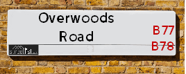
| Icon | Postcodes for Overwoods Road | |
| Walking Distances | ||
| Distance Info | Green Circle = 10 Minutes Walk (800 metres) | |
About Overwoods Road
Overwoods Road is a street located in the town of Tamworth and near the town of Tamworth. The street has a length of approximately 1,581 metres.
Overwoods Road is located within the North Warwickshire District (B) and Tamworth District (B) Council's jurisdiction. They provide various services, like refuse collection, and manage council tax collection. It's situated in the West Midlands region of the UK.
Overwoods Road has been assigned the Unique Street Reference Number of 28400666 and 39400263 in the National Street Gazetteer.
Overwoods Road is located within the county of Staffordshire, situated in the West Midlands region of the UK. It's 100.67 miles North West from central London., 13.11 miles North East from Birmingham, 14.63 miles North West from Coventry and 22.34 miles West from Leicester.

Do you know why this road is called Overwoods Road?
What's it like to live here?
Ask the community a question about Overwoods Road.
Do you have any questions, memories to share or know any facts about Overwoods Road? We'd love to know more.
Also on streetlist.co.uk, can you help?
Eldroth Road
15th April 2024
I wondered if anyone has any old pictures of Wenning Bank House in the 1940’s and also Lane Side before of the same era .. we visited today with my Mum in law as she used to live at both these properties. Also any photos of the schools around that time .. thank you.
Can You Help?Napps Way
15th April 2024
Why is the road called Napps Way (belonging to Napp, but minus an
apostrophe as is usual with such nomenclature)? Moreover, who or
what is, or was, “Napp” in the respective, possessive case?
Several years ago, I met an elderly man (probably in his late-eighties)
who lives on Bentham Drive, Liverpool 16, and during a conversation
with him whilst in a Northwest Passenger Transport Ambulance on the
way to the former RLUH (Royal Liverpool University Hospital), he told
me that he could remember (when he was a boy, living in Childwall,
Liverpool 16) that, “Where Napps Way is now, during WW2, there was
a two-man gun emplacement on the, then, open land to protect the
railway line passing over Childwall Valley Road - next to the railway
bridge - when suddenly, as they were loading a live “shell” into the gun’s
breach, the aforementioned “shell” accidentally exploded in the gun’s
breach killing both of the two soldiers, that had been manning the gun,
instantly! (Very sad, of course, but could - perhaps - two ghosts relating
to those two, very unfortunately and prematurely-killed soldiers have
haunted that place of their deaths ever since - and have any residents
of Napps Way - formerly and in its latest incarnation - seen two, WW2
(uniformed) soldiers unexpectedly appear in or near their homes?)
Mauritius Road
15th April 2024
Why is Mauritius Road so called, since when and by whom? Does Greenwich have any particular links with Mauritius? Very interested to know. 🤞🏼
Can You Help?Estate Agents near Overwoods Road
| Name | Address | Website |
|---|---|---|
| Next Place Property Agents Limited | 112 Glascote Road Glascote Tamworth B77 2AF | Visit Website |
| Mark Webster & Company | 29 Bridge Street, Polesworth, Tamworth, Staffordshire, B78 1DR | Visit Website |
| Bairstow Eves | 83 - 84 Bolebridge Street, Tamworth, Staffordshire, B79 7PD | Visit Website |
We have found 7 postcodes for Overwoods Road
Budget Hotels near Overwoods Road
| Budget Hotel Name | Distance (miles) |
|---|---|
| 1: Name:Premier Inn Tamworth South Address:Watling Street Telephone: Visit Premier Inn Tamworth South on booking.com |
0.60 |
| 2: Name:Travelodge Tamworth M42 Address:Tamworth Motorway Services Area, M42, Wilnecote, Tamworth, B77 5PS Telephone:0871 984 6109 Visit Travelodge Tamworth M42 on booking.com |
1.01 |
| 3: Name:Holiday Inn Express Tamworth Address:Leisure Island, Riverdrive Telephone: Visit Holiday Inn Express Tamworth on booking.com |
2.52 |
| 4: Name:Travelodge Tamworth Central Address:Bolebridge St, Tamworth, B79 7PB Telephone:0871 984 6390 Visit Travelodge Tamworth Central on booking.com |
2.62 |
| 5: Name:Premier Inn Tamworth Central Address:Bonehill Road Telephone: Visit Premier Inn Tamworth Central on booking.com |
2.75 |
Location Details
| Overwoods Road | |
|---|---|

| |
| Latitude | 52.598510 |
| Longitude | -1.659217 |
| OS Easting (X): | 423079 |
| OS Northing (Y): | 300173 |
| OS Grid Reference: | SK231002 |
Ordnance Survey Maps for Overwoods Road
If you purchase a map through the links below, we may earn an affiliate commission.
| Map Series | link | Ordnance Survey |
| Explorer 1:25,000 232 Nuneaton and Tamworth | Check Price on Amazon | Buy Direct from the Ordnance Survey |
| Landranger 1:50,000 139 Birmingham and Wolverhampton | Check Price on Amazon |
Neighbourhood Policing |
| Police Force: Staffordshire |
 View Neighbourhood Crime and Policing View Neighbourhood Crime and Policing |
| Find a Local Neighbourhood Watch Scheme |
Frequently asked Questions for Overwoods Road
What Council (Local Authority) is Overwoods Road in?
Overwoods Road is located within the local authority area of Tamworth Council which is a District Council.
What Parish Council is Overwoods Road in?
Overwoods Road is in an unparished area.
What Electoral Ward is Overwoods Road in?
Overwoods Road is located within the ward of Wilnecote.
What County is Overwoods Road in?
Overwoods Road is located within the ceremonial county of Staffordshire.
What Constituency is Overwoods Road in?
Overwoods Road is located within the constituency of Tamworth.
What Part of the UK is Overwoods Road in?
Overwoods Road is located within the West Midlands (England) region of the United Kingdom.
What County Council area is Overwoods Road in?
Overwoods Road is located within the Staffordshire Council area.
What Police Force area is Overwoods Road in?
Overwoods Road is located within the Staffordshire Police area.
Roads that have a Junction with Overwoods Road
| Street | Junction Type |
|---|---|
| Hockley Road | junction |
| Bailey Avenue | junction |
| Tinkers Green Road | junction |
| Galliers Close | junction |
| Goldcrest | junction |
| Tamar Road | junction |
| Jonkel Avenue | junction |
| Gorsy Bank Road | junction |
| Tamar Road | junction |
| Swallowhurst | junction |
| Trinity Road | junction |
Sunset and Sunrise times for Overwoods Road
| Sunrise | 05:45 |
|---|---|
| Sunset | 20:23 |
Latest Weather Conditions for Overwoods Road
| Observed at Weather Station: | Coleshill 24 April 2024 at 10:00 (8.28 miles away) |
|---|---|
| Current Weather: | Overcast |
| Temperature and Humidity: | 7.4°C (59.9%) |
| Wind Direction and Speed: | N (10 mph) |
Population Statistics
| ONS Area Code | E00152177 |
|---|---|
| ONS Area Name | Older Workers and Retirement |
| Average Age | 39.70 |
| Area Population | 1618.00 |
| Male Population | 805.00 (50%) |
| Female Population | 813.00 (50%) |
| Benefit Claimants | 12 (1%) |
| LSOA Code: | E01029869 |
|---|---|
| LSOA Name: | Tamworth 010E |
| SOA Code: | 5d |
| SOA Name: | |
| MSOA Code: | E02006226 |
| MSOA Name: | Tamworth 010 |
Nearest Supermarkets
| Tesco Dosthill Esso Express |
|---|
| High St, Dosthill, Tamworth, B77 1LE |
| 0345 675 7075 |
| Distance: 0.99 Miles |
| Directions from Overwoods Road to Tesco Dosthill Esso Express |
| Morrisons Tamworth |
|---|
| Marlborough Way, Tamworth B77 2NY |
| 01827 284082 |
| Distance: 1.08 Miles |
| Directions from Overwoods Road to Morrisons Tamworth |
| Tesco Fazeley Express |
|---|
| 13a-15 Coleshill St, Fazeley, Tamworth, B78 3RB |
| 0345 026 9220 |
| Distance: 1.98 Miles |
| Directions from Overwoods Road to Tesco Fazeley Express |
| Asda Tamworth |
|---|
| Ventura Road, Tamworth, B78 3HB |
| 01827 302180 |
| Distance: 2.59 Miles |
| Directions from Overwoods Road to Asda Tamworth |
Telephone Information
| Dialling Code | Telephone Exchange | Telephone Cabinet | Fibre to the Cabinet or Fibre to the Premises |
|---|---|---|---|
| 01827 | FAZELEY - EMFAZEL | P11 | FTTC |
Local Government
| Local Council Details |
|---|
| Within the area of Tamworth |
| Visit the Council's Website |
| Marmion House, Lichfield Street, Tamworth, Staffordshire &B79 7BZ |
| Send email |
| Telephone Number: 01827 709 709 |
| Local Member of Parliament |
|---|
| Within the Westminster Parliamentary Constituency of Tamworth |
| The Member of Parliament is Christopher Pincher |
| Details for the MP Christopher Pincher on parliament.uk |
| Details for the MP Christopher Pincher on theyworkforyou.com |
| In the 2019 General Election Christopher Pincher won with a majority of 19,634 the result was Con hold. The total electorate was 71,572 |
| Wards, Parish Councils and County Councils |
|---|
| Ward: Wilnecote Ward |
| Ceremonial County: Staffordshire |
Nearest Schools
England Primary Schools
Dordon Primary School
Address: Dordon Primary School, Roman Way, Dordon, Tamworth, Staffordshire, B78 1PJ
Distance: 1.81 miles
Contact: 01827892422
Wood End Primary School
Address: Wood End Primary School, Wood Street, Wood End, Atherstone, Warwickshire, CV9 2QL
Distance: 1.41 miles
Contact: 01827872237
Three Peaks Primary Academy
Address: Three Peaks Primary Academy, Fossdale Road, Wilnecote, Tamworth, Staffordshire, B77 4HN
Distance: 1.02 miles
Contact: 01827896424
Stoneydelph Primary School
Address: Stoneydelph Primary School, Crowden Road, Wilnecote, Tamworth, Staffordshire, B77 4LS
Distance: 1.30 miles
Contact:
Heathfields Infant School
Address: Heathfields Infant School, Saxon Close, Wilnecote, Tamworth, Staffordshire, B77 5LU
Distance: 0.32 miles
Contact:
Wilnecote Junior School
Address: Wilnecote Junior School, Smithy Lane, Wilnecote, Tamworth, Staffordshire, B77 5LA
Distance: 0.63 miles
Contact:
Hanbury's Farm Community Primary School
Address: Hanbury's Farm Community Primary School, Derwent, Off Field Farm Road, Tamworth, Staffordshire, B77 2LD
Distance: 1.60 miles
Contact: 01827214005
St Gabriel's Catholic Primary School
Address: St Gabriel's Catholic Primary School, Wilnecote Lane, Belgrave, Tamworth, Staffordshire, B77 2LF
Distance: 1.32 miles
Contact: 01827213910
Lakeside Primary School
Address: Lakeside Primary School, Leyland Road, Glascote, Tamworth, Staffordshire, B77 2SA
Distance: 1.81 miles
Contact:
Oakhill Primary School
Address: Oakhill Primary School, Hawksworth, Glascote Heath, Tamworth, Staffordshire, B77 2HH
Distance: 1.58 miles
Contact: 01827213960
Bird's Bush Primary School
Address: Bird's Bush Primary School, Birds Bush Road, Belgrave, Tamworth, Staffordshire, B77 2NE
Distance: 1.27 miles
Contact:
Dosthill Primary School
Address: Dosthill Primary School, High Street, Dosthill, Tamworth, Staffordshire, B77 1LQ
Distance: 1.08 miles
Contact:
Two Gates Community Primary School
Address: Two Gates Community Primary School, Tamworth Road, Two Gates, Tamworth, Staffordshire, B77 1EN
Distance: 1.56 miles
Contact:
England Secondary Schools
The Wilnecote School
Address: The Wilnecote School, Tinkers Green Road, Wilnecote, Tamworth, Staffordshire, B77 5LF
Distance: 0.55 miles
Contact: 01827831300
Kingsbury School, A Specialist Science College with Mathematics
Address: Kingsbury School, A Specialist Science College with Mathematics, Tamworth Road, Kingsbury, Tamworth, Staffordshire, B78 2LF
Distance: 2.45 miles
Contact:
Tamworth Enterprise College and AET Academy
Address: Tamworth Enterprise College and AET Academy, Birds Bush Road, Belgrave, Tamworth, Staffordshire, B77 2NE
Distance: 1.27 miles
Contact: 01827285596
Nearest Hospitals
| Name | Address | Postcode | Distance | Map |
|---|
Nearest Dentists
Dentists near Overwoods Road
| Name | Address | Postcode | Distance | Map |
|---|
Nearest GP Surgeries
Doctors near Overwoods Road
WILNECOTE SURGERY
Address: PARSON STREET, WILNECOTE, TAMWORTH, B77 5BD
Distance: 0.87 miles
Contact: :
WILNECOTE SURGERY
Address: PARSON STREET, WILNECOTE, TAMWORTH, STAFFORDSHIRE, B77 5BD
Distance: 0.87 miles
Contact: :
DOSTHILL SURGERY
Address: CADOGAN ROAD, DOSTHILL, TAMWORTH, STAFFORDSHIRE, B77 1PQ
Distance: 0.92 miles
Contact: :
TRINITY SURGERY
Address: 55 ELLERBECK, WILNECOTE, TAMWORTH, B77 4JA
Distance: 1.37 miles
Contact: :
DR KHARE'S SURGERY
Address: STONEYDELPH MEDICAL CTR, ELLERBECK, STONYDELPH, TAMWORTH, STAFFORDSHIRE, B77 4JA
Distance: 1.37 miles
Contact: tel: 01827 892809
STONYDELPH MEDICAL PRACTICE
Address: STONYDELPH HEALTH CENTRE, ELLERBECK, STONEYDELPH, TAMWORTH, STAFFORDSHIRE, B77 4JA
Distance: 1.37 miles
Contact: tel: 01827 899919
Nearest Dispensing Chemists
Pharmacies near Overwoods Road
| Name | Address | Postcode | Telephone | Map | Distance in Km |
|---|
Nearest Opticians
Opticians near Overwoods Road
MW PHILLIPS OPTICIANS
Address: 30 ELLERBECK, WILNECOTE, TAMWORTH, B77 4JA
Distance: 1.37 miles
Contact: :
A B OPTICS LTD (TAMWORTH)
Address: 25 BRIDGE STREET, POLESWORTH, TAMWORTH, STAFFORDSHIRE, B78 1DR
Distance: 2.32 miles
Contact: :
BOOTS OPTICIANS (TAMWORTH - VENTURA PARK)
Address: UNIT A, VENTURA RETAIL PARK, VENTURA PARK ROAD, TAMWORTH, STAFFORDSHIRE, B78 3JD
Distance: 2.63 miles
Contact: :
BOOTS OPTICIANS (VENTURA RETAIL PARK - TAMWORTH)
Address: UNIT A, VENTURA RETAIL PARK, VENTURA PARK ROAD, BONEHILL, TAMWORTH, STAFFORDSHIRE, B78 3HB
Distance: 2.68 miles
Contact: :
4170 TAMWORTH
Address: ASDA STORES LTD, VENTURA ROAD, BITTERSCOTE RETAIL PARK, TAMWORTH, STAFFORDSHIRE, B78 3HB
Distance: 2.68 miles
Contact: :
SPECSAVERS (TAMWORTH)
Address: UNIT 19, 35, THE ANKERSIDE SHOPPING CENTRE, GEORGE STREET, TAMWORTH, STAFFORDSHIRE, B79 7LG
Distance: 2.76 miles
Contact: :
Transport
Nearest Rail Stations
Wilnecote (Staffs) Station is 1.21 miles away.
Address: Wilnecote station, Watling Street, Tamworth, Staffordshire, B77 5AL
Wilnecote (Staffs) is situated on the Birmingham to Nottingham Line.
Wilnecote (Staffs) Station is an unstaffed station.
Directions from Overwoods Road to Wilnecote (Staffs) Rail Station
Polesworth Station is 2.80 miles away.
Address: Polesworth station, Orchard Close, Polesworth, Staffordshire, B78 1BX
Polesworth is situated on the Trent Valley line|West Coast Main Line and is managed by Grand Central North West.
Polesworth Station is an unstaffed station.