Map of Stechford Road
| Postcodes | ||
|---|---|---|
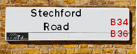
| Icon | Postcodes for Stechford Road | |
| Walking Distances | ||
| Distance Info | Green Circle = 10 Minutes Walk (800 metres) | |
About Stechford Road
Stechford Road is a street located in the city of Birmingham. The street has a length of approximately 1,325 metres.
Stechford Road is located within the Birmingham District (B) Council's jurisdiction. They provide various services, like refuse collection, and manage council tax collection. It's situated in the West Midlands region of the UK.
Stechford Road has been assigned the Unique Street Reference Number of 2706405 and 2759129 in the National Street Gazetteer.
Stechford Road is located within the county of West Midlands, situated in the West Midlands region of the UK. It's 99.92 miles North West from central London., 4.01 miles East from Birmingham, 14 miles North West from Coventry and 27.11 miles North East from Worcester.

Do you know why this road is called Stechford Road?
What's it like to live here?
Ask the community a question about Stechford Road.
Do you have any questions, memories to share or know any facts about Stechford Road? We'd love to know more.
Also on streetlist.co.uk, can you help?
Eldroth Road
15th April 2024
I wondered if anyone has any old pictures of Wenning Bank House in the 1940’s and also Lane Side before of the same era .. we visited today with my Mum in law as she used to live at both these properties. Also any photos of the schools around that time .. thank you.
Can You Help?Napps Way
15th April 2024
Why is the road called Napps Way (belonging to Napp, but minus an
apostrophe as is usual with such nomenclature)? Moreover, who or
what is, or was, “Napp” in the respective, possessive case?
Several years ago, I met an elderly man (probably in his late-eighties)
who lives on Bentham Drive, Liverpool 16, and during a conversation
with him whilst in a Northwest Passenger Transport Ambulance on the
way to the former RLUH (Royal Liverpool University Hospital), he told
me that he could remember (when he was a boy, living in Childwall,
Liverpool 16) that, “Where Napps Way is now, during WW2, there was
a two-man gun emplacement on the, then, open land to protect the
railway line passing over Childwall Valley Road - next to the railway
bridge - when suddenly, as they were loading a live “shell” into the gun’s
breach, the aforementioned “shell” accidentally exploded in the gun’s
breach killing both of the two soldiers, that had been manning the gun,
instantly! (Very sad, of course, but could - perhaps - two ghosts relating
to those two, very unfortunately and prematurely-killed soldiers have
haunted that place of their deaths ever since - and have any residents
of Napps Way - formerly and in its latest incarnation - seen two, WW2
(uniformed) soldiers unexpectedly appear in or near their homes?)
Mauritius Road
15th April 2024
Why is Mauritius Road so called, since when and by whom? Does Greenwich have any particular links with Mauritius? Very interested to know. 🤞🏼
Can You Help?Estate Agents near Stechford Road
| Name | Address | Website |
|---|---|---|
| Alex Smith & Company | 23 Coleshill Road, Hodge Hill, Birmingham, B36 8DT | Visit Website |
| YOUR MOVE Murray Rogers | 165 Station Road, Stechford, Birmingham, B33 8BA | Visit Website |
| YOUR MOVE Murray Rogers Lettings | 165 Station Road, Stechford, Birmingham, B33 8BA | Visit Website |
We have found 11 postcodes for Stechford Road
Hotels near Stechford Road
Budget Hotels near Stechford Road
| Budget Hotel Name | Distance (miles) |
|---|---|
| 1: Name:Travelodge Birmingham Fort Dunlop Address:Fort Dunlop, Fort Pkwy, Birmingham, B24 9FD Telephone:0871 984 6312 Visit Site |
1.17 |
| 2: Name:Holiday Inn Express Birmingham - Castle Bromwich Address:1200 Chester Rd, Castle Bromwich Telephone: Visit Site |
1.23 |
| 3: Name:Travelodge Birmingham Castle Bromwich Address:Chester Rd, Birmingham, B36 0AG Telephone:0871 559 1813 Visit Site |
1.56 |
| 4: Name:Holiday Inn Express Birmingham Star City Address:Cuckoo Road, Heartlands Parkway Telephone: Visit Site |
2.07 |
| 5: Name:Holiday Inn Express Birmingham�South A45 Address:1270 Coventry Road, Yardley Telephone: Visit Site |
2.24 |
Location Details
| Stechford Road | |
|---|---|

| |
| Latitude | 52.493674 |
| Longitude | -1.809150 |
| OS Easting (X): | 412956 |
| OS Northing (Y): | 288476 |
| OS Grid Reference: | SP130885 |
Ordnance Survey Maps for Stechford Road
If you purchase a map through the links below, we may earn an affiliate commission.
| Map Series | link | Ordnance Survey |
| Explorer 1:25,000 220 Birmingham, Walsall, Solihull and Redditch | Check Price on Amazon | |
| Landranger 1:50,000 139 Birmingham and Wolverhampton | Check Price on Amazon |
Neighbourhood Policing |
| Police Force: West Midlands |
 View Neighbourhood Crime and Policing View Neighbourhood Crime and Policing |
| Find a Local Neighbourhood Watch Scheme |
Frequently asked Questions for Stechford Road
What Council (Local Authority) is Stechford Road in?
Stechford Road is located within the local authority area of Birmingham Council which is a Metropolitan District.
What Parish Council is Stechford Road in?
Stechford Road is in an unparished area.
What Electoral Ward is Stechford Road in?
Stechford Road is located within the ward of Bromford & Hodge Hill.
What County is Stechford Road in?
Stechford Road is located within the ceremonial county of West Midlands.
What Constituency is Stechford Road in?
Stechford Road is located within the constituency of Birmingham &Hodge Hill.
What Part of the UK is Stechford Road in?
Stechford Road is located within the West Midlands (England) region of the United Kingdom.
What County Council area is Stechford Road in?
Stechford Road is located within the West Midlands Council area.
What Police Force area is Stechford Road in?
Stechford Road is located within the West Midlands Police area.
Roads that have a Junction with Stechford Road
| Street | Junction Type |
|---|---|
| Stechford Lane (A4040) | pseudo node |
| Beaufort Avenue | junction |
| Southbourne Avenue | junction |
| Hodge Hill Road | junction |
| Westbourne Avenue | junction |
| Eastbourne Avenue | junction |
| Coleshill Road (B4114) | roundabout |
Sunset and Sunrise times for Stechford Road
| Sunrise | 05:57 |
|---|---|
| Sunset | 20:15 |
Latest Weather Conditions for Stechford Road
| Observed at Weather Station: | Coleshill 19 April 2024 at 12:00 (5.14 miles away) |
|---|---|
| Current Weather: | Cloudy |
| Temperature and Humidity: | 13.3°C (58.8%) |
| Wind Direction and Speed: | NW (16 mph) |
Population Statistics
| ONS Area Code | E00046119, E00046120, E00046105 & E00046111 |
|---|---|
| ONS Area Name | Pakistani Communities & Achieving Minorities |
| Average Age | 35.57, 36.32 & 40.08 |
| Area Population | 1857.00, 1527.00 & 1514.00 |
| Male Population | 882.00, 764.00 & 768.00 (49%) |
| Female Population | 975.00, 763.00 & 746.00 (51%) |
| Benefit Claimants | 30 & 29 (2%) |
| LSOA Code: | E01009090, E01009089 &E01009087 |
|---|---|
| LSOA Name: | Birmingham 042E, Birmingham 042D &Birmingham 042C |
| SOA Code: | 7b &3b |
| SOA Name: | |
| MSOA Code: | E02001868 |
| MSOA Name: | Birmingham 042 |
Nearest Supermarkets
| Tesco Birmingham Hodge Hill Superstore |
|---|
| Coleshill Rd, Hodge Hill, B36 8DT |
| 0345 671 9451 |
| Distance: 0.38 Miles |
| Directions from Stechford Road to Tesco Birmingham Hodge Hill Superstore |
| Iceland Washwood Heath |
|---|
| 52 The Fox Goose Centre, Birmingham, B8 2EP |
| 01217837468 |
| Distance: 0.45 Miles |
| Directions from Stechford Road to Iceland Washwood Heath |
| Iceland Stechford Food Warehouse |
|---|
| Unit E, Stechford Retail Park, Birmingham, B33 9AN |
| 01217842668 |
| Distance: 0.49 Miles |
| Directions from Stechford Road to Iceland Stechford Food Warehouse |
| Tesco Castle Bromwich Express |
|---|
| 32-36 Chipperfield Rd Bromford, Castle Bromwich, Birmingham, B36 8BL |
| 0345 026 9706 |
| Distance: 0.59 Miles |
| Directions from Stechford Road to Tesco Castle Bromwich Express |
Telephone Information
| Area Code |
|---|
| Area Code: 0121 - Birmingham |
| Area Code: 01675 - Coleshill |
| Area Code: 01676 - Meriden |
Broadband Information
| Speed | Average Speed | Median Speed | Maximum Speed | Next-generation access (NGA) | Number of Connections |
|---|---|---|---|---|---|
| Greater than 2 Mbps | 15.1 | 7.8 | >=30 | Y | 3 |
Local Government
| Local Council Details |
|---|
| Within the area of Birmingham |
| Visit the Council's Website |
| Council House, Victoria Square, Birmingham &B1 1BB |
| Send email |
| Telephone Number: 0121 303 1111 |
| Local Member of Parliament |
|---|
| Within the Westminster Parliamentary Constituency of Birmingham &Hodge Hill |
| The Member of Parliament is Liam Byrne |
| Details for the MP Liam Byrne on parliament.uk |
| Details for the MP Liam Byrne on theyworkforyou.com |
| In the 2019 General Election Liam Byrne won with a majority of 28,655 the result was Lab hold. The total electorate was 78,295 |
| Wards, Parish Councils and County Councils |
|---|
| Ward: Bromford & Hodge Hill Ward |
| Ceremonial County: West Midlands |
Nearest Schools
| Name | Address | Postcode | Telephone | Type | Distance (Km) |
|---|
Data accessed from gov.scot 08-08-2019
Nearest Hospitals
| Name | Address | Postcode | Distance | Map |
|---|
Nearest Dentists
Dentists near Stechford Road
| Name | Address | Postcode | Distance | Map |
|---|
Nearest GP Surgeries
Doctors near Stechford Road
BUCKLANDS END LANE SURGERY
Address: 36 BUCKLANDS END LANE, BIRMINGHAM, WEST MIDLANDS, B34 6BP
Distance: 0.48 miles
Contact: tel: 0845 6750588
HODGE HILL FAMILY PRACTICE
Address: 1ST FLOOR HODGE HILL PCC, ROUGHLEA AVENUE, HODGE HILL, BIRMINGHAM, WEST MIDLANDS, B36 8GH
Distance: 0.72 miles
Contact: tel: 0121 6616961
WARD END MEDICAL CENTRE
Address: 794A WASHWOOD HEATH ROAD, WARD END, BIRMINGHAM, WEST MIDLANDS, B8 2JN
Distance: 0.73 miles
Contact: tel: 0121 3271049
GLEBE FARM ROAD SURGERY
Address: 37-41 GLEBE FARM ROAD, BIRMINGHAM, WEST MIDLANDS, B33 9LY
Distance: 0.77 miles
Contact: :
CHURCH LANE - KHAN
Address: 111-113 CHURCH LANE, KITTS GREEN, STECHFORD, BIRMINGHAM, WEST MIDLANDS, B33 9EJ
Distance: 0.79 miles
Contact: tel: 0845 0711104
THE POOLWAY MEDICAL CENTRE
Address: CHURCH LANE HEALTH CENTRE, 80 CHURCH LANE, KITTS GREEN, BIRMINGHAM, WEST MIDLANDS, B33 9EN
Distance: 0.81 miles
Contact: tel: 0151 3308200
Nearest Dispensing Chemists
Pharmacies near Stechford Road
| Name | Address | Postcode | Telephone | Map | Distance in Km |
|---|
Nearest Opticians
Opticians near Stechford Road
HODGE HILL OPTICIANS
Address: UNIT 2 (INSIDE OF TESCO), COLESHILL ROAD, WARD END, BIRMINGHAM, WEST MIDLANDS, B36 8DT
Distance: 0.35 miles
Contact: :
COLIN LEE OPTICIANS (WARD END)
Address: FOX & GOOSE SHOPPING CENTRE, WASHWOOD HEALTH ROAD, WARD END, BIRMINGHAM, WEST MIDLANDS, B8 2EP
Distance: 0.45 miles
Contact: :
ONSIGHT DOMICILIARY SERVICES LIMITED
Address: 190 FLAXLEY ROAD, BIRMINGHAM, B33 9HD
Distance: 0.64 miles
Contact: :
SPARK OPTICS STECHFORD LTD
Address: 149 STATION ROAD, STECHFORD, BIRMINGHAM, B33 8BA
Distance: 0.65 miles
Contact: :
RYTE DIRECT LTD
Address: 52 RADSTOCK AVENUE, BIRMINGHAM, WEST MIDLANDS, B36 8HD
Distance: 0.67 miles
Contact: :
MII HOME EYE CARE (BIRMINGHAM)
Address: 730 WASHWOOD HEATH ROAD, BIRMINGHAM, WEST MIDLANDS, B8 2JD
Distance: 0.87 miles
Contact: :
Transport
Nearest Rail Stations
Stechford Station is 0.62 miles away.
Address: Stechford station, Victoria Road, Stechford, West Midlands, B33 8AJ
Stechford is situated on the Rugby�Birmingham�Stafford line|West Coast Main Line.
Stechford Station is staffed on a part time basis.
Lea Hall Station is 1.33 miles away.
Address: Lea Hall station, Lea Hall Road, Lea Hall, West Midlands, B33 8JU
Lea Hall is situated on the Rugby�Birmingham�Stafford line|West Coast Main Line.
Lea Hall Station is staffed on a part time basis.