Map of Vicarage Fields
| Postcodes | ||
|---|---|---|
| Icon | Postcodes for Vicarage Fields | |
| Walking Distances | ||
| Distance Info | Green Circle = 10 Minutes Walk (800 metres) | |
About Vicarage Fields
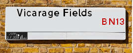
Vicarage Fields is a street located in the town of Worthing. It uses the postcode BN13 3SF. The street has a length of approximately 163 metres.
Vicarage Fields is located within the Worthing District (B) Council's jurisdiction. They provide various services, like refuse collection, and manage council tax collection. It's situated in the South East region of the UK.
Vicarage Fields has been assigned the Unique Street Reference Number of 45100570 in the National Street Gazetteer.
Vicarage Fields is located within the county of West Sussex, situated in the South East region of the UK. It's 47.68 miles South from central London., 11.89 miles West from Brighton, 15.96 miles East from Chichester and 18.96 miles West from Lewes.

Do you know why this road is called Vicarage Fields?
What's it like to live here?
Ask the community a question about Vicarage Fields.
Do you have any questions, memories to share or know any facts about Vicarage Fields? We'd love to know more.
Also on streetlist.co.uk, can you help?
Eldroth Road
15th April 2024
I wondered if anyone has any old pictures of Wenning Bank House in the 1940’s and also Lane Side before of the same era .. we visited today with my Mum in law as she used to live at both these properties. Also any photos of the schools around that time .. thank you.
Can You Help?Napps Way
15th April 2024
Why is the road called Napps Way (belonging to Napp, but minus an
apostrophe as is usual with such nomenclature)? Moreover, who or
what is, or was, “Napp” in the respective, possessive case?
Several years ago, I met an elderly man (probably in his late-eighties)
who lives on Bentham Drive, Liverpool 16, and during a conversation
with him whilst in a Northwest Passenger Transport Ambulance on the
way to the former RLUH (Royal Liverpool University Hospital), he told
me that he could remember (when he was a boy, living in Childwall,
Liverpool 16) that, “Where Napps Way is now, during WW2, there was
a two-man gun emplacement on the, then, open land to protect the
railway line passing over Childwall Valley Road - next to the railway
bridge - when suddenly, as they were loading a live “shell” into the gun’s
breach, the aforementioned “shell” accidentally exploded in the gun’s
breach killing both of the two soldiers, that had been manning the gun,
instantly! (Very sad, of course, but could - perhaps - two ghosts relating
to those two, very unfortunately and prematurely-killed soldiers have
haunted that place of their deaths ever since - and have any residents
of Napps Way - formerly and in its latest incarnation - seen two, WW2
(uniformed) soldiers unexpectedly appear in or near their homes?)
Mauritius Road
15th April 2024
Why is Mauritius Road so called, since when and by whom? Does Greenwich have any particular links with Mauritius? Very interested to know. 🤞🏼
Can You Help?Estate Agents near Vicarage Fields
| Name | Address | Website |
|---|---|---|
| Bacon Micawber Lettings | 5 Selden Parade, Salvington Road, Worthing, BN13 2HL | Visit Website |
| Ian Watkins Estate Agents | 4 Selden Parade, Salvington Road, Worthing, BN13 2HL | Visit Website |
| BoKlok | BoKlok on the Lake, Fulbeck Avenue, West Durrington BN13 3SS | Visit Website |
We have found 1 postcode for Vicarage Fields
Location Details
| Vicarage Fields | |
|---|---|

| |
| Latitude | 50.837264 |
| Longitude | -0.413005 |
| OS Easting (X): | 511734 |
| OS Northing (Y): | 105454 |
| OS Grid Reference: | TQ117055 |
Ordnance Survey Maps for Vicarage Fields
If you purchase a map through the links below, we may earn an affiliate commission.
| Map Series | link | Ordnance Survey |
| Explorer 1:25,000 ol10 Arundel & Pulborough | Check Price on Amazon | Buy Direct from the Ordnance Survey |
| Landranger 1:50,000 198 Brighton & Lewes | Check Price on Amazon |
Neighbourhood Policing |
| Police Force: Sussex |
 View Neighbourhood Crime and Policing View Neighbourhood Crime and Policing |
| Find a Local Neighbourhood Watch Scheme |
Frequently asked Questions for Vicarage Fields
What Council (Local Authority) is Vicarage Fields in?
Vicarage Fields is located within the local authority area of Worthing Council which is a District Council.
What Parish Council is Vicarage Fields in?
Vicarage Fields is in an unparished area.
What Electoral Ward is Vicarage Fields in?
Vicarage Fields is located within the ward of Durrington.
What County is Vicarage Fields in?
Vicarage Fields is located within the ceremonial county of West Sussex.
What Constituency is Vicarage Fields in?
Vicarage Fields is located within the constituency of Worthing West.
What Part of the UK is Vicarage Fields in?
Vicarage Fields is located within the South East (England) region of the United Kingdom.
What County Council area is Vicarage Fields in?
Vicarage Fields is located within the West Sussex Council area.
What Police Force area is Vicarage Fields in?
Vicarage Fields is located within the Sussex Police area.
Roads that have a Junction with Vicarage Fields
| Street | Junction Type |
|---|---|
| Bramble Lane | junction |
Sunset and Sunrise times for Vicarage Fields , BN13 3SF
| Sunrise | 05:43 |
|---|---|
| Sunset | 20:15 |
Latest Weather Conditions for Vicarage Fields, BN13 3SF
| Observed at Weather Station: | Shoreham 25 April 2024 at 22:00 (5.28 miles away) |
|---|---|
| Current Weather: | Clear night |
| Temperature and Humidity: | 7.2°C (94.7%) |
| Wind Direction and Speed: | N (0 mph) |
Population Statistics
| ONS Area Code | E00162117 |
|---|---|
| ONS Area Name | Self-Sufficient Retirement |
| Average Age | 44.31 |
| Area Population | 1356.00 |
| Male Population | 633.00 (47%) |
| Female Population | 723.00 (53%) |
| Benefit Claimants | 5 (0%) |
| LSOA Code: | E01031792 |
|---|---|
| LSOA Name: | Worthing 003A |
| SOA Code: | 5c |
| SOA Name: | |
| MSOA Code: | E02006623 |
| MSOA Name: | Worthing 003 |
Nearest Supermarkets
| Tesco Durrington Esso Express |
|---|
| 182 Littlehampton Rd, Durrington, Worthing, BN13 1QY |
| 0345 026 9936 |
| Distance: 0.63 Miles |
| Directions from Vicarage Fields to Tesco Durrington Esso Express |
| Tesco West Durrington Extra |
|---|
| New Rd, West Durrington, Worthing, BN13 3PB |
| 0345 026 9574 |
| Distance: 0.67 Miles |
| Directions from Vicarage Fields to Tesco West Durrington Extra |
| Sainsburys Worthing Littlehampton Road Local |
|---|
| 68 - 70 Littlehampton Road, Worthing, England, BN13 1QH |
| 1903694910 |
| Distance: 0.87 Miles |
| Directions from Vicarage Fields to Sainsburys Worthing Littlehampton Road Local |
| Tesco Worthing Findon Rd Express |
|---|
| 176-180 Findon Rd, Worthing, BN14 0EL |
| 0345 026 9012 |
| Distance: 1.03 Miles |
| Directions from Vicarage Fields to Tesco Worthing Findon Rd Express |
Telephone Information
| Dialling Code | Telephone Exchange | Telephone Cabinet | Fibre to the Cabinet or Fibre to the Premises |
|---|---|---|---|
| 01903 | WORTHING SWANDEAN - SDWSWND | P2 | FTTC |
Broadband Information
| Speed | Average Speed | Median Speed | Maximum Speed | Next-generation access (NGA) | Number of Connections |
|---|---|---|---|---|---|
| Greater than 2 Mbps | 21 | 19.5 | >=30 | Y | 20 |
Local Government
| Local Council Details |
|---|
| Within the area of Worthing |
| Visit the Council's Website |
| Worthing Town Hall, Chapel Road, Worthing, West Sussex &BN11 1HA |
| Send email |
| Telephone Number: 01903 239 999 |
| Local Member of Parliament |
|---|
| Within the Westminster Parliamentary Constituency of Worthing West |
| The Member of Parliament is Peter Bottomley |
| Details for the MP Peter Bottomley on parliament.uk |
| Details for the MP Peter Bottomley on theyworkforyou.com |
| In the 2019 General Election Peter Bottomley won with a majority of 14,823 the result was Con hold. The total electorate was 78,585 |
| Wards, Parish Councils and County Councils |
|---|
| Ward: Durrington Ward |
| Ceremonial County: West Sussex |
Nearest Schools
England Primary Schools
Bramber Primary School
Address: Bramber Primary School, Bramber Road, Worthing, West Sussex, BN14 8QB
Distance: 2.20 miles
Contact: 01903219277
Broadwater CofE Primary School
Address: Broadwater CofE Primary School, Rectory Gardens, Worthing, West Sussex, BN14 7TQ
Distance: 1.64 miles
Contact: 01903235389
Vale School, Worthing
Address: Vale School, Worthing, Vale Avenue, Worthing, West Sussex, BN14 0DB
Distance: 0.95 miles
Contact: 01903872322
Thomas A Becket Junior School
Address: Thomas A Becket Junior School, Glebeside Avenue, Worthing, West Sussex, BN14 7PR
Distance: 1.24 miles
Contact: 01903202268
Thomas A Becket Infant School
Address: Thomas A Becket Infant School, Pelham Road, Worthing, West Sussex, BN13 1JB
Distance: 1.01 miles
Contact: 01903235386
West Park CofE Primary (Controlled) School
Address: West Park CofE Primary (Controlled) School, Marlborough Road, Worthing, West Sussex, BN12 4HD
Distance: 1.66 miles
Contact: 01903243099
St John the Baptist CofE Primary School
Address: St John the Baptist CofE Primary School, School Hill, Findon, Worthing, West Sussex, BN14 0TR
Distance: 2.20 miles
Contact: 01903873072
Durrington Junior School
Address: Durrington Junior School, Salvington Road, Worthing, West Sussex, BN13 2JD
Distance: 0.34 miles
Contact: 01903260761
Durrington Infant School
Address: Durrington Infant School, Salvington Road, Worthing, West Sussex, BN13 2JD
Distance: 0.34 miles
Contact: 01903260138
English Martyrs Catholic Primary School, Worthing
Address: English Martyrs Catholic Primary School, Worthing, Derwent Drive, Goring-by-Sea, Worthing, West Sussex, BN12 6LA
Distance: 0.76 miles
Contact: 01903502868
Hawthorns Primary School, Durrington
Address: Hawthorns Primary School, Durrington, Poplar Road, Durrington, Worthing, West Sussex, BN13 3EZ
Distance: 0.67 miles
Contact: 01903268174
Orchards Junior School
Address: Orchards Junior School, Nelson Road, Worthing, West Sussex, BN12 6EN
Distance: 1.08 miles
Contact: 01903520202
Field Place Infant School
Address: Field Place Infant School, Nelson Road, Worthing, West Sussex, BN12 6EN
Distance: 1.08 miles
Contact: 01903700234
The Laurels Primary School, Worthing
Address: The Laurels Primary School, Worthing, Winterbourne Way, West Durrington, Worthing, West Sussex, BN13 3QH
Distance: 0.87 miles
Contact: 01903830901
The Laurels Primary School, Worthing
Address: The Laurels Primary School, Worthing, Winterbourne Way, West Durrington, Worthing, West Sussex, BN13 3QH
Distance: 0.87 miles
Contact:
Clapham and Patching CofE Primary School
Address: Clapham and Patching CofE Primary School, The Street, Clapham, Worthing, West Sussex, BN13 3UU
Distance: 1.61 miles
Contact:
England Secondary Schools
Bohunt School Worthing
Address: Bohunt School Worthing, 65a Broadwater Road, Worthing, West Sussex, BN14 8AH
Distance: 1.98 miles
Contact: 01903601361
Durrington High School
Address: Durrington High School, The Boulevard, Worthing, West Sussex, BN13 1JX
Distance: 0.68 miles
Contact: 01903244957
St Oscar Romero Catholic School
Address: St Oscar Romero Catholic School, Goring Street, Goring-By-Sea, Worthing, West Sussex, BN12 5AF
Distance: 1.72 miles
Contact: 01903241368
England Higher Schools
Greater Brighton Metropolitan College
Address: Greater Brighton Metropolitan College, Littlehampton Road, Worthing, West Sussex, BN12 6NU
Distance: 1.28 miles
Contact:
Nearest Hospitals
| Name | Address | Postcode | Distance | Map |
|---|
Nearest Dentists
Dentists near Vicarage Fields
| Name | Address | Postcode | Distance | Map |
|---|
Nearest GP Surgeries
Doctors near Vicarage Fields
THE MAYFLOWER SURGERY
Address: DURRINGTON LANE, WORTHING, WEST SUSSEX, BN13 2RX
Distance: 0.47 miles
Contact: :
DURRINGTON HEALTH CENTRE - COVID LOCAL VACCINATION SERVICE 2
Address: DURRINGTON LANE, WORTHING, BN13 2RX
Distance: 0.47 miles
Contact: :
DURRINGTON HEALTH CENTRE
Address: DURRINGTON HEALTH CENTRE, DURRINGTON LANE, WORTHING, WEST SUSSEX, BN13 2RX
Distance: 0.47 miles
Contact: tel: 01903843800
LIME TREE SURGERY
Address: LIME TREE AVENUE, FINDON VALLEY, WORTHING, WEST SUSSEX, BN14 0DL
Distance: 1.09 miles
Contact: tel: 01903 264101
STRAND MEDICAL GROUP - COVID LOCAL VACCINATION SERVICE 3
Address: 1B THE CAUSEWAY, GORING-BY-SEA, WORTHING, BN12 6FP
Distance: 1.28 miles
Contact: :
STRAND MEDICAL GROUP
Address: 1B THE CAUSEWAY, GORING-BY-SEA, WORTHING, BN12 6FA
Distance: 1.30 miles
Contact: tel: 01903 243351
Nearest Dispensing Chemists
Pharmacies near Vicarage Fields
| Name | Address | Postcode | Telephone | Map | Distance in Km |
|---|
Nearest Opticians
Opticians near Vicarage Fields
WEST DURRINGTON EXTRA
Address: NEW ROAD, WEST DURRINGTON, WORTHING, WEST SUSSEX, BN13 3PB
Distance: 0.46 miles
Contact: :
VISION EXPRESS (GORING-BY-SEA)
Address: 48 GORING ROAD, GORING-BY-SEA, WORTHING, WEST SUSSEX, BN12 4AD
Distance: 1.69 miles
Contact: :
THOMAS H COLLISON LTD (BROADWATER ST, WORTHING)
Address: 7 CRICKETERS PARADE, BROADWATER STREET WEST, WORTHING, WEST SUSSEX, BN14 9DB
Distance: 1.74 miles
Contact: :
INDIVIDUAL EYES
Address: 324 GORING ROAD, GORING-BY-SEA, WORTHING, WEST SUSSEX, BN12 4PE
Distance: 1.75 miles
Contact: :
BOURNEMOUTH 5 DOMICILIARY SPECSAVERS LIMITED
Address: 7 TURNER ROAD, WORTHING, WEST SUSSEX, BN14 8PX
Distance: 2.16 miles
Contact: :
FACTORY SPECS DIRECT (MONTAGUE STREET)
Address: 112 MONTAGUE STREET, WORTHING, WEST SUSSEX, BN11 3HG
Distance: 2.45 miles
Contact: :
Transport
Nearest Rail Stations
Durrington-on-Sea Station is 1.37 miles away.
Address: Durrington-on-Sea station, The Causeway, Durrington-on-Sea, West Sussex, BN12 6BT
Durrington-on-Sea is situated on the West Coastway Line and is managed by Southern.
Durrington-on-Sea Station is staffed on a part time basis.
Directions from Vicarage Fields to Durrington-on-Sea Rail Station
West Worthing Station is 1.57 miles away.
Address: West Worthing station, Tarring Road, Worthing, West Sussex, BN11 4SR
West Worthing is situated on the West Coastway Line and is managed by Southern.
West Worthing Station is staffed on a part time basis.
Directions from Vicarage Fields to West Worthing Rail Station