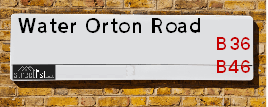
Map of Water Orton Road
| Postcodes | ||
|---|---|---|
| Icon | Postcodes for Water Orton Road | |
| Walking Distances | ||
| Distance Info | Green Circle = 10 Minutes Walk (800 metres) | |
About Water Orton Road
Water Orton Road is a street located in the city of Birmingham. The street has a length of approximately 3,473 metres.
Water Orton Road is located within the Solihull District (B) and Birmingham District (B) Council's jurisdiction. They provide various services, like refuse collection, and manage council tax collection. It's situated in the West Midlands region of the UK.
Water Orton Road has been assigned the Unique Street Reference Numbers of 35003145, 35003144, 35080137, 35007238, 35007239, 35003146, 2744750 and 2759236 in the National Street Gazetteer.
Water Orton Road is located within the county of West Midlands, situated in the West Midlands region of the UK. It's 99.4 miles North West from central London., 6 miles East from Birmingham, 13 miles North West from Coventry and 28.18 miles West from Leicester.

Do you know why this road is called Water Orton Road?
What's it like to live here?
Ask the community a question about Water Orton Road.
Do you have any questions, memories to share or know any facts about Water Orton Road? We'd love to know more.
Also on streetlist.co.uk, can you help?
Eldroth Road
15th April 2024
I wondered if anyone has any old pictures of Wenning Bank House in the 1940’s and also Lane Side before of the same era .. we visited today with my Mum in law as she used to live at both these properties. Also any photos of the schools around that time .. thank you.
Can You Help?Napps Way
15th April 2024
Why is the road called Napps Way (belonging to Napp, but minus an
apostrophe as is usual with such nomenclature)? Moreover, who or
what is, or was, “Napp” in the respective, possessive case?
Several years ago, I met an elderly man (probably in his late-eighties)
who lives on Bentham Drive, Liverpool 16, and during a conversation
with him whilst in a Northwest Passenger Transport Ambulance on the
way to the former RLUH (Royal Liverpool University Hospital), he told
me that he could remember (when he was a boy, living in Childwall,
Liverpool 16) that, “Where Napps Way is now, during WW2, there was
a two-man gun emplacement on the, then, open land to protect the
railway line passing over Childwall Valley Road - next to the railway
bridge - when suddenly, as they were loading a live “shell” into the gun’s
breach, the aforementioned “shell” accidentally exploded in the gun’s
breach killing both of the two soldiers, that had been manning the gun,
instantly! (Very sad, of course, but could - perhaps - two ghosts relating
to those two, very unfortunately and prematurely-killed soldiers have
haunted that place of their deaths ever since - and have any residents
of Napps Way - formerly and in its latest incarnation - seen two, WW2
(uniformed) soldiers unexpectedly appear in or near their homes?)
Mauritius Road
15th April 2024
Why is Mauritius Road so called, since when and by whom? Does Greenwich have any particular links with Mauritius? Very interested to know. 🤞🏼
Can You Help?Estate Agents near Water Orton Road
| Name | Address | Website |
|---|---|---|
| Prime Estates | 254 Chester Road, Castle Bromwich, Birmingham, B36 0JE | Visit Website |
| Shipways | 258 Chester Road, Castle Bromwich, B36 0JE | |
| YOUR MOVE Murray Rogers | 256 Chester Road, Castle Bromwich, Birmingham, B36 0JE | Visit Website |
We have found 10 postcodes for Water Orton Road
Location Details
| Water Orton Road | |
|---|---|

| |
| Latitude | 52.509429 |
| Longitude | -1.767871 |
| OS Easting (X): | 415752 |
| OS Northing (Y): | 290236 |
| OS Grid Reference: | SP158902 |
Neighbourhood Policing |
| Police Force: West Midlands |
 View Neighbourhood Crime and Policing View Neighbourhood Crime and Policing |
| Find a Local Neighbourhood Watch Scheme |
Frequently asked Questions for Water Orton Road
What Council (Local Authority) is Water Orton Road in?
Water Orton Road is located within the local authority area of Solihull Council which is a Metropolitan District.
What Parish Council is Water Orton Road in?
Water Orton Road is located within the area of Castle Bromwich Parish Council.
What Electoral Ward is Water Orton Road in?
Water Orton Road is located within the ward of Castle Bromwich.
What County is Water Orton Road in?
Water Orton Road is located within the ceremonial county of West Midlands.
What Constituency is Water Orton Road in?
Water Orton Road is located within the constituency of Meriden.
What Part of the UK is Water Orton Road in?
Water Orton Road is located within the West Midlands (England) region of the United Kingdom.
What County Council area is Water Orton Road in?
Water Orton Road is located within the West Midlands Council area.
What Police Force area is Water Orton Road in?
Water Orton Road is located within the West Midlands Police area.
Roads that have a Junction with Water Orton Road
| Street | Junction Type |
|---|---|
| Chester Road (B4119) | junction |
| Whateley Lodge Drive | junction |
| Blackthorn Road | junction |
| Marlborough Road | junction |
| Blackthorn Road | junction |
| Green Lane | junction |
| Parkfield Drive | junction |
| Birmingham Road (B4118) | pseudo node |
Sunset and Sunrise times for Water Orton Road
| Sunrise | 05:48 |
|---|---|
| Sunset | 20:21 |
Latest Weather Conditions for Water Orton Road
| Observed at Weather Station: | Coleshill 23 April 2024 at 12:00 (3.89 miles away) |
|---|---|
| Current Weather: | Drizzle |
| Temperature and Humidity: | 7.9°C (76.5%) |
| Wind Direction and Speed: | N (11 mph) |
Population Statistics
| ONS Area Code | E00051161, E00051190, E00051177, E00051181 & E00051153 |
|---|---|
| ONS Area Name | Self-Sufficient Retirement, Semi-Detached Ageing, Outer City Hardship & Ageing Industrious Workers |
| Average Age | 47.82, 43.44 & 43.41 |
| Area Population | 1416.00, 1386.00 & 1293.00 |
| Male Population | 715.00, 686.00 & 579.00 (48%) |
| Female Population | 701.00, 700.00 & 714.00 (52%) |
| Benefit Claimants | 11, 10 & 33 (1%) |
| LSOA Code: | E01010121, E01010117 &E01010120 |
|---|---|
| LSOA Name: | Solihull 001C, Solihull 003A &Solihull 001B |
| SOA Code: | 8b &4c |
| SOA Name: | |
| MSOA Code: | E02002081 &E02002083 |
| MSOA Name: | Solihull 001 &Solihull 003 |
Nearest Supermarkets
| Tesco Castle Bromwich Green Ln Express |
|---|
| 136-140 Green Ln, Castle Bromwich, Birmingham, B36 0BX |
| 0345 026 9107 |
| Distance: 0.39 Miles |
| Directions from Water Orton Road to Tesco Castle Bromwich Green Ln Express |
| Iceland Castle Bromwich |
|---|
| 18/26 Timberley Lane, Castle Bromwich, Birmingham, B34 7EH |
| 01217496886 |
| Distance: 0.58 Miles |
| Directions from Water Orton Road to Iceland Castle Bromwich |
| Morrisons Birmingham - Castle Bromwich |
|---|
| 264 Chester Road, Castle Bromwich, Birmingham B34 7HR |
| 0121 776 7878 |
| Distance: 0.71 Miles |
| Directions from Water Orton Road to Morrisons Birmingham - Castle Bromwich |
| Tesco Water Orton Express |
|---|
| 8 Station Buildings, Birmingham Rd, Birmingham, B46 1SR |
| 0345 026 9273 |
| Distance: 1.26 Miles |
| Directions from Water Orton Road to Tesco Water Orton Express |
Telephone Information
| Area Code |
|---|
| Area Code: 01675 - Coleshill |
| Area Code: 0121 - Birmingham |
| Area Code: 01676 - Meriden |
| Area Code: 01827 - Tamworth |
Local Government
| Local Council Details |
|---|
| Within the area of Solihull |
| Visit the Council's Website |
| PO Box 18, Council House, Solihull, West Midlands &B91 3QS |
| Send email |
| Telephone Number: 0121 704 6000 |
| Local Member of Parliament |
|---|
| Within the Westminster Parliamentary Constituency of Meriden |
| The Member of Parliament is Saqib Bhatti |
| Details for the MP Saqib Bhatti on parliament.uk |
| Details for the MP Saqib Bhatti on theyworkforyou.com |
| In the 2019 General Election Saqib Bhatti won with a majority of 22,836 the result was Con hold. The total electorate was 85,368 |
| Wards, Parish Councils and County Councils |
|---|
| Ward: Castle Bromwich Ward |
| Ceremonial County: West Midlands |
Nearest Schools
England Primary Schools
St John the Baptist Catholic Primary School
Address: St John the Baptist Catholic Primary School, Arran Way, Chelmsley Wood, Birmingham, West Midlands, B36 0QE
Distance: 1.23 miles
Contact:
St Mary and St Margaret's Church of England Aided Primary School
Address: St Mary and St Margaret's Church of England Aided Primary School, Southfield Avenue, Castle Bromwich, Birmingham, West Midlands, B36 9AX
Distance: 0.83 miles
Contact: 01217472025
St Wilfrid's Catholic Junior and Infant School
Address: St Wilfrid's Catholic Junior and Infant School, Shawsdale Road, Birmingham, West Midlands, B36 8LY
Distance: 1.42 miles
Contact:
Water Orton Primary School
Address: Water Orton Primary School, Plank Lane, Water Orton, Birmingham, Warwickshire, B46 1SG
Distance: 1.18 miles
Contact: 01217472851
Smith's Wood Primary Academy
Address: Smith's Wood Primary Academy, Burton's Way, Smith's Wood, Birmingham, West Midlands, B36 0SZ
Distance: 0.89 miles
Contact: 01217798050
Kingshurst Primary School
Address: Kingshurst Primary School, School Close, Kingshurst, Birmingham, West Midlands, B37 6BN
Distance: 1.21 miles
Contact: 01217886510
Hillstone Primary School
Address: Hillstone Primary School, Hillstone Road, Shard End, Birmingham, West Midlands, B34 7PY
Distance: 1.16 miles
Contact: 01216753573
Castle Bromwich Infant and Nursery School
Address: Castle Bromwich Infant and Nursery School, Green Lane, Castle Bromwich, Birmingham, West Midlands, B36 0BX
Distance: 0.36 miles
Contact:
Castle Bromwich Junior School
Address: Castle Bromwich Junior School, Castle Bromwich Junior School Hurst Lane North, Castle Bromwich, Birmingham, West Midlands, B36 0HD
Distance: 0.46 miles
Contact:
Timberley Academy
Address: Timberley Academy, Bradley Road, Shard End, Birmingham, West Midlands, B34 7RL
Distance: 0.82 miles
Contact: 01214642002
Guardian Angels Catholic Primary School
Address: Guardian Angels Catholic Primary School, Hurst Lane, Shard End, Birmingham, West Midlands, B34 7HN
Distance: 0.83 miles
Contact:
Brownmead Primary Academy
Address: Brownmead Primary Academy, Pencroft Road, Shard End, Birmingham, West Midlands, B34 6SS
Distance: 0.84 miles
Contact: 01216753102
Firs Primary School
Address: Firs Primary School, Dreghorn Road, Castle Bromwich, Firs Primary School, Birmingham, West Midlands, B36 8LL
Distance: 1.47 miles
Contact: 01214643792
Firs Primary School
Address: Firs Primary School, Dreghorn Road, Castle Bromwich, Birmingham, West Midlands, B36 8LL
Distance: 1.47 miles
Contact:
Heathlands Primary Academy
Address: Heathlands Primary Academy, Heath Way, Castle Bromwich, Birmingham, West Midlands, B34 6NB
Distance: 1.41 miles
Contact: 01217472705
Chivenor Primary School
Address: Chivenor Primary School, Farnborough Road, Castle Vale, Birmingham, West Midlands, B35 7JA
Distance: 1.08 miles
Contact: 01216759833
England Secondary Schools
Smith's Wood Sports College
Address: Smith's Wood Sports College, Windward Way, Smith's Wood, Birmingham, West Midlands, B36 0UE
Distance: 1.18 miles
Contact:
Smith's Wood Academy
Address: Smith's Wood Academy, Windward Way, Smith's Wood, Birmingham, West Midlands, B36 0UE
Distance: 1.18 miles
Contact: 01217884100
Park Hall Academy
Address: Park Hall Academy, Water Orton Road, Castle Bromwich, Birmingham, West Midlands, B36 9HF
Distance: 0.19 miles
Contact: 01217480400
Nearest Hospitals
| Name | Address | Postcode | Distance | Map |
|---|
Nearest Dentists
Dentists near Water Orton Road
| Name | Address | Postcode | Distance | Map |
|---|
Nearest GP Surgeries
Doctors near Water Orton Road
PARKFIELD MEDICAL CENTRE
Address: 10 PARKFIELD DRIVE, CASTLE BROMWICH, BIRMINGHAM, WEST MIDLANDS, B36 9EJ
Distance: 0.33 miles
Contact: tel: 0121 7495757
THE CASTLE PRACTICE
Address: 2 HAWTHORNE ROAD, CASTLE BROMWICH, BIRMINGHAM, WEST MIDLANDS, B36 0HH
Distance: 0.71 miles
Contact: tel: 0121 7472422
GREEN LANE SURGERY
Address: SMITHS WOOD MEDICAL CTR, BURTONS WAY, SMITHS WOOD, BIRMINGHAM, WEST MIDLANDS, B36 0SZ
Distance: 0.89 miles
Contact: tel: 0121 7495115
ARRAN MEDICAL CENTRE
Address: BURTONS WAY, BIRMINGHAM, WEST MIDLANDS, B36 0SZ
Distance: 0.89 miles
Contact: tel: 0121 7704043
SATIS HOUSE
Address: 10 BIRMINGHAM ROAD, WATER ORTON, BIRMINGHAM, WEST MIDLANDS, B46 1TH
Distance: 1.02 miles
Contact: tel: 0121 7767572
CHESTER ROAD SURGERY
Address: 406C CHESTER ROAD, KINGSHURST, BIRMINGHAM, B36 0LF
Distance: 1.04 miles
Contact: :
Nearest Dispensing Chemists
Pharmacies near Water Orton Road
| Name | Address | Postcode | Telephone | Map | Distance in Km |
|---|
Nearest Opticians
Opticians near Water Orton Road
ELLIS OPTICIANS
Address: 350 BRADFORD ROAD, BIRMINGHAM, WEST MIDLANDS, B36 9AD
Distance: 0.57 miles
Contact: :
COOK OPTICIANS
Address: 6 HURST LANE, CASTLE BROMWICH, BIRMINGHAM, WEST MIDLANDS, B34 7HR
Distance: 0.71 miles
Contact: :
VISION REPUBLIC OPTICIANS
Address: 15 OWNALL ROAD, BIRMINGHAM, WEST MIDLANDS, B34 7AH
Distance: 1.11 miles
Contact: :
I M HADFIELD OPTOMETRISTS - KINGSHURST
Address: 20 THE PARADE, KINGSHURST, BIRMINGHAM, WEST MIDLANDS, B37 6BA
Distance: 1.29 miles
Contact: :
CASTLE VALE SPECSAVERS LIMITED
Address: CASTLE VALE SHOPPING CENTRE, CASTLE VALE RETAIL PARK, CHESTER ROAD, BIRMINGHAM, B35 6HB
Distance: 1.35 miles
Contact: :
COVENTRY 2 DOMICILIARY SPECSAVERS LIMITED
Address: 165 MERIDEN DRIVE, BIRMINGHAM, B37 6BT
Distance: 1.47 miles
Contact: :
Transport
Nearest Rail Stations
Water Orton Station is 1.22 miles away.
Address: Water Orton station, Marsh Lane, Water Orton, Warwickshire, B46 1NE
Water Orton is situated on the Birmingham to Peterborough Line|Birmingham to Nottingham Line.
Water Orton Station is an unstaffed station.
Directions from Water Orton Road to Water Orton Rail Station
Lea Hall Station is 2.13 miles away.
Address: Lea Hall station, Lea Hall Road, Lea Hall, West Midlands, B33 8JU
Lea Hall is situated on the Rugby�Birmingham�Stafford line|West Coast Main Line.
Lea Hall Station is staffed on a part time basis.