The AL9 postcode district is a postal district located in the AL St Albans postcode area with a population of 11,706 residents according to the 2021 England and Wales Census.
The area of the AL9 postcode district is 15.96 square miles which is 41.34 square kilometres or 10,214.72 acres.
Currently, the AL9 district has about 429 postcode units spread across 3 geographic postcode sectors.
Given that each sector allows for 400 unique postcode combinations, the district has a capacity of 1,200 postcodes. With 429 postcodes already in use, this leaves 771 units available.
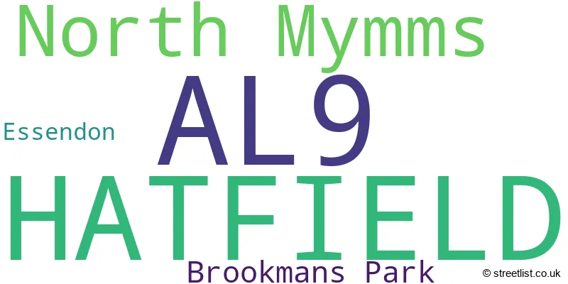
The largest settlement in the AL9 postal code is HATFIELD followed by North Mymms, and BROOKMANS PARK.
The AL9 Postcode shares a border with AL10 (HATFIELD), EN6 (POTTERS BAR, CUFFLEY), SG13 (HERTFORD, Hertford Heath, Bayford), AL7 (WELWYN GARDEN CITY) and AL8 (WELWYN GARDEN CITY, Lemsford).
The AL9 postcode district is primarily represented by the settlement of Hatfield, located in the county of Hertfordshire, England. Other significant settlements in this district include Essendon, North Mymms, and Brookmans Park. The postal town associated with this postcode district is Hatfield.
For the district AL9, we have data on 3 postcode sectors. Here's a breakdown: The sector AL9 5, covers Hatfield in Hertfordshire. The sector AL9 6, covers Essendon and Hatfield and Brookmans Park in Hertfordshire. The sector AL9 7, covers North Mymms and Brookmans Park in Hertfordshire.

Map of the AL9 Postcode District
Explore the AL9 postcode district by using our free interactive map.

When it comes to local government, postal geography often disregards political borders. However, for a breakdown in the AL9 District: the district mostly encompasses the Welwyn Hatfield District (B) area with a total of 427 postcodes.
Weather Forecast for AL9
Press Button to Show Forecast for Hatfield House
| Time Period | Icon | Description | Temperature | Rain Probability | Wind |
|---|---|---|---|---|---|
| 12:00 to 15:00 | Overcast | 9.0°C (feels like 7.0°C) | 13.00% | WNW 11 mph | |
| 15:00 to 18:00 | Cloudy | 9.0°C (feels like 7.0°C) | 12.00% | NNW 9 mph | |
| 18:00 to 21:00 | Cloudy | 8.0°C (feels like 6.0°C) | 9.00% | NNE 7 mph | |
| 21:00 to 00:00 | Cloudy | 6.0°C (feels like 4.0°C) | 5.00% | NE 4 mph |
Press Button to Show Forecast for Hatfield House
| Time Period | Icon | Description | Temperature | Rain Probability | Wind |
|---|---|---|---|---|---|
| 00:00 to 03:00 | Cloudy | 4.0°C (feels like 3.0°C) | 4.00% | NE 4 mph | |
| 03:00 to 06:00 | Partly cloudy (night) | 3.0°C (feels like 1.0°C) | 2.00% | NE 4 mph | |
| 06:00 to 09:00 | Cloudy | 4.0°C (feels like 2.0°C) | 4.00% | NE 4 mph | |
| 09:00 to 12:00 | Cloudy | 7.0°C (feels like 5.0°C) | 5.00% | ENE 7 mph | |
| 12:00 to 15:00 | Overcast | 10.0°C (feels like 8.0°C) | 10.00% | E 7 mph | |
| 15:00 to 18:00 | Overcast | 10.0°C (feels like 9.0°C) | 13.00% | E 7 mph | |
| 18:00 to 21:00 | Cloudy | 9.0°C (feels like 7.0°C) | 11.00% | E 7 mph | |
| 21:00 to 00:00 | Cloudy | 7.0°C (feels like 4.0°C) | 10.00% | E 7 mph |
Press Button to Show Forecast for Hatfield House
| Time Period | Icon | Description | Temperature | Rain Probability | Wind |
|---|---|---|---|---|---|
| 00:00 to 03:00 | Cloudy | 5.0°C (feels like 3.0°C) | 12.00% | ENE 7 mph | |
| 03:00 to 06:00 | Cloudy | 5.0°C (feels like 2.0°C) | 15.00% | ENE 7 mph | |
| 06:00 to 09:00 | Cloudy | 6.0°C (feels like 3.0°C) | 21.00% | ENE 9 mph | |
| 09:00 to 12:00 | Overcast | 8.0°C (feels like 6.0°C) | 22.00% | ENE 9 mph | |
| 12:00 to 15:00 | Overcast | 11.0°C (feels like 9.0°C) | 20.00% | E 9 mph | |
| 15:00 to 18:00 | Cloudy | 12.0°C (feels like 10.0°C) | 20.00% | E 11 mph | |
| 18:00 to 21:00 | Light rain | 11.0°C (feels like 8.0°C) | 52.00% | ENE 9 mph | |
| 21:00 to 00:00 | Light rain | 9.0°C (feels like 7.0°C) | 52.00% | ENE 9 mph |
Press Button to Show Forecast for Hatfield House
| Time Period | Icon | Description | Temperature | Rain Probability | Wind |
|---|---|---|---|---|---|
| 00:00 to 03:00 | Light rain | 8.0°C (feels like 6.0°C) | 51.00% | ENE 9 mph | |
| 03:00 to 06:00 | Light rain | 8.0°C (feels like 6.0°C) | 54.00% | E 9 mph | |
| 06:00 to 09:00 | Heavy rain | 9.0°C (feels like 6.0°C) | 73.00% | ESE 9 mph | |
| 09:00 to 12:00 | Heavy rain | 10.0°C (feels like 8.0°C) | 72.00% | ESE 9 mph | |
| 12:00 to 15:00 | Light rain | 12.0°C (feels like 10.0°C) | 55.00% | S 11 mph | |
| 15:00 to 18:00 | Light rain shower (day) | 12.0°C (feels like 10.0°C) | 39.00% | S 11 mph | |
| 18:00 to 21:00 | Light rain shower (day) | 12.0°C (feels like 10.0°C) | 35.00% | S 9 mph | |
| 21:00 to 00:00 | Clear night | 9.0°C (feels like 7.0°C) | 5.00% | S 7 mph |
Where is the AL9 Postcode District?
The postcode district AL9 is located in Hatfield. Hatfield is a district town in close proximity to several nearby towns. To the south, there is Brookmans Park, which is approximately 1.71 miles away. To the southwest, there is Welham Green, which is approximately 1.81 miles away. To the southeast, there is Cuffley, which is approximately 3.27 miles away. To the west, there is Colney Heath, which is approximately 3.59 miles away. Lastly, to the north, there is Welwyn Garden City, which is approximately 3.68 miles away. Additionally, the centre of London is approximately 16.69 miles away from the AL9 postcode district.
The district is within the post town of HATFIELD.
The sector has postcodes within the nation of England.
The AL9 Postcode District is in the Hertfordshire region of Bedfordshire and Hertfordshire within the East of England.
| Postcode Sector | Delivery Office |
|---|---|
| AL9 5 | Hatfield (al) Delivery Office |
| AL9 6 | Hatfield (al) Delivery Office |
| AL9 7 | Hatfield (al) Delivery Office |
| A | L | 9 | - | X | X | X |
| A | L | 9 | Space | Numeric | Letter | Letter |
Tourist Attractions within the Postcode Area
We found 1 visitor attractions within the AL9 postcode area
| Mill Green Museum and Mill |
|---|
| Historic Properties |
| Other Historic Property |
| View Mill Green Museum and Mill on Google Maps |
Current Monthly Rental Prices
| # Bedrooms | Min Price | Max Price | Avg Price |
|---|---|---|---|
| £925 | £1,050 | £988 | |
| 1 | £1,650 | £1,650 | £1,650 |
| 2 | £1,400 | £2,730 | £1,783 |
| 3 | £1,600 | £2,700 | £2,050 |
| 4 | £2,195 | £6,950 | £4,573 |
| 5 | £3,300 | £3,300 | £3,300 |
| 9 | £30,000 | £30,000 | £30,000 |
Current House Prices
| # Bedrooms | Min Price | Max Price | Avg Price |
|---|---|---|---|
| £2,000,000 | £2,000,000 | £2,000,000 | |
| 4 | £1,350,000 | £2,500,000 | £1,682,500 |
| 5 | £1,500,000 | £3,500,000 | £2,255,000 |
| 6 | £1,700,000 | £17,000,000 | £7,040,000 |
| 7 | £3,000,000 | £3,250,000 | £3,125,000 |
| 8 | £3,000,000 | £3,000,000 | £3,000,000 |
Estate Agents who Operate in the AL9 District
| Logo | Name | Brand Name | Address | Contact Number | Total Properties |
|---|---|---|---|---|---|
 | Brookmans Park | Duncan Perry Estate Agents | 79 Bradmore Green, Brookmans Park, AL9 7QT | 01707 244840 | 24 |
 | Brookmans Park | Statons | 53 Bradmore Green, Brookmans Park, AL9 7QS | 01707 954088 | 22 |
 | Hatfield | Country Properties | 7 The Broadway, Old Hatfield, AL9 5BG | 01707 271450 | 14 |
 | Brookmans Park | Andrew Ward | 35 Bradmore Green, Brookmans Park, AL9 7QR | 01707 954041 | 13 |
 | Potters Bar | Vanessa McCallum Estates | Maple House, High Street, Potters Bar, EN6 5BS | 01707 247348 | 11 |
| Type of Property | 2018 Average | 2018 Sales | 2017 Average | 2017 Sales | 2016 Average | 2016 Sales | 2015 Average | 2015 Sales |
|---|---|---|---|---|---|---|---|---|
| Detached | £1,085,011 | 47 | £977,262 | 56 | £1,067,456 | 61 | £994,476 | 52 |
| Semi-Detached | £598,590 | 39 | £555,026 | 38 | £531,668 | 40 | £483,179 | 50 |
| Terraced | £515,266 | 45 | £453,350 | 28 | £444,973 | 49 | £337,260 | 47 |
| Flats | £328,338 | 34 | £319,474 | 38 | £323,072 | 36 | £220,894 | 51 |