The B60 postcode district is a postal district located in the B Birmingham postcode area with a population of 27,871 residents according to the 2021 England and Wales Census.
The area of the B60 postcode district is 20.81 square miles which is 53.90 square kilometres or 13,319.47 acres.
Currently, the B60 district has about 847 postcode units spread across 4 geographic postcode sectors.
Given that each sector allows for 400 unique postcode combinations, the district has a capacity of 1,600 postcodes. With 847 postcodes already in use, this leaves 753 units available.
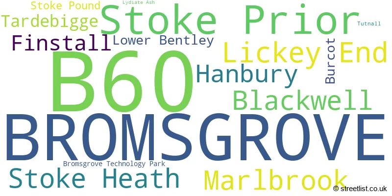
The largest settlement in the B60 postal code is BROMSGROVE followed by Stoke Prior, and Marlbrook.
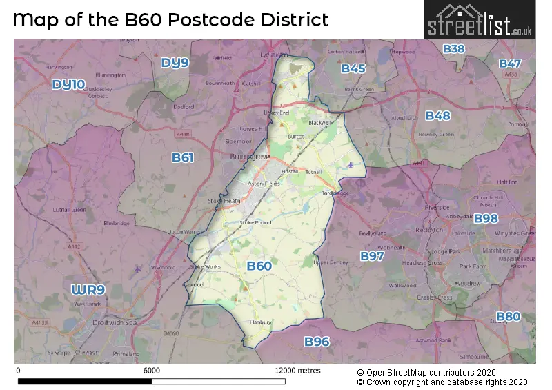
The B60 Postcode shares a border with B96 (Astwood Bank, Feckenham, Sambourne), B97 (REDDITCH, Callow Hill, Kingfisher Shopping Centre), B45 (Rednal, Barnt Green, Cofton Hackett) and B61 (BROMSGROVE, Catshill, Dodford).
In the B60 postcode district, the primary settlement with the highest count is Bromsgrove, located in Worcestershire, England. Other significant settlements in this district include Blackwell, Burcot, Finstall, Lickey End, Marlbrook, Tardebigge, and Tutnall, all located in Worcestershire as well. The most significant Post Town in the district is Bromsgrove.
For the district B60, we have data on 5 postcode sectors. Here's a breakdown: The sector B60 1, covers Lickey End and Marlbrook and Blackwell and Bromsgrove in Worcestershire. The sector B60 2, covers Bromsgrove in Worcestershire. The sector B60 3, covers Bromsgrove and Stoke Heath in Worcestershire. The sector B60 4, covers Stoke Prior and Hanbury in Worcestershire. The sector B60 9 is non-geographic. It's often designated for PO Boxes, large organisations, or special services.

Map of the B60 Postcode District
Explore the B60 postcode district by using our free interactive map.
When it comes to local government, postal geography often disregards political borders. However, for a breakdown in the B60 District: the district mostly encompasses the Bromsgrove District (814 postcodes), and finally, the Wychavon District area (38 postcodes).
Weather Forecast for B60
Press Button to Show Forecast for Bromsgrove
| Time Period | Icon | Description | Temperature | Rain Probability | Wind |
|---|---|---|---|---|---|
| 12:00 to 15:00 | Cloudy | 10.0°C (feels like 8.0°C) | 11.00% | NW 9 mph | |
| 15:00 to 18:00 | Cloudy | 10.0°C (feels like 8.0°C) | 6.00% | N 9 mph | |
| 18:00 to 21:00 | Cloudy | 9.0°C (feels like 8.0°C) | 7.00% | NNE 7 mph | |
| 21:00 to 00:00 | Cloudy | 7.0°C (feels like 6.0°C) | 6.00% | E 4 mph |
Press Button to Show Forecast for Bromsgrove
| Time Period | Icon | Description | Temperature | Rain Probability | Wind |
|---|---|---|---|---|---|
| 00:00 to 03:00 | Cloudy | 6.0°C (feels like 4.0°C) | 6.00% | E 7 mph | |
| 03:00 to 06:00 | Cloudy | 5.0°C (feels like 3.0°C) | 7.00% | ENE 7 mph | |
| 06:00 to 09:00 | Cloudy | 5.0°C (feels like 2.0°C) | 6.00% | ENE 7 mph | |
| 09:00 to 12:00 | Cloudy | 7.0°C (feels like 5.0°C) | 6.00% | E 7 mph | |
| 12:00 to 15:00 | Overcast | 9.0°C (feels like 8.0°C) | 12.00% | ENE 7 mph | |
| 15:00 to 18:00 | Cloudy | 10.0°C (feels like 9.0°C) | 10.00% | E 4 mph | |
| 18:00 to 21:00 | Cloudy | 9.0°C (feels like 8.0°C) | 10.00% | ENE 7 mph | |
| 21:00 to 00:00 | Cloudy | 7.0°C (feels like 5.0°C) | 12.00% | ENE 7 mph |
Press Button to Show Forecast for Bromsgrove
| Time Period | Icon | Description | Temperature | Rain Probability | Wind |
|---|---|---|---|---|---|
| 00:00 to 03:00 | Cloudy | 6.0°C (feels like 3.0°C) | 11.00% | ENE 7 mph | |
| 03:00 to 06:00 | Cloudy | 5.0°C (feels like 2.0°C) | 12.00% | ENE 7 mph | |
| 06:00 to 09:00 | Cloudy | 5.0°C (feels like 2.0°C) | 13.00% | NE 9 mph | |
| 09:00 to 12:00 | Cloudy | 7.0°C (feels like 4.0°C) | 17.00% | ENE 9 mph | |
| 12:00 to 15:00 | Light rain | 9.0°C (feels like 6.0°C) | 50.00% | ENE 11 mph | |
| 15:00 to 18:00 | Overcast | 10.0°C (feels like 8.0°C) | 23.00% | ENE 9 mph | |
| 18:00 to 21:00 | Cloudy | 10.0°C (feels like 8.0°C) | 18.00% | ENE 9 mph | |
| 21:00 to 00:00 | Cloudy | 8.0°C (feels like 6.0°C) | 22.00% | NE 11 mph |
Press Button to Show Forecast for Bromsgrove
| Time Period | Icon | Description | Temperature | Rain Probability | Wind |
|---|---|---|---|---|---|
| 00:00 to 03:00 | Heavy rain | 7.0°C (feels like 5.0°C) | 69.00% | NE 11 mph | |
| 03:00 to 06:00 | Light rain | 7.0°C (feels like 4.0°C) | 56.00% | NE 9 mph | |
| 06:00 to 09:00 | Heavy rain | 7.0°C (feels like 5.0°C) | 76.00% | NE 9 mph | |
| 09:00 to 12:00 | Heavy rain | 9.0°C (feels like 6.0°C) | 76.00% | NE 9 mph | |
| 12:00 to 15:00 | Light rain | 10.0°C (feels like 8.0°C) | 51.00% | ENE 11 mph | |
| 15:00 to 18:00 | Heavy rain shower (day) | 11.0°C (feels like 9.0°C) | 61.00% | NNW 11 mph | |
| 18:00 to 21:00 | Light rain shower (day) | 11.0°C (feels like 9.0°C) | 40.00% | NNE 9 mph | |
| 21:00 to 00:00 | Partly cloudy (night) | 8.0°C (feels like 7.0°C) | 10.00% | NNW 7 mph |
Where is the B60 Postcode District?
The postcode district B60 is located in Bromsgrove. Bromsgrove is surrounded by several nearby towns, including Redditch to the East (4.55 miles away), Droitwich to the South West (5.65 miles away), Halesowen to the North (9.20 miles away), Alcester to the South East (9.21 miles away), Stourport-on-Severn to the West (9.48 miles away), and Stourbridge to the North West (10.19 miles away). Additionally, Bromsgrove is approximately 98.94 miles away from the center of London.
The district is within the post town of BROMSGROVE.
The sector has postcodes within the nation of England.
The B60 Postcode District is in the Worcestershire region of Herefordshire, Worcestershire and Warwickshire within the West Midlands (England).
| Postcode Sector | Delivery Office |
|---|---|
| B60 1 | Bromsgrove Delivery Office |
| B60 2 | Bromsgrove Delivery Office |
| B60 3 | Bromsgrove Delivery Office |
| B60 4 | Bromsgrove Delivery Office |
| B | 6 | 0 | - | X | X | X |
| B | 6 | 0 | Space | Numeric | Letter | Letter |
Current Monthly Rental Prices
| # Bedrooms | Min Price | Max Price | Avg Price |
|---|---|---|---|
| 1 | £480 | £795 | £635 |
| 2 | £850 | £945 | £891 |
| 3 | £1,195 | £1,500 | £1,348 |
| 4 | £1,200 | £1,400 | £1,300 |
Current House Prices
| # Bedrooms | Min Price | Max Price | Avg Price |
|---|---|---|---|
| £699,950 | £699,950 | £699,950 | |
| 3 | £624,950 | £650,000 | £637,475 |
| 4 | £499,950 | £875,000 | £624,703 |
| 5 | £850,000 | £900,000 | £875,000 |
| 6 | £895,000 | £1,700,000 | £1,297,500 |
| 8 | £2,000,000 | £2,000,000 | £2,000,000 |
Estate Agents who Operate in the B60 District
| Logo | Name | Brand Name | Address | Contact Number | Total Properties |
|---|---|---|---|---|---|
 | Bromsgrove | A P Morgan | 4 Worcester Road, Bromsgrove, B61 7AE | 01527 913647 | 30 |
 | Bromsgrove | Robert Oulsnam & Company | 61 High Street, Bromsgrove, B61 8EX | 01527 913238 | 28 |
 | Bromsgrove | Arden Estates | 14 Old Birmingham Road Lickey End Bromsgrove B60 1DE | 01527 872479 | 18 |
 | Bromsgrove | Guest Estate Agents | 1 St. Godwalds Road, Bromsgrove, B60 3BN | 01527 306420 | 12 |
 | Bromsgrove | Your Move | The Tudor House New Road, Bromsgrove, B60 2HY | 01527 913443 | 7 |
| Type of Property | 2018 Average | 2018 Sales | 2017 Average | 2017 Sales | 2016 Average | 2016 Sales | 2015 Average | 2015 Sales |
|---|---|---|---|---|---|---|---|---|
| Detached | £410,930 | 192 | £378,149 | 201 | £363,960 | 213 | £356,563 | 240 |
| Semi-Detached | £243,093 | 152 | £235,557 | 144 | £229,950 | 159 | £226,736 | 146 |
| Terraced | £205,740 | 78 | £203,424 | 76 | £184,562 | 86 | £178,966 | 122 |
| Flats | £135,598 | 61 | £123,938 | 42 | £118,831 | 71 | £111,342 | 66 |