Map of Wimborne Road
| Postcodes | ||
|---|---|---|
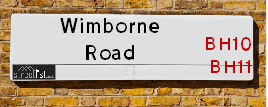
| Icon | Postcodes for Wimborne Road | |
| Walking Distances | ||
| Distance Info | Green Circle = 10 Minutes Walk (800 metres) | |
About Wimborne Road
Wimborne Road is a street located in the town of Bournemouth. The street has a length of approximately 9,675 metres.
Wimborne Road is located within the Bournemouth, Christchurch and Poole Council's jurisdiction. They provide various services, like refuse collection, and manage council tax collection. It's situated in the South West region of the UK.
Wimborne Road has been assigned the Unique Street Reference Numbers of 3700146, 3768401, 3771435, 3700142, 3770285, 3771434, 3700141, 3700140, 3770353, 3700144, 3700192, 3700145, 3770343, 3770317, 3770340, 3711301, 3700143, 3771436, 3770349, 3770347, 3770365 and 3771433 in the National Street Gazetteer.
Wimborne Road is located within the county of Dorset, situated in the South West region of the UK. It's 92.88 miles South West from central London., 2.63 miles North West from Bournemouth, 21.92 miles South from Salisbury and 23.48 miles South West from Southampton.

Do you know why this road is called Wimborne Road?
What's it like to live here?
Ask the community a question about Wimborne Road.
Do you have any questions, memories to share or know any facts about Wimborne Road? We'd love to know more.
Also on streetlist.co.uk, can you help?
Eldroth Road
15th April 2024
I wondered if anyone has any old pictures of Wenning Bank House in the 1940’s and also Lane Side before of the same era .. we visited today with my Mum in law as she used to live at both these properties. Also any photos of the schools around that time .. thank you.
Can You Help?Napps Way
15th April 2024
Why is the road called Napps Way (belonging to Napp, but minus an
apostrophe as is usual with such nomenclature)? Moreover, who or
what is, or was, “Napp” in the respective, possessive case?
Several years ago, I met an elderly man (probably in his late-eighties)
who lives on Bentham Drive, Liverpool 16, and during a conversation
with him whilst in a Northwest Passenger Transport Ambulance on the
way to the former RLUH (Royal Liverpool University Hospital), he told
me that he could remember (when he was a boy, living in Childwall,
Liverpool 16) that, “Where Napps Way is now, during WW2, there was
a two-man gun emplacement on the, then, open land to protect the
railway line passing over Childwall Valley Road - next to the railway
bridge - when suddenly, as they were loading a live “shell” into the gun’s
breach, the aforementioned “shell” accidentally exploded in the gun’s
breach killing both of the two soldiers, that had been manning the gun,
instantly! (Very sad, of course, but could - perhaps - two ghosts relating
to those two, very unfortunately and prematurely-killed soldiers have
haunted that place of their deaths ever since - and have any residents
of Napps Way - formerly and in its latest incarnation - seen two, WW2
(uniformed) soldiers unexpectedly appear in or near their homes?)
Mauritius Road
15th April 2024
Why is Mauritius Road so called, since when and by whom? Does Greenwich have any particular links with Mauritius? Very interested to know. 🤞🏼
Can You Help?Estate Agents near Wimborne Road
| Name | Address | Website |
|---|---|---|
| Specialist Letting Agency | 209 Redhill Drive, Bournemouth, BH10 6AJ | Visit Website |
| Homer Estates | 27-29 Columbia Road, Ensbury Park, Bournemouth BH10 4DZ | |
| Off-Plan Real Estate | 1a Ensbury Park Road, Bournemouth, BH9 2SQ |
We have found 131 postcodes for Wimborne Road
- BH9 2HS
- BH9 2HP
- BH9 2HN
- BH9 2HH
- BH9 2HE
- BH9 2HB
- BH9 2HA
- BH9 2EZ
- BH9 2EY
- BH9 2EX
- BH9 2ET
- BH9 2ER
- BH9 2EQ
- BH9 2EN
- BH9 2EH
- BH9 2EG
- BH9 2EA
- BH9 2DZ
- BH9 2DX
- BH9 2DW
- BH9 2DT
- BH9 2DS
- BH9 2DR
- BH9 2DN
- BH9 2DJ
- BH9 2DH
- BH9 2DG
- BH9 2DF
- BH9 2DE
- BH9 2DD
- BH9 2DB
- BH9 2DA
- BH9 2BZ
- BH9 2BY
- BH9 2BX
- BH9 2BU
- BH9 2BS
- BH9 2BN
- BH9 2BJ
- BH9 2BH
- BH9 2BG
- BH9 2BE
- BH9 2BD
- BH9 2BA
- BH9 2AY
- BH9 2AX
- BH9 2AW
- BH9 2AU
- BH9 2AT
- BH9 2AS
- BH9 2AR
- BH9 2AQ
- BH9 2AP
- BH9 2AN
- BH9 2AJ
- BH9 2AH
- BH9 2AF
- BH9 2AD
- BH9 2AB
- BH9 2AA
- BH3 7AX
- BH3 7AW
- BH3 7AT
- BH3 7AS
- BH3 7AR
- BH3 7AN
- BH3 7AL
- BH3 7AJ
- BH3 7AE
- BH3 7AD
- BH3 7AB
- BH3 7AA
- BH2 6QA
- BH2 6NU
- BH2 6NT
- BH2 6NG
- BH2 6NB
- BH2 6NA
- BH2 6LZ
- BH2 6LY
- BH2 6LX
- BH2 6LU
- BH11 9BE
- BH11 9AZ
- BH11 9AY
- BH11 9AX
- BH11 9AW
- BH11 9AU
- BH11 9AS
- BH11 9AR
- BH11 9AQ
- BH11 9AP
- BH11 9AN
- BH11 9AL
- BH11 9AJ
- BH11 9AH
- BH11 9AG
- BH11 9AF
- BH11 9AE
- BH11 9AD
- BH11 9AB
- BH11 9AA
- BH10 7DB
- BH10 7BY
- BH10 7BW
- BH10 7BT
- BH10 7BS
- BH10 7BQ
- BH10 7BP
- BH10 7BJ
- BH10 7BH
- BH10 7BG
- BH10 7BE
- BH10 7BD
- BH10 7BB
- BH10 7AZ
- BH10 7AY
- BH10 7AW
- BH10 7AS
- BH10 7AR
- BH10 7AQ
- BH10 7AP
- BH10 7AN
- BH10 7AL
- BH10 7AJ
- BH10 7AG
- BH10 7AF
- BH10 7AE
- BH10 7AA
- BH10 7BL
- BH2 6QB
Location Details
| Wimborne Road | |
|---|---|

| |
| Latitude | 50.757098 |
| Longitude | -1.888035 |
| OS Easting (X): | 407896 |
| OS Northing (Y): | 95347 |
| OS Grid Reference: | SZ079953 |
Neighbourhood Policing |
| Police Force: Dorset |
 View Neighbourhood Crime and Policing View Neighbourhood Crime and Policing |
| Find a Local Neighbourhood Watch Scheme |
Frequently asked Questions for Wimborne Road
What Council (Local Authority) is Wimborne Road in?
Wimborne Road is located within the local authority area of Bournemouth &Christchurch and Poole Council which is a Unitary Authority.
What Parish Council is Wimborne Road in?
Wimborne Road is in an unparished area.
What Electoral Ward is Wimborne Road in?
Wimborne Road is located within the ward of Moordown, Redhill & Northbourne, Kinson, Muscliff & Strouden Park, Bournemouth Central, Talbot & Branksome Woods, Winton East &Wallisdown & Winton West.
What County is Wimborne Road in?
Wimborne Road is located within the ceremonial county of Dorset.
What Constituency is Wimborne Road in?
Wimborne Road is located within the constituency of Bournemouth East &Bournemouth West.
What Part of the UK is Wimborne Road in?
Wimborne Road is located within the Array region of the United Kingdom.
What County Council area is Wimborne Road in?
Wimborne Road is located within the Bournemouth Council area.
What Police Force area is Wimborne Road in?
Wimborne Road is located within the Dorset Police area.
Roads that have a Junction with Wimborne Road
Sunset and Sunrise times for Wimborne Road
| Sunrise | 05:53 |
|---|---|
| Sunset | 20:17 |
Latest Weather Conditions for Wimborne Road
| Observed at Weather Station: | Bournemouth Airport 23 April 2024 at 16:00 (2.77 miles away) |
|---|---|
| Current Weather: | Overcast |
| Temperature and Humidity: | 12.6°C (53.4%) |
| Wind Direction and Speed: | NNE (11 mph) |
Population Statistics
| ONS Area Code | E00077462, E00077510, E00077539, E00077373, E00077377, E00077371, E00077364, E00077367, E00077354, E00077375, E00077605, E00077538, E00077361, E00077372, E00077370, E00077368, E00077365, E00077369, E00077276, E00077273, E00077247, E00077274, E00077244, E00077271, E00077596, E00077595, E00077584, E00077583, E00077730, E00077647, E00077742, E00077452, E00077450, E00077445, E00077444, E00077466, E00077461, E00077463, E00077638 & E00077733 |
|---|---|
| ONS Area Name | Delayed Retirement, Comfortable Suburbia, Ageing in Suburbia, Self-Sufficient Retirement, Ageing Industrious Workers, Detached Retirement Living, Renting Hard-Pressed Workers, Hampered Aspiration, White Professionals, Urban Cultural Mix, Ageing Communities and Families, Migrant Families & Students and Professionals |
| Average Age | 39.05, 46.97, 46.15, 47.68, 45.40, 42.54, 46.17, 42.12, 46.58, 36.52, 47.90, 36.02, 38.36, 32.71, 37.51, 30.98, 36.66 & 38.46 |
| Area Population | 1549.00, 1524.00, 1581.00, 1483.00, 1520.00, 1670.00, 1451.00, 1711.00, 1850.00, 1871.00, 1910.00, 1899.00, 1665.00, 1907.00, 1766.00, 2310.00, 1861.00 & 1706.00 |
| Male Population | 767.00, 733.00, 758.00, 727.00, 783.00, 819.00, 718.00, 817.00, 880.00, 1013.00, 955.00, 1020.00, 857.00, 916.00, 854.00, 1137.00, 944.00 & 813.00 (50%) |
| Female Population | 782.00, 791.00, 823.00, 756.00, 737.00, 851.00, 733.00, 894.00, 970.00, 858.00, 955.00, 879.00, 808.00, 991.00, 912.00, 1173.00, 917.00 & 893.00 (50%) |
| Benefit Claimants | 13, 12, 9, 17, 20, 40, 6, 22, 18, 51, 15, 24, 19, 38 & 21 (1%) |
| LSOA Code: | E01015324, E01015332, E01015333, E01015301, E01015303, E01015306, E01015350, E01015304, E01015302, E01015283, E01015286, E01015345, E01015346, E01015375, E01015356, E01015374, E01015321 &E01015325 |
|---|---|
| LSOA Name: | Bournemouth 006C, Bournemouth 003A, Bournemouth 003B, Bournemouth 001A, Bournemouth 001B, Bournemouth 001D, Bournemouth 006E, Bournemouth 002B, Bournemouth 002A, Bournemouth 017A, Bournemouth 017C, Bournemouth 013C, Bournemouth 012B, Bournemouth 009D, Bournemouth 009B, Bournemouth 009C, Bournemouth 009A &Bournemouth 006D |
| SOA Code: | 3a, 8a, 5c, 1a, 3c &3d |
| SOA Name: | |
| MSOA Code: | E02003177, E02003174, E02003172, E02003173, E02003188, E02003184, E02003183 &E02003180 |
| MSOA Name: | Bournemouth 006, Bournemouth 003, Bournemouth 001, Bournemouth 002, Bournemouth 017, Bournemouth 013, Bournemouth 012 &Bournemouth 009 |
Nearest Supermarkets
| Tesco Northbourne Express |
|---|
| 1256 Wimborne Rd, Northbourne, Bournemouth, BH10 7AG |
| 0345 026 9113 |
| Distance: 0.71 Miles |
| Directions from Wimborne Road to Tesco Northbourne Express |
| Tesco Moordown Express |
|---|
| 704 Wimbourne Rd, Moordown, Bournemouth, BH9 2EG |
| 0345 026 9400 |
| Distance: 0.72 Miles |
| Directions from Wimborne Road to Tesco Moordown Express |
| Sainsburys Winton Local |
|---|
| 501 Wimborne Road, Bournemouth, England, BH9 2AW |
| 1202510825 |
| Distance: 0.94 Miles |
| Directions from Wimborne Road to Sainsburys Winton Local |
| Tesco Kinson Superstore |
|---|
| 1585 Wimborne Rd, Kinson, BH10 7BB |
| 0345 610 6321 |
| Distance: 0.97 Miles |
| Directions from Wimborne Road to Tesco Kinson Superstore |
Telephone Information
| Dialling Code | Telephone Exchange | Telephone Cabinet | Fibre to the Cabinet or Fibre to the Premises |
|---|---|---|---|
| 01202 | WINTON - STWINTN | P58 | FTTC |
Local Government
| Local Council Details |
|---|
| Within the area of Bournemouth &Christchurch and Poole |
| Local Member of Parliament |
|---|
| Within the Westminster Parliamentary Constituency of Bournemouth East &Bournemouth West |
| The Member of Parliament is Tobias Ellwood &Conor Burns |
| Details for the MP Tobias Ellwood &Conor Burns on parliament.uk |
| Details for the MP Tobias Ellwood &Conor Burns on theyworkforyou.com |
| In the 2019 General Election Tobias Ellwood &Conor Burns won with a majority of 8,806 the result was Con hold. The total electorate was 74,125 |
| Wards, Parish Councils and County Councils |
|---|
| Ward: Moordown, Redhill & Northbourne, Kinson, Muscliff & Strouden Park, Bournemouth Central, Talbot & Branksome Woods, Winton East &Wallisdown & Winton West Ward |
| Ceremonial County: Dorset |
Nearest Schools
England Secondary Schools
Bournemouth School
Address: Bournemouth School, East Way, Bournemouth, Dorset, BH8 9PY
Distance: 1.42 miles
Contact: 01202512609
Winton Academy
Address: Winton Academy, Winton Way, Bournemouth, Dorset, BH10 4HT
Distance: 0.70 miles
Contact: 01202529738
Glenmoor Academy
Address: Glenmoor Academy, Beswick Avenue, Ensbury Park, Bournemouth, Dorset, BH10 4EX
Distance: 0.61 miles
Contact: 01202527818
The Bourne Academy
Address: The Bourne Academy, Hadow Road, Bournemouth, Dorset, BH10 5HS
Distance: 0.57 miles
Contact: 01202528554
England Primary Schools
Queen's Park Infant Academy
Address: Queen's Park Infant Academy, East Way, Bournemouth, Dorset, BH8 9PU
Distance: 1.44 miles
Contact: 01202528805
Queen's Park Academy
Address: Queen's Park Academy, East Way, Bournemouth, Dorset, BH8 9PU
Distance: 1.44 miles
Contact: 01202526079
The Epiphany School
Address: The Epiphany School, Shillingstone Drive, Muscliff, Bournemouth, Dorset, BH9 3PE
Distance: 1.19 miles
Contact: 01202530960
St. Walburga's Catholic Primary School
Address: St. Walburga's Catholic Primary School, St. Walburga's Catholic Primary School, Malvern Road, Moordown, Bournemouth, Dorset, BH9 3BY
Distance: 1.19 miles
Contact: 01202528811
St Luke's Church of England Primary School
Address: St Luke's Church of England Primary School, Bemister Road, Winton, Bournemouth, Dorset, BH9 1LG
Distance: 1.14 miles
Contact: 01202514396
Hill View Primary School
Address: Hill View Primary School, Hill View Road, Ensbury Park, Bournemouth, Dorset, BH10 5BD
Distance: 0.13 miles
Contact: 01202512813
Moordown St John's Church of England Primary School
Address: Moordown St John's Church of England Primary School, Vicarage Road, Moordown, Bournemouth, Dorset, BH9 2SA
Distance: 0.60 miles
Contact: 01202527683
Winton Primary School
Address: Winton Primary School, Oswald Road, Bournemouth, Dorset, BH9 2TG
Distance: 0.43 miles
Contact: 01202513988
St Mark's Church of England Primary School
Address: St Mark's Church of England Primary School, Talbot Village, Bournemouth, Dorset, BH10 4JA
Distance: 0.88 miles
Contact: 01202512241
Kingsleigh Primary School
Address: Kingsleigh Primary School, Hadow Road, Kinson, Bournemouth, Dorset, BH10 5HT
Distance: 0.56 miles
Contact: 01202528893
Heathlands Primary Academy
Address: Heathlands Primary Academy, Springwater Road, Bournemouth, Dorset, BH11 8HB
Distance: 1.18 miles
Contact: 01202574452
Talbot Primary School
Address: Talbot Primary School, Talbot Drive, Wallisdown, Poole, Dorset, BH12 5ED
Distance: 1.27 miles
Contact:
Elm Academy
Address: Elm Academy, Holloway Avenue, Bournemouth, Dorset, BH11 9JN
Distance: 1.18 miles
Contact: 01202574212
Kinson Primary School
Address: Kinson Primary School, School Lane, Kinson, Bournemouth, Dorset, BH11 9DG
Distance: 1.01 miles
Contact:
Christ The King Catholic Primary School
Address: Christ The King Catholic Primary School, Durdells Avenue, Kinson, Bournemouth, Dorset, BH11 9EH
Distance: 1.24 miles
Contact: 01202574277
Nearest Hospitals
| Name | Address | Postcode | Distance | Map |
|---|
Nearest Dentists
Dentists near Wimborne Road
| Name | Address | Postcode | Distance | Map |
|---|
Nearest GP Surgeries
Doctors near Wimborne Road
MOORDOWN MEDICAL CENTRE
Address: 2A REDHILL CRESCENT, MOORDOWN, BOURNEMOUTH, DORSET, BH9 2XF
Distance: 0.60 miles
Contact: tel: 01202 974700
NORTHBOURNE SURGERY
Address: 1368 WIMBORNE ROAD, BOURNEMOUTH, DORSET, BH10 7AR
Distance: 0.79 miles
Contact: :
DENMARK ROAD MEDICAL CENTRE
Address: 37 DENMARK ROAD, WINTON, BOURNEMOUTH, DORSET, BH9 1PB
Distance: 0.87 miles
Contact: tel: 01202 521111
KINSON ROAD MEDICAL CENTRE
Address: 440 KINSON ROAD, KINSON, BOURNEMOUTH, DORSET, BH10 5EY
Distance: 0.92 miles
Contact: tel: 01202 574604
WEST HOWE CLINIC
Address: CUNNINGHAM CRESCENT, WEST HOWE, BOURNEMOUTH, DORSET, BH11 8DN
Distance: 0.95 miles
Contact: :
STUDENT MEDICAL CENTRE
Address: TALBOT HOUSE, TALBOT CAMPUS, FERN BARROW, POOLE, DORSET, BH12 5BB
Distance: 1.05 miles
Contact: :
Nearest Dispensing Chemists
Pharmacies near Wimborne Road
| Name | Address | Postcode | Telephone | Map | Distance in Km |
|---|
Nearest Opticians
Opticians near Wimborne Road
STILL & BEDFORD
Address: 922 WIMBORNE ROAD, BOURNEMOUTH, BH9 2DH
Distance: 0.58 miles
Contact: :
FORSPEX OPTICAL
Address: 683 WIMBORNE ROAD, BOURNEMOUTH, BH9 2AT
Distance: 0.74 miles
Contact: :
K C OPTICIANS (KINSON)
Address: 1553 WIMBORNE ROAD, KINSON, BOURNEMOUTH, DORSET, BH10 7AZ
Distance: 0.92 miles
Contact: tel: 01202 571601
WINTON SPECSCAVERS
Address: 411 WIMBORNE ROAD, WINTON, BOURNEMOUTH, DORSET, BH9 2AJ
Distance: 1.07 miles
Contact: :
SCRIVENS OPTICIANS (WINTON)
Address: 373 WIMBORNE ROAD, WINTON, BOURNEMOUTH, DORSET, BH9 2AQ
Distance: 1.13 miles
Contact: :
KELLY EYECARE (WINTON)
Address: 369 WIMBORNE ROAD, WINTON, BOURNEMOUTH, DORSET, BH9 2AQ
Distance: 1.13 miles
Contact: :
Transport
Nearest Rail Stations
Bournemouth Station is 2.30 miles away.
Address: Bournemouth station, Holdenhurst Road, Bournemouth, Dorset, BH8 8HX
Bournemouth is situated on the Portsmouth Direct line|South Western Main Line and is managed by South Western Railway.
Bournemouth Station is staffed on a full time basis.
Branksome Station is 2.45 miles away.
Address: Branksome station, Poole Road, Branksome, Dorset, BH12 1DF
Branksome is situated on the Portsmouth Direct line|South Western Main Line and is managed by South Western Railway.
Branksome Station is staffed on a part time basis.