The CA12 postcode district is a postal district located in the CA Carlisle postcode area with a population of 7,451 residents according to the 2021 England and Wales Census.
The area of the CA12 postcode district is 115.77 square miles which is 299.84 square kilometres or 74,091.77 acres.
Currently, the CA12 district has about 462 postcode units spread across 2 geographic postcode sectors.
Given that each sector allows for 400 unique postcode combinations, the district has a capacity of 800 postcodes. With 462 postcodes already in use, this leaves 338 units available.
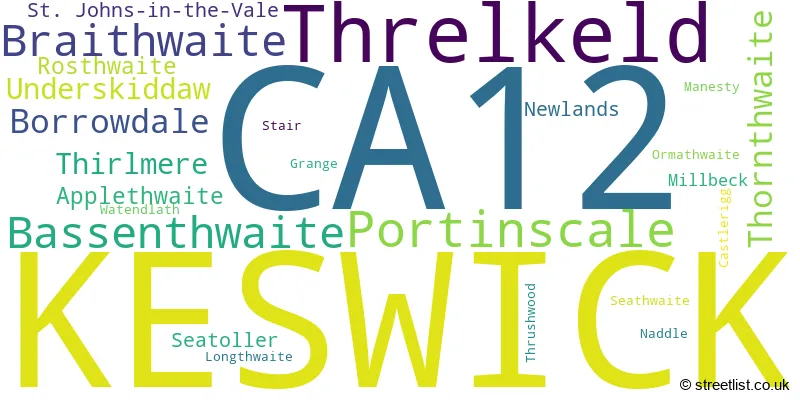
The largest settlement in the CA12 postal code is KESWICK followed by Threlkeld, and Braithwaite.
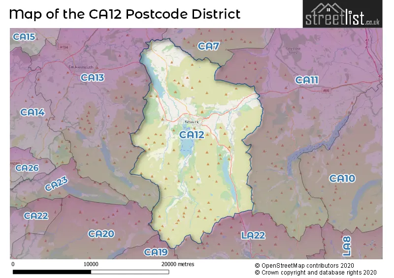
The CA12 Postcode shares a border with CA13 (COCKERMOUTH, Great Broughton, Brigham), CA7 (WIGTON, Aspatria, Silloth), CA11 (PENRITH, Stainton, Greystoke), LA22 (AMBLESIDE, Grasmere, Hawkshead), CA19 (Drigg, Eskdale, HOLMROOK) and CA20 (SEASCALE, Gosforth, Calderbridge).
The primary settlement in the CA12 postcode district is Keswick, located in the county of Cumbria in England. Other significant settlements in this district include Applethwaite, Bassenthwaite, Castlerigg, Millbeck, Naddle, Ormathwaite, St. Johns-in-the-Vale, Thirlmere, Threlkeld, Thrushwood, and Underskiddaw. The most significant post town in this district is Keswick.
For the district CA12, we have data on 3 postcode sectors. Here's a breakdown: The sector CA12 4, covers Keswick and Threlkeld in Cumbria. The sector CA12 5, covers Keswick in Cumbria. The sector CA12 9 is non-geographic. It's often designated for PO Boxes, large organisations, or special services.

Map of the CA12 Postcode District
Explore the CA12 postcode district by using our free interactive map.
When it comes to local government, postal geography often disregards political borders. However, for a breakdown in the CA12 District: the district mostly encompasses the Cumberland (442 postcodes), and finally, the Westmorland and Furness area (28 postcodes).
Weather Forecast for CA12
Press Button to Show Forecast for Derwent Independent Hostel
| Time Period | Icon | Description | Temperature | Rain Probability | Wind |
|---|---|---|---|---|---|
| 18:00 to 21:00 | Cloudy | 8.0°C (feels like 7.0°C) | 4.00% | N 4 mph | |
| 21:00 to 00:00 | Partly cloudy (night) | 6.0°C (feels like 4.0°C) | 1.00% | E 4 mph |
Press Button to Show Forecast for Derwent Independent Hostel
| Time Period | Icon | Description | Temperature | Rain Probability | Wind |
|---|---|---|---|---|---|
| 00:00 to 03:00 | Clear night | 4.0°C (feels like 2.0°C) | 0.00% | E 4 mph | |
| 03:00 to 06:00 | Clear night | 3.0°C (feels like 1.0°C) | 1.00% | ENE 4 mph | |
| 06:00 to 09:00 | Partly cloudy (day) | 4.0°C (feels like 2.0°C) | 2.00% | E 4 mph | |
| 09:00 to 12:00 | Cloudy | 7.0°C (feels like 5.0°C) | 5.00% | NE 7 mph | |
| 12:00 to 15:00 | Overcast | 8.0°C (feels like 7.0°C) | 9.00% | NE 4 mph | |
| 15:00 to 18:00 | Cloudy | 9.0°C (feels like 7.0°C) | 8.00% | NNW 4 mph | |
| 18:00 to 21:00 | Cloudy | 8.0°C (feels like 6.0°C) | 8.00% | NNE 4 mph | |
| 21:00 to 00:00 | Partly cloudy (night) | 5.0°C (feels like 4.0°C) | 1.00% | ENE 4 mph |
Press Button to Show Forecast for Derwent Independent Hostel
| Time Period | Icon | Description | Temperature | Rain Probability | Wind |
|---|---|---|---|---|---|
| 00:00 to 03:00 | Partly cloudy (night) | 4.0°C (feels like 2.0°C) | 1.00% | E 4 mph | |
| 03:00 to 06:00 | Partly cloudy (night) | 3.0°C (feels like 1.0°C) | 2.00% | E 4 mph | |
| 06:00 to 09:00 | Partly cloudy (day) | 5.0°C (feels like 3.0°C) | 2.00% | E 4 mph | |
| 09:00 to 12:00 | Partly cloudy (day) | 8.0°C (feels like 6.0°C) | 5.00% | ENE 7 mph | |
| 12:00 to 15:00 | Overcast | 9.0°C (feels like 8.0°C) | 14.00% | ENE 7 mph | |
| 15:00 to 18:00 | Cloudy | 10.0°C (feels like 8.0°C) | 11.00% | NNE 7 mph | |
| 18:00 to 21:00 | Cloudy | 9.0°C (feels like 7.0°C) | 10.00% | NNE 7 mph | |
| 21:00 to 00:00 | Partly cloudy (night) | 6.0°C (feels like 4.0°C) | 6.00% | NE 7 mph |
Press Button to Show Forecast for Derwent Independent Hostel
| Time Period | Icon | Description | Temperature | Rain Probability | Wind |
|---|---|---|---|---|---|
| 00:00 to 03:00 | Cloudy | 5.0°C (feels like 2.0°C) | 11.00% | NE 7 mph | |
| 03:00 to 06:00 | Partly cloudy (night) | 4.0°C (feels like 1.0°C) | 13.00% | NE 9 mph | |
| 06:00 to 09:00 | Partly cloudy (day) | 6.0°C (feels like 3.0°C) | 12.00% | NE 9 mph | |
| 09:00 to 12:00 | Cloudy | 8.0°C (feels like 6.0°C) | 18.00% | NNE 11 mph | |
| 12:00 to 15:00 | Overcast | 10.0°C (feels like 8.0°C) | 18.00% | NNE 11 mph | |
| 15:00 to 18:00 | Cloudy | 11.0°C (feels like 9.0°C) | 15.00% | N 9 mph | |
| 18:00 to 21:00 | Partly cloudy (day) | 10.0°C (feels like 8.0°C) | 12.00% | N 11 mph | |
| 21:00 to 00:00 | Clear night | 7.0°C (feels like 5.0°C) | 8.00% | N 9 mph |
Where is the CA12 Postcode District?
The postcode district CA12 is located in the town of Keswick. Keswick is surrounded by several nearby towns, including Cockermouth to the northwest (10.93 miles away), Ambleside to the southeast (12.14 miles away), Coniston to the south (14.74 miles away), Frizington to the west (14.98 miles away), Penrith to the northeast (15.66 miles away), and Wigton to the north (15.98 miles away). Additionally, Keswick is approximately 246.27 miles away from the center of London.
The district is within the post town of KESWICK.
The sector has postcodes within the nation of England.
The CA12 Postcode District is covers the following regions.
- West Cumbria - Cumbria - North West (England)
- East Cumbria - Cumbria - North West (England)
| Postcode Sector | Delivery Office |
|---|---|
| CA12 4 | Keswick Delivery Office |
| CA12 5 | Keswick Delivery Office |
| C | A | 1 | 2 | - | X | X | X |
| C | A | 1 | 2 | Space | Numeric | Letter | Letter |
Tourist Attractions within the Postcode Area
We found 2 visitor attractions within the CA12 postcode area
| Go Ape! Tree Top Adventure - Whinlatter Forest Park |
|---|
| Country Parks |
| Country Park |
| View Go Ape! Tree Top Adventure - Whinlatter Forest Park on Google Maps |
| Mirehouse Historic House and Gardens |
| Historic Properties |
| Historic House / House and Garden / Palace |
| View Mirehouse Historic House and Gardens on Google Maps |
Current Monthly Rental Prices
| # Bedrooms | Min Price | Max Price | Avg Price |
|---|---|---|---|
| 1 | £525 | £525 | £525 |
| 2 | £850 | £850 | £850 |
Current House Prices
| # Bedrooms | Min Price | Max Price | Avg Price |
|---|---|---|---|
| 2 | £650,000 | £650,000 | £650,000 |
| 3 | £635,000 | £895,000 | £736,000 |
| 4 | £650,000 | £1,950,000 | £931,875 |
| 5 | £700,000 | £1,750,000 | £1,180,000 |
| 6 | £800,000 | £950,000 | £875,000 |
| 7 | £945,000 | £945,000 | £945,000 |
| 8 | £1,500,000 | £1,500,000 | £1,500,000 |
| 13 | £1,475,000 | £1,475,000 | £1,475,000 |
| 14 | £2,210,000 | £2,500,000 | £2,355,000 |
Estate Agents who Operate in the CA12 District
| Logo | Name | Brand Name | Address | Contact Number | Total Properties |
|---|---|---|---|---|---|
 | Keswick | PFK | 19 Station Street Keswick Cumbria CA12 5HH | 01768 807510 | 25 |
 | Keswick | Hackney & Leigh | 11 Bank Street, Keswick, CA12 5JY | 01761 258293 | 22 |
 | Keswick | Edwin Thompson | 28, St. Johns Street, Keswick, CA12 5AF | 01768 800887 | 15 |
 | Whitehaven | Lillingtons Estate Agents | 58 Lowther Street, Whitehaven, CA28 7DP | 01946 590412 | 6 |
 | North West | eXp UK | 1 Northumberland Avenue, Trafalgar Square, London, WC2N 5BW | 03304 609968 | 3 |
| Type of Property | 2018 Average | 2018 Sales | 2017 Average | 2017 Sales | 2016 Average | 2016 Sales | 2015 Average | 2015 Sales |
|---|---|---|---|---|---|---|---|---|
| Detached | £469,682 | 44 | £508,351 | 50 | £451,629 | 39 | £438,903 | 36 |
| Semi-Detached | £328,823 | 46 | £299,646 | 50 | £313,634 | 37 | £339,372 | 34 |
| Terraced | £275,888 | 41 | £247,310 | 54 | £261,632 | 48 | £246,525 | 54 |
| Flats | £217,690 | 34 | £197,800 | 30 | £184,709 | 37 | £199,450 | 40 |