The CF33 postcode district is a postal district located in the CF Cardiff postcode area with a population of 14,928 residents according to the 2021 England and Wales Census.
The area of the CF33 postcode district is 10.54 square miles which is 27.31 square kilometres or 6,748.01 acres.
Currently, the CF33 district has about 311 postcode units spread across 2 geographic postcode sectors.
Given that each sector allows for 400 unique postcode combinations, the district has a capacity of 800 postcodes. With 311 postcodes already in use, this leaves 489 units available.
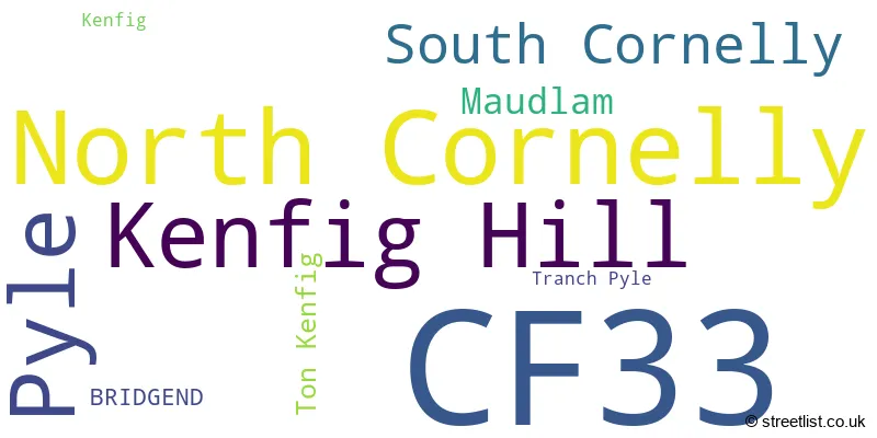
The largest settlement in the CF33 postal code is NORTH CORNELLY followed by KENFIG HILL, and PYLE.
The postcode area has a boundary with The Bristol Channel.
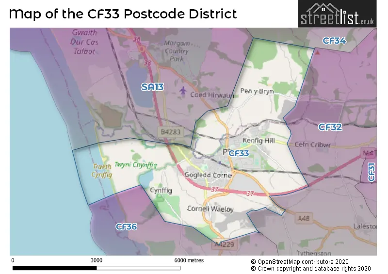
The CF33 Postcode shares a border with CF32 (TONDU, OGMORE VALE, SARN), CF36 (PORTHCAWL, Nottage, NEWTON) and SA13 (PORT TALBOT, MARGAM, TAIBACH).
In the CF33 postcode district in Mid Glamorgan, the primary settlement with the highest count is North Cornelly. Other significant settlements include Kenfig Hill, Pyle, South Cornelly, Ton Kenfig, and Tranch Pyle. The post town for this district is Bridgend in Mid Glamorgan.
For the district CF33, we have data on 2 postcode sectors. Here's a breakdown: The sector CF33 4, covers North Cornelly and South Cornelly in Mid Glamorgan. The sector CF33 6, covers Kenfig Hill and Pyle in Mid Glamorgan.

Map of the CF33 Postcode District
Explore the CF33 postcode district by using our free interactive map.
When it comes to local government, postal geography often disregards political borders. However, for a breakdown in the CF33 District: the district mostly encompasses the Pen-y-bont ar Ogwr - Bridgend (303 postcodes), and finally, the Castell-nedd Port Talbot - Neath Port Talbot area (7 postcodes).
Weather Forecast for CF33
Press Button to Show Forecast for Pyle
| Time Period | Icon | Description | Temperature | Rain Probability | Wind |
|---|---|---|---|---|---|
| 12:00 to 15:00 | Cloudy | 12.0°C (feels like 10.0°C) | 4.00% | WNW 9 mph | |
| 15:00 to 18:00 | Cloudy | 12.0°C (feels like 10.0°C) | 5.00% | WNW 11 mph | |
| 18:00 to 21:00 | Sunny day | 12.0°C (feels like 10.0°C) | 0.00% | NW 11 mph | |
| 21:00 to 00:00 | Clear night | 8.0°C (feels like 6.0°C) | 0.00% | NNW 7 mph |
Press Button to Show Forecast for Pyle
| Time Period | Icon | Description | Temperature | Rain Probability | Wind |
|---|---|---|---|---|---|
| 00:00 to 03:00 | Clear night | 7.0°C (feels like 5.0°C) | 1.00% | NW 7 mph | |
| 03:00 to 06:00 | Clear night | 5.0°C (feels like 4.0°C) | 1.00% | NNW 7 mph | |
| 06:00 to 09:00 | Cloudy | 7.0°C (feels like 5.0°C) | 5.00% | NNW 4 mph | |
| 09:00 to 12:00 | Partly cloudy (day) | 9.0°C (feels like 7.0°C) | 5.00% | W 9 mph | |
| 12:00 to 15:00 | Light rain shower (day) | 11.0°C (feels like 8.0°C) | 27.00% | WNW 11 mph | |
| 15:00 to 18:00 | Cloudy | 11.0°C (feels like 9.0°C) | 8.00% | W 11 mph | |
| 18:00 to 21:00 | Cloudy | 11.0°C (feels like 8.0°C) | 6.00% | WNW 11 mph | |
| 21:00 to 00:00 | Partly cloudy (night) | 8.0°C (feels like 7.0°C) | 5.00% | NW 7 mph |
Press Button to Show Forecast for Pyle
| Time Period | Icon | Description | Temperature | Rain Probability | Wind |
|---|---|---|---|---|---|
| 00:00 to 03:00 | Cloudy | 7.0°C (feels like 6.0°C) | 12.00% | NW 7 mph | |
| 03:00 to 06:00 | Cloudy | 7.0°C (feels like 5.0°C) | 13.00% | N 7 mph | |
| 06:00 to 09:00 | Cloudy | 7.0°C (feels like 5.0°C) | 11.00% | E 9 mph | |
| 09:00 to 12:00 | Cloudy | 9.0°C (feels like 6.0°C) | 12.00% | SE 11 mph | |
| 12:00 to 15:00 | Cloudy | 10.0°C (feels like 8.0°C) | 15.00% | SSE 11 mph | |
| 15:00 to 18:00 | Cloudy | 10.0°C (feels like 8.0°C) | 17.00% | SSW 11 mph | |
| 18:00 to 21:00 | Cloudy | 10.0°C (feels like 8.0°C) | 17.00% | E 9 mph | |
| 21:00 to 00:00 | Cloudy | 9.0°C (feels like 7.0°C) | 14.00% | NNE 9 mph |
Press Button to Show Forecast for Pyle
| Time Period | Icon | Description | Temperature | Rain Probability | Wind |
|---|---|---|---|---|---|
| 00:00 to 03:00 | Cloudy | 8.0°C (feels like 6.0°C) | 14.00% | NNE 11 mph | |
| 03:00 to 06:00 | Cloudy | 8.0°C (feels like 5.0°C) | 16.00% | NNE 11 mph | |
| 06:00 to 09:00 | Cloudy | 8.0°C (feels like 5.0°C) | 13.00% | NE 11 mph | |
| 09:00 to 12:00 | Cloudy | 10.0°C (feels like 7.0°C) | 11.00% | NE 11 mph | |
| 12:00 to 15:00 | Cloudy | 11.0°C (feels like 9.0°C) | 14.00% | NNE 11 mph | |
| 15:00 to 18:00 | Cloudy | 12.0°C (feels like 10.0°C) | 17.00% | NE 11 mph | |
| 18:00 to 21:00 | Light rain | 11.0°C (feels like 9.0°C) | 53.00% | ENE 11 mph | |
| 21:00 to 00:00 | Light rain | 10.0°C (feels like 7.0°C) | 57.00% | NNW 11 mph |
Where is the CF33 Postcode District?
The CF33 postcode district is located in the town of Bridgend. It is situated near several nearby towns. To the south, there is Porthcawl which is approximately 2.66 miles away. To the north-west, there is Port Talbot which is approximately 5.41 miles away. Maesteg is located to the north and is about 5.89 miles away. To the south-east, there is Llantwit Major which is around 11.95 miles away. Finally, Tonypandy is located to the north-east and is approximately 12.06 miles away. Additionally, the CF33 postcode district is roughly 153.83 miles away from the center of London.
The district is within the post town of BRIDGEND.
The sector has postcodes within the nation of Wales.
The CF33 Postcode District is in the Bridgend and Neath Port Talbot region of West Wales within the Wales.
| Postcode Sector | Delivery Office |
|---|---|
| CF33 4 | Bridgend (cf) Delivery Office |
| CF33 6 | Bridgend (cf) Delivery Office |
| C | F | 3 | 3 | - | X | X | X |
| C | F | 3 | 3 | Space | Numeric | Letter | Letter |
Current Monthly Rental Prices
| # Bedrooms | Min Price | Max Price | Avg Price |
|---|
Current House Prices
| # Bedrooms | Min Price | Max Price | Avg Price |
|---|---|---|---|
| £200,000 | £200,000 | £200,000 | |
| 2 | £215,000 | £215,000 | £215,000 |
| 3 | £200,000 | £425,000 | £263,889 |
| 4 | £225,000 | £385,000 | £287,595 |
| 5 | £400,000 | £925,000 | £543,750 |
Estate Agents who Operate in the CF33 District
| Logo | Name | Brand Name | Address | Contact Number | Total Properties |
|---|---|---|---|---|---|
 | Porthcawl | Peter Alan | 58 John Street, Porthcawl, CF36 3BD | 01656 335073 | 12 |
 | Kenfig Hill | Ferriers Estate Agents | 41a Bridge Street, Kenfig Hill, CF33 6DB | 01656 330512 | 8 |
 | Porthcawl | Prestons | 16 Lias Road, Porthcawl, CF36 3AH | 01656 338835 | 5 |
 | Wales | eXp UK | 1 Northumberland Avenue, Trafalgar Square, London, WC2N 5BW | 03304 609968 | 4 |
 | Porthcawl | Thompsons Estate Agents | 69 John Street, Porthcawl, CF36 3AY | 01656 331502 | 4 |
| Type of Property | 2018 Average | 2018 Sales | 2017 Average | 2017 Sales | 2016 Average | 2016 Sales | 2015 Average | 2015 Sales |
|---|---|---|---|---|---|---|---|---|
| Detached | £212,354 | 46 | £199,665 | 42 | £189,061 | 48 | £180,615 | 47 |
| Semi-Detached | £136,301 | 90 | £125,564 | 76 | £125,118 | 86 | £117,136 | 107 |
| Terraced | £105,981 | 66 | £109,629 | 66 | £102,388 | 60 | £104,712 | 70 |
| Flats | £61,968 | 17 | £67,708 | 12 | £61,650 | 10 | £68,139 | 19 |