The DN10 postcode district is a postal district located in the DN Doncaster postcode area with a population of 12,593 residents according to the 2021 England and Wales Census.
The area of the DN10 postcode district is 54.49 square miles which is 141.13 square kilometres or 34,872.98 acres.
Currently, the DN10 district has about 550 postcode units spread across 3 geographic postcode sectors.
Given that each sector allows for 400 unique postcode combinations, the district has a capacity of 1,200 postcodes. With 550 postcodes already in use, this leaves 650 units available.
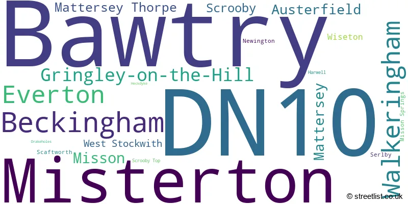
The largest settlement in the DN10 postal code is Bawtry followed by Misterton, and Beckingham.
The DN10 Postcode shares a border with DN11 (New Rossington, Harworth, Tickhill), DN21 (GAINSBOROUGH, Kirton Lindsey, Scotter), DN22 (RETFORD, Ranskill, Clarborough) and DN9 (Epworth, Auckley, Belton).
The primary settlement in the DN10 postcode district is Beckingham, located in the county of Nottinghamshire, England. Other significant settlements in this district include Gringley-on-the-Hill, Misterton, Walkeringham, and West Stockwith. The post town for this district is Doncaster, which is also located in Nottinghamshire, England.
For the district DN10, we have data on 3 postcode sectors. Here's a breakdown: The sector DN10 4, covers Misterton and Beckingham and Walkeringham and Gringley-On-The-Hill in Nottinghamshire. The sector DN10 5, covers Everton and Mattersey and Mattersey Thorpe in Nottinghamshire. The sector DN10 6, covers Bawtry and Austerfield in South Yorkshire. The sector DN10 6, covers Misson in Nottinghamshire.

Map of the DN10 Postcode District
Explore the DN10 postcode district by using our free interactive map.

When it comes to local government, postal geography often disregards political borders. However, for a breakdown in the DN10 District: the district mostly encompasses the Bassetlaw District (399 postcodes), and finally, the Doncaster District (B) area (158 postcodes).
Weather Forecast for DN10
Press Button to Show Forecast for Bawtry
| Time Period | Icon | Description | Temperature | Rain Probability | Wind |
|---|---|---|---|---|---|
| 03:00 to 06:00 | Cloudy | 5.0°C (feels like 3.0°C) | 4.00% | WSW 7 mph | |
| 06:00 to 09:00 | Cloudy | 6.0°C (feels like 3.0°C) | 5.00% | WSW 9 mph | |
| 09:00 to 12:00 | Cloudy | 7.0°C (feels like 5.0°C) | 12.00% | NNW 9 mph | |
| 12:00 to 15:00 | Cloudy | 8.0°C (feels like 6.0°C) | 10.00% | N 7 mph | |
| 15:00 to 18:00 | Cloudy | 9.0°C (feels like 7.0°C) | 7.00% | NNE 9 mph | |
| 18:00 to 21:00 | Partly cloudy (day) | 8.0°C (feels like 6.0°C) | 4.00% | NE 7 mph | |
| 21:00 to 00:00 | Partly cloudy (night) | 5.0°C (feels like 3.0°C) | 2.00% | ENE 4 mph |
Press Button to Show Forecast for Bawtry
| Time Period | Icon | Description | Temperature | Rain Probability | Wind |
|---|---|---|---|---|---|
| 00:00 to 03:00 | Clear night | 2.0°C (feels like 1.0°C) | 2.00% | N 4 mph | |
| 03:00 to 06:00 | Partly cloudy (night) | 2.0°C (feels like 0.0°C) | 2.00% | NNW 4 mph | |
| 06:00 to 09:00 | Partly cloudy (day) | 3.0°C (feels like 1.0°C) | 2.00% | N 4 mph | |
| 09:00 to 12:00 | Cloudy | 7.0°C (feels like 6.0°C) | 7.00% | NE 4 mph | |
| 12:00 to 15:00 | Overcast | 9.0°C (feels like 8.0°C) | 11.00% | E 4 mph | |
| 15:00 to 18:00 | Cloudy | 9.0°C (feels like 8.0°C) | 9.00% | ENE 7 mph | |
| 18:00 to 21:00 | Cloudy | 8.0°C (feels like 6.0°C) | 10.00% | ENE 7 mph | |
| 21:00 to 00:00 | Cloudy | 6.0°C (feels like 4.0°C) | 6.00% | ENE 4 mph |
Press Button to Show Forecast for Bawtry
| Time Period | Icon | Description | Temperature | Rain Probability | Wind |
|---|---|---|---|---|---|
| 00:00 to 03:00 | Cloudy | 4.0°C (feels like 2.0°C) | 8.00% | ENE 4 mph | |
| 03:00 to 06:00 | Cloudy | 3.0°C (feels like 1.0°C) | 11.00% | NE 4 mph | |
| 06:00 to 09:00 | Cloudy | 4.0°C (feels like 2.0°C) | 11.00% | NE 7 mph | |
| 09:00 to 12:00 | Cloudy | 8.0°C (feels like 6.0°C) | 11.00% | ENE 9 mph | |
| 12:00 to 15:00 | Overcast | 10.0°C (feels like 8.0°C) | 22.00% | ENE 9 mph | |
| 15:00 to 18:00 | Cloudy | 10.0°C (feels like 8.0°C) | 20.00% | ENE 9 mph | |
| 18:00 to 21:00 | Cloudy | 9.0°C (feels like 7.0°C) | 19.00% | ENE 9 mph | |
| 21:00 to 00:00 | Cloudy | 7.0°C (feels like 5.0°C) | 16.00% | NE 9 mph |
Press Button to Show Forecast for Bawtry
| Time Period | Icon | Description | Temperature | Rain Probability | Wind |
|---|---|---|---|---|---|
| 00:00 to 03:00 | Overcast | 7.0°C (feels like 4.0°C) | 24.00% | NE 9 mph | |
| 03:00 to 06:00 | Light rain | 7.0°C (feels like 4.0°C) | 50.00% | NE 9 mph | |
| 06:00 to 09:00 | Heavy rain | 8.0°C (feels like 5.0°C) | 75.00% | NNE 9 mph | |
| 09:00 to 12:00 | Light rain | 10.0°C (feels like 7.0°C) | 57.00% | NE 9 mph | |
| 12:00 to 15:00 | Heavy rain | 11.0°C (feels like 9.0°C) | 78.00% | NNE 11 mph | |
| 15:00 to 18:00 | Heavy rain shower (day) | 11.0°C (feels like 9.0°C) | 57.00% | NNW 11 mph | |
| 18:00 to 21:00 | Light rain shower (day) | 11.0°C (feels like 9.0°C) | 36.00% | NE 9 mph | |
| 21:00 to 00:00 | Partly cloudy (night) | 9.0°C (feels like 7.0°C) | 9.00% | ESE 9 mph |
Where is the DN10 Postcode District?
The DN10 postcode district is located in Doncaster. Doncaster is surrounded by several nearby towns, including Retford, Gainsborough, Worksop, Mexborough, Scunthorpe, Goole, and Lincoln. Additionally, Doncaster is approximately 137.1415809178313 miles away from the center of London.
The district is within the post town of DONCASTER.
The sector has postcodes within the nation of England.
The DN10 Postcode District is covers the following regions.
- North Nottinghamshire - Derbyshire and Nottinghamshire - East Midlands (England)
- Barnsley, Doncaster and Rotherham - South Yorkshire - Yorkshire and The Humber
| Postcode Sector | Delivery Office |
|---|---|
| DN10 4 | Gringley-on-the-hill Scale Payment Delivery Office |
| DN10 4 | Misterton Scale Payment Delivery Office |
| DN10 4 | Walkeringham Scale Payment Delivery Office |
| DN10 5 | Bawtry Scale Payment Delivery Office |
| DN10 6 | Bawtry Scale Payment Delivery Office |
| D | N | 1 | 0 | - | X | X | X |
| D | N | 1 | 0 | Space | Numeric | Letter | Letter |
Current Monthly Rental Prices
| # Bedrooms | Min Price | Max Price | Avg Price |
|---|---|---|---|
| 1 | £545 | £550 | £548 |
| 2 | £625 | £1,200 | £836 |
| 3 | £900 | £1,050 | £983 |
| 4 | £1,300 | £1,650 | £1,475 |
| 5 | £1,400 | £1,400 | £1,400 |
Current House Prices
| # Bedrooms | Min Price | Max Price | Avg Price |
|---|---|---|---|
| £55,000 | £1,700,000 | £297,632 | |
| 1 | £65,000 | £155,000 | £110,625 |
| 2 | £79,950 | £300,000 | £174,292 |
| 3 | £90,000 | £950,000 | £314,031 |
| 4 | £169,950 | £2,250,000 | £507,636 |
| 5 | £480,000 | £1,395,000 | £807,692 |
| 6 | £650,000 | £1,200,000 | £856,143 |
Estate Agents who Operate in the DN10 District
| Logo | Name | Brand Name | Address | Contact Number | Total Properties |
|---|---|---|---|---|---|
 | Bawtry | William H. Brown | 38 High Street, Bawtry, Doncaster, DN10 6JE | 01302 490061 | 39 |
 | Bawtry | Hunters | 6 High Street, Bawtry, DN10 6JE | 01302 490627 | 11 |
 | Retford | William H. Brown | Grove Street, Retford, DN22 6JR | 01777 802239 | 10 |
 | Bawtry | Fine & Country | 30 South Parade, Bawtry, Doncaster, DN10 6JH | 01302 490489 | 9 |
 | Lincoln | Brown & Co | 5 Oakwood Road, Lincoln, Lincolnshire, LN6 3LH | 01522 303264 | 9 |
| Type of Property | 2018 Average | 2018 Sales | 2017 Average | 2017 Sales | 2016 Average | 2016 Sales | 2015 Average | 2015 Sales |
|---|---|---|---|---|---|---|---|---|
| Detached | £297,847 | 111 | £278,871 | 154 | £274,532 | 135 | £265,239 | 149 |
| Semi-Detached | £172,067 | 51 | £153,863 | 52 | £152,864 | 49 | £152,053 | 52 |
| Terraced | £153,144 | 34 | £157,878 | 37 | £165,267 | 40 | £136,594 | 42 |
| Flats | £178,821 | 45 | £95,286 | 7 | £104,222 | 9 | £112,125 | 8 |