The HS3 postcode district is a postal district located in the HS Outer Hebrides postcode area with a population of 1,324 residents according to the 2011 Scotland Census.
The area of the HS3 postcode district is 169.77 square miles which is 439.70 square kilometres or 108,651.15 acres.
Currently, the HS3 district has about 75 postcode units spread across 1 geographic postcode sectors.
Given that each sector allows for 400 unique postcode combinations, the district has a capacity of 400 postcodes. With 75 postcodes already in use, this leaves 325 units available.
The largest settlement in the HS3 postal code is Tarbert followed by ISLE OF HARRIS, and Rhenigidale.
The postcode area has a boundary with Sea of the Hebredes and The North Atlantic Ocean.
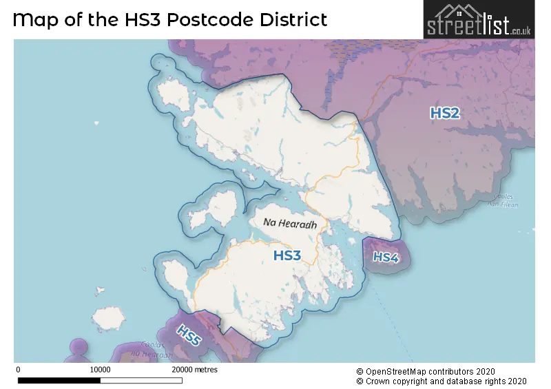
The HS3 Postcode shares a border with HS5 (Leverburgh, Strond, Rodel) and HS2 (Newmarket, Sandwick, Point).
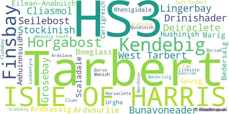
The primary settlement in the HS3 postcode district is Isle of Harris, located in the Western Isles county of Scotland. Other significant settlements in this district include Amhuinnsuidh, Ardhasaig, Ardslave, Ardvourlie, Beckrivig, Bedersaig, Borsam, Borve, Bowglass, Bunavoneader, Carrigreich, Caw, Cliasmol, Cluer, Deiraclete, Drinishader, East Tarbert, Eilean-Anabuich, Finsbay, Flodabay, Geocrab, Govig, Grosebay, Horgabost, Horsaclete, Hushinish, Kendebig, Lickisto, Lingerbay, Luskentyre, Manish, Marig, Meavaig South, Northton, Plockropool, Quidinish, Rhenigidale, Scadabay, Scaladale, Scarista, Seilebost, Stockinish, Tarbert, Urgha, and West Tarbert. The most significant post town in this district is Isle of Harris, with the highest count of postal codes.
For the district HS3, we have data on 1 postcode sectors. Here's a breakdown: The sector HS3 3, covers Tarbert in Western Isles.
HS3 Postcode Sectors

Map of the HS3 Postcode District
Explore the HS3 postcode district by using our free interactive map.
When it comes to local government, postal geography often disregards political borders. However, for a breakdown in the HS3 District: the district mostly encompasses the Na h-Eileanan an Iar area with a total of 76 postcodes.
Weather Forecast for HS3
Press Button to Show Forecast for Rhenigidale Youth Hostel
| Time Period | Icon | Description | Temperature | Rain Probability | Wind |
|---|---|---|---|---|---|
| 21:00 to 00:00 | Cloudy | 6.0°C (feels like 3.0°C) | 3.00% | NW 11 mph |
Press Button to Show Forecast for Rhenigidale Youth Hostel
| Time Period | Icon | Description | Temperature | Rain Probability | Wind |
|---|---|---|---|---|---|
| 00:00 to 03:00 | Cloudy | 6.0°C (feels like 2.0°C) | 4.00% | N 9 mph | |
| 03:00 to 06:00 | Partly cloudy (night) | 5.0°C (feels like 1.0°C) | 1.00% | NNE 11 mph | |
| 06:00 to 09:00 | Partly cloudy (day) | 4.0°C (feels like 1.0°C) | 1.00% | NNE 11 mph | |
| 09:00 to 12:00 | Cloudy | 7.0°C (feels like 4.0°C) | 5.00% | NE 11 mph | |
| 12:00 to 15:00 | Partly cloudy (day) | 8.0°C (feels like 5.0°C) | 32.00% | NE 11 mph | |
| 15:00 to 18:00 | Cloudy | 8.0°C (feels like 5.0°C) | 6.00% | NNE 11 mph | |
| 18:00 to 21:00 | Partly cloudy (day) | 7.0°C (feels like 4.0°C) | 28.00% | NNE 13 mph | |
| 21:00 to 00:00 | Clear night | 5.0°C (feels like 2.0°C) | 2.00% | NNE 9 mph |
Press Button to Show Forecast for Rhenigidale Youth Hostel
| Time Period | Icon | Description | Temperature | Rain Probability | Wind |
|---|---|---|---|---|---|
| 00:00 to 03:00 | Partly cloudy (night) | 4.0°C (feels like 1.0°C) | 39.00% | NNE 9 mph | |
| 03:00 to 06:00 | Partly cloudy (night) | 3.0°C (feels like 0.0°C) | 4.00% | N 9 mph | |
| 06:00 to 09:00 | Partly cloudy (day) | 4.0°C (feels like 1.0°C) | 5.00% | N 9 mph | |
| 09:00 to 12:00 | Cloudy | 6.0°C (feels like 3.0°C) | 9.00% | NNE 9 mph | |
| 12:00 to 15:00 | Light rain shower (day) | 7.0°C (feels like 4.0°C) | 39.00% | NNW 7 mph | |
| 15:00 to 18:00 | Light rain shower (day) | 8.0°C (feels like 5.0°C) | 35.00% | N 9 mph | |
| 18:00 to 21:00 | Light rain shower (day) | 7.0°C (feels like 4.0°C) | 33.00% | NNE 9 mph | |
| 21:00 to 00:00 | Cloudy | 5.0°C (feels like 3.0°C) | 11.00% | N 7 mph |
Press Button to Show Forecast for Rhenigidale Youth Hostel
| Time Period | Icon | Description | Temperature | Rain Probability | Wind |
|---|---|---|---|---|---|
| 00:00 to 03:00 | Cloudy | 5.0°C (feels like 3.0°C) | 6.00% | NNW 7 mph | |
| 03:00 to 06:00 | Cloudy | 4.0°C (feels like 2.0°C) | 6.00% | NNW 4 mph | |
| 06:00 to 09:00 | Cloudy | 4.0°C (feels like 2.0°C) | 6.00% | N 7 mph | |
| 09:00 to 12:00 | Partly cloudy (day) | 7.0°C (feels like 5.0°C) | 8.00% | NNE 7 mph | |
| 12:00 to 15:00 | Light rain shower (day) | 7.0°C (feels like 5.0°C) | 32.00% | N 7 mph | |
| 15:00 to 18:00 | Light rain shower (day) | 8.0°C (feels like 6.0°C) | 30.00% | N 7 mph | |
| 18:00 to 21:00 | Light rain shower (day) | 7.0°C (feels like 5.0°C) | 34.00% | N 7 mph | |
| 21:00 to 00:00 | Partly cloudy (night) | 5.0°C (feels like 4.0°C) | 2.00% | NNE 4 mph |
Press Button to Show Forecast for Rhenigidale Youth Hostel
| Time Period | Icon | Description | Temperature | Rain Probability | Wind |
|---|---|---|---|---|---|
| 00:00 to 03:00 | Clear night | 4.0°C (feels like 2.0°C) | 2.00% | NW 4 mph | |
| 03:00 to 06:00 | Partly cloudy (night) | 4.0°C (feels like 1.0°C) | 2.00% | NW 4 mph | |
| 06:00 to 09:00 | Partly cloudy (day) | 5.0°C (feels like 3.0°C) | 2.00% | NW 4 mph | |
| 09:00 to 12:00 | Cloudy | 7.0°C (feels like 5.0°C) | 6.00% | SSE 7 mph | |
| 12:00 to 15:00 | Cloudy | 8.0°C (feels like 6.0°C) | 12.00% | NW 9 mph | |
| 15:00 to 18:00 | Cloudy | 9.0°C (feels like 7.0°C) | 12.00% | WNW 9 mph | |
| 18:00 to 21:00 | Partly cloudy (day) | 8.0°C (feels like 6.0°C) | 10.00% | W 11 mph | |
| 21:00 to 00:00 | Cloudy | 7.0°C (feels like 4.0°C) | 9.00% | WNW 9 mph |
Where is the HS3 Postcode District?
The postcode district HS3 is located in the town of Isle of Harris. It is nearby several towns, including Isle of Scalpay, Isle of Lewis, Isle of North Uist, Gairloch, and Isle of Canna. The town of Isle of Harris is situated approximately 518.84 miles away from the center of London.
The district is within the post town of ISLE OF HARRIS.
The sector has postcodes within the nation of Scotland.
The HS3 Postcode District is in the Na h-Eileanan Siar (Western Isles) region of Highlands and Islands within the Scotland.
Postcode Sectors within the HS3 District
| Postcode Sector | Delivery Office |
|---|---|
| HS3 3 | Stornoway Delivery Office |
| HS3 3 | Harris Scale Payment Delivery Office |
| HS3 3 | Leverburgh Scale Payment Delivery Office |
| H | S | 3 | - | X | X | X |
| H | S | 3 | Space | Numeric | Letter | Letter |
Current Monthly Rental Prices
| # Bedrooms | Min Price | Max Price | Avg Price |
|---|
Current House Prices
| # Bedrooms | Min Price | Max Price | Avg Price |
|---|---|---|---|
| 1 | £245,000 | £245,000 | £245,000 |
| 2 | £65,000 | £65,000 | £65,000 |
Estate Agents who Operate in the HS3 District
| Logo | Name | Brand Name | Address | Contact Number | Total Properties |
|---|---|---|---|---|---|
 | Inverness | Galbraith | Clark Thomson House Fairways Business Park Inverness IV2 6AA | 01463 490056 | 1 |
 | Paisley | Auction House Scotland | Auction House Scotland Office 2 Craigs Business Centre Macdowall Street Paisley Renfrewshire PA3 2NB | 0141 673 7275 | 1 |