The HS6 postcode district is a postal district located in the HS Outer Hebrides postcode area with a population of 1,619 residents according to the 2011 Scotland Census.
The area of the HS6 postcode district is 126.64 square miles which is 327.99 square kilometres or 81,047.15 acres.
Currently, the HS6 district has about 78 postcode units spread across 1 geographic postcode sectors.
Given that each sector allows for 400 unique postcode combinations, the district has a capacity of 400 postcodes. With 78 postcodes already in use, this leaves 322 units available.
The largest settlement in the HS6 postal code is Locheport followed by Berneray, and Grimsay.
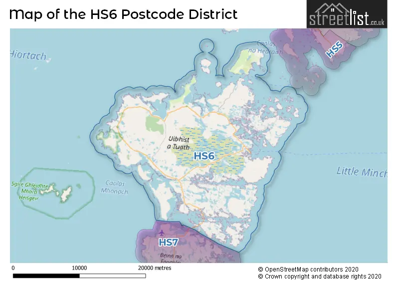
The postcode area has a boundary with Sea of the Hebredes and The North Atlantic Ocean.
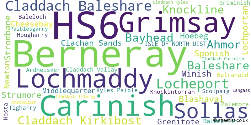
The primary settlement in the HS6 postcode district is Isle of North Uist, located in the Western Isles. Other significant settlements in this district include Ahmor, Ardheisker, Baleloch, Balemartin, Balemore, Baleshare, Balranald, Bayhead, Berneray, Blashaval, Carinish, Cheesebay, Clachan Sands, Claddach Baleshare, Claddach Carinish, Claddach Illeray, Claddach Kirkibost, Claddach Kyles, Claddach Vallay, Grenitote, Griminish, Grimsay, Hoebeg, Hosta, Hougharry, Knockintorran, Knockline, Knockquien, Kyles Paible, Langass, Locheport, Lochmaddy, Lochportan, Middlequarter, Minish, Newton, Paiblesgarry, Scolpaig, Sollas, Sponish, Strombane, Strumore, and Tigharry. The most significant post town in this district is Isle of North Uist.
For the district HS6, we have data on 1 postcode sectors. Here's a breakdown: The sector HS6 5, covers Berneray in Western Isles.
HS6 Postcode Sectors

Map of the HS6 Postcode District
Explore the HS6 postcode district by using our free interactive map.
When it comes to local government, postal geography often disregards political borders. However, for a breakdown in the HS6 District: the district mostly encompasses the Na h-Eileanan an Iar area with a total of 79 postcodes.
Weather Forecast for HS6
Press Button to Show Forecast for Benbecula (Balivanich) Airport
| Time Period | Icon | Description | Temperature | Rain Probability | Wind |
|---|---|---|---|---|---|
| 21:00 to 00:00 | Clear night | 8.0°C (feels like 4.0°C) | 0.00% | N 11 mph |
Press Button to Show Forecast for Benbecula (Balivanich) Airport
| Time Period | Icon | Description | Temperature | Rain Probability | Wind |
|---|---|---|---|---|---|
| 00:00 to 03:00 | Clear night | 6.0°C (feels like 3.0°C) | 1.00% | NNE 9 mph | |
| 03:00 to 06:00 | Clear night | 5.0°C (feels like 2.0°C) | 1.00% | N 7 mph | |
| 06:00 to 09:00 | Cloudy | 5.0°C (feels like 3.0°C) | 3.00% | NNE 4 mph | |
| 09:00 to 12:00 | Cloudy | 9.0°C (feels like 6.0°C) | 3.00% | N 9 mph | |
| 12:00 to 15:00 | Sunny day | 10.0°C (feels like 8.0°C) | 0.00% | NNW 11 mph | |
| 15:00 to 18:00 | Sunny day | 10.0°C (feels like 8.0°C) | 0.00% | NW 13 mph | |
| 18:00 to 21:00 | Partly cloudy (day) | 9.0°C (feels like 6.0°C) | 1.00% | NNW 13 mph | |
| 21:00 to 00:00 | Cloudy | 8.0°C (feels like 5.0°C) | 4.00% | NNW 11 mph |
Press Button to Show Forecast for Benbecula (Balivanich) Airport
| Time Period | Icon | Description | Temperature | Rain Probability | Wind |
|---|---|---|---|---|---|
| 00:00 to 03:00 | Cloudy | 7.0°C (feels like 4.0°C) | 17.00% | NNW 11 mph | |
| 03:00 to 06:00 | Cloudy | 6.0°C (feels like 3.0°C) | 5.00% | N 9 mph | |
| 06:00 to 09:00 | Cloudy | 6.0°C (feels like 3.0°C) | 7.00% | N 9 mph | |
| 09:00 to 12:00 | Cloudy | 7.0°C (feels like 5.0°C) | 8.00% | NNE 9 mph | |
| 12:00 to 15:00 | Cloudy | 9.0°C (feels like 6.0°C) | 10.00% | NE 11 mph | |
| 15:00 to 18:00 | Cloudy | 9.0°C (feels like 7.0°C) | 9.00% | NE 11 mph | |
| 18:00 to 21:00 | Cloudy | 8.0°C (feels like 5.0°C) | 9.00% | NE 11 mph | |
| 21:00 to 00:00 | Partly cloudy (night) | 6.0°C (feels like 3.0°C) | 2.00% | NE 11 mph |
Press Button to Show Forecast for Benbecula (Balivanich) Airport
| Time Period | Icon | Description | Temperature | Rain Probability | Wind |
|---|---|---|---|---|---|
| 00:00 to 03:00 | Cloudy | 6.0°C (feels like 2.0°C) | 5.00% | NE 11 mph | |
| 03:00 to 06:00 | Partly cloudy (night) | 5.0°C (feels like 2.0°C) | 3.00% | NE 9 mph | |
| 06:00 to 09:00 | Sunny day | 5.0°C (feels like 2.0°C) | 1.00% | NE 9 mph | |
| 09:00 to 12:00 | Partly cloudy (day) | 7.0°C (feels like 4.0°C) | 7.00% | NE 11 mph | |
| 12:00 to 15:00 | Light rain shower (day) | 9.0°C (feels like 6.0°C) | 30.00% | NE 11 mph | |
| 15:00 to 18:00 | Light rain shower (day) | 9.0°C (feels like 7.0°C) | 30.00% | NNE 11 mph | |
| 18:00 to 21:00 | Light rain shower (day) | 8.0°C (feels like 5.0°C) | 29.00% | NNE 11 mph | |
| 21:00 to 00:00 | Cloudy | 6.0°C (feels like 3.0°C) | 6.00% | NNE 9 mph |
Press Button to Show Forecast for Benbecula (Balivanich) Airport
| Time Period | Icon | Description | Temperature | Rain Probability | Wind |
|---|---|---|---|---|---|
| 00:00 to 03:00 | Partly cloudy (night) | 5.0°C (feels like 3.0°C) | 1.00% | NNE 7 mph | |
| 03:00 to 06:00 | Partly cloudy (night) | 4.0°C (feels like 2.0°C) | 2.00% | NNE 4 mph | |
| 06:00 to 09:00 | Partly cloudy (day) | 5.0°C (feels like 3.0°C) | 1.00% | NNE 4 mph | |
| 09:00 to 12:00 | Cloudy | 8.0°C (feels like 6.0°C) | 9.00% | NE 7 mph | |
| 12:00 to 15:00 | Cloudy | 9.0°C (feels like 8.0°C) | 13.00% | ENE 7 mph | |
| 15:00 to 18:00 | Light rain shower (day) | 10.0°C (feels like 8.0°C) | 37.00% | NNE 9 mph | |
| 18:00 to 21:00 | Partly cloudy (day) | 9.0°C (feels like 7.0°C) | 7.00% | NNE 9 mph | |
| 21:00 to 00:00 | Clear night | 6.0°C (feels like 4.0°C) | 3.00% | NNE 7 mph |
Where is the HS6 Postcode District?
The postcode district HS6 is located in the town of Isle of North Uist. It is situated in close proximity to the nearby towns of Isle of Harris, Portree, and Isle of Canna. In terms of distance, the postcode district is approximately 509.71 miles away from the center of London.
The district is within the post town of ISLE OF NORTH UIST.
The sector has postcodes within the nation of Scotland.
The HS6 Postcode District is in the Na h-Eileanan Siar (Western Isles) region of Highlands and Islands within the Scotland.
Postcode Sectors within the HS6 District
Postcode Districts that Share a Border with HS6
| Postcode Sector | Delivery Office |
|---|---|
| HS6 5 | Lochmaddy Delivery Office |
| HS6 5 | Berneray Scale Payment Delivery Office |
| H | S | 6 | - | X | X | X |
| H | S | 6 | Space | Numeric | Letter | Letter |
Current Monthly Rental Prices
| # Bedrooms | Min Price | Max Price | Avg Price |
|---|
Current House Prices
| # Bedrooms | Min Price | Max Price | Avg Price |
|---|---|---|---|
| £20,000 | £75,000 | £41,667 | |
| 3 | £340,000 | £340,000 | £340,000 |
| 4 | £235,000 | £235,000 | £235,000 |
Estate Agents who Operate in the HS6 District
| Logo | Name | Brand Name | Address | Contact Number | Total Properties |
|---|---|---|---|---|---|
 | Beauly | Bell Ingram | 5 High Street Beauly IV4 7BS | 01463 211703 | 3 |
 | Stirling | Galbraith | Suite C1, Stirling Agricultural Centre, Stirling, FK9 4RN | 01786 649945 | 1 |
 | Edinburgh | McEwan Fraser Legal | Claremont House 130 East Claremont Street Edinburgh EH7 4LB | 0131 381 4292 | 1 |