The HU17 postcode district is a postal district located in the HU Hull postcode area with a population of 43,822 residents according to the 2021 England and Wales Census.
The area of the HU17 postcode district is 66.45 square miles which is 172.11 square kilometres or 42,529.17 acres.
Currently, the HU17 district has about 1188 postcode units spread across 5 geographic postcode sectors.
Given that each sector allows for 400 unique postcode combinations, the district has a capacity of 2,000 postcodes. With 1188 postcodes already in use, this leaves 812 units available.
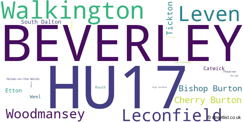
The largest settlement in the HU17 postal code is BEVERLEY followed by Leven, and Walkington.
The HU17 Postcode shares a border with HU6 (HULL, Dunswell), HU7 (Bransholme, Kingswood, HULL), HU11 (Bilton, Aldbrough, Sproatley), HU20 (Little Weighton, Rowley, High Hunsley), YO43 (Market Weighton, Holme-on-Spalding-Moor, North Newbald) and YO25 (DRIFFIELD, Skipsea, Nafferton).
In the HU17 postcode district, the primary settlement is Beverley, which is located in the county of East Riding of Yorkshire in England. The most significant secondary settlements in this district include Woodmansey, Leven, Leconfield, and Walkington. The main post town for this postcode district is Beverley.
For the district HU17, we have data on 6 postcode sectors. Here's a breakdown: The sector HU17 0, covers Beverley in East Riding of Yorkshire. The sector HU17 5, covers Leven and Catwick in East Riding of Yorkshire. The sector HU17 6 is non-geographic. It's often designated for PO Boxes, large organisations, or special services. The sector HU17 7, covers Beverley and Leconfield and Cherry Burton in East Riding of Yorkshire. The sector HU17 8, covers Beverley and Walkington in East Riding of Yorkshire. The sector HU17 9, covers Beverley and Tickton in East Riding of Yorkshire.

Map of the HU17 Postcode District
Explore the HU17 postcode district by using our free interactive map.

When it comes to local government, postal geography often disregards political borders. However, for a breakdown in the HU17 District: the district mostly encompasses the East Riding of Yorkshire area with a total of 1261 postcodes.
Recent House Sales in HU17
| Date | Price | Address |
|---|---|---|
| 13/10/2023 | £310,000 | Chester Avenue, Beverley, HU17 8UQ |
| 06/10/2023 | £265,000 | Highfield Road, Beverley, HU17 9QS |
| 02/10/2023 | £160,000 | Brimley Green, Beverley, HU17 7BU |
| 29/09/2023 | £349,950 | Ploughmans Gardens, Woodmansey, Beverley, HU17 0GN |
| 22/09/2023 | £380,000 | Aspen Way, Beverley, HU17 7SZ |
| 22/09/2023 | £100,000 | Corporation Road, Beverley, HU17 9HG |
| 18/09/2023 | £289,950 | Whitefields Close, Beverley, HU17 9GY |
| 18/09/2023 | £235,000 | Coopers Croft, Leven, Beverley, HU17 5QE |
| 15/09/2023 | £228,000 | Woodhall Way, Molescroft, Beverley, HU17 7JA |
| 15/09/2023 | £190,000 | North Bar Within, Beverley, HU17 8DE |
Weather Forecast for HU17
Press Button to Show Forecast for Leconfield Sar
| Time Period | Icon | Description | Temperature | Rain Probability | Wind |
|---|---|---|---|---|---|
| 12:00 to 15:00 | Light rain shower (day) | 8.0°C (feels like 6.0°C) | 53.00% | N 9 mph | |
| 15:00 to 18:00 | Cloudy | 9.0°C (feels like 7.0°C) | 7.00% | NNE 9 mph | |
| 18:00 to 21:00 | Sunny day | 7.0°C (feels like 4.0°C) | 0.00% | NNE 9 mph | |
| 21:00 to 00:00 | Clear night | 3.0°C (feels like 1.0°C) | 0.00% | NNW 4 mph |
Press Button to Show Forecast for Leconfield Sar
| Time Period | Icon | Description | Temperature | Rain Probability | Wind |
|---|---|---|---|---|---|
| 00:00 to 03:00 | Partly cloudy (night) | 2.0°C (feels like 0.0°C) | 0.00% | NW 4 mph | |
| 03:00 to 06:00 | Clear night | 1.0°C (feels like -1.0°C) | 2.00% | NW 2 mph | |
| 06:00 to 09:00 | Cloudy | 3.0°C (feels like 1.0°C) | 5.00% | NNW 2 mph | |
| 09:00 to 12:00 | Cloudy | 7.0°C (feels like 5.0°C) | 48.00% | NE 4 mph | |
| 12:00 to 15:00 | Cloudy | 9.0°C (feels like 7.0°C) | 32.00% | NE 7 mph | |
| 15:00 to 18:00 | Overcast | 9.0°C (feels like 7.0°C) | 12.00% | ENE 7 mph | |
| 18:00 to 21:00 | Partly cloudy (day) | 8.0°C (feels like 6.0°C) | 5.00% | E 7 mph | |
| 21:00 to 00:00 | Partly cloudy (night) | 4.0°C (feels like 2.0°C) | 2.00% | E 4 mph |
Press Button to Show Forecast for Leconfield Sar
| Time Period | Icon | Description | Temperature | Rain Probability | Wind |
|---|---|---|---|---|---|
| 00:00 to 03:00 | Partly cloudy (night) | 3.0°C (feels like 1.0°C) | 3.00% | NE 4 mph | |
| 03:00 to 06:00 | Cloudy | 3.0°C (feels like 1.0°C) | 8.00% | NE 4 mph | |
| 06:00 to 09:00 | Cloudy | 5.0°C (feels like 3.0°C) | 8.00% | ENE 4 mph | |
| 09:00 to 12:00 | Cloudy | 9.0°C (feels like 6.0°C) | 9.00% | E 9 mph | |
| 12:00 to 15:00 | Cloudy | 10.0°C (feels like 8.0°C) | 14.00% | E 9 mph | |
| 15:00 to 18:00 | Cloudy | 10.0°C (feels like 8.0°C) | 13.00% | ENE 11 mph | |
| 18:00 to 21:00 | Cloudy | 9.0°C (feels like 6.0°C) | 13.00% | ENE 9 mph | |
| 21:00 to 00:00 | Cloudy | 8.0°C (feels like 5.0°C) | 11.00% | NE 7 mph |
Press Button to Show Forecast for Leconfield Sar
| Time Period | Icon | Description | Temperature | Rain Probability | Wind |
|---|---|---|---|---|---|
| 00:00 to 03:00 | Cloudy | 7.0°C (feels like 4.0°C) | 19.00% | NE 9 mph | |
| 03:00 to 06:00 | Light rain | 7.0°C (feels like 4.0°C) | 52.00% | NE 9 mph | |
| 06:00 to 09:00 | Heavy rain | 8.0°C (feels like 4.0°C) | 77.00% | NE 9 mph | |
| 09:00 to 12:00 | Heavy rain | 9.0°C (feels like 6.0°C) | 80.00% | ENE 11 mph | |
| 12:00 to 15:00 | Overcast | 11.0°C (feels like 8.0°C) | 25.00% | ENE 11 mph | |
| 15:00 to 18:00 | Light rain shower (day) | 11.0°C (feels like 8.0°C) | 44.00% | E 11 mph | |
| 18:00 to 21:00 | Light rain shower (day) | 10.0°C (feels like 7.0°C) | 36.00% | NE 9 mph | |
| 21:00 to 00:00 | Partly cloudy (night) | 8.0°C (feels like 6.0°C) | 7.00% | SSW 7 mph |
Where is the HU17 Postcode District?
The postcode district HU17 is located in the town of Beverley. Beverley is situated near several other towns, including Cottingham, Hull, Brough, Driffield, and Hornsea. The distance from HU17 to London is approximately 163.13 miles.
The district covers the post towns of BEVERLEY, HORNSEA.
The sector has postcodes within the nation of England.
The HU17 Postcode District is in the East Riding of Yorkshire region of East Yorkshire and Northern Lincolnshire within the Yorkshire and The Humber.
| Postcode Sector | Delivery Office |
|---|---|
| HU17 0 | Beverley Delivery Office |
| HU17 5 | Beverley Delivery Office |
| HU17 7 | Beverley Delivery Office |
| HU17 8 | Beverley Delivery Office |
| HU17 9 | Beverley Delivery Office |
| H | U | 1 | 7 | - | X | X | X |
| H | U | 1 | 7 | Space | Numeric | Letter | Letter |
Tourist Attractions within the Postcode Area
We found 2 visitor attractions within the HU17 postcode area
| St Mary's Church, Beverley |
|---|
| Places of Worship |
| Place of Worship (still in use) |
| View St Mary's Church, Beverley on Google Maps |
| Beverley Minster |
| Places of Worship |
| Place of Worship (still in use) |
| View Beverley Minster on Google Maps |
Current Monthly Rental Prices
| # Bedrooms | Min Price | Max Price | Avg Price |
|---|---|---|---|
| 1 | £450 | £850 | £613 |
| 2 | £495 | £850 | £694 |
| 3 | £825 | £1,200 | £993 |
| 4 | £1,095 | £1,900 | £1,484 |
| 5 | £2,100 | £2,100 | £2,100 |
Current House Prices
| # Bedrooms | Min Price | Max Price | Avg Price |
|---|---|---|---|
| £120,000 | £120,000 | £120,000 | |
| 1 | £69,950 | £250,000 | £151,300 |
| 2 | £37,500 | £425,000 | £185,945 |
| 3 | £69,000 | £650,000 | £264,171 |
| 4 | £86,250 | £1,695,000 | £418,600 |
| 5 | £270,000 | £1,200,000 | £670,095 |
| 6 | £1,795,000 | £1,795,000 | £1,795,000 |
| 7 | £995,000 | £1,000,000 | £997,500 |
| 8 | £650,000 | £650,000 | £650,000 |
Estate Agents who Operate in the HU17 District
| Logo | Name | Brand Name | Address | Contact Number | Total Properties |
|---|---|---|---|---|---|
 | Beverley | Quick & Clarke | Grindell House, 35 North Bar Within, Beverley, HU17 8DB | 01482 425088 | 71 |
 | Beverley | Staniford Grays | 3 Sow Hill Road, Beverley, HU17 8BG | 01482 947824 | 43 |
 | Beverley | Hunters | 2-4 Hengate Beverley HU17 8BN | 01482 425092 | 40 |
 | Beverley | EweMove | Beckside North, Beverley, HU17 0PR | 01482 251657 | 39 |
 | Beverley | Beercocks | 1 Market Place, Saturday Market, Beverley, HU17 8BB | 01482 251898 | 36 |
| Type of Property | 2018 Average | 2018 Sales | 2017 Average | 2017 Sales | 2016 Average | 2016 Sales | 2015 Average | 2015 Sales |
|---|---|---|---|---|---|---|---|---|
| Detached | £348,522 | 321 | £314,528 | 307 | £300,759 | 322 | £288,912 | 320 |
| Semi-Detached | £188,753 | 308 | £189,252 | 294 | £190,579 | 303 | £179,731 | 284 |
| Terraced | £174,080 | 271 | £175,018 | 302 | £179,217 | 249 | £167,783 | 275 |
| Flats | £146,963 | 60 | £174,014 | 43 | £172,194 | 89 | £122,152 | 50 |