The PL15 postcode district is a postal district located in the PL Plymouth postcode area with a population of 21,403 residents according to the 2021 England and Wales Census.
The area of the PL15 postcode district is 145.16 square miles which is 375.97 square kilometres or 92,904.66 acres.
Currently, the PL15 district has about 808 postcode units spread across 3 geographic postcode sectors.
Given that each sector allows for 400 unique postcode combinations, the district has a capacity of 1,200 postcodes. With 808 postcodes already in use, this leaves 392 units available.
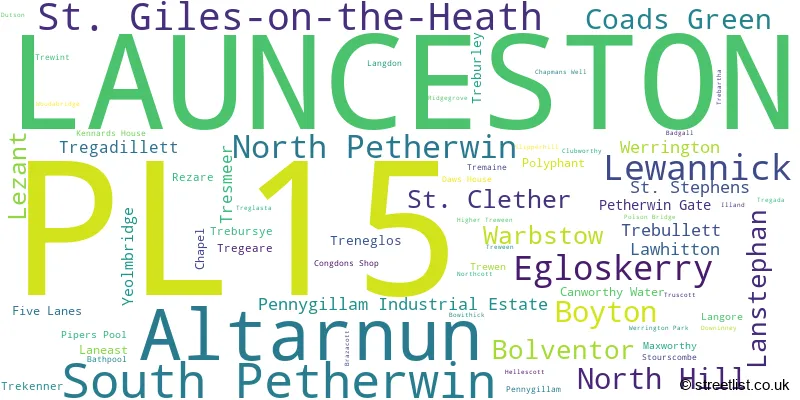
The largest settlement in the PL15 postal code is LAUNCESTON followed by St. Giles-on-the-Heath, and Altarnun.
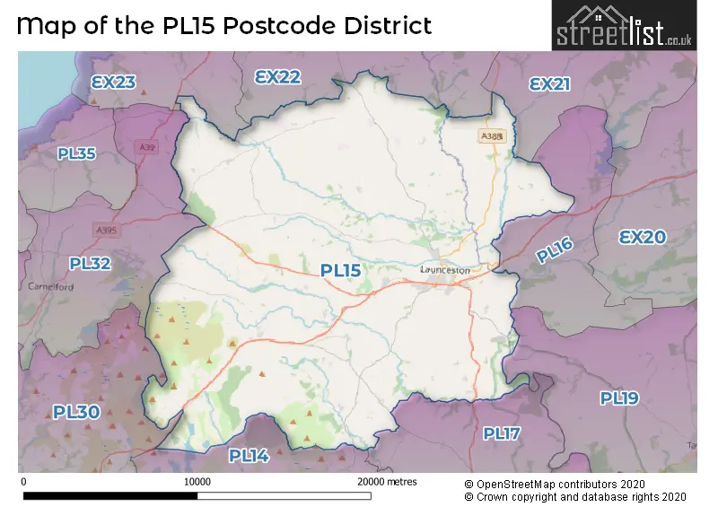
The PL15 Postcode shares a border with EX21 (Ashwater, Shebbear, Halwill), EX22 (HOLSWORTHY, Bradworthy, Pyworthy), PL16 (LIFTON, Broadwoodwidger, Chillaton), PL32 (CAMELFORD, Davidstow, Advent), EX23 (BUDE, Kilkhampton, Stratton), PL17 (CALLINGTON, Kelly Bray, Harrowbarrow), PL19 (TAVISTOCK, Mary Tavy, Whitchurch), PL14 (LISKEARD, Pensilva, Dobwalls) and PL30 (St. Breward, Lanivet, St. Teath).
The primary settlement in the PL15 postcode district is Launceston, located in the county of Cornwall, England. Other significant settlements in the district include Altarnun, Bathpool, Bolventor, Chapel, Coads Green, Lewannick, North Hill, Polyphant, South Petherwin, and Egloskerry. The post town for the district is also Launceston.
For the district PL15, we have data on 4 postcode sectors. Here's a breakdown: The sector PL15 0 is non-geographic. It's often designated for PO Boxes, large organisations, or special services. The sector PL15 7, covers Launceston and Altarnun and South Petherwin in Cornwall. The sector PL15 8, covers Launceston in Cornwall. The sector PL15 9, covers Launceston in Cornwall.

Map of the PL15 Postcode District
Explore the PL15 postcode district by using our free interactive map.
When it comes to local government, postal geography often disregards political borders. However, for a breakdown in the PL15 District: the district mostly encompasses the Cornwall (786 postcodes), and finally, the Torridge District area (31 postcodes).
Recent House Sales in PL15
| Date | Price | Address |
|---|---|---|
| 20/10/2023 | £640,000 | Boyton, Launceston, PL15 9RN |
| 16/10/2023 | £130,500 | Dunheved Road, Launceston, PL15 9DR |
| 13/10/2023 | £145,000 | Blackbird Crescent, Launceston, PL15 9LW |
| 11/10/2023 | £240,000 | Long Field Road, Launceston, PL15 9FW |
| 11/10/2023 | £560,000 | Yeolmbridge, Launceston, PL15 8NH |
| 10/10/2023 | £365,000 | Dunheved Fields, Launceston, PL15 7HS |
| 09/10/2023 | £315,000 | Foundry Gardens, Launceston, PL15 8PA |
| 06/10/2023 | £440,000 | Tremaine, Launceston, PL15 8UD |
| 03/10/2023 | £302,000 | Chestnut Drive, Launceston, PL15 9GP |
| 02/10/2023 | £600,000 | Lawhitton, Launceston, PL15 9PE |
Weather Forecast for PL15
Press Button to Show Forecast for St Joseph's School
| Time Period | Icon | Description | Temperature | Rain Probability | Wind |
|---|---|---|---|---|---|
| 15:00 to 18:00 | Partly cloudy (day) | 11.0°C (feels like 8.0°C) | 1.00% | NW 11 mph | |
| 18:00 to 21:00 | Partly cloudy (day) | 9.0°C (feels like 7.0°C) | 1.00% | NW 9 mph | |
| 21:00 to 00:00 | Cloudy | 7.0°C (feels like 6.0°C) | 5.00% | NW 4 mph |
Press Button to Show Forecast for St Joseph's School
| Time Period | Icon | Description | Temperature | Rain Probability | Wind |
|---|---|---|---|---|---|
| 00:00 to 03:00 | Cloudy | 6.0°C (feels like 5.0°C) | 4.00% | NNE 4 mph | |
| 03:00 to 06:00 | Cloudy | 6.0°C (feels like 4.0°C) | 7.00% | NE 2 mph | |
| 06:00 to 09:00 | Cloudy | 6.0°C (feels like 5.0°C) | 8.00% | E 4 mph | |
| 09:00 to 12:00 | Cloudy | 9.0°C (feels like 7.0°C) | 12.00% | ESE 7 mph | |
| 12:00 to 15:00 | Overcast | 10.0°C (feels like 9.0°C) | 19.00% | SE 7 mph | |
| 15:00 to 18:00 | Cloudy | 10.0°C (feels like 9.0°C) | 23.00% | ESE 7 mph | |
| 18:00 to 21:00 | Cloudy | 9.0°C (feels like 7.0°C) | 19.00% | E 9 mph | |
| 21:00 to 00:00 | Cloudy | 8.0°C (feels like 6.0°C) | 14.00% | E 7 mph |
Press Button to Show Forecast for St Joseph's School
| Time Period | Icon | Description | Temperature | Rain Probability | Wind |
|---|---|---|---|---|---|
| 00:00 to 03:00 | Cloudy | 7.0°C (feels like 5.0°C) | 15.00% | ENE 7 mph | |
| 03:00 to 06:00 | Cloudy | 7.0°C (feels like 4.0°C) | 13.00% | ENE 7 mph | |
| 06:00 to 09:00 | Overcast | 7.0°C (feels like 4.0°C) | 14.00% | ENE 9 mph | |
| 09:00 to 12:00 | Cloudy | 8.0°C (feels like 6.0°C) | 11.00% | ENE 11 mph | |
| 12:00 to 15:00 | Cloudy | 10.0°C (feels like 8.0°C) | 14.00% | NE 11 mph | |
| 15:00 to 18:00 | Cloudy | 11.0°C (feels like 8.0°C) | 14.00% | NE 13 mph | |
| 18:00 to 21:00 | Cloudy | 10.0°C (feels like 7.0°C) | 17.00% | NE 11 mph | |
| 21:00 to 00:00 | Light rain | 9.0°C (feels like 6.0°C) | 44.00% | NNE 13 mph |
Press Button to Show Forecast for St Joseph's School
| Time Period | Icon | Description | Temperature | Rain Probability | Wind |
|---|---|---|---|---|---|
| 00:00 to 03:00 | Cloudy | 8.0°C (feels like 5.0°C) | 16.00% | NNE 13 mph | |
| 03:00 to 06:00 | Light rain | 8.0°C (feels like 4.0°C) | 46.00% | NNE 13 mph | |
| 06:00 to 09:00 | Light rain | 7.0°C (feels like 4.0°C) | 48.00% | N 13 mph | |
| 09:00 to 12:00 | Light rain shower (day) | 8.0°C (feels like 5.0°C) | 36.00% | NNW 16 mph | |
| 12:00 to 15:00 | Light rain shower (day) | 10.0°C (feels like 7.0°C) | 36.00% | NNW 16 mph | |
| 15:00 to 18:00 | Partly cloudy (day) | 11.0°C (feels like 8.0°C) | 10.00% | NNW 16 mph | |
| 18:00 to 21:00 | Sunny day | 10.0°C (feels like 8.0°C) | 7.00% | WNW 11 mph | |
| 21:00 to 00:00 | Clear night | 8.0°C (feels like 6.0°C) | 5.00% | WNW 9 mph |
Where is the PL15 Postcode District?
The postcode district PL15 is located in the town of Launceston. Launceston is situated near several nearby towns, including Liskeard to the south (9.89 miles away), Camelford to the west (10.08 miles away), Callington to the southeast (10.34 miles away), Lifton to the east (11.50 miles away), and Holsworthy to the north (12.99 miles away). Additionally, the distance from Launceston to the center of London is 197.45 miles.
The district is within the post town of LAUNCESTON.
The sector has postcodes within the nation of England.
The PL15 Postcode District is covers the following regions.
- Cornwall and Isles of Scilly - Cornwall and Isles of Scilly - South West (England)
- Devon CC - Devon - South West (England)
| Postcode Sector | Delivery Office |
|---|---|
| PL15 7 | Launceston Delivery Office |
| PL15 8 | Launceston Delivery Office |
| PL15 9 | Launceston Delivery Office |
| P | L | 1 | 5 | - | X | X | X |
| P | L | 1 | 5 | Space | Numeric | Letter | Letter |
Tourist Attractions within the Postcode Area
We found 1 visitor attractions within the PL15 postcode area
| Launceston Castle |
|---|
| Historic Properties |
| Castle / Fort |
| View Launceston Castle on Google Maps |
Current Monthly Rental Prices
| # Bedrooms | Min Price | Max Price | Avg Price |
|---|---|---|---|
| 1 | £576 | £576 | £576 |
| 3 | £625 | £1,000 | £886 |
| 4 | £1,100 | £1,100 | £1,100 |
| 6 | £2,000 | £2,000 | £2,000 |
Current House Prices
| # Bedrooms | Min Price | Max Price | Avg Price |
|---|---|---|---|
| £60,000 | £1,100,000 | £365,294 | |
| 1 | £69,950 | £285,000 | £144,190 |
| 2 | £105,000 | £550,000 | £281,774 |
| 3 | £116,000 | £795,000 | £341,230 |
| 4 | £245,000 | £2,100,000 | £523,727 |
| 5 | £325,000 | £1,100,000 | £692,920 |
| 6 | £450,000 | £4,000,000 | £1,729,167 |
| 8 | £495,000 | £1,530,000 | £1,012,500 |
| 10 | £825,000 | £825,000 | £825,000 |
| 11 | £300,000 | £300,000 | £300,000 |
Estate Agents who Operate in the PL15 District
| Logo | Name | Brand Name | Address | Contact Number | Total Properties |
|---|---|---|---|---|---|
 | Launceston | View Property | Office 1, Unit 3 Scarne Industrial Estate, Launceston, PL15 9HS | 01566 708746 | 61 |
 | Launceston | Webbers Property Services | 10a Broad Street, Launceston, Cornwall, PL15 8AD | 01566 706684 | 50 |
 | Launceston | Millerson | 6a High Street, Launceston, PL15 8ER | 01566 708754 | 32 |
 | Launceston | Stags | Kensey House, 18 Western Road, Launceston, PL15 7AS | 01566 708728 | 21 |
 | Launceston | Fine & Country | 10a Broad Street, Launceston, PL15 8AD | 01566 708745 | 13 |
- Altarnun
- Bolventor
- Boyton
- Coad's Green
- Davidstow
- Daw's House
- Egloskerry
- Fivelanes
- Laneast
- Langore
- Launceston
- Lawhitton
- Lewannick
- North Hill
- North Petherwin
- North Tamerton
- Polyphant
- Rilla Mill
- South Petherwin
- St Giles on the Heath
- Stourscombe
- Tinhay
- Trebullett
- Treburley
- Tregadillett
- Tregeare
- Trevadlock
- Trewint
- Wainhouse Corner
- Warbstow
- Week St Mary
- Whitstone
- Withnoe
- Yeolmbridge
| Type of Property | 2018 Average | 2018 Sales | 2017 Average | 2017 Sales | 2016 Average | 2016 Sales | 2015 Average | 2015 Sales |
|---|---|---|---|---|---|---|---|---|
| Detached | £305,034 | 141 | £293,157 | 171 | £282,114 | 166 | £264,451 | 149 |
| Semi-Detached | £197,580 | 75 | £188,581 | 87 | £178,714 | 71 | £163,123 | 55 |
| Terraced | £170,283 | 112 | £163,529 | 139 | £150,114 | 85 | £148,613 | 60 |
| Flats | £94,911 | 23 | £88,592 | 25 | £99,125 | 24 | £88,102 | 26 |