The S65 postcode district is a postal district located in the S Sheffield postcode area with a population of 35,178 residents according to the 2021 England and Wales Census.
The area of the S65 postcode district is 10.29 square miles which is 26.66 square kilometres or 6,587.96 acres.
Currently, the S65 district has about 808 postcode units spread across 4 geographic postcode sectors.
Given that each sector allows for 400 unique postcode combinations, the district has a capacity of 1,600 postcodes. With 808 postcodes already in use, this leaves 792 units available.
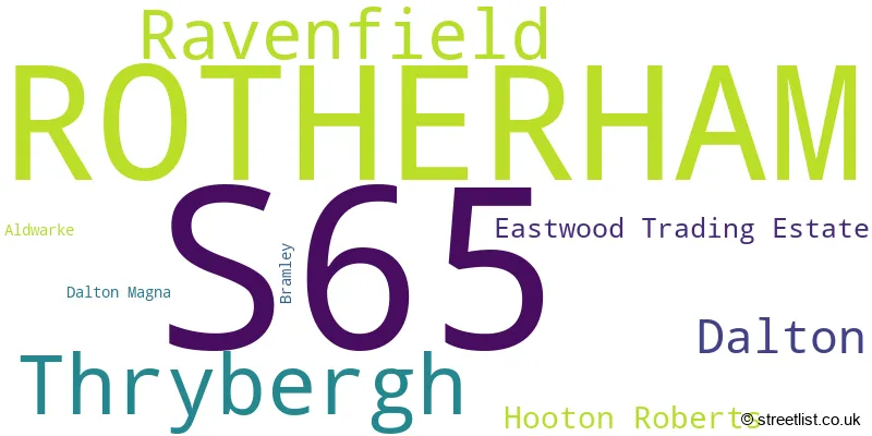
The largest settlement in the S65 postal code is ROTHERHAM followed by Thrybergh, and Ravenfield.
The S65 Postcode shares a border with S60 (ROTHERHAM, Brinsworth, Whiston), S62 (Rawmarsh, Parkgate, Wentworth), DN12 (Conisbrough, Edlington, Denaby Main), S64 (MEXBOROUGH, Swinton, Kilnhurst) and S66 (Maltby, Wickersley, Bramley).
In the S65 postcode district in South Yorkshire, the primary settlement is Rotherham. There are also other significant settlements in this district including Eastwood Trading Estate, Aldwarke, Dalton, Dalton Magna, Bramley, Hooton Roberts, Ravenfield, and Thrybergh. The most significant post town in this district is Rotherham.
For the district S65, we have data on 4 postcode sectors. Here's a breakdown: The sector S65 1, covers Rotherham in South Yorkshire. The sector S65 2, covers Rotherham in South Yorkshire. The sector S65 3, covers Rotherham in South Yorkshire. The sector S65 4, covers Thrybergh and Ravenfield in South Yorkshire.

Map of the S65 Postcode District
Explore the S65 postcode district by using our free interactive map.

When it comes to local government, postal geography often disregards political borders. However, for a breakdown in the S65 District: the district mostly encompasses the Rotherham District (B) area with a total of 821 postcodes.
Recent House Sales in S65
| Date | Price | Address |
|---|---|---|
| 20/10/2023 | £50,000 | Carlisle Street, Rotherham, S65 1EZ |
| 18/10/2023 | £142,033 | Middle Lane South, Rotherham, S65 2JB |
| 13/10/2023 | £39,000 | Milton Road, Rotherham, S65 1QS |
| 29/09/2023 | £155,000 | Far Lane, Rotherham, S65 2HJ |
| 25/09/2023 | £125,000 | Bosville Street, Rotherham, S65 3QR |
| 25/09/2023 | £212,000 | Chatham Street, Rotherham, S65 1DR |
| 21/09/2023 | £92,000 | Beaumont Drive, Rotherham, S65 2JX |
| 18/09/2023 | £89,000 | High Greave Road, Rotherham, S65 3LW |
| 15/09/2023 | £110,000 | Cambridge Street, Rotherham, S65 2SS |
| 11/09/2023 | £185,000 | Toll Bar Road, Rotherham, S65 3HR |
Weather Forecast for S65
Press Button to Show Forecast for Wickersley
| Time Period | Icon | Description | Temperature | Rain Probability | Wind |
|---|---|---|---|---|---|
| 21:00 to 00:00 | Clear night | 5.0°C (feels like 2.0°C) | 1.00% | N 9 mph |
Press Button to Show Forecast for Wickersley
| Time Period | Icon | Description | Temperature | Rain Probability | Wind |
|---|---|---|---|---|---|
| 00:00 to 03:00 | Clear night | 4.0°C (feels like 2.0°C) | 1.00% | NNW 7 mph | |
| 03:00 to 06:00 | Partly cloudy (night) | 4.0°C (feels like 1.0°C) | 1.00% | NW 9 mph | |
| 06:00 to 09:00 | Partly cloudy (day) | 4.0°C (feels like 1.0°C) | 1.00% | NNW 7 mph | |
| 09:00 to 12:00 | Cloudy | 6.0°C (feels like 3.0°C) | 4.00% | N 11 mph | |
| 12:00 to 15:00 | Overcast | 8.0°C (feels like 6.0°C) | 7.00% | N 11 mph | |
| 15:00 to 18:00 | Cloudy | 9.0°C (feels like 7.0°C) | 4.00% | N 9 mph | |
| 18:00 to 21:00 | Cloudy | 9.0°C (feels like 7.0°C) | 5.00% | NNE 9 mph | |
| 21:00 to 00:00 | Overcast | 7.0°C (feels like 5.0°C) | 7.00% | NE 7 mph |
Press Button to Show Forecast for Wickersley
| Time Period | Icon | Description | Temperature | Rain Probability | Wind |
|---|---|---|---|---|---|
| 00:00 to 03:00 | Overcast | 6.0°C (feels like 4.0°C) | 8.00% | NNE 4 mph | |
| 03:00 to 06:00 | Overcast | 5.0°C (feels like 3.0°C) | 9.00% | N 4 mph | |
| 06:00 to 09:00 | Overcast | 5.0°C (feels like 3.0°C) | 11.00% | N 4 mph | |
| 09:00 to 12:00 | Overcast | 6.0°C (feels like 4.0°C) | 14.00% | NNE 7 mph | |
| 12:00 to 15:00 | Overcast | 8.0°C (feels like 6.0°C) | 15.00% | NNE 7 mph | |
| 15:00 to 18:00 | Overcast | 9.0°C (feels like 7.0°C) | 15.00% | NE 7 mph | |
| 18:00 to 21:00 | Overcast | 8.0°C (feels like 6.0°C) | 13.00% | NE 7 mph | |
| 21:00 to 00:00 | Cloudy | 6.0°C (feels like 4.0°C) | 12.00% | ENE 4 mph |
Press Button to Show Forecast for Wickersley
| Time Period | Icon | Description | Temperature | Rain Probability | Wind |
|---|---|---|---|---|---|
| 00:00 to 03:00 | Cloudy | 5.0°C (feels like 3.0°C) | 11.00% | NE 4 mph | |
| 03:00 to 06:00 | Overcast | 4.0°C (feels like 3.0°C) | 16.00% | W 2 mph | |
| 06:00 to 09:00 | Overcast | 5.0°C (feels like 3.0°C) | 25.00% | W 4 mph | |
| 09:00 to 12:00 | Light rain | 6.0°C (feels like 5.0°C) | 48.00% | ESE 4 mph | |
| 12:00 to 15:00 | Light rain | 8.0°C (feels like 6.0°C) | 51.00% | SE 4 mph | |
| 15:00 to 18:00 | Light rain | 8.0°C (feels like 7.0°C) | 50.00% | N 4 mph | |
| 18:00 to 21:00 | Light rain | 9.0°C (feels like 7.0°C) | 48.00% | NNE 7 mph | |
| 21:00 to 00:00 | Cloudy | 7.0°C (feels like 6.0°C) | 12.00% | NNE 4 mph |
Press Button to Show Forecast for Wickersley
| Time Period | Icon | Description | Temperature | Rain Probability | Wind |
|---|---|---|---|---|---|
| 00:00 to 03:00 | Cloudy | 7.0°C (feels like 5.0°C) | 11.00% | ENE 4 mph | |
| 03:00 to 06:00 | Overcast | 6.0°C (feels like 4.0°C) | 13.00% | NNE 7 mph | |
| 06:00 to 09:00 | Overcast | 6.0°C (feels like 4.0°C) | 12.00% | NNE 7 mph | |
| 09:00 to 12:00 | Overcast | 8.0°C (feels like 5.0°C) | 10.00% | NNE 9 mph | |
| 12:00 to 15:00 | Cloudy | 9.0°C (feels like 7.0°C) | 8.00% | NE 9 mph | |
| 15:00 to 18:00 | Cloudy | 10.0°C (feels like 8.0°C) | 11.00% | NNE 9 mph | |
| 18:00 to 21:00 | Partly cloudy (day) | 9.0°C (feels like 7.0°C) | 5.00% | NNE 9 mph | |
| 21:00 to 00:00 | Clear night | 7.0°C (feels like 5.0°C) | 5.00% | NNE 7 mph |
Where is the S65 Postcode District?
The postcode district S65 is located in Rotherham. Rotherham is a town in the vicinity of several nearby towns, including Mexborough to the north (3.69 miles away), Doncaster to the northeast (8.58 miles away), Barnsley to the northwest (9.71 miles away), Sheffield to the southwest (10.09 miles away), Worksop to the southeast (12.69 miles away), and Chesterfield to the south (15.41 miles away). Additionally, Rotherham is approximately 142.75 miles away from the center of London.
The district is within the post town of ROTHERHAM.
The sector has postcodes within the nation of England.
The S65 Postcode District is in the Barnsley, Doncaster and Rotherham region of South Yorkshire within the Yorkshire and The Humber.
| Postcode Sector | Delivery Office |
|---|---|
| S65 1 | Rotherham Delivery Office |
| S65 2 | Rotherham Delivery Office |
| S65 3 | Rotherham Delivery Office |
| S65 4 | Rotherham Delivery Office |
| S | 6 | 5 | - | X | X | X |
| S | 6 | 5 | Space | Numeric | Letter | Letter |
Current Monthly Rental Prices
| # Bedrooms | Min Price | Max Price | Avg Price |
|---|---|---|---|
| £750 | £750 | £750 | |
| 1 | £520 | £520 | £520 |
| 2 | £589 | £675 | £632 |
| 3 | £900 | £1,100 | £1,000 |
Current House Prices
| # Bedrooms | Min Price | Max Price | Avg Price |
|---|---|---|---|
| £210,000 | £950,000 | £580,000 | |
| 1 | £60,000 | £65,000 | £61,250 |
| 2 | £57,000 | £230,000 | £117,348 |
| 3 | £60,000 | £455,000 | £204,608 |
| 4 | £135,000 | £650,000 | £404,588 |
| 5 | £200,000 | £850,000 | £459,494 |
| 6 | £250,000 | £250,000 | £250,000 |
Estate Agents who Operate in the S65 District
| Logo | Name | Brand Name | Address | Contact Number | Total Properties |
|---|---|---|---|---|---|
 | Rotherham | Merryweathers | Ship Hill Rotherham S60 2HG | 01709 912085 | 13 |
 | Rotherham | William H. Brown | 32 Mansfield Road, Rotherham, S60 2DR | 01709 212549 | 12 |
 | Rotherham | Bartons | 51 - 53 Moorgate Street Rotherham S60 2EY | 01709 212542 | 9 |
 | Wickersley | Crucible Homes | 234 Bawtry Road Wickersley Rotherham S66 1AA | 01709 300333 | 7 |
 | Rotherham | Lincoln Ralph | London House Clifford Lister Business Centre Bawtry Road Wickersley Rotherham S66 2BL | 01709 212513 | 7 |
| Type of Property | 2018 Average | 2018 Sales | 2017 Average | 2017 Sales | 2016 Average | 2016 Sales | 2015 Average | 2015 Sales |
|---|---|---|---|---|---|---|---|---|
| Detached | £236,685 | 40 | £224,125 | 54 | £232,499 | 45 | £212,043 | 38 |
| Semi-Detached | £118,734 | 164 | £113,297 | 193 | £113,936 | 182 | £114,959 | 155 |
| Terraced | £80,074 | 121 | £71,511 | 113 | £77,378 | 99 | £74,402 | 107 |
| Flats | £64,703 | 17 | £51,152 | 26 | £52,555 | 65 | £57,250 | 24 |