The SG4 postcode district is a postal district located in the SG Stevenage postcode area with a population of 30,135 residents according to the 2021 England and Wales Census.
The area of the SG4 postcode district is 42.55 square miles which is 110.20 square kilometres or 27,231.31 acres.
Currently, the SG4 district has about 881 postcode units spread across 4 geographic postcode sectors.
Given that each sector allows for 400 unique postcode combinations, the district has a capacity of 1,600 postcodes. With 881 postcodes already in use, this leaves 719 units available.
The largest settlement in the SG4 postal code is HITCHIN followed by Codicote, and Kimpton.
The SG4 Postcode shares a border with AL4 (ST. ALBANS, Wheathampstead, Sandridge), AL5 (HARPENDEN), AL6 (WELWYN, Tewin, Ayot St. Peter), LU2 (LUTON, Lilley, London Luton Airport), SG5 (HITCHIN, Stotfold, Fairfield), SG6 (LETCHWORTH GARDEN CITY), SG7 (BALDOCK, Ashwell, Hinxworth), SG1 (STEVENAGE) and SG2 (STEVENAGE, Walkern, Benington).
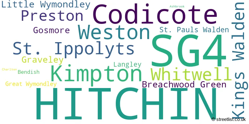
The primary settlement in the SG4 postcode district is Hitchin, located in Hertfordshire, England. Other significant settlements in the district include Ashbrook, Charlton, Gosmore, Graveley, Great Wymondley, Langley, Little Wymondley, Preston, St. Ippolyts, Weston, Bendish, Breachwood Green, Codicote, Kimpton, Kings Walden, St. Pauls Walden, and Whitwell. However, their mention is omitted due to their smaller proportion of the data. The most significant post town in the district is Hitchin.
For the district SG4, we have data on 4 postcode sectors. Here's a breakdown: The sector SG4 0, covers Hitchin in Hertfordshire. The sector SG4 7, covers Weston and St. Ippolyts and Preston and Little Wymondley and Gosmore and Graveley in Hertfordshire. The sector SG4 8, covers Codicote and Kimpton and Whitwell and Kings Walden in Hertfordshire. The sector SG4 9, covers Hitchin in Hertfordshire.

Map of the SG4 Postcode District
Explore the SG4 postcode district by using our free interactive map.

When it comes to local government, postal geography often disregards political borders. However, for a breakdown in the SG4 District: the district mostly encompasses the North Hertfordshire District (887 postcodes), and finally, the Stevenage District (B) area (6 postcodes).
Recent House Sales in SG4
| Date | Price | Address |
|---|---|---|
| 20/10/2023 | £1,000,000 | High Street, Kimpton, Hitchin, SG4 8QL |
| 12/10/2023 | £160,000 | Pond Court, Codicote, Hitchin, SG4 8YY |
| 11/10/2023 | £485,000 | Grovelands Avenue, Hitchin, SG4 0QT |
| 05/10/2023 | £335,000 | Maylin Close, Hitchin, SG4 0NQ |
| 25/09/2023 | £203,000 | Queen Street, Hitchin, SG4 9TT |
| 11/09/2023 | £300,000 | Allwoods Place, Hitchin, SG4 0BQ |
| 08/09/2023 | £500,000 | Waterdell Lane, St Ippolyts, Hitchin, SG4 7QZ |
| 07/09/2023 | £440,000 | Tristram Road, Hitchin, SG4 0BH |
| 01/09/2023 | £488,500 | Kershaws Hill, Hitchin, SG4 9AQ |
| 01/09/2023 | £560,400 | Wilbury Way, Hitchin, SG4 0TW |
Weather Forecast for SG4
Press Button to Show Forecast for St Paul's Walden
| Time Period | Icon | Description | Temperature | Rain Probability | Wind |
|---|---|---|---|---|---|
| 15:00 to 18:00 | Cloudy | 9.0°C (feels like 6.0°C) | 8.00% | N 9 mph | |
| 18:00 to 21:00 | Cloudy | 7.0°C (feels like 5.0°C) | 3.00% | N 7 mph | |
| 21:00 to 00:00 | Cloudy | 5.0°C (feels like 4.0°C) | 4.00% | E 4 mph |
Press Button to Show Forecast for St Paul's Walden
| Time Period | Icon | Description | Temperature | Rain Probability | Wind |
|---|---|---|---|---|---|
| 00:00 to 03:00 | Cloudy | 4.0°C (feels like 3.0°C) | 4.00% | S 4 mph | |
| 03:00 to 06:00 | Cloudy | 4.0°C (feels like 2.0°C) | 4.00% | SSW 7 mph | |
| 06:00 to 09:00 | Cloudy | 5.0°C (feels like 2.0°C) | 12.00% | WSW 7 mph | |
| 09:00 to 12:00 | Cloudy | 8.0°C (feels like 6.0°C) | 8.00% | W 9 mph | |
| 12:00 to 15:00 | Cloudy | 9.0°C (feels like 6.0°C) | 36.00% | W 11 mph | |
| 15:00 to 18:00 | Light rain | 8.0°C (feels like 6.0°C) | 56.00% | NNW 9 mph | |
| 18:00 to 21:00 | Cloudy | 7.0°C (feels like 5.0°C) | 9.00% | NE 7 mph | |
| 21:00 to 00:00 | Cloudy | 5.0°C (feels like 3.0°C) | 4.00% | ENE 4 mph |
Press Button to Show Forecast for St Paul's Walden
| Time Period | Icon | Description | Temperature | Rain Probability | Wind |
|---|---|---|---|---|---|
| 00:00 to 03:00 | Cloudy | 3.0°C (feels like 1.0°C) | 4.00% | NE 4 mph | |
| 03:00 to 06:00 | Clear night | 1.0°C (feels like -1.0°C) | 1.00% | NE 4 mph | |
| 06:00 to 09:00 | Partly cloudy (day) | 2.0°C (feels like 0.0°C) | 1.00% | NNE 4 mph | |
| 09:00 to 12:00 | Partly cloudy (day) | 7.0°C (feels like 5.0°C) | 1.00% | NE 7 mph | |
| 12:00 to 15:00 | Cloudy | 9.0°C (feels like 8.0°C) | 9.00% | NE 4 mph | |
| 15:00 to 18:00 | Overcast | 10.0°C (feels like 9.0°C) | 12.00% | NE 4 mph | |
| 18:00 to 21:00 | Cloudy | 8.0°C (feels like 6.0°C) | 10.00% | ENE 7 mph | |
| 21:00 to 00:00 | Cloudy | 5.0°C (feels like 3.0°C) | 9.00% | ENE 7 mph |
Press Button to Show Forecast for St Paul's Walden
| Time Period | Icon | Description | Temperature | Rain Probability | Wind |
|---|---|---|---|---|---|
| 00:00 to 03:00 | Cloudy | 3.0°C (feels like 1.0°C) | 11.00% | ENE 7 mph | |
| 03:00 to 06:00 | Cloudy | 3.0°C (feels like 0.0°C) | 14.00% | ENE 7 mph | |
| 06:00 to 09:00 | Cloudy | 4.0°C (feels like 1.0°C) | 21.00% | NE 7 mph | |
| 09:00 to 12:00 | Cloudy | 8.0°C (feels like 6.0°C) | 19.00% | ENE 9 mph | |
| 12:00 to 15:00 | Cloudy | 11.0°C (feels like 9.0°C) | 16.00% | E 9 mph | |
| 15:00 to 18:00 | Cloudy | 11.0°C (feels like 9.0°C) | 19.00% | E 11 mph | |
| 18:00 to 21:00 | Cloudy | 10.0°C (feels like 8.0°C) | 19.00% | ENE 9 mph | |
| 21:00 to 00:00 | Light rain | 8.0°C (feels like 5.0°C) | 51.00% | NE 11 mph |
Press Button to Show Forecast for St Paul's Walden
| Time Period | Icon | Description | Temperature | Rain Probability | Wind |
|---|---|---|---|---|---|
| 00:00 to 03:00 | Heavy rain | 7.0°C (feels like 5.0°C) | 73.00% | NE 11 mph | |
| 03:00 to 06:00 | Heavy rain | 8.0°C (feels like 5.0°C) | 75.00% | ENE 9 mph | |
| 06:00 to 09:00 | Light rain shower (day) | 9.0°C (feels like 6.0°C) | 42.00% | SE 9 mph | |
| 09:00 to 12:00 | Heavy rain | 10.0°C (feels like 8.0°C) | 71.00% | SE 9 mph | |
| 12:00 to 15:00 | Light rain | 11.0°C (feels like 9.0°C) | 55.00% | S 9 mph | |
| 15:00 to 18:00 | Light rain shower (day) | 12.0°C (feels like 10.0°C) | 42.00% | SSW 11 mph | |
| 18:00 to 21:00 | Light rain shower (day) | 11.0°C (feels like 8.0°C) | 35.00% | SW 11 mph | |
| 21:00 to 00:00 | Partly cloudy (night) | 8.0°C (feels like 6.0°C) | 6.00% | WSW 7 mph |
Where is the SG4 Postcode District?
The postcode district for SG4 is located in Hitchin, a town in Hertfordshire. Hitchin is surrounded by several nearby towns, including Stevenage to the East (2.84 miles away), Knebworth to the South East (4.88 miles away), Letchworth Garden City to the North (5.37 miles away), Luton to the West (7.02 miles away), Harpenden to the South West (7.49 miles away), and Baldock to the North East (7.59 miles away). Additionally, Hitchin is located approximately 28.12 miles north of central London.
The district is within the post town of HITCHIN.
The sector has postcodes within the nation of England.
The SG4 Postcode District is in the Hertfordshire region of Bedfordshire and Hertfordshire within the East of England.
| Postcode Sector | Delivery Office |
|---|---|
| SG4 0 | Hitchin Delivery Office |
| SG4 7 | Weston Scale Payment Delivery Office |
| SG4 7 | Hitchin Delivery Office |
| SG4 8 | Hitchin Delivery Office |
| SG4 8 | Codicote Scale Payment Delivery Office |
| SG4 8 | Kimpton Scale Payment Delivery Office |
| SG4 9 | Hitchin Delivery Office |
| S | G | 4 | - | X | X | X |
| S | G | 4 | Space | Numeric | Letter | Letter |
Current Monthly Rental Prices
| # Bedrooms | Min Price | Max Price | Avg Price |
|---|---|---|---|
| 1 | £775 | £965 | £902 |
| 2 | £1,000 | £2,500 | £1,350 |
| 3 | £1,400 | £1,850 | £1,590 |
| 4 | £2,300 | £3,000 | £2,650 |
Current House Prices
| # Bedrooms | Min Price | Max Price | Avg Price |
|---|---|---|---|
| 1 | £60,000 | £325,000 | £197,680 |
| 2 | £55,000 | £600,000 | £342,462 |
| 3 | £315,000 | £1,600,000 | £585,744 |
| 4 | £565,000 | £1,800,000 | £856,452 |
| 5 | £624,000 | £4,500,000 | £1,412,761 |
| 6 | £650,000 | £1,999,950 | £1,478,990 |
| 11 | £4,250,000 | £4,250,000 | £4,250,000 |
Estate Agents who Operate in the SG4 District
| Logo | Name | Brand Name | Address | Contact Number | Total Properties |
|---|---|---|---|---|---|
 | Hitchin | Country Properties | 6 Brand Street, Hitchin, SG5 1HX | 01462 415830 | 41 |
 | Hitchin | Michael Graham | 20 Bucklersbury, Hitchin, SG5 1BG | 01462 415316 | 16 |
 | Hitchin | Connells | 15 High Street, Hitchin, SG5 1AT | 01462 416422 | 14 |
 | Hitchin | Norgans Estate Agents | 8 Brand Street, Hitchin, SG5 1HX | 01462 415794 | 11 |
 | Land & New Homes | Ashtons | 32 Bridge Street Hitchin SG5 2DF | 01707 241293 | 11 |
- Bendish
- Blackmore End
- Breachwood Green
- Codicote Bottom
- Codicote
- Frogmore
- Gosmore
- Graveley
- Great Wymondley
- Hall's Green
- Hitchin
- Kimpton
- King's Walden
- Langley
- Letchworth
- Ley Green
- Little Almshoe
- Little Wymondley
- Nup End Green
- Peters Green
- Preston
- St Ippolyts
- St Paul's Walden
- Stevenage
- Tea Green
- Temple Dinsley
- The Heath
- Todd's Green
- Weston
- Whitwell
| Type of Property | 2018 Average | 2018 Sales | 2017 Average | 2017 Sales | 2016 Average | 2016 Sales | 2015 Average | 2015 Sales |
|---|---|---|---|---|---|---|---|---|
| Detached | £874,738 | 90 | £737,687 | 109 | £690,014 | 105 | £629,934 | 119 |
| Semi-Detached | £460,139 | 130 | £452,489 | 143 | £418,880 | 129 | £386,435 | 157 |
| Terraced | £343,267 | 120 | £365,624 | 129 | £329,567 | 139 | £319,147 | 144 |
| Flats | £262,255 | 129 | £247,921 | 134 | £209,918 | 120 | £195,815 | 133 |