The SL2 postcode district is a postal district located in the SL Slough postcode area with a population of 59,956 residents according to the 2021 England and Wales Census.
The area of the SL2 postcode district is 11.27 square miles which is 29.18 square kilometres or 7,209.82 acres.
Currently, the SL2 district has about 1128 postcode units spread across 5 geographic postcode sectors.
Given that each sector allows for 400 unique postcode combinations, the district has a capacity of 2,000 postcodes. With 1128 postcodes already in use, this leaves 872 units available.
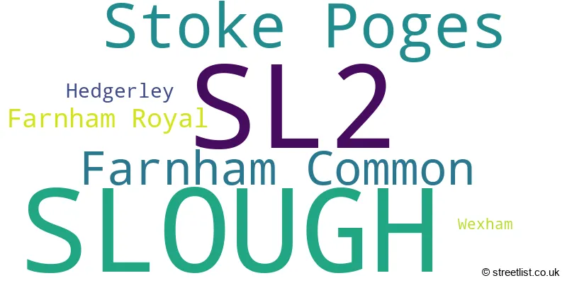
The largest settlement in the SL2 postal code is SLOUGH followed by Stoke Poges, and Farnham Common.
The SL2 Postcode shares a border with SL1 (SLOUGH, Burnham) and SL3 (SLOUGH, DATCHET, POYLE).
In the SL2 postcode district, the primary settlement is Slough, located in the county of Berkshire. It has the highest count among all settlements in the postcode. Other significant settlements in the area include Farnham Royal and Hedgerley, both located in Buckinghamshire. Additionally, there is Stoke Poges and Wexham in Buckinghamshire, as well as Farnham Common in Slough. The most significant post town in the SL2 postcode district is Slough, which has the highest number of postcodes.
For the district SL2, we have data on 5 postcode sectors. Here's a breakdown: The sector SL2 1, covers Slough in Berkshire. The sector SL2 2, covers Slough in Berkshire. The sector SL2 3, covers Farnham Common and Farnham Royal and Hedgerley in Buckinghamshire. The sector SL2 4, covers Stoke Poges in Buckinghamshire. The sector SL2 4, covers Wexham in Berkshire. The sector SL2 5, covers Slough in Berkshire.

Map of the SL2 Postcode District
Explore the SL2 postcode district by using our free interactive map.

When it comes to local government, postal geography often disregards political borders. However, for a breakdown in the SL2 District: the district mostly encompasses the Slough (B) (705 postcodes), and finally, the Buckinghamshire area (426 postcodes).
Recent House Sales in SL2
| Date | Price | Address |
|---|---|---|
| 21/09/2023 | £280,000 | Ramsey Court, Slough, SL2 2PB |
| 15/09/2023 | £750,000 | Rogers Lane, Stoke Poges, Slough, SL2 4LF |
| 05/09/2023 | £220,000 | Hazlemere Road, Slough, SL2 5PW |
| 01/09/2023 | £425,000 | Kidderminster Road, Slough, SL2 2AZ |
| 31/08/2023 | £438,000 | Wexham Road, Slough, SL2 5EJ |
| 30/08/2023 | £904,000 | Bunby Road, Stoke Poges, Slough, SL2 4BP |
| 30/08/2023 | £780,000 | Farthing Green Lane, Stoke Poges, Slough, SL2 4JH |
| 25/08/2023 | £185,000 | Littlebrook Avenue, Slough, SL2 2PE |
| 24/08/2023 | £382,500 | Calbroke Road, Slough, SL2 2HJ |
| 24/08/2023 | £940,000 | Hedgerley Hill, Hedgerley, Slough, SL2 3RL |
Weather Forecast for SL2
Press Button to Show Forecast for Slough
| Time Period | Icon | Description | Temperature | Rain Probability | Wind |
|---|---|---|---|---|---|
| 06:00 to 09:00 | Cloudy | 6.0°C (feels like 4.0°C) | 5.00% | WSW 7 mph | |
| 09:00 to 12:00 | Cloudy | 9.0°C (feels like 8.0°C) | 7.00% | W 7 mph | |
| 12:00 to 15:00 | Cloudy | 10.0°C (feels like 8.0°C) | 51.00% | W 9 mph | |
| 15:00 to 18:00 | Cloudy | 11.0°C (feels like 9.0°C) | 50.00% | WNW 7 mph | |
| 18:00 to 21:00 | Cloudy | 9.0°C (feels like 7.0°C) | 11.00% | NNE 7 mph | |
| 21:00 to 00:00 | Cloudy | 8.0°C (feels like 6.0°C) | 7.00% | NE 7 mph |
Press Button to Show Forecast for Slough
| Time Period | Icon | Description | Temperature | Rain Probability | Wind |
|---|---|---|---|---|---|
| 00:00 to 03:00 | Cloudy | 7.0°C (feels like 5.0°C) | 5.00% | ENE 7 mph | |
| 03:00 to 06:00 | Cloudy | 6.0°C (feels like 3.0°C) | 5.00% | NE 7 mph | |
| 06:00 to 09:00 | Cloudy | 5.0°C (feels like 3.0°C) | 5.00% | NE 7 mph | |
| 09:00 to 12:00 | Cloudy | 8.0°C (feels like 6.0°C) | 6.00% | ENE 7 mph | |
| 12:00 to 15:00 | Cloudy | 10.0°C (feels like 9.0°C) | 12.00% | E 7 mph | |
| 15:00 to 18:00 | Overcast | 11.0°C (feels like 10.0°C) | 16.00% | ENE 4 mph | |
| 18:00 to 21:00 | Cloudy | 10.0°C (feels like 9.0°C) | 12.00% | NE 4 mph | |
| 21:00 to 00:00 | Cloudy | 7.0°C (feels like 5.0°C) | 12.00% | ENE 7 mph |
Press Button to Show Forecast for Slough
| Time Period | Icon | Description | Temperature | Rain Probability | Wind |
|---|---|---|---|---|---|
| 00:00 to 03:00 | Cloudy | 6.0°C (feels like 4.0°C) | 14.00% | ENE 7 mph | |
| 03:00 to 06:00 | Light rain | 5.0°C (feels like 3.0°C) | 47.00% | NE 7 mph | |
| 06:00 to 09:00 | Light rain | 6.0°C (feels like 3.0°C) | 50.00% | NE 7 mph | |
| 09:00 to 12:00 | Cloudy | 9.0°C (feels like 7.0°C) | 17.00% | ENE 9 mph | |
| 12:00 to 15:00 | Overcast | 12.0°C (feels like 10.0°C) | 19.00% | E 9 mph | |
| 15:00 to 18:00 | Overcast | 12.0°C (feels like 10.0°C) | 27.00% | ENE 11 mph | |
| 18:00 to 21:00 | Light rain | 11.0°C (feels like 9.0°C) | 54.00% | ENE 9 mph | |
| 21:00 to 00:00 | Light rain | 9.0°C (feels like 7.0°C) | 54.00% | NE 11 mph |
Press Button to Show Forecast for Slough
| Time Period | Icon | Description | Temperature | Rain Probability | Wind |
|---|---|---|---|---|---|
| 00:00 to 03:00 | Heavy rain | 9.0°C (feels like 6.0°C) | 73.00% | NE 11 mph | |
| 03:00 to 06:00 | Heavy rain | 9.0°C (feels like 7.0°C) | 76.00% | ENE 7 mph | |
| 06:00 to 09:00 | Light rain | 9.0°C (feels like 7.0°C) | 53.00% | ESE 7 mph | |
| 09:00 to 12:00 | Light rain shower (day) | 11.0°C (feels like 9.0°C) | 46.00% | ESE 9 mph | |
| 12:00 to 15:00 | Light rain shower (day) | 12.0°C (feels like 11.0°C) | 43.00% | SSE 9 mph | |
| 15:00 to 18:00 | Light rain shower (day) | 13.0°C (feels like 11.0°C) | 39.00% | WSW 11 mph | |
| 18:00 to 21:00 | Cloudy | 11.0°C (feels like 9.0°C) | 17.00% | W 11 mph | |
| 21:00 to 00:00 | Cloudy | 9.0°C (feels like 8.0°C) | 7.00% | WSW 7 mph |
Where is the SL2 Postcode District?
The postcode district SL2 is located in Slough, which is a town in Buckinghamshire. It is near several towns, including Fulmer to the East, Wexham to the South East, Gerrards Cross to the North East, and Beaconsfield to the North. The district is approximately 20.6 miles away from the centre of London.
The district is within the post town of SLOUGH.
The sector has postcodes within the nation of England.
The SL2 Postcode District is in the Berkshire region of Berkshire, Buckinghamshire and Oxfordshire within the South East (England).
| Postcode Sector | Delivery Office |
|---|---|
| SL2 1 | Slough Delivery Office |
| SL2 2 | Slough Delivery Office |
| SL2 3 | Slough Delivery Office |
| SL2 4 | Slough Delivery Office |
| SL2 5 | Slough Delivery Office |
| S | L | 2 | - | X | X | X |
| S | L | 2 | Space | Numeric | Letter | Letter |
Current Monthly Rental Prices
| # Bedrooms | Min Price | Max Price | Avg Price |
|---|---|---|---|
| 1 | £650 | £4,313 | £1,773 |
| 2 | £1,400 | £5,405 | £2,357 |
| 3 | £1,294 | £4,500 | £2,135 |
| 4 | £2,050 | £4,500 | £3,017 |
| 5 | £4,500 | £4,500 | £4,500 |
| 6 | £5,500 | £5,850 | £5,675 |
| 8 | £19,500 | £19,500 | £19,500 |
Current House Prices
| # Bedrooms | Min Price | Max Price | Avg Price |
|---|---|---|---|
| £30,000 | £1,950,000 | £879,590 | |
| 1 | £97,500 | £375,000 | £224,961 |
| 2 | £112,000 | £575,000 | £337,378 |
| 3 | £319,950 | £900,000 | £482,931 |
| 4 | £389,950 | £2,150,000 | £1,064,646 |
| 5 | £585,000 | £3,250,000 | £1,512,677 |
| 6 | £1,375,000 | £4,500,000 | £2,376,250 |
| 7 | £15,000,000 | £15,000,000 | £15,000,000 |
| 15 | £2,500,000 | £2,500,000 | £2,500,000 |
Estate Agents who Operate in the SL2 District
| Logo | Name | Brand Name | Address | Contact Number | Total Properties |
|---|---|---|---|---|---|
 | Farnham Common | Hilton King & Locke | Sherriff House The Broadway, Farnham Common, SL2 3QH | 01753 362500 | 34 |
 | Slough | Connells | 111 High Street, Slough, Berkshire, SL1 1DH | 01753 387402 | 31 |
 | Slough | Chancellors | 92 High Street, Slough, SL1 1EL | 01753 251931 | 18 |
 | Slough | B. Simmons & Son | 306 Farnham Road, Slough, SL1 4XL | 01753 575676 | 17 |
 | Farnham Common | Foreman King | 2/3 Robin Parade The Broadway, Farnham Common, SL2 3QL | 01753 387827 | 16 |
| Type of Property | 2018 Average | 2018 Sales | 2017 Average | 2017 Sales | 2016 Average | 2016 Sales | 2015 Average | 2015 Sales |
|---|---|---|---|---|---|---|---|---|
| Detached | £937,350 | 104 | £882,923 | 91 | £948,290 | 94 | £764,671 | 95 |
| Semi-Detached | £422,891 | 127 | £430,585 | 99 | £390,075 | 93 | £351,375 | 83 |
| Terraced | £340,686 | 175 | £339,434 | 184 | £336,682 | 220 | £286,116 | 292 |
| Flats | £246,111 | 118 | £237,975 | 145 | £242,290 | 183 | £193,137 | 273 |