The SP8 postcode district is a postal district located in the SP Salisbury postcode area with a population of 14,386 residents according to the 2021 England and Wales Census.
The area of the SP8 postcode district is 28.52 square miles which is 73.87 square kilometres or 18,254.51 acres.
Currently, the SP8 district has about 552 postcode units spread across 2 geographic postcode sectors.
Given that each sector allows for 400 unique postcode combinations, the district has a capacity of 800 postcodes. With 552 postcodes already in use, this leaves 248 units available.
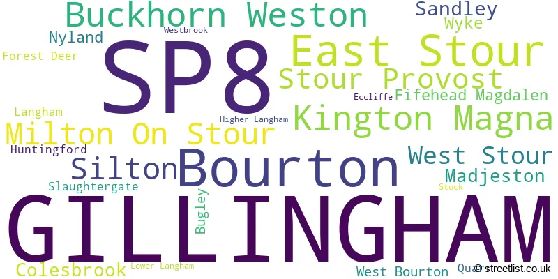
The largest settlement in the SP8 postal code is GILLINGHAM followed by Bourton, and East Stour.
The SP8 Postcode shares a border with BA8 (Henstridge, TEMPLECOMBE, Horsington), BA9 (WINCANTON, Charlton Musgrove, Pen Selwood), BA12 (WARMINSTER, Mere, Codford), SP7 (SHAFTESBURY, Motcombe, Donhead St. Mary) and DT10 (STURMINSTER NEWTON, Stalbridge, Marnhull).
The primary settlement in the SP8 postcode district is Gillingham, located in the county of Dorset in England. Other significant settlements within this postcode district include Colesbrook, Wyke, Bourton, Buckhorn Weston, Bugley, East Stour, Eccliffe, Fifehead Magdalen, Forest Deer, Higher Langham, Huntingford, Kington Magna, Langham, Lower Langham, Madjeston, Milton On Stour, Nyland, Quarr, Sandley, Silton, Slaughtergate, Stock, Stour Provost, West Bourton, West Stour, and Westbrook. However, only Gillingham and Colesbrook have a relatively low number of counts.
For the district SP8, we have data on 3 postcode sectors. Here's a breakdown: The sector SP8 4, covers Gillingham in Dorset. The sector SP8 5, covers Bourton and East Stour in Dorset. The sector SP8 9 is non-geographic. It's often designated for PO Boxes, large organisations, or special services.

Map of the SP8 Postcode District
Explore the SP8 postcode district by using our free interactive map.

When it comes to local government, postal geography often disregards political borders. However, for a breakdown in the SP8 District: the district mostly encompasses the Dorset area with a total of 559 postcodes.
Recent House Sales in SP8
| Date | Price | Address |
|---|---|---|
| 10/10/2023 | £565,000 | Colesbrook, Gillingham, SP8 4HH |
| 06/10/2023 | £419,000 | River View, Gillingham, SP8 4UB |
| 04/10/2023 | £504,000 | Bay Road, Gillingham, SP8 4EW |
| 02/10/2023 | £265,000 | Cerne Avenue, Gillingham, SP8 4FW |
| 15/09/2023 | £332,500 | Poppyfields, Gillingham, SP8 4TH |
| 15/09/2023 | £228,500 | Wiltshire Close, Gillingham, SP8 4LZ |
| 14/09/2023 | £225,000 | Woodsage Drive, Gillingham, SP8 4UE |
| 08/09/2023 | £1,550,000 | Woodville, Stour Provost, Gillingham, SP8 5LX |
| 08/09/2023 | £227,500 | Sylvan Way, Gillingham, SP8 4EQ |
| 08/09/2023 | £250,000 | Church Street, West Stour, Gillingham, SP8 5RL |
Weather Forecast for SP8
Press Button to Show Forecast for Gillingham (Dorset)
| Time Period | Icon | Description | Temperature | Rain Probability | Wind |
|---|---|---|---|---|---|
| 21:00 to 00:00 | Cloudy | 7.0°C (feels like 5.0°C) | 4.00% | NNE 4 mph |
Press Button to Show Forecast for Gillingham (Dorset)
| Time Period | Icon | Description | Temperature | Rain Probability | Wind |
|---|---|---|---|---|---|
| 00:00 to 03:00 | Cloudy | 6.0°C (feels like 5.0°C) | 6.00% | NE 4 mph | |
| 03:00 to 06:00 | Cloudy | 6.0°C (feels like 4.0°C) | 15.00% | ENE 7 mph | |
| 06:00 to 09:00 | Cloudy | 6.0°C (feels like 3.0°C) | 14.00% | ENE 7 mph | |
| 09:00 to 12:00 | Cloudy | 8.0°C (feels like 5.0°C) | 10.00% | E 9 mph | |
| 12:00 to 15:00 | Overcast | 10.0°C (feels like 8.0°C) | 19.00% | E 9 mph | |
| 15:00 to 18:00 | Overcast | 10.0°C (feels like 9.0°C) | 20.00% | E 7 mph | |
| 18:00 to 21:00 | Cloudy | 9.0°C (feels like 8.0°C) | 16.00% | E 7 mph | |
| 21:00 to 00:00 | Cloudy | 7.0°C (feels like 5.0°C) | 13.00% | ENE 4 mph |
Press Button to Show Forecast for Gillingham (Dorset)
| Time Period | Icon | Description | Temperature | Rain Probability | Wind |
|---|---|---|---|---|---|
| 00:00 to 03:00 | Cloudy | 6.0°C (feels like 4.0°C) | 19.00% | ENE 9 mph | |
| 03:00 to 06:00 | Cloudy | 6.0°C (feels like 3.0°C) | 22.00% | ENE 9 mph | |
| 06:00 to 09:00 | Cloudy | 6.0°C (feels like 3.0°C) | 22.00% | ENE 9 mph | |
| 09:00 to 12:00 | Cloudy | 8.0°C (feels like 5.0°C) | 18.00% | ENE 11 mph | |
| 12:00 to 15:00 | Overcast | 11.0°C (feels like 9.0°C) | 19.00% | ENE 11 mph | |
| 15:00 to 18:00 | Overcast | 11.0°C (feels like 9.0°C) | 26.00% | ENE 11 mph | |
| 18:00 to 21:00 | Light rain | 10.0°C (feels like 8.0°C) | 53.00% | NE 11 mph | |
| 21:00 to 00:00 | Light rain | 9.0°C (feels like 6.0°C) | 51.00% | NE 13 mph |
Press Button to Show Forecast for Gillingham (Dorset)
| Time Period | Icon | Description | Temperature | Rain Probability | Wind |
|---|---|---|---|---|---|
| 00:00 to 03:00 | Light rain | 8.0°C (feels like 4.0°C) | 53.00% | NE 13 mph | |
| 03:00 to 06:00 | Heavy rain | 7.0°C (feels like 4.0°C) | 74.00% | NE 11 mph | |
| 06:00 to 09:00 | Heavy rain | 7.0°C (feels like 5.0°C) | 74.00% | NNE 11 mph | |
| 09:00 to 12:00 | Light rain | 9.0°C (feels like 6.0°C) | 49.00% | ENE 11 mph | |
| 12:00 to 15:00 | Light rain | 10.0°C (feels like 7.0°C) | 49.00% | WSW 13 mph | |
| 15:00 to 18:00 | Light rain shower (day) | 11.0°C (feels like 8.0°C) | 39.00% | W 13 mph | |
| 18:00 to 21:00 | Cloudy | 10.0°C (feels like 9.0°C) | 13.00% | NNW 9 mph | |
| 21:00 to 00:00 | Partly cloudy (night) | 7.0°C (feels like 6.0°C) | 5.00% | SSW 4 mph |
Where is the SP8 Postcode District?
The postcode district SP8 is located in Gillingham. Gillingham is surrounded by several nearby towns in different directions. To the South East, there is Shaftesbury which is approximately 4.5 miles away. To the West, there is Templecombe which is roughly 5 miles away. Sturminster Newton is located to the South at a distance of about 6.3 miles. Moving towards the North West, you will find Bruton which is approximately 8.4 miles away. Towards the South West, there is Sherborne which is around 11.7 miles away. Lastly, in the North East, there is Warminster which is about 13.3 miles away. Moreover, Gillingham is approximately 99.96 miles away from the center of London.
The district is within the post town of GILLINGHAM.
The sector has postcodes within the nation of England.
The SP8 Postcode District is in the region of within the .
| Postcode Sector | Delivery Office |
|---|---|
| SP8 4 | Gillingham Delivery Office (sp) |
| SP8 5 | Gillingham Delivery Office (sp) |
| S | P | 8 | - | X | X | X |
| S | P | 8 | Space | Numeric | Letter | Letter |
Current Monthly Rental Prices
| # Bedrooms | Min Price | Max Price | Avg Price |
|---|---|---|---|
| 1 | £750 | £750 | £750 |
| 2 | £875 | £995 | £935 |
| 3 | £1,050 | £1,550 | £1,375 |
| 4 | £1,600 | £2,700 | £2,150 |
| 5 | £4,850 | £4,850 | £4,850 |
Current House Prices
| # Bedrooms | Min Price | Max Price | Avg Price |
|---|---|---|---|
| £100,000 | £2,150,000 | £528,571 | |
| 1 | £75,000 | £175,000 | £115,525 |
| 2 | £110,000 | £625,000 | £260,366 |
| 3 | £135,000 | £675,000 | £338,683 |
| 4 | £275,000 | £1,200,000 | £476,743 |
| 5 | £325,000 | £700,000 | £512,500 |
| 6 | £510,000 | £1,500,000 | £1,103,333 |
| 9 | £6,250,000 | £6,250,000 | £6,250,000 |
Estate Agents who Operate in the SP8 District
| Logo | Name | Brand Name | Address | Contact Number | Total Properties |
|---|---|---|---|---|---|
 | Gillingham | Morton New | The Centre, High Street, Gillingham, SP8 4AB | 01747 441239 | 33 |
 | Gillingham | Chapman Moore | Townbridge House, High Street, Gillingham, SP8 4AA | 01747 445545 | 24 |
 | Gillingham | Chaffers Estate Agents | 6 The Centre, High Street, Gillingham, SP8 4AB | 01747 447019 | 23 |
 | Gillingham | Connells | 4 High Street Gillingham SP8 4QT | 01747 445552 | 13 |
 | Sturminster Newton | Symonds & Sampson | Agriculture House, Market Place, Sturminster Newton, DT10 1AR | 01258 442389 | 9 |
| Type of Property | 2018 Average | 2018 Sales | 2017 Average | 2017 Sales | 2016 Average | 2016 Sales | 2015 Average | 2015 Sales |
|---|---|---|---|---|---|---|---|---|
| Detached | £359,930 | 100 | £388,295 | 140 | £341,187 | 124 | £302,159 | 138 |
| Semi-Detached | £237,352 | 83 | £230,043 | 78 | £198,061 | 66 | £198,012 | 78 |
| Terraced | £194,446 | 70 | £180,088 | 99 | £187,167 | 74 | £168,627 | 77 |
| Flats | £129,015 | 26 | £120,869 | 35 | £126,078 | 37 | £104,804 | 37 |