The ST2 postcode district is a postal district located in the ST Stoke-on-Trent postcode area with a population of 35,460 residents according to the 2021 England and Wales Census.
The area of the ST2 postcode district is 6.77 square miles which is 17.53 square kilometres or 4,331.97 acres.
Currently, the ST2 district has about 759 postcode units spread across 6 geographic postcode sectors.
Given that each sector allows for 400 unique postcode combinations, the district has a capacity of 2,400 postcodes. With 759 postcodes already in use, this leaves 1641 units available.
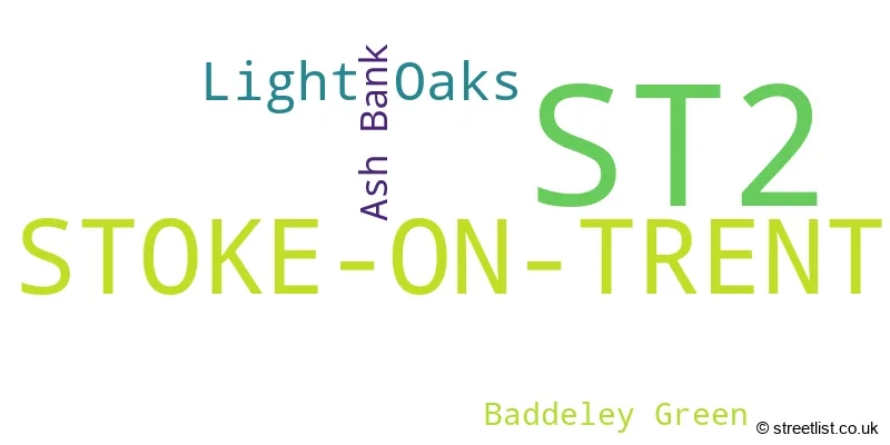
The largest settlements in the ST2 postal code are STOKE-ON-TRENT and Light Oaks.
The ST2 Postcode shares a border with ST1 (STOKE-ON-TRENT), ST3 (STOKE-ON-TRENT, Weston Coyney), ST4 (STOKE-ON-TRENT), ST6 (STOKE-ON-TRENT, Brown Edge) and ST9 (Werrington, Endon, Stockton Brook).
In the ST2 postcode district, the primary settlement is Stoke-on-Trent, which is located in the county of Staffordshire. Other significant settlements include Baddeley Green, Light Oaks, and Ash Bank. The post town for this district is Stoke-on-Trent, which is in the county of Staffordshire, England.
For the district ST2, we have data on 4 postcode sectors. Here's a breakdown: The sector ST2 0, covers Stoke-On-Trent in Staffordshire. The sector ST2 7, covers Stoke-On-Trent in Staffordshire. The sector ST2 8, covers Stoke-On-Trent in Staffordshire. The sector ST2 9, covers Stoke-On-Trent in Staffordshire.

Map of the ST2 Postcode District
Explore the ST2 postcode district by using our free interactive map.

When it comes to local government, postal geography often disregards political borders. However, for a breakdown in the ST2 District: the district mostly encompasses the City of Stoke-on-Trent (B) (738 postcodes), and finally, the Staffordshire Moorlands District area (21 postcodes).
Recent House Sales in ST2
| Date | Price | Address |
|---|---|---|
| 20/10/2023 | £50,000 | Highton Street, Stoke-on-trent, ST2 7BA |
| 11/10/2023 | £73,463 | Ash Grove, Ash Bank, Stoke-on-trent, ST2 9EF |
| 02/10/2023 | £98,000 | Leek Road, Stoke-on-trent, ST2 8BT |
| 29/09/2023 | £151,151 | Leek Road, Stoke-on-trent, ST2 7AA |
| 29/09/2023 | £159,000 | Blakelow Road, Stoke-on-trent, ST2 8HN |
| 15/09/2023 | £116,000 | Benedict Place, Stoke-on-trent, ST2 8AN |
| 08/09/2023 | £112,000 | Leek New Road, Stoke-on-trent, ST2 7HG |
| 08/09/2023 | £110,000 | Newstead Road, Stoke-on-trent, ST2 8HX |
| 08/09/2023 | £200,000 | Braemar Close, Stoke-on-trent, ST2 8NL |
| 04/09/2023 | £173,000 | Eaveswood Road, Stoke-on-trent, ST2 8ER |
Weather Forecast for ST2
Press Button to Show Forecast for Bucknall
| Time Period | Icon | Description | Temperature | Rain Probability | Wind |
|---|---|---|---|---|---|
| 09:00 to 12:00 | Cloudy | 6.0°C (feels like 3.0°C) | 50.00% | NW 11 mph | |
| 12:00 to 15:00 | Light rain shower (day) | 7.0°C (feels like 4.0°C) | 37.00% | N 9 mph | |
| 15:00 to 18:00 | Cloudy | 8.0°C (feels like 6.0°C) | 48.00% | NW 7 mph | |
| 18:00 to 21:00 | Cloudy | 7.0°C (feels like 6.0°C) | 9.00% | N 4 mph | |
| 21:00 to 00:00 | Cloudy | 5.0°C (feels like 3.0°C) | 6.00% | ESE 4 mph |
Press Button to Show Forecast for Bucknall
| Time Period | Icon | Description | Temperature | Rain Probability | Wind |
|---|---|---|---|---|---|
| 00:00 to 03:00 | Partly cloudy (night) | 4.0°C (feels like 1.0°C) | 3.00% | E 7 mph | |
| 03:00 to 06:00 | Partly cloudy (night) | 2.0°C (feels like 0.0°C) | 1.00% | E 4 mph | |
| 06:00 to 09:00 | Cloudy | 3.0°C (feels like 0.0°C) | 4.00% | ENE 4 mph | |
| 09:00 to 12:00 | Cloudy | 6.0°C (feels like 5.0°C) | 6.00% | E 4 mph | |
| 12:00 to 15:00 | Overcast | 8.0°C (feels like 7.0°C) | 10.00% | ESE 4 mph | |
| 15:00 to 18:00 | Cloudy | 9.0°C (feels like 8.0°C) | 8.00% | E 4 mph | |
| 18:00 to 21:00 | Cloudy | 8.0°C (feels like 7.0°C) | 8.00% | E 4 mph | |
| 21:00 to 00:00 | Partly cloudy (night) | 5.0°C (feels like 2.0°C) | 7.00% | E 7 mph |
Press Button to Show Forecast for Bucknall
| Time Period | Icon | Description | Temperature | Rain Probability | Wind |
|---|---|---|---|---|---|
| 00:00 to 03:00 | Cloudy | 3.0°C (feels like 0.0°C) | 11.00% | E 7 mph | |
| 03:00 to 06:00 | Cloudy | 3.0°C (feels like 0.0°C) | 9.00% | E 7 mph | |
| 06:00 to 09:00 | Cloudy | 4.0°C (feels like 1.0°C) | 9.00% | ENE 7 mph | |
| 09:00 to 12:00 | Cloudy | 7.0°C (feels like 4.0°C) | 9.00% | E 9 mph | |
| 12:00 to 15:00 | Cloudy | 9.0°C (feels like 6.0°C) | 18.00% | E 9 mph | |
| 15:00 to 18:00 | Cloudy | 10.0°C (feels like 7.0°C) | 18.00% | E 9 mph | |
| 18:00 to 21:00 | Cloudy | 9.0°C (feels like 7.0°C) | 18.00% | ENE 9 mph | |
| 21:00 to 00:00 | Cloudy | 7.0°C (feels like 4.0°C) | 16.00% | ENE 9 mph |
Press Button to Show Forecast for Bucknall
| Time Period | Icon | Description | Temperature | Rain Probability | Wind |
|---|---|---|---|---|---|
| 00:00 to 03:00 | Cloudy | 6.0°C (feels like 3.0°C) | 16.00% | NE 9 mph | |
| 03:00 to 06:00 | Cloudy | 6.0°C (feels like 3.0°C) | 21.00% | NNE 11 mph | |
| 06:00 to 09:00 | Heavy rain | 6.0°C (feels like 3.0°C) | 71.00% | NNE 11 mph | |
| 09:00 to 12:00 | Heavy rain | 7.0°C (feels like 4.0°C) | 77.00% | NNE 11 mph | |
| 12:00 to 15:00 | Heavy rain | 8.0°C (feels like 5.0°C) | 76.00% | N 11 mph | |
| 15:00 to 18:00 | Heavy rain | 9.0°C (feels like 6.0°C) | 72.00% | N 11 mph | |
| 18:00 to 21:00 | Cloudy | 9.0°C (feels like 7.0°C) | 19.00% | N 9 mph | |
| 21:00 to 00:00 | Clear night | 7.0°C (feels like 5.0°C) | 11.00% | WNW 7 mph |
Where is the ST2 Postcode District?
The data indicates that the postcode district ST2 is located in STOKE-ON-TRENT. STOKE-ON-TRENT is situated in close proximity to several nearby towns. To the west is NEWCASTLE, which is approximately 4.72 miles away. To the north-east is LEEK, which is about 6.04 miles away. To the south is STONE, which is roughly 8.36 miles away. To the north is CONGLETON, approximately 9.70 miles away. To the north-west is SANDBACH, which is about 12.87 miles away. Lastly, to the south-east is UTTOXETER, which is roughly 15.04 miles away. Additionally, the distance to the centre of London from ST2 postcode district is approximately 135.15 miles.
The district is within the post town of STOKE-ON-TRENT.
The sector has postcodes within the nation of England.
The ST2 Postcode District is covers the following regions.
- Stoke-on-Trent - Shropshire and Staffordshire - West Midlands (England)
- Staffordshire CC - Shropshire and Staffordshire - West Midlands (England)
| Postcode Sector | Delivery Office |
|---|---|
| ST2 0 | Stoke-hanley Delivery Office |
| ST2 7 | Stoke-hanley Delivery Office |
| ST2 8 | Stoke-hanley Delivery Office |
| ST2 9 | Stoke-hanley Delivery Office |
| S | T | 2 | - | X | X | X |
| S | T | 2 | Space | Numeric | Letter | Letter |
Current Monthly Rental Prices
| # Bedrooms | Min Price | Max Price | Avg Price |
|---|---|---|---|
| 1 | £450 | £940 | £621 |
| 2 | £436 | £850 | £629 |
| 3 | £550 | £1,750 | £941 |
| 4 | £995 | £995 | £995 |
Current House Prices
| # Bedrooms | Min Price | Max Price | Avg Price |
|---|---|---|---|
| £75,000 | £595,000 | £253,333 | |
| 2 | £80,000 | £225,000 | £143,638 |
| 3 | £95,000 | £560,000 | £206,052 |
| 4 | £210,000 | £850,000 | £317,858 |
| 5 | £160,000 | £500,000 | £330,000 |
Estate Agents who Operate in the ST2 District
| Logo | Name | Brand Name | Address | Contact Number | Total Properties |
|---|---|---|---|---|---|
 | Milton | Debra Timmis Estate Agents | 24 Millrise Road, Stoke-On-Trent, ST2 7BW | 01782 493503 | 9 |
 | Leek | Whittaker & Biggs | 47 Derby Street, Leek, Staffordshire, ST13 6HU | 01535 288209 | 7 |
 | Stoke-On-Trent | Dunn & Rate | 112a Baddeley Green Lane, Baddeley Green, Stoke-On-Trent, ST2 7HA | 01782 493754 | 6 |
 | Stoke-On-Trent | Belvoir Sales | 8 Albion Street, Hanley, Stoke-On-Trent, ST1 1QH | 01782 493685 | 6 |
 | Hanley | Butters John Bee | 2-6 Tontine Street, Stoke-On-Trent, Staffordshire, ST1 1NP | 01782 493723 | 6 |
| Type of Property | 2018 Average | 2018 Sales | 2017 Average | 2017 Sales | 2016 Average | 2016 Sales | 2015 Average | 2015 Sales |
|---|---|---|---|---|---|---|---|---|
| Detached | £192,521 | 92 | £195,752 | 86 | £213,602 | 68 | £198,203 | 72 |
| Semi-Detached | £112,758 | 263 | £110,255 | 276 | £106,855 | 233 | £99,058 | 202 |
| Terraced | £96,859 | 101 | £82,072 | 99 | £96,490 | 102 | £91,269 | 70 |
| Flats | £68,100 | 5 | £83,656 | 9 | £62,500 | 2 | £64,500 | 2 |