The ST3 postcode district is a postal district located in the ST Stoke-on-Trent postcode area with a population of 68,507 residents according to the 2021 England and Wales Census.
The area of the ST3 postcode district is 11.75 square miles which is 30.43 square kilometres or 7,518.56 acres.
Currently, the ST3 district has about 1646 postcode units spread across 7 geographic postcode sectors.
Given that each sector allows for 400 unique postcode combinations, the district has a capacity of 2,800 postcodes. With 1646 postcodes already in use, this leaves 1154 units available.
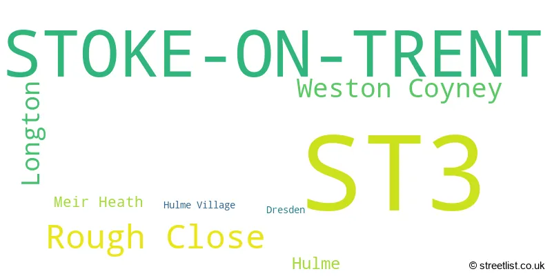
The largest settlements in the ST3 postal code are STOKE-ON-TRENT and Weston Coyney.
The ST3 Postcode shares a border with CW3 (Madeley, Audlem, Woore), ST11 (Blythe Bridge, Forsbrook, Caverswall), ST15 (STONE, Yarnfield, Hilderstone), ST2 (STOKE-ON-TRENT, Light Oaks) and ST4 (STOKE-ON-TRENT).
The primary settlement in the ST3 postcode district is Stoke-on-Trent, located in the county of Staffordshire, England. Other significant settlements in the district include Longton, Dresden, Rough Close, Hulme, Hulme Village, Weston Coyney, and Meir Heath. The most significant post town in the district is Stoke-on-Trent.
For the district ST3, we have data on 8 postcode sectors. Here's a breakdown: The sector ST3 1, covers Stoke-On-Trent in Staffordshire. The sector ST3 2, covers Stoke-On-Trent in Staffordshire. The sector ST3 3, covers Stoke-On-Trent in Staffordshire. The sector ST3 4, covers Stoke-On-Trent in Staffordshire. The sector ST3 5, covers Stoke-On-Trent in Staffordshire. The sector ST3 6, covers Stoke-On-Trent in Staffordshire. The sector ST3 7, covers Stoke-On-Trent in Staffordshire. The sector ST3 9 is non-geographic. It's often designated for PO Boxes, large organisations, or special services.

Map of the ST3 Postcode District
Explore the ST3 postcode district by using our free interactive map.

When it comes to local government, postal geography often disregards political borders. However, for a breakdown in the ST3 District: the district mostly encompasses the City of Stoke-on-Trent (B) (1550 postcodes), followed by the Stafford District (B) area (90 postcodes), and finally, the Staffordshire Moorlands District area (8 postcodes).
Recent House Sales in ST3
| Date | Price | Address |
|---|---|---|
| 09/10/2023 | £65,000 | Meir View, Stoke-on-trent, ST3 6AH |
| 04/10/2023 | £125,000 | Waterdale Grove, Stoke-on-trent, ST3 5TX |
| 29/09/2023 | £200,000 | Colin Crescent, Stoke-on-trent, ST3 6NL |
| 29/09/2023 | £167,500 | Coupe Drive, Stoke-on-trent, ST3 5HS |
| 27/09/2023 | £90,000 | Larch Grove, Stoke-on-trent, ST3 2BN |
| 27/09/2023 | £110,000 | Evesham Way, Stoke-on-trent, ST3 5TP |
| 25/09/2023 | £157,500 | Hampshire Crescent, Stoke-on-trent, ST3 4TR |
| 22/09/2023 | £70,000 | Meir Road, Stoke-on-trent, ST3 7JG |
| 20/09/2023 | £190,000 | The Wood, Stoke-on-trent, ST3 6HR |
| 15/09/2023 | £130,000 | Pinhoe Place, Stoke-on-trent, ST3 5UA |
Weather Forecast for ST3
Press Button to Show Forecast for Lightwood
| Time Period | Icon | Description | Temperature | Rain Probability | Wind |
|---|---|---|---|---|---|
| 06:00 to 09:00 | Cloudy | 6.0°C (feels like 1.0°C) | 5.00% | NW 18 mph | |
| 09:00 to 12:00 | Partly cloudy (day) | 7.0°C (feels like 3.0°C) | 2.00% | NW 18 mph | |
| 12:00 to 15:00 | Cloudy | 9.0°C (feels like 6.0°C) | 5.00% | NW 16 mph | |
| 15:00 to 18:00 | Partly cloudy (day) | 9.0°C (feels like 7.0°C) | 9.00% | NNW 13 mph | |
| 18:00 to 21:00 | Sunny day | 8.0°C (feels like 5.0°C) | 8.00% | NW 13 mph | |
| 21:00 to 00:00 | Partly cloudy (night) | 5.0°C (feels like 2.0°C) | 36.00% | WNW 9 mph |
Press Button to Show Forecast for Lightwood
| Time Period | Icon | Description | Temperature | Rain Probability | Wind |
|---|---|---|---|---|---|
| 00:00 to 03:00 | Light rain shower (night) | 4.0°C (feels like 0.0°C) | 43.00% | WNW 13 mph | |
| 03:00 to 06:00 | Sleet shower (night) | 3.0°C (feels like -2.0°C) | 41.00% | NW 11 mph | |
| 06:00 to 09:00 | Sunny day | 2.0°C (feels like -2.0°C) | 5.00% | NW 11 mph | |
| 09:00 to 12:00 | Cloudy | 6.0°C (feels like 2.0°C) | 11.00% | NW 16 mph | |
| 12:00 to 15:00 | Cloudy | 8.0°C (feels like 4.0°C) | 8.00% | NW 16 mph | |
| 15:00 to 18:00 | Cloudy | 8.0°C (feels like 5.0°C) | 7.00% | NW 13 mph | |
| 18:00 to 21:00 | Partly cloudy (day) | 7.0°C (feels like 4.0°C) | 7.00% | NW 11 mph | |
| 21:00 to 00:00 | Partly cloudy (night) | 4.0°C (feels like 2.0°C) | 3.00% | NNW 7 mph |
Press Button to Show Forecast for Lightwood
| Time Period | Icon | Description | Temperature | Rain Probability | Wind |
|---|---|---|---|---|---|
| 00:00 to 03:00 | Clear night | 3.0°C (feels like 0.0°C) | 2.00% | N 4 mph | |
| 03:00 to 06:00 | Clear night | 1.0°C (feels like -1.0°C) | 3.00% | NNW 4 mph | |
| 06:00 to 09:00 | Partly cloudy (day) | 2.0°C (feels like 0.0°C) | 4.00% | NW 4 mph | |
| 09:00 to 12:00 | Partly cloudy (day) | 6.0°C (feels like 5.0°C) | 6.00% | WNW 4 mph | |
| 12:00 to 15:00 | Cloudy | 9.0°C (feels like 7.0°C) | 13.00% | WNW 7 mph | |
| 15:00 to 18:00 | Cloudy | 10.0°C (feels like 8.0°C) | 15.00% | W 9 mph | |
| 18:00 to 21:00 | Light rain | 8.0°C (feels like 6.0°C) | 47.00% | WNW 9 mph | |
| 21:00 to 00:00 | Cloudy | 7.0°C (feels like 4.0°C) | 19.00% | W 9 mph |
Press Button to Show Forecast for Lightwood
| Time Period | Icon | Description | Temperature | Rain Probability | Wind |
|---|---|---|---|---|---|
| 00:00 to 03:00 | Overcast | 7.0°C (feels like 4.0°C) | 18.00% | W 11 mph | |
| 03:00 to 06:00 | Overcast | 7.0°C (feels like 4.0°C) | 12.00% | WNW 13 mph | |
| 06:00 to 09:00 | Overcast | 7.0°C (feels like 3.0°C) | 11.00% | WNW 16 mph | |
| 09:00 to 12:00 | Overcast | 8.0°C (feels like 5.0°C) | 12.00% | NW 18 mph | |
| 12:00 to 15:00 | Cloudy | 10.0°C (feels like 7.0°C) | 9.00% | NW 20 mph | |
| 15:00 to 18:00 | Cloudy | 11.0°C (feels like 7.0°C) | 5.00% | NW 18 mph | |
| 18:00 to 21:00 | Partly cloudy (day) | 10.0°C (feels like 7.0°C) | 2.00% | NW 13 mph | |
| 21:00 to 00:00 | Partly cloudy (night) | 7.0°C (feels like 5.0°C) | 2.00% | NW 7 mph |
Where is the ST3 Postcode District?
The postcode district for ST3 is located in Stoke-on-Trent. It is associated with several nearby towns. To the South, there is Stone, which is approximately 4.9 miles away. To the North West, there is Newcastle, which is approximately 5.6 miles away. To the North, there is Leek, which is approximately 9.1 miles away. To the South East, there is Uttoxeter, which is approximately 12.8 miles away. And to the West, there is Market Drayton, which is approximately 15.5 miles away. Furthermore, the distance from this postcode district to the center of London is approximately 132.3 miles.
The district is within the post town of STOKE-ON-TRENT.
The sector has postcodes within the nation of England.
The ST3 Postcode District is covers the following regions.
- Stoke-on-Trent - Shropshire and Staffordshire - West Midlands (England)
- Staffordshire CC - Shropshire and Staffordshire - West Midlands (England)
| Postcode Sector | Delivery Office |
|---|---|
| ST3 1 | Longton Delivery Office |
| ST3 2 | Longton Delivery Office |
| ST3 3 | Longton Delivery Office |
| ST3 4 | Longton Delivery Office |
| ST3 5 | Longton Delivery Office |
| ST3 6 | Longton Delivery Office |
| ST3 7 | Longton Delivery Office |
| S | T | 3 | - | X | X | X |
| S | T | 3 | Space | Numeric | Letter | Letter |
Current Monthly Rental Prices
| # Bedrooms | Min Price | Max Price | Avg Price |
|---|---|---|---|
| 1 | £465 | £1,000 | £728 |
| 2 | £395 | £1,000 | £658 |
| 3 | £775 | £1,300 | £981 |
| 4 | £1,250 | £1,250 | £1,250 |
Current House Prices
| # Bedrooms | Min Price | Max Price | Avg Price |
|---|---|---|---|
| £65,000 | £65,000 | £65,000 | |
| 1 | £75,000 | £125,000 | £95,580 |
| 2 | £39,500 | £350,000 | £158,150 |
| 3 | £90,000 | £485,000 | £211,597 |
| 4 | £160,000 | £650,000 | £357,584 |
| 5 | £280,000 | £725,000 | £451,875 |
| 6 | £390,000 | £950,000 | £673,571 |
Estate Agents who Operate in the ST3 District
| Logo | Name | Brand Name | Address | Contact Number | Total Properties |
|---|---|---|---|---|---|
 | Stoke On Trent | Platinum Property | 422 Sandon Road, Meir Heath, Stoke-On-Trent, ST3 7LH | 01782 493538 | 43 |
 | Longton | Austerberry | 4 Edensor Road, Stoke-On-Trent, ST3 2NU | 01782 493964 | 35 |
 | Longton | Butters John Bee | 75 The Strand, Stoke-On-Trent, ST3 2NS | 01782 493449 | 34 |
 | Trentham | Dale and Collins | Unit 14 Trentham Technology Park Bellringer Road Trentham Stoke on Trent ST4 8LJ | 01782 493505 | 31 |
 | Stoke-on-Trent | Findahome Online Ltd | 80 Victoria Road, Stoke-On-Trent, ST4 2JX | 01782 493531 | 18 |
| Type of Property | 2018 Average | 2018 Sales | 2017 Average | 2017 Sales | 2016 Average | 2016 Sales | 2015 Average | 2015 Sales |
|---|---|---|---|---|---|---|---|---|
| Detached | £205,509 | 220 | £207,791 | 228 | £194,971 | 232 | £182,962 | 233 |
| Semi-Detached | £122,233 | 504 | £117,383 | 560 | £111,272 | 532 | £110,197 | 479 |
| Terraced | £86,619 | 201 | £84,593 | 214 | £85,417 | 230 | £79,214 | 183 |
| Flats | £69,238 | 21 | £73,247 | 15 | £77,091 | 11 | £57,130 | 18 |
Hotels within the Postcode Area
We found 3 hotels and guest houses within the ST3 postcode area
Best Western Stoke East
Lysander Road, Meir Park, Stoke-On-Trent, stoke-on-trent, ST3 7WA.
View detailsThe Crescent Budget Hotel
1 Battison Crescent, Dresden, England, Stoke on Trent, stoke-on-trent, ST3 4DS.
View details