The ST9 postcode district is a postal district located in the ST Stoke-on-Trent postcode area with a population of 12,021 residents according to the 2021 England and Wales Census.
The area of the ST9 postcode district is 19.76 square miles which is 51.17 square kilometres or 12,644.66 acres.
Currently, the ST9 district has about 330 postcode units spread across 2 geographic postcode sectors.
Given that each sector allows for 400 unique postcode combinations, the district has a capacity of 800 postcodes. With 330 postcodes already in use, this leaves 470 units available.
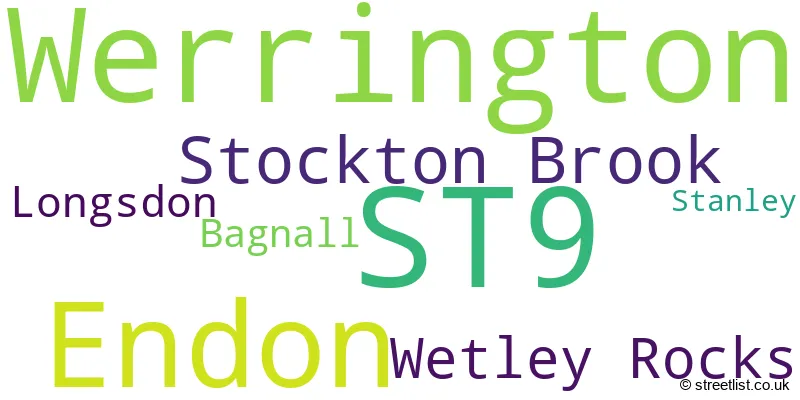
The largest settlement in the ST9 postal code is Werrington followed by Endon, and Stockton Brook.
The ST9 Postcode shares a border with ST13 (LEEK, Cheddleton, Rudyard), ST2 (STOKE-ON-TRENT, Light Oaks), ST6 (STOKE-ON-TRENT, Brown Edge) and ST10 (Cheadle, Tean, Alton).
The primary settlement in the ST9 postcode district is Werrington, located in Stoke-on-Trent, Staffordshire. Other significant settlements in the district include Wetley Rocks, Bagnall, Endon, Longsdon, Stanley, and Stockton Brook. The county in which these settlements are located is Staffordshire, in the country of England. The most significant post town in the district is Stoke-on-Trent.
For the district ST9, we have data on 2 postcode sectors. Here's a breakdown: The sector ST9 0, covers Werrington and Wetley Rocks in Staffordshire. The sector ST9 9, covers Endon and Stockton Brook and Longsdon in Staffordshire.

Map of the ST9 Postcode District
Explore the ST9 postcode district by using our free interactive map.

When it comes to local government, postal geography often disregards political borders. However, for a breakdown in the ST9 District: the district mostly encompasses the Staffordshire Moorlands District (308 postcodes), and finally, the City of Stoke-on-Trent (B) area (26 postcodes).
Recent House Sales in ST9
| Date | Price | Address |
|---|---|---|
| 06/10/2023 | £150,300 | Chartwell Close, Werrington, Stoke-on-trent, ST9 0PQ |
| 08/09/2023 | £470,000 | Leek Road, Werrington, Stoke-on-trent, ST9 0DG |
| 01/09/2023 | £233,000 | Washerwall Lane, Werrington, Stoke-on-trent, ST9 0LY |
| 25/08/2023 | £205,000 | High View Road, Endon, Stoke-on-trent, ST9 9HT |
| 25/08/2023 | £193,000 | Russell Grove, Werrington, Stoke-on-trent, ST9 0EX |
| 18/08/2023 | £170,000 | Stanley Road, Stockton Brook, Stoke-on-trent, ST9 9LL |
| 18/08/2023 | £280,000 | Heath Avenue, Werrington, Stoke-on-trent, ST9 0HU |
| 18/08/2023 | £220,000 | Wilton Avenue, Werrington, Stoke-on-trent, ST9 0HZ |
| 18/08/2023 | £240,000 | Moorland Avenue, Werrington, Stoke-on-trent, ST9 0EQ |
| 18/08/2023 | £214,000 | Moss Park Avenue, Werrington, Stoke-on-trent, ST9 0LS |
Weather Forecast for ST9
Press Button to Show Forecast for Milton (Stoke-On-Trent)
| Time Period | Icon | Description | Temperature | Rain Probability | Wind |
|---|---|---|---|---|---|
| 00:00 to 03:00 | Cloudy | 5.0°C (feels like 4.0°C) | 3.00% | NE 2 mph | |
| 03:00 to 06:00 | Partly cloudy (night) | 4.0°C (feels like 3.0°C) | 1.00% | NNW 2 mph | |
| 06:00 to 09:00 | Partly cloudy (day) | 4.0°C (feels like 3.0°C) | 1.00% | NNW 2 mph | |
| 09:00 to 12:00 | Cloudy | 7.0°C (feels like 6.0°C) | 3.00% | NNW 4 mph | |
| 12:00 to 15:00 | Cloudy | 10.0°C (feels like 8.0°C) | 4.00% | NNW 7 mph | |
| 15:00 to 18:00 | Cloudy | 11.0°C (feels like 9.0°C) | 6.00% | N 7 mph | |
| 18:00 to 21:00 | Cloudy | 10.0°C (feels like 9.0°C) | 5.00% | N 7 mph | |
| 21:00 to 00:00 | Cloudy | 8.0°C (feels like 7.0°C) | 3.00% | NNE 4 mph |
Press Button to Show Forecast for Milton (Stoke-On-Trent)
| Time Period | Icon | Description | Temperature | Rain Probability | Wind |
|---|---|---|---|---|---|
| 00:00 to 03:00 | Partly cloudy (night) | 6.0°C (feels like 5.0°C) | 1.00% | ENE 4 mph | |
| 03:00 to 06:00 | Overcast | 6.0°C (feels like 5.0°C) | 8.00% | ESE 2 mph | |
| 06:00 to 09:00 | Cloudy | 5.0°C (feels like 4.0°C) | 9.00% | NE 2 mph | |
| 09:00 to 12:00 | Cloudy | 7.0°C (feels like 6.0°C) | 11.00% | NE 7 mph | |
| 12:00 to 15:00 | Cloudy | 9.0°C (feels like 8.0°C) | 11.00% | ENE 7 mph | |
| 15:00 to 18:00 | Overcast | 10.0°C (feels like 9.0°C) | 13.00% | NE 7 mph | |
| 18:00 to 21:00 | Cloudy | 9.0°C (feels like 8.0°C) | 9.00% | ENE 7 mph | |
| 21:00 to 00:00 | Cloudy | 7.0°C (feels like 5.0°C) | 8.00% | ENE 4 mph |
Press Button to Show Forecast for Milton (Stoke-On-Trent)
| Time Period | Icon | Description | Temperature | Rain Probability | Wind |
|---|---|---|---|---|---|
| 00:00 to 03:00 | Cloudy | 5.0°C (feels like 4.0°C) | 8.00% | E 4 mph | |
| 03:00 to 06:00 | Overcast | 4.0°C (feels like 3.0°C) | 12.00% | ESE 2 mph | |
| 06:00 to 09:00 | Overcast | 5.0°C (feels like 4.0°C) | 17.00% | ESE 2 mph | |
| 09:00 to 12:00 | Light rain | 7.0°C (feels like 5.0°C) | 45.00% | S 4 mph | |
| 12:00 to 15:00 | Light rain | 9.0°C (feels like 7.0°C) | 47.00% | SSE 7 mph | |
| 15:00 to 18:00 | Light rain | 10.0°C (feels like 8.0°C) | 49.00% | ENE 7 mph | |
| 18:00 to 21:00 | Light rain | 9.0°C (feels like 8.0°C) | 45.00% | ENE 7 mph | |
| 21:00 to 00:00 | Cloudy | 8.0°C (feels like 6.0°C) | 13.00% | NE 4 mph |
Press Button to Show Forecast for Milton (Stoke-On-Trent)
| Time Period | Icon | Description | Temperature | Rain Probability | Wind |
|---|---|---|---|---|---|
| 00:00 to 03:00 | Cloudy | 7.0°C (feels like 6.0°C) | 10.00% | E 4 mph | |
| 03:00 to 06:00 | Overcast | 6.0°C (feels like 5.0°C) | 9.00% | E 4 mph | |
| 06:00 to 09:00 | Cloudy | 6.0°C (feels like 5.0°C) | 7.00% | NE 4 mph | |
| 09:00 to 12:00 | Cloudy | 9.0°C (feels like 7.0°C) | 9.00% | NE 7 mph | |
| 12:00 to 15:00 | Overcast | 11.0°C (feels like 9.0°C) | 11.00% | NNE 9 mph | |
| 15:00 to 18:00 | Cloudy | 12.0°C (feels like 10.0°C) | 8.00% | NNE 9 mph | |
| 18:00 to 21:00 | Cloudy | 11.0°C (feels like 9.0°C) | 6.00% | NNE 9 mph | |
| 21:00 to 00:00 | Partly cloudy (night) | 8.0°C (feels like 6.0°C) | 3.00% | NNE 7 mph |
Where is the ST9 Postcode District?
The postcode district ST9 is located in the town of Stoke-on-Trent. This district is situated near several nearby towns. To the North, there is the town of Leek, which is approximately 3.24 miles away. To the South West, there is Newcastle, located around 7.36 miles from ST9. The town of Congleton is situated to the North West, about 8.63 miles from the postcode district. Towards the South, there is Stone, which is approximately 10.72 miles away. Furthermore, Crewe is located to the West of ST9, around 14.67 miles away. Moving East, you will find Ashbourne at a distance of about 15.04 miles. Uttoxeter is situated to the South East of ST9, approximately 15.07 miles away. Lastly, Buxton is situated to the North East, around 15.14 miles from the postcode district. Additionally, the distance between ST9 and the center of London is about 135.44 miles.
The district is within the post town of STOKE-ON-TRENT.
The sector has postcodes within the nation of England.
The ST9 Postcode District is covers the following regions.
- Staffordshire CC - Shropshire and Staffordshire - West Midlands (England)
- Stoke-on-Trent - Shropshire and Staffordshire - West Midlands (England)
| Postcode Sector | Delivery Office |
|---|---|
| ST9 0 | Stoke-hanley Delivery Office |
| ST9 0 | Werrington Scale Payment Delivery Office |
| ST9 0 | Wetley Rocks Scale Payment Delivery Office |
| ST9 9 | Stockton Brook Scale Payment Delivery Office |
| S | T | 9 | - | X | X | X |
| S | T | 9 | Space | Numeric | Letter | Letter |
Current Monthly Rental Prices
| # Bedrooms | Min Price | Max Price | Avg Price |
|---|
Current House Prices
| # Bedrooms | Min Price | Max Price | Avg Price |
|---|---|---|---|
| £280,000 | £280,000 | £280,000 | |
| 2 | £107,500 | £485,000 | £253,317 |
| 3 | £130,000 | £860,000 | £328,863 |
| 4 | £162,500 | £695,000 | £481,973 |
| 5 | £345,000 | £875,000 | £650,000 |
| 6 | £675,000 | £825,000 | £750,000 |
| 14 | £625,000 | £625,000 | £625,000 |
Estate Agents who Operate in the ST9 District
| Logo | Name | Brand Name | Address | Contact Number | Total Properties |
|---|---|---|---|---|---|
 | Leek | Whittaker & Biggs | 47 Derby Street, Leek, Staffordshire, ST13 6HU | 01535 288209 | 28 |
 | Stoke-On-Trent | Dunn & Rate | 112a Baddeley Green Lane, Baddeley Green, Stoke-On-Trent, ST2 7HA | 01782 493754 | 10 |
 | Werrington | Feeney Estate Agents | 9 Moorland Avenue, Werrington, ST9 0EQ | 01728 443998 | 9 |
 | Leek | Graham Watkins | 57 Derby Street, Leek, ST13 6JL | 01538 714103 | 4 |
 | Milton | Debra Timmis Estate Agents | 24 Millrise Road, Stoke-On-Trent, ST2 7BW | 01782 493503 | 3 |
| Type of Property | 2018 Average | 2018 Sales | 2017 Average | 2017 Sales | 2016 Average | 2016 Sales | 2015 Average | 2015 Sales |
|---|---|---|---|---|---|---|---|---|
| Detached | £286,956 | 83 | £287,461 | 103 | £239,203 | 94 | £238,955 | 92 |
| Semi-Detached | £172,626 | 73 | £170,089 | 81 | £163,843 | 89 | £170,993 | 80 |
| Terraced | £191,931 | 8 | £145,803 | 14 | £163,992 | 13 | £162,609 | 11 |
| Flats | £214,667 | 3 | £186,493 | 7 | £178,000 | 2 | £183,875 | 4 |