The TN15 postcode district is a postal district located in the TN Tonbridge postcode area with a population of 25,728 residents according to the 2021 England and Wales Census.
The area of the TN15 postcode district is 43.59 square miles which is 112.89 square kilometres or 27,896.48 acres.
Currently, the TN15 district has about 935 postcode units spread across 5 geographic postcode sectors.
Given that each sector allows for 400 unique postcode combinations, the district has a capacity of 2,000 postcodes. With 935 postcodes already in use, this leaves 1065 units available.
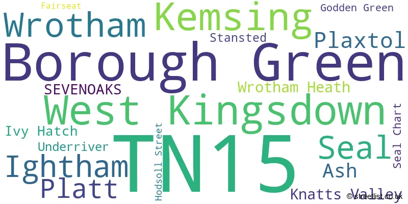
The largest settlement in the TN15 postal code is West Kingsdown followed by Borough Green, and KEMSING.
The TN15 Postcode shares a border with DA3 (LONGFIELD, New Ash Green, Hartley), DA4 (South Darenth, EYNSFORD, Sutton At Hone), ME18 (Wateringbury, Yalding, Mereworth), ME19 (Kings Hill, East Malling, WEST MALLING), TN11 (Hildenborough, Hadlow, TONBRIDGE) and TN14 (OTFORD, SEVENOAKS, HALSTEAD).
The primary settlement in the TN15 postcode district is Sevenoaks, located in the county of Kent, England. Other significant settlements in this district include Godden Green, Ivy Hatch, Plaxtol, Seal, Seal Chart, Underriver, Kemsing, Knatts Valley, West Kingsdown, Ash, Fairseat, Hodsoll Street, Stansted, Wrotham, Borough Green, and Platt. The most significant Postal Town in this district is Sevenoaks.
For the district TN15, we have data on 5 postcode sectors. Here's a breakdown: The sector TN15 0, covers Seal and Plaxtol and Sevenoaks in Kent. The sector TN15 6, covers West Kingsdown and Kemsing in Kent. The sector TN15 7, covers Wrotham and Ash and Wrotham Heath in Kent. The sector TN15 8, covers Borough Green and Platt in Kent. The sector TN15 9, covers Ightham in Kent.

Map of the TN15 Postcode District
Explore the TN15 postcode district by using our free interactive map.

When it comes to local government, postal geography often disregards political borders. However, for a breakdown in the TN15 District: the district mostly encompasses the Tonbridge and Malling District (B) (478 postcodes), and finally, the Sevenoaks District area (458 postcodes).
Recent House Sales in TN15
| Date | Price | Address |
|---|---|---|
| 19/10/2023 | £585,000 | Greenlands Road, Kemsing, Sevenoaks, TN15 6PH |
| 11/10/2023 | £770,000 | Highlands Park, Seal, Sevenoaks, TN15 0AQ |
| 03/10/2023 | £637,500 | Hever Avenue, West Kingsdown, Sevenoaks, TN15 6DT |
| 28/09/2023 | £420,000 | Park Lane, Kemsing, Sevenoaks, TN15 6NX |
| 31/08/2023 | £430,000 | Viking Way, West Kingsdown, Sevenoaks, TN15 6DY |
| 25/08/2023 | £735,000 | Borough Green Road, Ightham, Sevenoaks, TN15 9HS |
| 25/08/2023 | £425,000 | The Close, Borough Green, Sevenoaks, TN15 8EG |
| 25/08/2023 | £1,525,000 | Plaxdale Green Road, Stansted, Sevenoaks, TN15 7PE |
| 21/08/2023 | £365,000 | Windmill Hill, Wrotham Heath, Sevenoaks, TN15 7ST |
| 18/08/2023 | £765,000 | Gravesend Road, Wrotham, Sevenoaks, TN15 7JS |
Weather Forecast for TN15
Press Button to Show Forecast for Kemsing
| Time Period | Icon | Description | Temperature | Rain Probability | Wind |
|---|---|---|---|---|---|
| 21:00 to 00:00 | Overcast | 6.0°C (feels like 4.0°C) | 49.00% | NE 4 mph |
Press Button to Show Forecast for Kemsing
| Time Period | Icon | Description | Temperature | Rain Probability | Wind |
|---|---|---|---|---|---|
| 00:00 to 03:00 | Cloudy | 5.0°C (feels like 3.0°C) | 8.00% | NE 7 mph | |
| 03:00 to 06:00 | Cloudy | 5.0°C (feels like 2.0°C) | 5.00% | NE 7 mph | |
| 06:00 to 09:00 | Cloudy | 4.0°C (feels like 2.0°C) | 6.00% | NE 7 mph | |
| 09:00 to 12:00 | Cloudy | 7.0°C (feels like 4.0°C) | 6.00% | ENE 9 mph | |
| 12:00 to 15:00 | Cloudy | 9.0°C (feels like 7.0°C) | 15.00% | ENE 7 mph | |
| 15:00 to 18:00 | Overcast | 10.0°C (feels like 8.0°C) | 15.00% | ENE 7 mph | |
| 18:00 to 21:00 | Cloudy | 9.0°C (feels like 7.0°C) | 12.00% | E 7 mph | |
| 21:00 to 00:00 | Cloudy | 6.0°C (feels like 4.0°C) | 13.00% | E 7 mph |
Press Button to Show Forecast for Kemsing
| Time Period | Icon | Description | Temperature | Rain Probability | Wind |
|---|---|---|---|---|---|
| 00:00 to 03:00 | Cloudy | 5.0°C (feels like 2.0°C) | 17.00% | ENE 7 mph | |
| 03:00 to 06:00 | Overcast | 5.0°C (feels like 2.0°C) | 20.00% | NE 7 mph | |
| 06:00 to 09:00 | Cloudy | 6.0°C (feels like 3.0°C) | 18.00% | NE 7 mph | |
| 09:00 to 12:00 | Overcast | 9.0°C (feels like 7.0°C) | 19.00% | E 9 mph | |
| 12:00 to 15:00 | Cloudy | 11.0°C (feels like 9.0°C) | 18.00% | E 11 mph | |
| 15:00 to 18:00 | Light rain | 11.0°C (feels like 9.0°C) | 49.00% | E 11 mph | |
| 18:00 to 21:00 | Light rain | 10.0°C (feels like 7.0°C) | 55.00% | ENE 11 mph | |
| 21:00 to 00:00 | Light rain | 9.0°C (feels like 6.0°C) | 49.00% | ENE 11 mph |
Press Button to Show Forecast for Kemsing
| Time Period | Icon | Description | Temperature | Rain Probability | Wind |
|---|---|---|---|---|---|
| 00:00 to 03:00 | Heavy rain | 9.0°C (feels like 7.0°C) | 77.00% | ENE 9 mph | |
| 03:00 to 06:00 | Heavy rain shower (night) | 9.0°C (feels like 7.0°C) | 57.00% | SE 9 mph | |
| 06:00 to 09:00 | Light rain | 9.0°C (feels like 7.0°C) | 48.00% | SSE 9 mph | |
| 09:00 to 12:00 | Light rain shower (day) | 10.0°C (feels like 7.0°C) | 42.00% | SSE 13 mph | |
| 12:00 to 15:00 | Heavy rain shower (day) | 12.0°C (feels like 10.0°C) | 61.00% | SSW 13 mph | |
| 15:00 to 18:00 | Light rain shower (day) | 13.0°C (feels like 10.0°C) | 39.00% | SW 13 mph | |
| 18:00 to 21:00 | Light rain shower (day) | 12.0°C (feels like 9.0°C) | 35.00% | WSW 11 mph | |
| 21:00 to 00:00 | Cloudy | 9.0°C (feels like 7.0°C) | 8.00% | SW 7 mph |
Where is the TN15 Postcode District?
The postcode district for TN15 is located in Sevenoaks. It is near the towns of Seal, Godden Green, and Knatts Valley. The district is approximately 22.46 miles away from the center of London.
The district is within the post town of SEVENOAKS.
The sector has postcodes within the nation of England.
The TN15 Postcode District is in the West Kent region of Kent within the South East (England).
| Postcode Sector | Delivery Office |
|---|---|
| TN15 0 | Sevenoaks Delivery Office |
| TN15 6 | Sevenoaks Delivery Office |
| TN15 7 | Sevenoaks Delivery Office |
| TN15 8 | Sevenoaks Delivery Office |
| TN15 9 | Sevenoaks Delivery Office |
| T | N | 1 | 5 | - | X | X | X |
| T | N | 1 | 5 | Space | Numeric | Letter | Letter |
Tourist Attractions within the Postcode Area
We found 2 visitor attractions within the TN15 postcode area
| Knole |
|---|
| Historic Properties |
| Historic House / House and Garden / Palace |
| View Knole on Google Maps |
| Ightham Mote |
| Historic Properties |
| Historic House / House and Garden / Palace |
| View Ightham Mote on Google Maps |
Current Monthly Rental Prices
| # Bedrooms | Min Price | Max Price | Avg Price |
|---|---|---|---|
| 2 | £1,400 | £1,400 | £1,400 |
| 3 | £1,550 | £3,300 | £2,383 |
| 4 | £2,250 | £3,950 | £3,190 |
| 5 | £3,950 | £9,000 | £5,650 |
Current House Prices
| # Bedrooms | Min Price | Max Price | Avg Price |
|---|---|---|---|
| £20,000 | £799,950 | £279,983 | |
| 1 | £95,000 | £1,000,000 | £244,333 |
| 2 | £105,000 | £2,200,000 | £385,922 |
| 3 | £248,000 | £1,295,000 | £593,732 |
| 4 | £281,000 | £2,250,000 | £810,567 |
| 5 | £600,000 | £3,495,000 | £1,454,483 |
| 6 | £850,000 | £4,500,000 | £2,277,857 |
| 7 | £1,350,000 | £3,395,000 | £2,713,333 |
| 10 | £5,500,000 | £5,500,000 | £5,500,000 |
| 12 | £1,400,000 | £1,400,000 | £1,400,000 |
Estate Agents who Operate in the TN15 District
| Logo | Name | Brand Name | Address | Contact Number | Total Properties |
|---|---|---|---|---|---|
 | West Kingsdown | Wards | 44 Hever Road, West Kingsdown, Kent, TN15 6HD | 01474 552514 | 27 |
 | Borough Green | Kings Estate Agents | 51 Western Road, Borough Green, TN15 8AN | 01732 448035 | 25 |
 | Sevenoaks | Savills | 74 High Street, Sevenoaks, TN13 1JR | 01732 444945 | 24 |
 | Borough Green | Ibbett Mosely | Pluckley House, High Street, Borough Green, Kent, TN15 8BJ | 01732 447469 | 16 |
 | Borough Green | Hillier Reynolds | 3 Sevenoaks Road, Borough Green, TN15 8AX | 01732 446323 | 16 |
- Ash
- Basted
- Borough Green
- Claygate Cross
- Crouch
- Culverstone Green
- Fairseat
- Godden Green
- Heaverham
- Hildenborough
- Hodsoll Street
- Ightham
- Ivy Hatch
- Kemsing
- Labour-in-vain
- New Ash Green
- New Street
- Oldbury
- Otford
- Platt
- Plaxtol
- Ridley
- Roughway
- Seal
- Sevenoaks
- Sevenoaks Weald
- Stansted
- Stone Street
- Styants Bottom
- Trottiscliffe
- Underriver
- Vigo Village
- West Kingsdown
- West Kingsdown
- West Yoke
- Woodlands
- Wrotham Heath
- Wrotham
- Yopps Green
| Type of Property | 2018 Average | 2018 Sales | 2017 Average | 2017 Sales | 2016 Average | 2016 Sales | 2015 Average | 2015 Sales |
|---|---|---|---|---|---|---|---|---|
| Detached | £771,213 | 159 | £878,433 | 152 | £739,786 | 195 | £699,152 | 171 |
| Semi-Detached | £433,374 | 99 | £424,440 | 109 | £395,466 | 142 | £357,105 | 114 |
| Terraced | £345,410 | 81 | £355,254 | 96 | £361,514 | 107 | £310,702 | 126 |
| Flats | £281,795 | 28 | £202,461 | 27 | £202,777 | 26 | £178,972 | 39 |