The TW20 postcode district is a postal district located in the TW Twickenham postcode area with a population of 27,424 residents according to the 2021 England and Wales Census.
The area of the TW20 postcode district is 8.03 square miles which is 20.80 square kilometres or 5,140.95 acres.
Currently, the TW20 district has about 653 postcode units spread across 3 geographic postcode sectors.
Given that each sector allows for 400 unique postcode combinations, the district has a capacity of 1,200 postcodes. With 653 postcodes already in use, this leaves 547 units available.
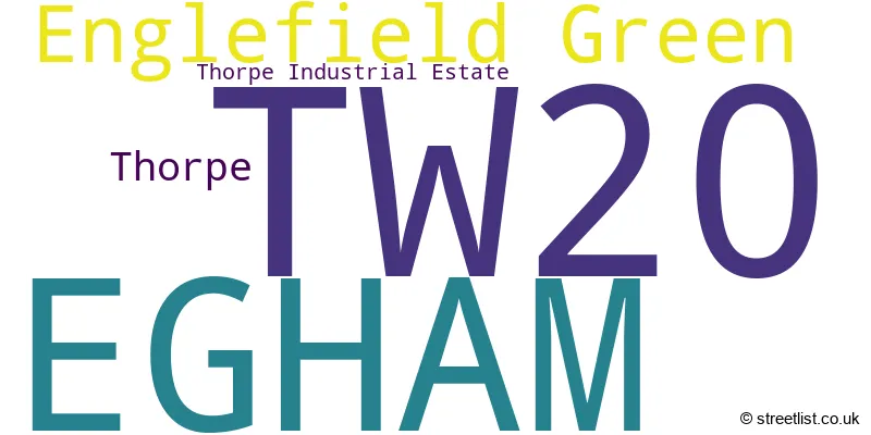
The largest settlement in the TW20 postal code is EGHAM followed by Englefield Green, and THORPE.
The TW20 Postcode shares a border with SL4 (WINDSOR, Old Windsor, Winkfield), KT16 (CHERTSEY, OTTERSHAW, Longcross), GU25 (VIRGINIA WATER) and TW18 (STAINES-UPON-THAMES, LALEHAM).
In the TW20 postcode district, the primary settlement is Egham, which is located in the county of Surrey. The post town for this district is Egham as well. Additionally, there are other significant settlements in the district, including Englefield Green and Thorpe. However, since these settlements represent a small proportion of the data, they will not be mentioned in the concise sentence.
For the district TW20, we have data on 4 postcode sectors. Here's a breakdown: The sector TW20 0, covers Englefield Green and Egham in Surrey. The sector TW20 2 is non-geographic. It's often designated for PO Boxes, large organisations, or special services. The sector TW20 8, covers Egham in Surrey. The sector TW20 9, covers Egham in Surrey.

Map of the TW20 Postcode District
Explore the TW20 postcode district by using our free interactive map.

When it comes to local government, postal geography often disregards political borders. However, for a breakdown in the TW20 District: the district mostly encompasses the Runnymede District (B) area with a total of 660 postcodes.
Recent House Sales in TW20
| Date | Price | Address |
|---|---|---|
| 05/10/2023 | £480,000 | Warwick Villas, Egham, TW20 8LL |
| 02/10/2023 | £555,000 | Woodhaw, Egham, TW20 9AR |
| 22/09/2023 | £400,000 | Fitzrobert Place, Egham, TW20 9JS |
| 15/09/2023 | £210,000 | Albany Place, Egham, TW20 9HW |
| 12/09/2023 | £625,000 | Clare Gardens, Egham, TW20 9JQ |
| 05/09/2023 | £347,500 | Coopers Hill Lane, Englefield Green, Egham, TW20 0JY |
| 31/08/2023 | £578,000 | Hummer Road, Egham, TW20 9BW |
| 25/08/2023 | £281,000 | Queens Road, Egham, TW20 9RS |
| 25/08/2023 | £373,500 | Quincy Road, Egham, TW20 9JH |
| 24/08/2023 | £375,000 | Larksfield, Englefield Green, Egham, TW20 0RA |
Weather Forecast for TW20
Press Button to Show Forecast for Egham
| Time Period | Icon | Description | Temperature | Rain Probability | Wind |
|---|---|---|---|---|---|
| 03:00 to 06:00 | Clear night | 4.0°C (feels like 1.0°C) | 0.00% | NNW 7 mph | |
| 06:00 to 09:00 | Sunny day | 4.0°C (feels like 1.0°C) | 0.00% | NNW 7 mph | |
| 09:00 to 12:00 | Partly cloudy (day) | 8.0°C (feels like 5.0°C) | 0.00% | N 11 mph | |
| 12:00 to 15:00 | Cloudy | 10.0°C (feels like 8.0°C) | 3.00% | N 11 mph | |
| 15:00 to 18:00 | Cloudy | 11.0°C (feels like 9.0°C) | 4.00% | N 11 mph | |
| 18:00 to 21:00 | Cloudy | 10.0°C (feels like 8.0°C) | 4.00% | NNE 9 mph | |
| 21:00 to 00:00 | Partly cloudy (night) | 7.0°C (feels like 6.0°C) | 4.00% | NE 4 mph |
Press Button to Show Forecast for Egham
| Time Period | Icon | Description | Temperature | Rain Probability | Wind |
|---|---|---|---|---|---|
| 00:00 to 03:00 | Cloudy | 6.0°C (feels like 4.0°C) | 8.00% | N 4 mph | |
| 03:00 to 06:00 | Cloudy | 6.0°C (feels like 3.0°C) | 5.00% | N 7 mph | |
| 06:00 to 09:00 | Cloudy | 6.0°C (feels like 3.0°C) | 8.00% | N 7 mph | |
| 09:00 to 12:00 | Overcast | 8.0°C (feels like 5.0°C) | 8.00% | NNE 11 mph | |
| 12:00 to 15:00 | Overcast | 10.0°C (feels like 8.0°C) | 9.00% | NNE 11 mph | |
| 15:00 to 18:00 | Cloudy | 11.0°C (feels like 9.0°C) | 6.00% | NNE 11 mph | |
| 18:00 to 21:00 | Partly cloudy (day) | 10.0°C (feels like 8.0°C) | 4.00% | NNE 11 mph | |
| 21:00 to 00:00 | Clear night | 7.0°C (feels like 5.0°C) | 3.00% | NNE 9 mph |
Press Button to Show Forecast for Egham
| Time Period | Icon | Description | Temperature | Rain Probability | Wind |
|---|---|---|---|---|---|
| 00:00 to 03:00 | Clear night | 5.0°C (feels like 3.0°C) | 3.00% | NNE 7 mph | |
| 03:00 to 06:00 | Clear night | 4.0°C (feels like 2.0°C) | 2.00% | N 4 mph | |
| 06:00 to 09:00 | Partly cloudy (day) | 4.0°C (feels like 2.0°C) | 2.00% | NNW 4 mph | |
| 09:00 to 12:00 | Cloudy | 8.0°C (feels like 7.0°C) | 7.00% | N 4 mph | |
| 12:00 to 15:00 | Cloudy | 9.0°C (feels like 8.0°C) | 12.00% | NNW 4 mph | |
| 15:00 to 18:00 | Overcast | 9.0°C (feels like 7.0°C) | 17.00% | NW 7 mph | |
| 18:00 to 21:00 | Overcast | 9.0°C (feels like 8.0°C) | 17.00% | WNW 7 mph | |
| 21:00 to 00:00 | Cloudy | 8.0°C (feels like 7.0°C) | 17.00% | NNW 7 mph |
Press Button to Show Forecast for Egham
| Time Period | Icon | Description | Temperature | Rain Probability | Wind |
|---|---|---|---|---|---|
| 00:00 to 03:00 | Cloudy | 8.0°C (feels like 6.0°C) | 14.00% | N 4 mph | |
| 03:00 to 06:00 | Cloudy | 7.0°C (feels like 5.0°C) | 12.00% | N 7 mph | |
| 06:00 to 09:00 | Cloudy | 6.0°C (feels like 4.0°C) | 10.00% | N 7 mph | |
| 09:00 to 12:00 | Cloudy | 8.0°C (feels like 6.0°C) | 7.00% | N 11 mph | |
| 12:00 to 15:00 | Overcast | 11.0°C (feels like 8.0°C) | 13.00% | NNE 11 mph | |
| 15:00 to 18:00 | Overcast | 12.0°C (feels like 9.0°C) | 14.00% | NNE 11 mph | |
| 18:00 to 21:00 | Cloudy | 11.0°C (feels like 9.0°C) | 9.00% | NNE 9 mph | |
| 21:00 to 00:00 | Partly cloudy (night) | 8.0°C (feels like 6.0°C) | 3.00% | NNE 7 mph |
Where is the TW20 Postcode District?
The postcode district TW20 is located in the town of Egham. It is situated near several towns such as Englefield Green, Thorpe Industrial Estate, Thorpe, and Virginia Water. The distance from TW20 to the center of London is approximately 19.65 miles.
The district is within the post town of EGHAM.
The sector has postcodes within the nation of England.
The TW20 Postcode District is in the West Surrey region of Surrey, East and West Sussex within the South East (England).
| Postcode Sector | Delivery Office |
|---|---|
| TW20 0 | Egham Delivery Office |
| TW20 0 | Egham & Staines Delivery Office |
| TW20 1 | Egham & Staines Delivery Office |
| TW20 2 | Egham & Staines Delivery Office |
| TW20 3 | Egham & Staines Delivery Office |
| TW20 4 | Egham & Staines Delivery Office |
| TW20 5 | Egham & Staines Delivery Office |
| TW20 6 | Egham & Staines Delivery Office |
| TW20 7 | Egham & Staines Delivery Office |
| TW20 8 | Egham & Staines Delivery Office |
| TW20 8 | Egham Delivery Office |
| TW20 9 | Egham Delivery Office |
| T | W | 2 | 0 | - | X | X | X |
| T | W | 2 | 0 | Space | Numeric | Letter | Letter |
Tourist Attractions within the Postcode Area
We found 1 visitor attractions within the TW20 postcode area
| Runnymede |
|---|
| Historic Properties |
| Historic Monument / Archaeological Site |
| View Runnymede on Google Maps |
Current Monthly Rental Prices
| # Bedrooms | Min Price | Max Price | Avg Price |
|---|---|---|---|
| £925 | £1,625 | £1,260 | |
| 1 | £520 | £1,600 | £1,098 |
| 2 | £1,250 | £3,200 | £1,715 |
| 3 | £1,900 | £5,150 | £2,738 |
| 4 | £2,200 | £5,500 | £3,931 |
| 5 | £2,850 | £7,000 | £4,160 |
Current House Prices
| # Bedrooms | Min Price | Max Price | Avg Price |
|---|---|---|---|
| £150,000 | £1,500,000 | £825,000 | |
| 1 | £90,000 | £320,000 | £214,209 |
| 2 | £150,000 | £1,845,000 | £504,055 |
| 3 | £300,000 | £2,500,000 | £550,593 |
| 4 | £425,000 | £2,000,000 | £895,629 |
| 5 | £399,000 | £2,250,000 | £1,227,682 |
| 6 | £425,000 | £5,500,000 | £1,770,625 |
| 7 | £1,400,000 | £1,400,000 | £1,400,000 |
| 8 | £600,000 | £600,000 | £600,000 |
Estate Agents who Operate in the TW20 District
| Logo | Name | Brand Name | Address | Contact Number | Total Properties |
|---|---|---|---|---|---|
 | Egham | Nevin and Wells Residential | 169-170 High Street, Egham, TW20 9EJ | 01784 777975 | 39 |
 | Egham | Stirling Ackroyd | 179 High Street, Egham, TW20 9EJ | 01784 779751 | 24 |
 | Englefield Green | Stirling Ackroyd | 19 St. Judes Road, Englefield Green, TW20 0BY | 01784 777956 | 19 |
 | Egham | Alpha Residential | 43 Spring Avenue, Egham, TW20 9PJ | 01784 918808 | 13 |
 | Egham - Lettings | Stirling Ackroyd Lettings | 179 High Street, Egham, TW20 9EJ | 01784 778857 | 10 |
| Type of Property | 2018 Average | 2018 Sales | 2017 Average | 2017 Sales | 2016 Average | 2016 Sales | 2015 Average | 2015 Sales |
|---|---|---|---|---|---|---|---|---|
| Detached | £761,416 | 61 | £784,023 | 65 | £805,488 | 75 | £700,505 | 83 |
| Semi-Detached | £436,866 | 91 | £476,290 | 106 | £435,216 | 108 | £389,840 | 125 |
| Terraced | £447,461 | 91 | £468,905 | 86 | £368,319 | 112 | £337,078 | 112 |
| Flats | £265,710 | 67 | £297,642 | 90 | £257,225 | 110 | £240,471 | 94 |
Hotels within the Postcode Area
We found 6 hotels and guest houses within the TW20 postcode area