The WA2 postcode district is a postal district located in the WA Warrington postcode area with a population of 41,009 residents according to the 2021 England and Wales Census.
The area of the WA2 postcode district is 7.10 square miles which is 18.38 square kilometres or 4,541.61 acres.
Currently, the WA2 district has about 915 postcode units spread across 4 geographic postcode sectors.
Given that each sector allows for 400 unique postcode combinations, the district has a capacity of 1,600 postcodes. With 915 postcodes already in use, this leaves 685 units available.
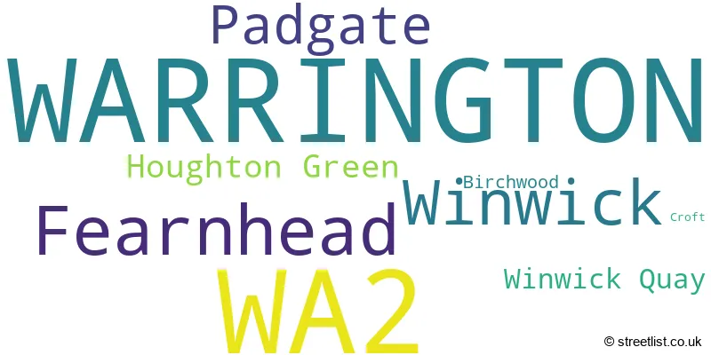
The largest settlement in the WA2 postal code is WARRINGTON followed by Fearnhead, and Padgate.
The WA2 Postcode shares a border with WA1 (WARRINGTON, Woolston, Padgate), WA5 (Great Sankey, WARRINGTON, Penketh) and WA12 (NEWTON-LE-WILLOWS).
The primary settlement in the WA2 postcode district is WARRINGTON, which is located in the county of Cheshire, England. Other significant settlements in the district include Birchwood, Croft, Fearnhead, Houghton Green, Padgate, and Winwick. The most significant postal town in the district is WARRINGTON.
For the district WA2, we have data on 4 postcode sectors. Here's a breakdown: The sector WA2 0, covers Fearnhead and Warrington and Padgate in Cheshire. The sector WA2 7, covers Warrington in Cheshire. The sector WA2 8, covers Warrington and Winwick in Cheshire. The sector WA2 9, covers Warrington in Cheshire.

Map of the WA2 Postcode District
Explore the WA2 postcode district by using our free interactive map.

When it comes to local government, postal geography often disregards political borders. However, for a breakdown in the WA2 District: the district mostly encompasses the Warrington (B) area with a total of 915 postcodes.
Recent House Sales in WA2
| Date | Price | Address |
|---|---|---|
| 20/10/2023 | £126,000 | Central Way, Warrington, WA2 7TB |
| 13/10/2023 | £135,000 | Gorsey Lane, Warrington, WA2 7RX |
| 06/10/2023 | £89,000 | Central Way, Warrington, WA2 7TG |
| 29/09/2023 | £124,000 | Central Way, Warrington, WA2 7TE |
| 28/09/2023 | £190,000 | Station Road South, Padgate, Warrington, WA2 0QS |
| 22/09/2023 | £118,000 | Central Way, Warrington, WA2 7TB |
| 22/09/2023 | £90,000 | Leonard Street, Warrington, WA2 7HA |
| 15/09/2023 | £212,500 | Hudson Road, Padgate, Warrington, WA2 0GP |
| 12/09/2023 | £325,000 | Coldstream Close, Warrington, WA2 0LJ |
| 11/09/2023 | £253,000 | Capesthorne Road, Orford, Warrington, WA2 9AW |
Weather Forecast for WA2
Press Button to Show Forecast for Warrington
| Time Period | Icon | Description | Temperature | Rain Probability | Wind |
|---|---|---|---|---|---|
| 09:00 to 12:00 | Cloudy | 8.0°C (feels like 5.0°C) | 49.00% | NW 11 mph | |
| 12:00 to 15:00 | Cloudy | 9.0°C (feels like 7.0°C) | 49.00% | NNW 7 mph | |
| 15:00 to 18:00 | Cloudy | 9.0°C (feels like 8.0°C) | 6.00% | NE 4 mph | |
| 18:00 to 21:00 | Cloudy | 9.0°C (feels like 8.0°C) | 10.00% | NNW 7 mph | |
| 21:00 to 00:00 | Cloudy | 7.0°C (feels like 5.0°C) | 6.00% | ENE 7 mph |
Press Button to Show Forecast for Warrington
| Time Period | Icon | Description | Temperature | Rain Probability | Wind |
|---|---|---|---|---|---|
| 00:00 to 03:00 | Cloudy | 5.0°C (feels like 3.0°C) | 4.00% | ENE 4 mph | |
| 03:00 to 06:00 | Partly cloudy (night) | 4.0°C (feels like 2.0°C) | 1.00% | ENE 4 mph | |
| 06:00 to 09:00 | Partly cloudy (day) | 4.0°C (feels like 2.0°C) | 1.00% | ENE 4 mph | |
| 09:00 to 12:00 | Cloudy | 7.0°C (feels like 6.0°C) | 5.00% | E 4 mph | |
| 12:00 to 15:00 | Cloudy | 9.0°C (feels like 9.0°C) | 9.00% | E 4 mph | |
| 15:00 to 18:00 | Cloudy | 10.0°C (feels like 10.0°C) | 7.00% | ENE 4 mph | |
| 18:00 to 21:00 | Cloudy | 10.0°C (feels like 9.0°C) | 7.00% | NE 4 mph | |
| 21:00 to 00:00 | Partly cloudy (night) | 6.0°C (feels like 4.0°C) | 4.00% | ENE 7 mph |
Press Button to Show Forecast for Warrington
| Time Period | Icon | Description | Temperature | Rain Probability | Wind |
|---|---|---|---|---|---|
| 00:00 to 03:00 | Partly cloudy (night) | 4.0°C (feels like 3.0°C) | 5.00% | ENE 4 mph | |
| 03:00 to 06:00 | Partly cloudy (night) | 4.0°C (feels like 2.0°C) | 6.00% | ENE 4 mph | |
| 06:00 to 09:00 | Partly cloudy (day) | 5.0°C (feels like 3.0°C) | 6.00% | ENE 4 mph | |
| 09:00 to 12:00 | Partly cloudy (day) | 8.0°C (feels like 7.0°C) | 5.00% | E 7 mph | |
| 12:00 to 15:00 | Overcast | 10.0°C (feels like 9.0°C) | 16.00% | E 7 mph | |
| 15:00 to 18:00 | Cloudy | 11.0°C (feels like 9.0°C) | 18.00% | ENE 9 mph | |
| 18:00 to 21:00 | Cloudy | 10.0°C (feels like 8.0°C) | 15.00% | ENE 9 mph | |
| 21:00 to 00:00 | Cloudy | 8.0°C (feels like 5.0°C) | 17.00% | NE 9 mph |
Press Button to Show Forecast for Warrington
| Time Period | Icon | Description | Temperature | Rain Probability | Wind |
|---|---|---|---|---|---|
| 00:00 to 03:00 | Cloudy | 6.0°C (feels like 4.0°C) | 16.00% | NE 9 mph | |
| 03:00 to 06:00 | Cloudy | 6.0°C (feels like 4.0°C) | 20.00% | NNE 9 mph | |
| 06:00 to 09:00 | Cloudy | 7.0°C (feels like 4.0°C) | 22.00% | NNE 9 mph | |
| 09:00 to 12:00 | Light rain | 8.0°C (feels like 5.0°C) | 51.00% | NNE 11 mph | |
| 12:00 to 15:00 | Heavy rain | 9.0°C (feels like 7.0°C) | 77.00% | N 11 mph | |
| 15:00 to 18:00 | Light rain | 10.0°C (feels like 7.0°C) | 57.00% | N 9 mph | |
| 18:00 to 21:00 | Cloudy | 10.0°C (feels like 8.0°C) | 18.00% | N 9 mph | |
| 21:00 to 00:00 | Clear night | 8.0°C (feels like 6.0°C) | 10.00% | NW 7 mph |
Where is the WA2 Postcode District?
The postcode district WA2 is located in Warrington. It is a district town in the North West of England. The nearby towns to Warrington are Newton-le-Willows, Lymm, Leigh, Widnes, Wigan, Prescot, and Altrincham. The distance from Warrington to London is approximately 168.03 miles.
The district is within the post town of WARRINGTON.
The sector has postcodes within the nation of England.
The WA2 Postcode District is covers the following regions.
- Warrington - Cheshire - North West (England)
- East Merseyside - Merseyside - North West (England)
| Postcode Sector | Delivery Office |
|---|---|
| WA2 0 | Warrington Delivery Office |
| WA2 7 | Warrington Delivery Office |
| WA2 8 | Warrington Delivery Office |
| WA2 9 | Warrington Delivery Office |
| W | A | 2 | - | X | X | X |
| W | A | 2 | Space | Numeric | Letter | Letter |
Current Monthly Rental Prices
| # Bedrooms | Min Price | Max Price | Avg Price |
|---|---|---|---|
| 1 | £485 | £625 | £555 |
| 2 | £550 | £1,300 | £879 |
| 3 | £875 | £1,150 | £989 |
| 4 | £1,200 | £1,350 | £1,275 |
Current House Prices
| # Bedrooms | Min Price | Max Price | Avg Price |
|---|---|---|---|
| £72,000 | £72,000 | £72,000 | |
| 1 | £80,000 | £150,000 | £104,286 |
| 2 | £42,000 | £370,000 | £164,122 |
| 3 | £125,000 | £550,000 | £234,508 |
| 4 | £200,000 | £825,000 | £366,360 |
| 5 | £200,000 | £730,000 | £509,091 |
| 6 | £270,000 | £980,000 | £508,333 |
Estate Agents who Operate in the WA2 District
| Logo | Name | Brand Name | Address | Contact Number | Total Properties |
|---|---|---|---|---|---|
 | Warrington | Ashtons Estate Agency | 146-148 Padgate Lane Padgate Warrington WA1 3SP | 01925 361690 | 44 |
 | Warrington | Lloyds Estate Agents | 181 Padgate Lane, Padgate, Warrington, WA1 3SW | 01925 470175 | 17 |
 | covering Warrington | Purplebricks | Suite 7 First Floor Cranmore Drive Shirley Solihull B90 4RZ | 020 3834 8353 | 15 |
 | Warrington | Entwistle Green | New Oxford House, 59 / 61 Sankey Street, Warrington, Cheshire, WA1 1SL | 01925 361677 | 15 |
 | Newton-le-Willows | Ashtons Estate Agency | 60 High Street Newton-Le-Willows Merseyside WA12 9SH | 01925 361662 | 12 |
| Type of Property | 2018 Average | 2018 Sales | 2017 Average | 2017 Sales | 2016 Average | 2016 Sales | 2015 Average | 2015 Sales |
|---|---|---|---|---|---|---|---|---|
| Detached | £275,608 | 85 | £261,432 | 87 | £265,368 | 79 | £231,841 | 82 |
| Semi-Detached | £150,695 | 161 | £135,754 | 180 | £137,087 | 196 | £129,005 | 140 |
| Terraced | £106,528 | 213 | £99,168 | 218 | £92,663 | 225 | £94,849 | 226 |
| Flats | £97,938 | 32 | £91,351 | 60 | £90,462 | 66 | £81,578 | 44 |