The WR4 postcode district is a postal district located in the WR Worcester postcode area with a population of 26,506 residents according to the 2021 England and Wales Census.
The area of the WR4 postcode district is 2.89 square miles which is 7.50 square kilometres or 1,852.58 acres.
Currently, the WR4 district has about 621 postcode units spread across 2 geographic postcode sectors.
Given that each sector allows for 400 unique postcode combinations, the district has a capacity of 800 postcodes. With 621 postcodes already in use, this leaves 179 units available.
The largest settlement in the WR4 postal code is WORCESTER followed by Lyppard Hanford, and Long Meadow.
The WR4 Postcode shares a border with WR5 (WORCESTER, Kempsey, Whittington) and WR3 (WORCESTER, Fernhill Heath, Claines).
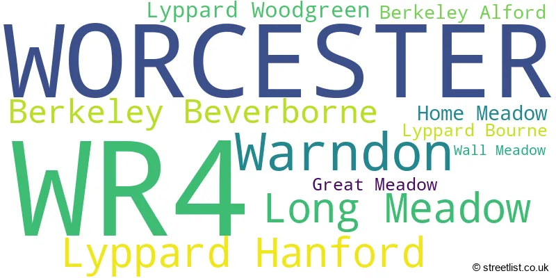
The primary settlement in the WR4 postcode district is Worcester in the county of Worcestershire, England. Other significant settlements in the district include Berkeley Alford, Berkeley Beverborne, Great Meadow, Home Meadow, Long Meadow, Lyppard Bourne, Lyppard Hanford, Lyppard Woodgreen, Wall Meadow, and Warndon. The most significant post town in the district is Worcester.
For the district WR4, we have data on 3 postcode sectors. Here's a breakdown: The sector WR4 0, covers Worcester in Worcestershire. The sector WR4 4 is non-geographic. It's often designated for PO Boxes, large organisations, or special services. The sector WR4 9, covers Worcester in Worcestershire.

Map of the WR4 Postcode District
Explore the WR4 postcode district by using our free interactive map.

When it comes to local government, postal geography often disregards political borders. However, for a breakdown in the WR4 District: the district mostly encompasses the Worcester District (B) (612 postcodes), and finally, the Wychavon District area (4 postcodes).
Recent House Sales in WR4
| Date | Price | Address |
|---|---|---|
| 09/10/2023 | £300,500 | Wilberforce Place, Worcester, WR4 0NJ |
| 06/10/2023 | £360,000 | Hornsby Avenue, Worcester, WR4 0PN |
| 05/10/2023 | £241,500 | Slade Avenue, Lyppard Hanford, Worcester, WR4 0HB |
| 03/10/2023 | £200,000 | Linden Road, Worcester, WR4 9RY |
| 25/09/2023 | £299,000 | Lyneham Close, Worcester, WR4 9YY |
| 01/09/2023 | £195,000 | Coney Green Close, Great Meadow, Worcester, WR4 0DT |
| 31/08/2023 | £207,000 | Pippen Field, Worcester, WR4 0LP |
| 24/08/2023 | £250,000 | Pippen Field, Worcester, WR4 0LP |
| 21/08/2023 | £226,000 | Peabody Avenue, Worcester, WR4 0QA |
| 18/08/2023 | £260,000 | Winchcombe Drive, Worcester, WR4 9XA |
Weather Forecast for WR4
Press Button to Show Forecast for Worcester
| Time Period | Icon | Description | Temperature | Rain Probability | Wind |
|---|---|---|---|---|---|
| 18:00 to 21:00 | Cloudy | 9.0°C (feels like 7.0°C) | 6.00% | NE 7 mph | |
| 21:00 to 00:00 | Cloudy | 7.0°C (feels like 6.0°C) | 4.00% | NE 4 mph |
Press Button to Show Forecast for Worcester
| Time Period | Icon | Description | Temperature | Rain Probability | Wind |
|---|---|---|---|---|---|
| 00:00 to 03:00 | Cloudy | 6.0°C (feels like 5.0°C) | 4.00% | ENE 4 mph | |
| 03:00 to 06:00 | Cloudy | 5.0°C (feels like 3.0°C) | 6.00% | ENE 4 mph | |
| 06:00 to 09:00 | Cloudy | 5.0°C (feels like 3.0°C) | 6.00% | ENE 4 mph | |
| 09:00 to 12:00 | Cloudy | 7.0°C (feels like 5.0°C) | 6.00% | E 7 mph | |
| 12:00 to 15:00 | Overcast | 10.0°C (feels like 9.0°C) | 12.00% | ENE 4 mph | |
| 15:00 to 18:00 | Overcast | 10.0°C (feels like 9.0°C) | 13.00% | E 4 mph | |
| 18:00 to 21:00 | Cloudy | 10.0°C (feels like 9.0°C) | 10.00% | E 4 mph | |
| 21:00 to 00:00 | Partly cloudy (night) | 6.0°C (feels like 4.0°C) | 9.00% | ENE 7 mph |
Press Button to Show Forecast for Worcester
| Time Period | Icon | Description | Temperature | Rain Probability | Wind |
|---|---|---|---|---|---|
| 00:00 to 03:00 | Partly cloudy (night) | 5.0°C (feels like 3.0°C) | 9.00% | ENE 7 mph | |
| 03:00 to 06:00 | Cloudy | 4.0°C (feels like 1.0°C) | 15.00% | NE 7 mph | |
| 06:00 to 09:00 | Overcast | 4.0°C (feels like 2.0°C) | 16.00% | NE 7 mph | |
| 09:00 to 12:00 | Overcast | 8.0°C (feels like 6.0°C) | 20.00% | ENE 9 mph | |
| 12:00 to 15:00 | Light rain | 10.0°C (feels like 8.0°C) | 48.00% | ENE 9 mph | |
| 15:00 to 18:00 | Overcast | 11.0°C (feels like 9.0°C) | 21.00% | ENE 9 mph | |
| 18:00 to 21:00 | Cloudy | 10.0°C (feels like 8.0°C) | 18.00% | ENE 9 mph | |
| 21:00 to 00:00 | Overcast | 8.0°C (feels like 6.0°C) | 23.00% | NE 11 mph |
Press Button to Show Forecast for Worcester
| Time Period | Icon | Description | Temperature | Rain Probability | Wind |
|---|---|---|---|---|---|
| 00:00 to 03:00 | Light rain | 7.0°C (feels like 4.0°C) | 50.00% | NNE 11 mph | |
| 03:00 to 06:00 | Heavy rain | 7.0°C (feels like 4.0°C) | 74.00% | NNE 11 mph | |
| 06:00 to 09:00 | Heavy rain | 7.0°C (feels like 4.0°C) | 75.00% | NNE 11 mph | |
| 09:00 to 12:00 | Heavy rain | 8.0°C (feels like 5.0°C) | 76.00% | NNW 11 mph | |
| 12:00 to 15:00 | Heavy rain | 9.0°C (feels like 6.0°C) | 72.00% | NNW 13 mph | |
| 15:00 to 18:00 | Light rain shower (day) | 10.0°C (feels like 8.0°C) | 42.00% | N 13 mph | |
| 18:00 to 21:00 | Light rain shower (day) | 10.0°C (feels like 8.0°C) | 37.00% | NNW 9 mph | |
| 21:00 to 00:00 | Clear night | 7.0°C (feels like 6.0°C) | 7.00% | NW 4 mph |
Where is the WR4 Postcode District?
The postcode district WR4 is located in the town of Worcester. Worcester is surrounded by several nearby towns, including Droitwich to the north, Pershore to the south-east, Malvern to the south-west, Bromsgrove to the north-east, and Alcester to the east. Additionally, Worcester is approximately 100.33 miles away from the centre of London.
The district is within the post town of WORCESTER.
The sector has postcodes within the nation of England.
The WR4 Postcode District is in the Worcestershire region of Herefordshire, Worcestershire and Warwickshire within the West Midlands (England).
| Postcode Sector | Delivery Office |
|---|---|
| WR4 0 | Worcester Apc |
| WR4 9 | Worcester Apc |
| W | R | 4 | - | X | X | X |
| W | R | 4 | Space | Numeric | Letter | Letter |
Current Monthly Rental Prices
| # Bedrooms | Min Price | Max Price | Avg Price |
|---|---|---|---|
| 1 | £750 | £775 | £758 |
| 2 | £795 | £895 | £845 |
| 3 | £1,150 | £1,150 | £1,150 |
| 4 | £1,500 | £1,500 | £1,500 |
Current House Prices
| # Bedrooms | Min Price | Max Price | Avg Price |
|---|---|---|---|
| £85,000 | £85,000 | £85,000 | |
| 1 | £75,000 | £180,000 | £111,071 |
| 2 | £115,000 | £240,000 | £173,333 |
| 3 | £140,000 | £370,000 | £251,538 |
| 4 | £325,000 | £450,000 | £393,750 |
| 5 | £350,000 | £650,000 | £475,000 |
Estate Agents who Operate in the WR4 District
| Logo | Name | Brand Name | Address | Contact Number | Total Properties |
|---|---|---|---|---|---|
 | Warndon Villages | Connells | 3 Lyppard Grange, Ankerage Green, The Lyppards, Warndon Villages, Worcestershire, WR4 0DZ | 01905 674628 | 22 |
 | Worcester | The Property Centre | 292 Tolladine Road, Worcester, WR4 9BA | 01905 917025 | 18 |
 | Worcester | Allan Morris Worcester | 32 Sidbury, Worcester, WR1 2HZ | 01905 917024 | 7 |
 | Worcester | Philip Laney & Jolly | 30 College Street, Worcester, WR1 2LS | 01905 26664 | 5 |
 | Worcester | Shelton & Lines | 37 Droitwich Road, Worcester, WR3 7LG | 01905 672222 | 5 |
| Type of Property | 2018 Average | 2018 Sales | 2017 Average | 2017 Sales | 2016 Average | 2016 Sales | 2015 Average | 2015 Sales |
|---|---|---|---|---|---|---|---|---|
| Detached | £291,659 | 107 | £284,425 | 113 | £260,691 | 115 | £251,750 | 122 |
| Semi-Detached | £180,870 | 124 | £171,859 | 125 | £163,717 | 123 | £152,282 | 108 |
| Terraced | £171,114 | 109 | £164,978 | 97 | £156,290 | 107 | £147,996 | 106 |
| Flats | £99,167 | 36 | £92,664 | 29 | £96,988 | 102 | £86,485 | 33 |