The WS13 postcode district is a postal district located in the WS Walsall postcode area with a population of 29,131 residents according to the 2021 England and Wales Census.
The area of the WS13 postcode district is 24.63 square miles which is 63.78 square kilometres or 15,761.44 acres.
Currently, the WS13 district has about 852 postcode units spread across 3 geographic postcode sectors.
Given that each sector allows for 400 unique postcode combinations, the district has a capacity of 1,200 postcodes. With 852 postcodes already in use, this leaves 348 units available.
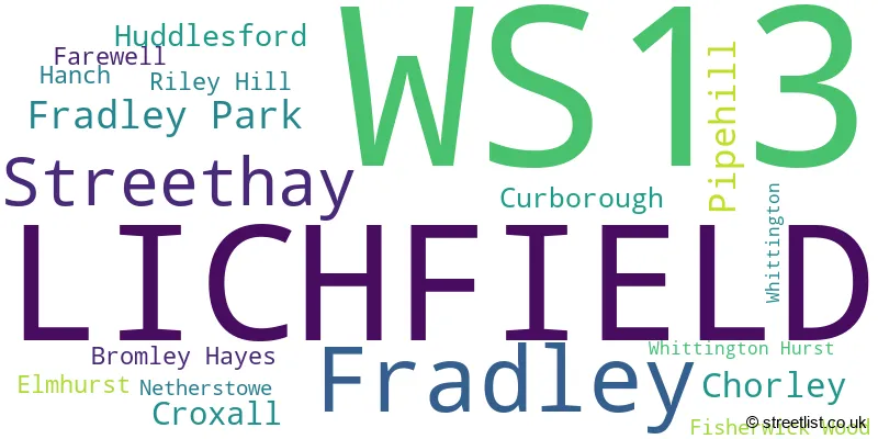
The largest settlement in the WS13 postal code is LICHFIELD followed by Fradley, and Streethay.
The WS13 Postcode shares a border with B79 (TAMWORTH, Warton, Elford), WS15 (RUGELEY, Brereton, Abbots Bromley), DE13 (BURTON-ON-TRENT, Stretton, Barton Under Needwood), WS14 (LICHFIELD, Shenstone, Whittington) and WS7 (BURNTWOOD, Chase Terrace, Chasetown).
The primary settlement in the WS13 postcode district is Lichfield, located in the county of Staffordshire in England. Other significant settlements within the WS13 district include Bromley Hayes, Chorley, Croxall, Curborough, Elmhurst, Farewell, Fisherwick Wood, Fradley, Fradley Park, Hanch, Huddlesford, Netherstowe, Pipehill, Riley Hill, Streethay, Whittington, and Whittington Hurst. Lichfield is the most significant post town within the WS13 district.
For the district WS13, we have data on 3 postcode sectors. Here's a breakdown: The sector WS13 6, covers Lichfield in Staffordshire. The sector WS13 7, covers Lichfield in Staffordshire. The sector WS13 8, covers Lichfield and Fradley and Streethay in Staffordshire.

Map of the WS13 Postcode District
Explore the WS13 postcode district by using our free interactive map.

When it comes to local government, postal geography often disregards political borders. However, for a breakdown in the WS13 District: the district mostly encompasses the Lichfield District area with a total of 889 postcodes.
Recent House Sales in WS13
| Date | Price | Address |
|---|---|---|
| 09/10/2023 | £96,500 | Wade Street, Lichfield, WS13 6HL |
| 29/09/2023 | £75,000 | Castle Dyke, Lichfield, WS13 6XD |
| 29/09/2023 | £145,000 | Lower Sandford Street, Lichfield, WS13 6QY |
| 29/09/2023 | £210,000 | Dyott Close, Lichfield, WS13 8LG |
| 28/09/2023 | £155,500 | Stychbrook Gardens, Lichfield, WS13 7NP |
| 27/09/2023 | £292,000 | Swan Road, Lichfield, WS13 6QZ |
| 18/09/2023 | £81,500 | Castle Dyke, Lichfield, WS13 6XD |
| 15/09/2023 | £286,500 | Marshall Road, Lichfield, WS13 6UP |
| 15/09/2023 | £300,000 | Wolsey Road, Lichfield, WS13 7QH |
| 11/09/2023 | £423,000 | Greenhough Road, Lichfield, WS13 7FE |
Weather Forecast for WS13
Press Button to Show Forecast for Lichfield
| Time Period | Icon | Description | Temperature | Rain Probability | Wind |
|---|---|---|---|---|---|
| 06:00 to 09:00 | Cloudy | 5.0°C (feels like 3.0°C) | 4.00% | N 7 mph | |
| 09:00 to 12:00 | Cloudy | 7.0°C (feels like 5.0°C) | 3.00% | N 9 mph | |
| 12:00 to 15:00 | Cloudy | 10.0°C (feels like 8.0°C) | 3.00% | N 9 mph | |
| 15:00 to 18:00 | Cloudy | 11.0°C (feels like 9.0°C) | 4.00% | N 9 mph | |
| 18:00 to 21:00 | Cloudy | 10.0°C (feels like 9.0°C) | 4.00% | N 7 mph | |
| 21:00 to 00:00 | Partly cloudy (night) | 7.0°C (feels like 5.0°C) | 1.00% | NNW 4 mph |
Press Button to Show Forecast for Lichfield
| Time Period | Icon | Description | Temperature | Rain Probability | Wind |
|---|---|---|---|---|---|
| 00:00 to 03:00 | Partly cloudy (night) | 5.0°C (feels like 4.0°C) | 1.00% | W 4 mph | |
| 03:00 to 06:00 | Cloudy | 5.0°C (feels like 2.0°C) | 4.00% | W 7 mph | |
| 06:00 to 09:00 | Cloudy | 5.0°C (feels like 2.0°C) | 5.00% | W 7 mph | |
| 09:00 to 12:00 | Cloudy | 8.0°C (feels like 5.0°C) | 7.00% | WNW 9 mph | |
| 12:00 to 15:00 | Cloudy | 10.0°C (feels like 8.0°C) | 9.00% | NW 9 mph | |
| 15:00 to 18:00 | Cloudy | 11.0°C (feels like 9.0°C) | 8.00% | NW 9 mph | |
| 18:00 to 21:00 | Cloudy | 10.0°C (feels like 8.0°C) | 6.00% | N 7 mph | |
| 21:00 to 00:00 | Cloudy | 7.0°C (feels like 6.0°C) | 7.00% | NE 4 mph |
Press Button to Show Forecast for Lichfield
| Time Period | Icon | Description | Temperature | Rain Probability | Wind |
|---|---|---|---|---|---|
| 00:00 to 03:00 | Cloudy | 6.0°C (feels like 4.0°C) | 7.00% | ENE 4 mph | |
| 03:00 to 06:00 | Cloudy | 5.0°C (feels like 3.0°C) | 8.00% | ENE 4 mph | |
| 06:00 to 09:00 | Cloudy | 5.0°C (feels like 2.0°C) | 8.00% | ENE 4 mph | |
| 09:00 to 12:00 | Cloudy | 7.0°C (feels like 5.0°C) | 13.00% | E 7 mph | |
| 12:00 to 15:00 | Overcast | 9.0°C (feels like 8.0°C) | 17.00% | ESE 7 mph | |
| 15:00 to 18:00 | Overcast | 10.0°C (feels like 8.0°C) | 17.00% | E 7 mph | |
| 18:00 to 21:00 | Cloudy | 9.0°C (feels like 7.0°C) | 19.00% | E 9 mph | |
| 21:00 to 00:00 | Cloudy | 8.0°C (feels like 6.0°C) | 22.00% | E 7 mph |
Press Button to Show Forecast for Lichfield
| Time Period | Icon | Description | Temperature | Rain Probability | Wind |
|---|---|---|---|---|---|
| 00:00 to 03:00 | Cloudy | 7.0°C (feels like 4.0°C) | 22.00% | E 7 mph | |
| 03:00 to 06:00 | Light rain | 6.0°C (feels like 4.0°C) | 48.00% | E 7 mph | |
| 06:00 to 09:00 | Cloudy | 6.0°C (feels like 4.0°C) | 22.00% | E 7 mph | |
| 09:00 to 12:00 | Cloudy | 8.0°C (feels like 6.0°C) | 17.00% | E 9 mph | |
| 12:00 to 15:00 | Cloudy | 11.0°C (feels like 8.0°C) | 19.00% | E 9 mph | |
| 15:00 to 18:00 | Cloudy | 11.0°C (feels like 9.0°C) | 20.00% | E 9 mph | |
| 18:00 to 21:00 | Cloudy | 11.0°C (feels like 9.0°C) | 16.00% | ENE 9 mph | |
| 21:00 to 00:00 | Light rain | 9.0°C (feels like 7.0°C) | 44.00% | NE 9 mph |
Where is the WS13 Postcode District?
The postcode district for WS13 is located in the town of Lichfield. Lichfield is surrounded by several nearby towns, including Burntwood to the West (5.12 miles away), Tamworth to the South East (6.32 miles away), Rugeley to the North West (6.62 miles away), Walsall to the South West (9.25 miles away), Sutton Coldfield to the South (9.30 miles away), Burton-on-Trent to the North East (10.06 miles away), and Swadlincote to the East (11.05 miles away). Additionally, the distance from the WS13 postcode district to the center of London is 109.01 miles.
The district is within the post town of LICHFIELD.
The sector has postcodes within the nation of England.
The WS13 Postcode District is in the Staffordshire CC region of Shropshire and Staffordshire within the West Midlands (England).
| Postcode Sector | Delivery Office |
|---|---|
| WS13 6 | Lichfield Delivery Office |
| WS13 7 | Lichfield Delivery Office |
| WS13 8 | Lichfield Delivery Office |
| W | S | 1 | 3 | - | X | X | X |
| W | S | 1 | 3 | Space | Numeric | Letter | Letter |
Tourist Attractions within the Postcode Area
We found 3 visitor attractions within the WS13 postcode area
| Beacon Park |
|---|
| Country Parks |
| Country Park |
| View Beacon Park on Google Maps |
| Erasmus Darwin House |
| Historic Properties |
| Historic House / House and Garden / Palace |
| View Erasmus Darwin House on Google Maps |
| Samuel Johnson Birthplace Museum & Bookshop |
| Museums & Art Galleries |
| Museum and / or Art Gallery |
| View Samuel Johnson Birthplace Museum & Bookshop on Google Maps |
Current Monthly Rental Prices
| # Bedrooms | Min Price | Max Price | Avg Price |
|---|---|---|---|
| £625 | £625 | £625 | |
| 1 | £425 | £1,754 | £864 |
| 2 | £775 | £2,297 | £1,203 |
| 3 | £925 | £1,800 | £1,400 |
| 4 | £1,500 | £2,000 | £1,800 |
| 5 | £1,300 | £2,250 | £1,775 |
Current House Prices
| # Bedrooms | Min Price | Max Price | Avg Price |
|---|---|---|---|
| £5,000 | £45,000 | £25,000 | |
| 1 | £52,500 | £350,000 | £172,598 |
| 2 | £95,000 | £650,000 | £268,151 |
| 3 | £160,000 | £950,000 | £345,491 |
| 4 | £250,000 | £1,250,000 | £509,591 |
| 5 | £310,000 | £1,700,000 | £691,000 |
| 6 | £525,000 | £525,000 | £525,000 |
| 7 | £975,000 | £975,000 | £975,000 |
| 10 | £1,600,000 | £1,600,000 | £1,600,000 |
Estate Agents who Operate in the WS13 District
| Logo | Name | Brand Name | Address | Contact Number | Total Properties |
|---|---|---|---|---|---|
 | Lichfield | Andrew Downing-Booth Estate Agents | 6-8 City Arcade, Lichfield, WS13 6LY | 01543 395668 | 40 |
 | Lichfield | Connells | 11-13 Bore Street Lichfield WS13 6LZ | 01543 228273 | 28 |
 | Lichfield | Bill Tandy & Co | 3 Bore Street, Lichfield, WS13 6LJ | 01543 228321 | 20 |
 | Lichfield | Dixons | 9 Bore Street, Lichfield, Staffordshire, WS13 6lj | 01543 395699 | 20 |
 | Lichfield | John German | 22 Bore Street Lichfield WS13 6LL | 01543 414323 | 17 |
| Type of Property | 2018 Average | 2018 Sales | 2017 Average | 2017 Sales | 2016 Average | 2016 Sales | 2015 Average | 2015 Sales |
|---|---|---|---|---|---|---|---|---|
| Detached | £394,742 | 243 | £381,733 | 199 | £362,691 | 125 | £354,368 | 126 |
| Semi-Detached | £249,209 | 186 | £234,373 | 146 | £226,816 | 108 | £208,841 | 79 |
| Terraced | £218,990 | 145 | £201,239 | 137 | £207,630 | 127 | £201,238 | 129 |
| Flats | £189,164 | 138 | £202,345 | 135 | £146,662 | 123 | £137,847 | 101 |