The WS3 postcode district is a postal district located in the WS Walsall postcode area with a population of 53,257 residents according to the 2021 England and Wales Census.
The area of the WS3 postcode district is 8.15 square miles which is 21.10 square kilometres or 5,213.38 acres.
Currently, the WS3 district has about 980 postcode units spread across 5 geographic postcode sectors.
Given that each sector allows for 400 unique postcode combinations, the district has a capacity of 2,000 postcodes. With 980 postcodes already in use, this leaves 1020 units available.
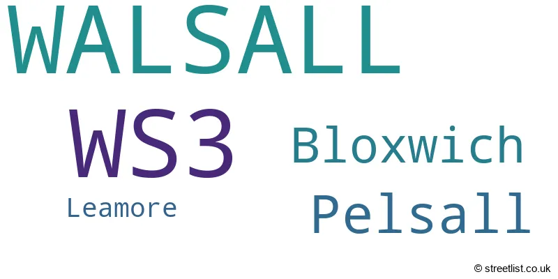
The largest settlement in the WS3 postal code is WALSALL followed by Pelsall, and Bloxwich.
The WS3 Postcode shares a border with WS11 (CANNOCK, Norton Canes, Churchbridge), WS2 (WALSALL, Bentley), WS6 (WALSALL, Great Wyrley, Cheslyn Hay), WV11 (WOLVERHAMPTON, Essington, Wednesfield), WS4 (WALSALL, Rushall, Shelfield) and WS9 (WALSALL, Aldridge, Walsall Wood).
The primary settlement in the WS3 postcode district is Walsall, located in the county of West Midlands, England. Other significant settlements include Bloxwich and Leamore. The most significant post town in the district is Walsall.
For the district WS3, we have data on 5 postcode sectors. Here's a breakdown: The sector WS3 1, covers Walsall in West Midlands. The sector WS3 2, covers Walsall and Bloxwich in West Midlands. The sector WS3 3, covers Walsall and Bloxwich in West Midlands. The sector WS3 4, covers Walsall and Pelsall in West Midlands. The sector WS3 5, covers Walsall and Pelsall in West Midlands. The sector WS3 5, covers Walsall in Staffordshire.

Map of the WS3 Postcode District
Explore the WS3 postcode district by using our free interactive map.

When it comes to local government, postal geography often disregards political borders. However, for a breakdown in the WS3 District: the district mostly encompasses the Walsall District (B) (983 postcodes), and finally, the Cannock Chase District area (10 postcodes).
Recent House Sales in WS3
| Date | Price | Address |
|---|---|---|
| 27/10/2023 | £70,000 | Rockingham Close, Walsall, WS3 2JB |
| 20/10/2023 | £100,000 | Cope Street, Walsall, WS3 2AT |
| 17/10/2023 | £217,500 | Chapel Street, Pelsall, Walsall, WS3 4LN |
| 13/10/2023 | £140,000 | Central Drive, Walsall, WS3 2QH |
| 13/10/2023 | £275,000 | Almond Close, Walsall, WS3 4LA |
| 29/09/2023 | £179,000 | Lichfield Road, Bloxwich, Walsall, WS3 3DF |
| 29/09/2023 | £310,000 | Broad Lane, Walsall, WS3 2TG |
| 21/09/2023 | £96,000 | Wolverhampton Road, Bloxwich, Walsall, WS3 2EZ |
| 08/09/2023 | £450,000 | Ganton Road, Walsall, WS3 3XQ |
| 07/09/2023 | £200,000 | Ashtree Road, Walsall, WS3 4LS |
Weather Forecast for WS3
Press Button to Show Forecast for Pelsall
| Time Period | Icon | Description | Temperature | Rain Probability | Wind |
|---|---|---|---|---|---|
| 15:00 to 18:00 | Light rain | 8.0°C (feels like 6.0°C) | 48.00% | NNE 7 mph | |
| 18:00 to 21:00 | Cloudy | 7.0°C (feels like 6.0°C) | 30.00% | ENE 4 mph | |
| 21:00 to 00:00 | Cloudy | 6.0°C (feels like 4.0°C) | 5.00% | ENE 4 mph |
Press Button to Show Forecast for Pelsall
| Time Period | Icon | Description | Temperature | Rain Probability | Wind |
|---|---|---|---|---|---|
| 00:00 to 03:00 | Cloudy | 4.0°C (feels like 2.0°C) | 6.00% | ENE 4 mph | |
| 03:00 to 06:00 | Cloudy | 3.0°C (feels like 1.0°C) | 4.00% | ENE 4 mph | |
| 06:00 to 09:00 | Partly cloudy (day) | 3.0°C (feels like 0.0°C) | 1.00% | ENE 4 mph | |
| 09:00 to 12:00 | Cloudy | 6.0°C (feels like 4.0°C) | 6.00% | ENE 7 mph | |
| 12:00 to 15:00 | Overcast | 8.0°C (feels like 7.0°C) | 10.00% | ENE 4 mph | |
| 15:00 to 18:00 | Cloudy | 9.0°C (feels like 8.0°C) | 9.00% | ENE 4 mph | |
| 18:00 to 21:00 | Cloudy | 9.0°C (feels like 7.0°C) | 9.00% | ENE 4 mph | |
| 21:00 to 00:00 | Cloudy | 5.0°C (feels like 3.0°C) | 10.00% | E 7 mph |
Press Button to Show Forecast for Pelsall
| Time Period | Icon | Description | Temperature | Rain Probability | Wind |
|---|---|---|---|---|---|
| 00:00 to 03:00 | Partly cloudy (night) | 3.0°C (feels like 1.0°C) | 8.00% | ENE 7 mph | |
| 03:00 to 06:00 | Cloudy | 3.0°C (feels like 0.0°C) | 11.00% | ENE 7 mph | |
| 06:00 to 09:00 | Cloudy | 4.0°C (feels like 1.0°C) | 10.00% | ENE 7 mph | |
| 09:00 to 12:00 | Cloudy | 7.0°C (feels like 4.0°C) | 15.00% | ENE 9 mph | |
| 12:00 to 15:00 | Overcast | 9.0°C (feels like 7.0°C) | 21.00% | E 9 mph | |
| 15:00 to 18:00 | Overcast | 10.0°C (feels like 7.0°C) | 23.00% | ENE 9 mph | |
| 18:00 to 21:00 | Cloudy | 9.0°C (feels like 7.0°C) | 18.00% | ENE 9 mph | |
| 21:00 to 00:00 | Cloudy | 7.0°C (feels like 4.0°C) | 19.00% | NE 11 mph |
Press Button to Show Forecast for Pelsall
| Time Period | Icon | Description | Temperature | Rain Probability | Wind |
|---|---|---|---|---|---|
| 00:00 to 03:00 | Cloudy | 6.0°C (feels like 3.0°C) | 18.00% | NE 11 mph | |
| 03:00 to 06:00 | Light rain | 6.0°C (feels like 3.0°C) | 51.00% | NE 11 mph | |
| 06:00 to 09:00 | Heavy rain | 6.0°C (feels like 3.0°C) | 77.00% | NNE 11 mph | |
| 09:00 to 12:00 | Light rain | 7.0°C (feels like 4.0°C) | 56.00% | NNE 9 mph | |
| 12:00 to 15:00 | Light rain | 9.0°C (feels like 6.0°C) | 55.00% | N 11 mph | |
| 15:00 to 18:00 | Light rain | 9.0°C (feels like 6.0°C) | 55.00% | N 11 mph | |
| 18:00 to 21:00 | Light rain shower (day) | 9.0°C (feels like 7.0°C) | 39.00% | N 9 mph | |
| 21:00 to 00:00 | Partly cloudy (night) | 7.0°C (feels like 5.0°C) | 11.00% | N 7 mph |
Where is the WS3 Postcode District?
The postcode district for WS3 is located in Walsall. This district is nearby several towns, including Willenhall to the South West, Burntwood to the North East, Cannock to the North, Wednesbury to the South, Wolverhampton to the West, and Sutton Coldfield to the South East. In addition, WS3 is approximately 110.77 miles away from the center of London.
The district is within the post town of WALSALL.
The sector has postcodes within the nation of England.
The WS3 Postcode District is covers the following regions.
- Walsall - West Midlands - West Midlands (England)
- Staffordshire CC - Shropshire and Staffordshire - West Midlands (England)
| Postcode Sector | Delivery Office |
|---|---|
| WS3 1 | Walsall Delivery Office |
| WS3 2 | Walsall Delivery Office |
| WS3 3 | Walsall Delivery Office |
| WS3 4 | Walsall Delivery Office |
| WS3 5 | Walsall Delivery Office |
| W | S | 3 | - | X | X | X |
| W | S | 3 | Space | Numeric | Letter | Letter |
Current Monthly Rental Prices
| # Bedrooms | Min Price | Max Price | Avg Price |
|---|---|---|---|
| 1 | £500 | £675 | £567 |
| 3 | £950 | £1,000 | £982 |
| 4 | £1,050 | £1,050 | £1,050 |
| 5 | £2,300 | £2,300 | £2,300 |
| 9 | £5,400 | £5,400 | £5,400 |
Current House Prices
| # Bedrooms | Min Price | Max Price | Avg Price |
|---|---|---|---|
| £150,000 | £230,000 | £190,000 | |
| 1 | £35,000 | £112,500 | £76,383 |
| 2 | £75,000 | £390,000 | £191,788 |
| 3 | £130,000 | £580,000 | £243,895 |
| 4 | £167,500 | £530,000 | £340,017 |
| 5 | £240,000 | £500,000 | £357,990 |
| 6 | £550,000 | £550,000 | £550,000 |
Estate Agents who Operate in the WS3 District
| Logo | Name | Brand Name | Address | Contact Number | Total Properties |
|---|---|---|---|---|---|
 | Walsall | Webbs Estate Agents | 212 High Street Bloxwich Walsall WS3 3LA | 01922 663399 | 50 |
 | Aldridge | Paul Carr | 5 High Street, Aldridge, Walsall, WS9 8LX | 01922 662062 | 29 |
 | Walsall | Connells | 57-61 Bridge Street, Walsall, Staffordshire, WS1 1JQ | 01922 662024 | 17 |
 | Bloxwich | Skitts Estate Agents | 3 Queens Parade, Walsall, WS3 2EX | 01922 662065 | 16 |
 | Covering West Midlands | Homewise | B46 1DL | 01273 092409 | 15 |
| Type of Property | 2018 Average | 2018 Sales | 2017 Average | 2017 Sales | 2016 Average | 2016 Sales | 2015 Average | 2015 Sales |
|---|---|---|---|---|---|---|---|---|
| Detached | £249,619 | 124 | £240,886 | 127 | £219,702 | 116 | £222,078 | 119 |
| Semi-Detached | £146,120 | 287 | £136,593 | 332 | £129,487 | 273 | £126,191 | 262 |
| Terraced | £122,728 | 228 | £115,201 | 203 | £110,527 | 257 | £102,990 | 192 |
| Flats | £94,705 | 37 | £107,183 | 53 | £83,273 | 31 | £74,255 | 29 |