The WS7 postcode district is a postal district located in the WS Walsall postcode area with a population of 30,204 residents according to the 2021 England and Wales Census.
The area of the WS7 postcode district is 7.66 square miles which is 19.83 square kilometres or 4,899.52 acres.
Currently, the WS7 district has about 660 postcode units spread across 6 geographic postcode sectors.
Given that each sector allows for 400 unique postcode combinations, the district has a capacity of 2,400 postcodes. With 660 postcodes already in use, this leaves 1740 units available.
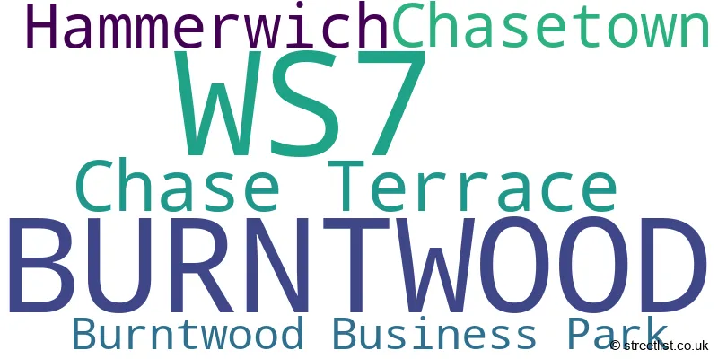
The largest settlement in the WS7 postal code is BURNTWOOD followed by Chase Terrace, and Chasetown.
The WS7 Postcode shares a border with WS12 (Hednesford, CANNOCK, Huntington), WS13 (LICHFIELD, Fradley, Streethay) and WS15 (RUGELEY, Brereton, Abbots Bromley).
The primary settlement in the WS7 postcode district is Burntwood, located in the county of Staffordshire, England. Other significant settlements in the district include Hammerwich, Chase Terrace, and Chasetown. The most significant post town in the district is Burntwood.
For the district WS7, we have data on 6 postcode sectors. Here's a breakdown: The sector WS7 0, covers Burntwood and Hammerwich in Staffordshire. The sector WS7 1, covers Burntwood and Chase Terrace in Staffordshire. The sector WS7 2, covers Burntwood in Staffordshire. The sector WS7 3, covers Burntwood and Chasetown and Burntwood Business Park in Staffordshire. The sector WS7 4, covers Burntwood in Staffordshire. The sector WS7 9, covers Burntwood in Staffordshire.

Map of the WS7 Postcode District
Explore the WS7 postcode district by using our free interactive map.

When it comes to local government, postal geography often disregards political borders. However, for a breakdown in the WS7 District: the district mostly encompasses the Lichfield District area with a total of 668 postcodes.
Recent House Sales in WS7
| Date | Price | Address |
|---|---|---|
| 22/09/2023 | £192,000 | Ferndale Close, Burntwood, WS7 4US |
| 15/09/2023 | £247,450 | Gough Lane, Burntwood, WS7 3RS |
| 07/09/2023 | £137,000 | Collis Close, Burntwood, WS7 3RQ |
| 01/09/2023 | £350,000 | Cross Street, Burntwood, WS7 1AP |
| 01/09/2023 | £256,500 | Derry Drive, Burntwood, WS7 3AF |
| 01/09/2023 | £185,000 | Nailers Drive, Burntwood, WS7 0ES |
| 01/09/2023 | £700,000 | Highfields Road, Chasetown, Burntwood, WS7 4QU |
| 01/09/2023 | £345,000 | Manifold Close, Burntwood, WS7 9JR |
| 01/09/2023 | £275,000 | Eastwood Avenue, Burntwood, WS7 2DX |
| 31/08/2023 | £300,000 | Knoll Close, Burntwood, WS7 4TD |
Weather Forecast for WS7
Press Button to Show Forecast for Brownhills
| Time Period | Icon | Description | Temperature | Rain Probability | Wind |
|---|---|---|---|---|---|
| 03:00 to 06:00 | Light rain | 8.0°C (feels like 5.0°C) | 54.00% | WNW 13 mph | |
| 06:00 to 09:00 | Cloudy | 8.0°C (feels like 5.0°C) | 17.00% | NW 13 mph | |
| 09:00 to 12:00 | Light rain shower (day) | 9.0°C (feels like 5.0°C) | 41.00% | NW 18 mph | |
| 12:00 to 15:00 | Cloudy | 11.0°C (feels like 7.0°C) | 17.00% | NW 18 mph | |
| 15:00 to 18:00 | Cloudy | 10.0°C (feels like 7.0°C) | 49.00% | NNW 16 mph | |
| 18:00 to 21:00 | Light rain shower (day) | 9.0°C (feels like 6.0°C) | 36.00% | N 9 mph | |
| 21:00 to 00:00 | Cloudy | 6.0°C (feels like 4.0°C) | 5.00% | NE 7 mph |
Press Button to Show Forecast for Brownhills
| Time Period | Icon | Description | Temperature | Rain Probability | Wind |
|---|---|---|---|---|---|
| 00:00 to 03:00 | Partly cloudy (night) | 4.0°C (feels like 2.0°C) | 1.00% | NNE 4 mph | |
| 03:00 to 06:00 | Clear night | 3.0°C (feels like 1.0°C) | 1.00% | NNW 4 mph | |
| 06:00 to 09:00 | Partly cloudy (day) | 3.0°C (feels like 0.0°C) | 1.00% | NNW 7 mph | |
| 09:00 to 12:00 | Sunny day | 7.0°C (feels like 4.0°C) | 1.00% | N 7 mph | |
| 12:00 to 15:00 | Overcast | 10.0°C (feels like 8.0°C) | 8.00% | N 9 mph | |
| 15:00 to 18:00 | Overcast | 10.0°C (feels like 9.0°C) | 8.00% | N 7 mph | |
| 18:00 to 21:00 | Overcast | 10.0°C (feels like 9.0°C) | 9.00% | NNE 4 mph | |
| 21:00 to 00:00 | Partly cloudy (night) | 6.0°C (feels like 5.0°C) | 2.00% | NE 4 mph |
Press Button to Show Forecast for Brownhills
| Time Period | Icon | Description | Temperature | Rain Probability | Wind |
|---|---|---|---|---|---|
| 00:00 to 03:00 | Clear night | 4.0°C (feels like 3.0°C) | 1.00% | NE 4 mph | |
| 03:00 to 06:00 | Clear night | 3.0°C (feels like 2.0°C) | 1.00% | NNW 4 mph | |
| 06:00 to 09:00 | Cloudy | 4.0°C (feels like 2.0°C) | 5.00% | NW 4 mph | |
| 09:00 to 12:00 | Overcast | 8.0°C (feels like 6.0°C) | 10.00% | N 4 mph | |
| 12:00 to 15:00 | Cloudy | 10.0°C (feels like 8.0°C) | 9.00% | NNE 9 mph | |
| 15:00 to 18:00 | Overcast | 10.0°C (feels like 8.0°C) | 11.00% | NE 9 mph | |
| 18:00 to 21:00 | Partly cloudy (day) | 9.0°C (feels like 8.0°C) | 3.00% | NE 9 mph | |
| 21:00 to 00:00 | Partly cloudy (night) | 6.0°C (feels like 4.0°C) | 3.00% | NE 7 mph |
Press Button to Show Forecast for Brownhills
| Time Period | Icon | Description | Temperature | Rain Probability | Wind |
|---|---|---|---|---|---|
| 00:00 to 03:00 | Cloudy | 4.0°C (feels like 2.0°C) | 6.00% | NE 7 mph | |
| 03:00 to 06:00 | Partly cloudy (night) | 3.0°C (feels like 1.0°C) | 3.00% | NNE 4 mph | |
| 06:00 to 09:00 | Partly cloudy (day) | 4.0°C (feels like 2.0°C) | 3.00% | NNE 4 mph | |
| 09:00 to 12:00 | Cloudy | 7.0°C (feels like 6.0°C) | 7.00% | NE 7 mph | |
| 12:00 to 15:00 | Cloudy | 9.0°C (feels like 7.0°C) | 12.00% | ENE 7 mph | |
| 15:00 to 18:00 | Cloudy | 9.0°C (feels like 7.0°C) | 10.00% | ENE 7 mph | |
| 18:00 to 21:00 | Cloudy | 8.0°C (feels like 6.0°C) | 8.00% | ENE 7 mph | |
| 21:00 to 00:00 | Cloudy | 7.0°C (feels like 5.0°C) | 7.00% | ENE 7 mph |
Where is the WS7 Postcode District?
The postcode district WS7 is located in Burntwood. It is situated near several towns. To the east, there is Lichfield, which is approximately 4.2 miles away. To the west lies Cannock, which is around 4.3 miles away. Walsall is located to the southwest, with a distance of about 4.8 miles. Rugeley is situated to the north, approximately 6.2 miles away. Lastly, to the southeast, there is Sutton Coldfield, which is about 8.2 miles away. Additionally, the postcode district WS7 is located approximately 111 miles away from the center of London.
The district is within the post town of BURNTWOOD.
The sector has postcodes within the nation of England.
The WS7 Postcode District is in the Staffordshire CC region of Shropshire and Staffordshire within the West Midlands (England).
| Postcode Sector | Delivery Office |
|---|---|
| WS7 0 | Lichfield Delivery Office |
| WS7 1 | Lichfield Delivery Office |
| WS7 2 | Lichfield Delivery Office |
| WS7 3 | Lichfield Delivery Office |
| WS7 4 | Lichfield Delivery Office |
| WS7 9 | Lichfield Delivery Office |
| W | S | 7 | - | X | X | X |
| W | S | 7 | Space | Numeric | Letter | Letter |
Current Monthly Rental Prices
| # Bedrooms | Min Price | Max Price | Avg Price |
|---|---|---|---|
| 1 | £500 | £750 | £638 |
| 2 | £725 | £725 | £725 |
| 3 | £895 | £1,295 | £1,012 |
Current House Prices
| # Bedrooms | Min Price | Max Price | Avg Price |
|---|---|---|---|
| £450,000 | £450,000 | £450,000 | |
| 1 | £87,000 | £190,000 | £129,250 |
| 2 | £100,500 | £450,000 | £244,894 |
| 3 | £124,000 | £425,000 | £256,819 |
| 4 | £217,750 | £750,000 | £406,464 |
| 5 | £440,000 | £750,000 | £595,613 |
| 6 | £550,000 | £550,000 | £550,000 |
Estate Agents who Operate in the WS7 District
| Logo | Name | Brand Name | Address | Contact Number | Total Properties |
|---|---|---|---|---|---|
 | Lichfield | Lovett&Co. Estate Agents | Unit 3 Boley Park Centre Ryknild Street Lichfield WS14 9XU | 01543 228310 | 43 |
 | Burntwood | Paul Carr | 1 Lichfield Road, Burntwood, WS7 0HQ | 01543 222322 | 32 |
 | Burntwood | Bill Tandy & Co | 16 Cannock Road, Burntwood, WS7 0BJ | 01543 222249 | 24 |
 | Burntwood | Chariot Estates | 9A Cannock Road, Chase Terrace, Burntwood, WS7 1JS | 01543 228294 | 21 |
 | Covering West Midlands | Homewise | B46 1DL | 01273 092409 | 14 |
| Type of Property | 2018 Average | 2018 Sales | 2017 Average | 2017 Sales | 2016 Average | 2016 Sales | 2015 Average | 2015 Sales |
|---|---|---|---|---|---|---|---|---|
| Detached | £283,012 | 155 | £279,223 | 184 | £268,126 | 178 | £261,358 | 163 |
| Semi-Detached | £186,425 | 200 | £181,043 | 236 | £161,472 | 201 | £150,431 | 173 |
| Terraced | £160,378 | 138 | £150,994 | 122 | £145,906 | 139 | £135,344 | 113 |
| Flats | £114,338 | 46 | £120,580 | 18 | £113,875 | 39 | £102,163 | 15 |
Hotels within the Postcode Area
We found 1 hotels and guest houses within the WS7 postcode area