Map of Greenburn Drive
| Postcodes | ||
|---|---|---|
| Icon | Postcodes for Greenburn Drive | |
| Walking Distances | ||
| Distance Info | Green Circle = 10 Minutes Walk (800 metres) | |
About Greenburn Drive
Greenburn Drive is a street located in Aberdeen. The street has a length of approximately 1,063 metres.
Greenburn Drive is located within the Aberdeen City Council's jurisdiction. They provide various services, like refuse collection, and manage council tax collection. It's situated in the (pseudo) Scotland region of the UK.
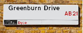
Greenburn Drive has the postcodes of AB21 9HB and AB21 9ER.
Greenburn Drive is located within the county of City of Aberdeen, situated in the (pseudo) Scotland region of the UK. It's 401.6 miles North from central London., 4.22 miles North West from Aberdeen, 58.26 miles North East from Dundee and 78.99 miles East from Inverness.
Greenburn Drive is within the Post Town of ABERDEEN.

Do you know why this road is called Greenburn Drive?
What's it like to live here?
Ask the community a question about Greenburn Drive.
Do you have any questions, memories to share or know any facts about Greenburn Drive? We'd love to know more.
Also on streetlist.co.uk, can you help?
Eldroth Road
15th April 2024
I wondered if anyone has any old pictures of Wenning Bank House in the 1940’s and also Lane Side before of the same era .. we visited today with my Mum in law as she used to live at both these properties. Also any photos of the schools around that time .. thank you.
Can You Help?Napps Way
15th April 2024
Why is the road called Napps Way (belonging to Napp, but minus an
apostrophe as is usual with such nomenclature)? Moreover, who or
what is, or was, “Napp” in the respective, possessive case?
Several years ago, I met an elderly man (probably in his late-eighties)
who lives on Bentham Drive, Liverpool 16, and during a conversation
with him whilst in a Northwest Passenger Transport Ambulance on the
way to the former RLUH (Royal Liverpool University Hospital), he told
me that he could remember (when he was a boy, living in Childwall,
Liverpool 16) that, “Where Napps Way is now, during WW2, there was
a two-man gun emplacement on the, then, open land to protect the
railway line passing over Childwall Valley Road - next to the railway
bridge - when suddenly, as they were loading a live “shell” into the gun’s
breach, the aforementioned “shell” accidentally exploded in the gun’s
breach killing both of the two soldiers, that had been manning the gun,
instantly! (Very sad, of course, but could - perhaps - two ghosts relating
to those two, very unfortunately and prematurely-killed soldiers have
haunted that place of their deaths ever since - and have any residents
of Napps Way - formerly and in its latest incarnation - seen two, WW2
(uniformed) soldiers unexpectedly appear in or near their homes?)
Mauritius Road
15th April 2024
Why is Mauritius Road so called, since when and by whom? Does Greenwich have any particular links with Mauritius? Very interested to know. 🤞🏼
Can You Help?Estate Agents near Greenburn Drive
| Name | Address | Website |
|---|---|---|
| Northwood | 207 - 211 Rosemount Place, Aberdeen, AB25 2XS | Visit Website |
| Aberdeen Property Leasing | 138 - 140 Rosemount Place, Aberdeen, AB25 2YU | Visit Website |
| Martin & Co | 123 Rosemount Place, Aberdeen, AB25 2YH | Visit Website |
Location Details
| Greenburn Drive | |
|---|---|

| |
| Latitude | 57.181525 |
| Longitude | -2.183136 |
| OS Easting (X): | 388930 |
| OS Northing (Y): | 810072 |
| OS Grid Reference: | NJ889101 |
Ordnance Survey Maps for Greenburn Drive
If you purchase a map through the links below, we may earn an affiliate commission.
| Map Series | link | Ordnance Survey |
| Explorer 1:25,000 406 Aberdeen & Banchory | Check Price on Amazon | Buy Direct from the Ordnance Survey |
| Landranger 1:50,000 38 Aberdeen | Check Price on Amazon | Buy Direct from the Ordnance Survey |
Neighbourhood Policing |
| Police Force: Scotland |
| Find a Local Neighbourhood Watch Scheme |
Frequently asked Questions for Greenburn Drive
What Council (Local Authority) is Greenburn Drive in?
Greenburn Drive is located within the local authority area of Aberdeen City Council which is a Scottish unitary authority.
What Parish Council is Greenburn Drive in?
Greenburn Drive is in an unparished area.
What Electoral Ward is Greenburn Drive in?
Greenburn Drive is located within the ward of Dyce/Bucksburn/Danestone.
What County is Greenburn Drive in?
Greenburn Drive is located within the ceremonial county of City of Aberdeen.
What Constituency is Greenburn Drive in?
Greenburn Drive is located within the constituency of Gordon.
What Part of the UK is Greenburn Drive in?
Greenburn Drive is located within the historic nation of Scotland.
What County Council area is Greenburn Drive in?
Greenburn Drive is not in a County Council area.
What Police Force area is Greenburn Drive in?
Greenburn Drive is located within the Scotland Police area.
Roads that have a Junction with Greenburn Drive
| Street | Junction Type |
|---|---|
| Greenburn Park | junction |
| Greenburn Road | junction |
| Stoneywood Road | junction |
| Bankhead Avenue | junction |
| Greenburn Terrace | junction |
| Inverurie Road (A96) | junction |
Sunset and Sunrise times for Greenburn Drive
| Sunrise | 05:33 |
|---|---|
| Sunset | 20:40 |
Latest Weather Conditions for Greenburn Drive
| Observed at Weather Station: | Aberdeen Airport 24 April 2024 at 22:00 (1.83 miles away) |
|---|---|
| Current Weather: | Light rain |
| Temperature and Humidity: | 4.5°C (83.0%) |
| Wind Direction and Speed: | NW (5 mph) |
Population Statistics
| ONS Area Code | S00090177 & S00090180 |
|---|---|
| ONS Area Name | Challenged Transitionaries & Outer City Hardship |
| LSOA Code: | S01006744 &S01006745 |
|---|---|
| LSOA Name: | Bucksburn North - 02 &Bucksburn North - 03 |
| SOA Code: | 4b |
| SOA Name: | |
| MSOA Code: | S02001277 |
| MSOA Name: | Bucksburn North |
Nearest Supermarkets
| Tesco Aberdeen Extra |
|---|
| Laurel Dr, Danestone, Aberdeen, AB22 8HB |
| 0345 677 8993 |
| Distance: 1.39 Miles |
| Directions from Greenburn Drive to Tesco Aberdeen Extra |
| Tesco Dyce Express |
|---|
| 35 Victoria St, Dyce, Aberdeen, AB21 0ET |
| 0345 675 7062 |
| Distance: 1.5 Miles |
| Directions from Greenburn Drive to Tesco Dyce Express |
| Asda Dyce |
|---|
| Riverview Drive, Dyce, Aberdeen, AB21 7NG |
| 01224 724134 |
| Distance: 1.61 Miles |
| Directions from Greenburn Drive to Asda Dyce |
| Iceland Gt.northern Rd |
|---|
| Units 461/475, Great Northern Road, Aberdeen, AB24 2BD |
| 01224277188 |
| Distance: 2.2 Miles |
| Directions from Greenburn Drive to Iceland Gt.northern Rd |
Telephone Information
| Area Code |
|---|
| Area Code: 01224 - Aberdeen |
Broadband Information
| Speed | Average Speed | Median Speed | Maximum Speed | Next-generation access (NGA) | Number of Connections |
|---|---|---|---|---|---|
| Less than 2 Mbps | 15.3 | 16.4 | 21 | N | 21 |
Local Government
| Local Council Details |
|---|
| Within the area of Aberdeen City |
| Visit the Council's Website |
| Aberdeen City Council Customer Service Centre, Ground Floor, Marischal College, Broad Street, Aberdeen &AB10 1AB |
| Telephone Number: 0845 608 0910 |
| Local Member of Parliament |
|---|
| Within the Westminster Parliamentary Constituency of Gordon |
| The Member of Parliament is Richard Thomson |
| Details for the MP Richard Thomson on parliament.uk |
| Details for the MP Richard Thomson on theyworkforyou.com |
| In the 2019 General Election Richard Thomson won with a majority of 819 the result was SNP gain from Con. The total electorate was 79,629 |
| Wards, Parish Councils and County Councils |
|---|
| Ward: Dyce/Bucksburn/Danestone Ward |
| Ceremonial County: City of Aberdeen |
Nearest Schools
Scotland Primary Schools
Woodside School
Address: Woodside School, Clifton Road, Aberdeen, AB24 4EA
Distance: 2.11 miles
Contact: 01224 484778
Dyce Primary School
Address: Dyce Primary School, Gordon Terrace, Dyce, ABERDEEN, AB21 7BD
Distance: 1.68 miles
Contact: 01224 772220
Brimmond School
Address: Brimmond School, Netherhills Place, Bucksburn, ABERDEEN, AB21 9DF
Distance: 0.51 miles
Contact: 01224 719930
Stoneywood School
Address: Stoneywood School, Greenburn Road, Bucksburn, ABERDEEN, AB21 9EL
Distance: 0.15 miles
Contact: 01224 712720
Scotland Secondary Schools
Bucksburn Academy
Address: Bucksburn Academy, Kepplehills Road, Bucksburn, ABERDEEN, AB21 9DG
Distance: 0.34 miles
Contact: 01224 710700
Nearest Hospitals
| Name | Address | Postcode | Distance | Map |
|---|---|---|---|---|
| Hyperbaric Centre | 123 Ashgrove Road West, Aberdeen | AB16 5FA | 3.79 Km | View Directions |
| Woodend General Hospital | Aberdeen | AB15 6XS | 3.87 Km | View Directions |
| Maidencraig House | Woodend Hospital, Eday Road | AB15 6XS | 3.87 Km | View Directions |
Nearest Dentists
Dentists near Greenburn Drive
| Name | Address | Postcode | Distance | Map |
|---|---|---|---|---|
| NORTHFIELD DENTAL CENTRE | 7b Byron Square, Northfield,aberdeen | AB167LL | 2.15 Km | View Directions |
| DYCE DENTAL PRACTICE,UNITS 8&9 | Asda Shopping Centre,riverview Dr., Dyce, Aberdeen | AB217NG | 2.58 Km | View Directions |
| MASTRICK DENTAL CENTRE | 6 Greenfern Place, Mastrick, Aberdeen | AB166JR | 3.18 Km | View Directions |
Nearest GP Surgeries
Doctors near Greenburn Drive
BUCKSBURN MEDICAL PRACTICE
Address: BUCKSBURN CLINIC, KEPPLEHILLS ROAD, BUCKSBURN, ABERDEEN, AB21 9DG
Distance: 0.34 miles
Contact: tel: 01224 713927
GILBERT ROAD MEDICAL GROUP
Address: 39 GILBERT ROAD, BUCKSBURN, ABERDEEN, ABERDEENSHIRE, AB21 9AN
Distance: 0.38 miles
Contact: tel: 01224 712138
HEALTHY HOOSE @ THE HUB
Address: VIRTUAL PRACTICE ONLY, HEALTHY HOOSE @ THE HUB, MANOR AVENUE, ABERDEEN, ABERDEENSHIRE, AB16 7UR
Distance: 1.34 miles
Contact: tel: 01224 558928
DANESTONE MEDICAL PRACTICE
Address: FAIRVIEW STREET, DANESTONE, ABERDEEN, ABERDEENSHIRE, AB22 8ZP
Distance: 1.73 miles
Contact: tel: 01224 822866
NEW DYCE MEDICAL PRACTICE
Address: DYCE HEALTH CENTRE, 23A ALTONREA GARDENS, DYCE, ABERDEEN, AB21 7NQ
Distance: 1.76 miles
Contact: :
KINGSWELLS MEDICAL PRACTICE
Address: KINGSWOOD DRIVE, KINGSWELLS, ABERDEEN, AB15 8TB
Distance: 2.25 miles
Contact: tel: 01224 745800
Nearest Dispensing Chemists
Pharmacies near Greenburn Drive
| Name | Address | Postcode | Telephone | Map | Distance in Km |
|---|---|---|---|---|---|
| N S Wilson Ltd | Unit 3/4, Sclattie Park, Bucksburn, , Aberdeen, | AB21 9QL | 01224 712900 | View Directions | |
| Lloyds Pharmacy Ltd | 9-11 Inverurie Road, Bucksburn, Aberdeen, | AB21 9LJ | 01224 714476 | View Directions | |
| L Rowland & Co (Retail) Ltd | 10 Bryon Square, Northfield, Aberdeen, | AB16 7LL | 01224 693419 | View Directions |
Nearest Opticians
Opticians near Greenburn Drive
VISION EXPRESS (ABERDEEN)
Address: UNIT 32, BON ACCORD CENTRE, GEORGE STREET, ABERDEEN, ABERDEENSHIRE, AB25 1HZ
Distance: 3.84 miles
Contact: :
BOOTS OPTICIANS (ABERDEEN - BON ACCORD CENTRE)
Address: BON ACCORD CENTRE, GEORGE STREET, ABERDEEN, ABERDEENSHIRE, AB25 1HZ
Distance: 3.84 miles
Contact: :
OPTIMAX LASER EYE CLINIC
Address: 2 GOLDEN SQUARE, ABERDEEN, ABERDEENSHIRE, AB10 1RD
Distance: 3.85 miles
Contact: :
ABERDEEN DOMICILIARY SPECSAVERS LIMITED
Address: 56-58 UNION STREET, ABERDEEN, ABERDEENSHIRE, AB10 1BB
Distance: 4.00 miles
Contact: :
COSTCO WHOLESALE UK LTD - MANDELA WAY
Address: COSTCO, ENDEAVOUR DRIVE, ARNHALL BUSINESS PARK, WESTHILL, ABERDEENSHIRE, AB32 6UF
Distance: 4.25 miles
Contact: :
ASDA OPTICIANS (BRIDGE OF DEE)
Address: ASDA STORES LTD, GARTHDEE ROAD, BRIDGE OF DEE, ABERDEEN, ABERDEENSHIRE, AB10 7QA
Distance: 4.52 miles
Contact: :
Transport
Nearest Rail Stations
Dyce Station is 1.70 miles away.
Address: Dyce station, Station Road, Dyce, Aberdeenshire, AB21 7EQ
Dyce is situated on the Aberdeen to Inverness line|Edinburgh to Aberdeen line and is managed by ScotRail.
Dyce Station is an unstaffed station.
Aberdeen Station is 4.17 miles away.
Address: Aberdeen station, Guild Street, Union Square, Aberdeen, AB11 6LX
Aberdeen is situated on the Aberdeen to Inverness line|Glasgow to Aberdeen line|Edinburgh to Aberdeen line and is managed by ScotRail.
Aberdeen Station is staffed on a part time basis.