Map of Pennan Way
| Postcodes | ||
|---|---|---|
| Icon | Postcodes for Pennan Way | |
| Walking Distances | ||
| Distance Info | Green Circle = 10 Minutes Walk (800 metres) | |
About Pennan Way
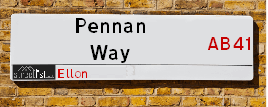
Pennan Way is a street located in Ellon. It uses the postcode AB41 8AQ. The street has a length of approximately 192 metres.
Pennan Way is located within the Aberdeenshire Council's jurisdiction. They provide various services, like refuse collection, and manage council tax collection. It's situated in the (pseudo) Scotland region of the UK.
Pennan Way is located within the county of Aberdeenshire, situated in the (pseudo) Scotland region of the UK. It's 414.04 miles North from central London., 16.31 miles North from Aberdeen, 72.27 miles North East from Dundee and 80.64 miles East from Inverness.
Pennan Way is within the Post Town of ELLON.

Do you know why this road is called Pennan Way?
What's it like to live here?
Ask the community a question about Pennan Way.
Do you have any questions, memories to share or know any facts about Pennan Way? We'd love to know more.
Also on streetlist.co.uk, can you help?
Eldroth Road
15th April 2024
I wondered if anyone has any old pictures of Wenning Bank House in the 1940’s and also Lane Side before of the same era .. we visited today with my Mum in law as she used to live at both these properties. Also any photos of the schools around that time .. thank you.
Can You Help?Napps Way
15th April 2024
Why is the road called Napps Way (belonging to Napp, but minus an
apostrophe as is usual with such nomenclature)? Moreover, who or
what is, or was, “Napp” in the respective, possessive case?
Several years ago, I met an elderly man (probably in his late-eighties)
who lives on Bentham Drive, Liverpool 16, and during a conversation
with him whilst in a Northwest Passenger Transport Ambulance on the
way to the former RLUH (Royal Liverpool University Hospital), he told
me that he could remember (when he was a boy, living in Childwall,
Liverpool 16) that, “Where Napps Way is now, during WW2, there was
a two-man gun emplacement on the, then, open land to protect the
railway line passing over Childwall Valley Road - next to the railway
bridge - when suddenly, as they were loading a live “shell” into the gun’s
breach, the aforementioned “shell” accidentally exploded in the gun’s
breach killing both of the two soldiers, that had been manning the gun,
instantly! (Very sad, of course, but could - perhaps - two ghosts relating
to those two, very unfortunately and prematurely-killed soldiers have
haunted that place of their deaths ever since - and have any residents
of Napps Way - formerly and in its latest incarnation - seen two, WW2
(uniformed) soldiers unexpectedly appear in or near their homes?)
Mauritius Road
15th April 2024
Why is Mauritius Road so called, since when and by whom? Does Greenwich have any particular links with Mauritius? Very interested to know. 🤞🏼
Can You Help?Estate Agents near Pennan Way
| Name | Address | Website |
|---|---|---|
| Stewart & Watson | 4 North Street, Mintlaw,AB42 5HH | Visit Website |
| Belvoir | 24 Rosemount Place, Aberdeen, AB25 2XU | Visit Website |
| Homeguard Leasing | 115 Rosemount Place, Aberdeen, AB25 2YG | Visit Website |
We have found 1 postcode for Pennan Way
Hotels near Pennan Way
Budget Hotels near Pennan Way
| Budget Hotel Name | Distance (miles) |
|---|---|
| 1: Name:Premier Inn Aberdeen North Bridge Of Don Address:Ellon Road Telephone: Visit Site |
12.16 |
| 2: Name:Travelodge Aberdeen Airport Address:Burnside Dr, Dyce, Aberdeen, AB21 0HW Telephone:0871 984 6309 Visit Site |
12.91 |
| 3: Name:Holiday Inn Express Aberdeen Exhibition Centre Address:Parkway East, Bridge Of Don Telephone: Visit Site |
13.34 |
| 4: Name:Holiday Inn Express Aberdeen Airport Address:2 International Gate, Dyce Telephone: Visit Site |
13.50 |
| 5: Name:Premier Inn Aberdeen Airport - Dyce Address:Aberdeen Airport, Main Terminal, Argyll Way Telephone: Visit Site |
13.64 |
Location Details
| Pennan Way | |
|---|---|

| |
| Latitude | 57.379337 |
| Longitude | -2.067963 |
| OS Easting (X): | 395913 |
| OS Northing (Y): | 832077 |
| OS Grid Reference: | NJ959321 |
Ordnance Survey Maps for Pennan Way
If you purchase a map through the links below, we may earn an affiliate commission.
| Map Series | link | Ordnance Survey |
| Explorer 1:25,000 421 Ellon and Inverurie | Check Price on Amazon | Buy Direct from the Ordnance Survey |
| Explorer 1:25,000 427 Peterhead and Fraserburgh | Check Price on Amazon | Buy Direct from the Ordnance Survey |
| Landranger 1:50,000 30 Fraserburgh | Buy Direct from the Ordnance Survey |
Neighbourhood Policing |
| Police Force: Scotland |
| Find a Local Neighbourhood Watch Scheme |
Frequently asked Questions for Pennan Way
What Council (Local Authority) is Pennan Way in?
Pennan Way is located within the local authority area of Aberdeenshire Council which is a Scottish unitary authority.
What Parish Council is Pennan Way in?
Pennan Way is in an unparished area.
What Electoral Ward is Pennan Way in?
Pennan Way is located within the ward of Ellon and District.
What County is Pennan Way in?
Pennan Way is located within the ceremonial county of Aberdeenshire.
What Constituency is Pennan Way in?
Pennan Way is located within the constituency of Gordon.
What Part of the UK is Pennan Way in?
Pennan Way is located within the historic nation of Scotland.
What County Council area is Pennan Way in?
Pennan Way is not in a County Council area.
What Police Force area is Pennan Way in?
Pennan Way is located within the Scotland Police area.
Roads that have a Junction with Pennan Way
| Street | Junction Type |
|---|---|
| Pennan Road | junction |
Sunset and Sunrise times for Pennan Way , AB41 8AQ
| Sunrise | 05:44 |
|---|---|
| Sunset | 20:29 |
Latest Weather Conditions for Pennan Way, AB41 8AQ
| Observed at Weather Station: | Aberdeen Airport 19 April 2024 at 02:00 (12.98 miles away) |
|---|---|
| Current Weather: | Overcast |
| Temperature and Humidity: | 7.1°C (81.1%) |
| Wind Direction and Speed: | NW (16 mph) |
Population Statistics
| ONS Area Code | S00092560 |
|---|---|
| ONS Area Name | Ageing Industrious Workers |
| LSOA Code: | S01006960 |
|---|---|
| LSOA Name: | Ellon East - 03 |
| SOA Code: | 8c |
| SOA Name: | |
| MSOA Code: | S02001313 |
| MSOA Name: | Ellon East |
Nearest Supermarkets
| Tesco Ellon Superstore |
|---|
| Castle Rd, Ellon, AB41 9RY |
| 0345 026 9495 |
| Distance: 1.17 Miles |
| Directions from Pennan Way to Tesco Ellon Superstore |
| Asda Dyce |
|---|
| Riverview Drive, Dyce, Aberdeen, AB21 7NG |
| 01224 724134 |
| Distance: 12.73 Miles |
| Directions from Pennan Way to Asda Dyce |
| Asda Peterhead |
|---|
| Longside Road, Peterhead, AB42 2FY |
| 01779 484000 |
| Distance: 12.88 Miles |
| Directions from Pennan Way to Asda Peterhead |
| Tesco Dyce Express |
|---|
| 35 Victoria St, Dyce, Aberdeen, AB21 0ET |
| 0345 675 7062 |
| Distance: 13 Miles |
| Directions from Pennan Way to Tesco Dyce Express |
Telephone Information
| Area Code |
|---|
| Area Code: 01358 - Ellon |
Broadband Information
| Speed | Average Speed | Median Speed | Maximum Speed | Next-generation access (NGA) | Number of Connections |
|---|---|---|---|---|---|
| Less than 2 Mbps | 11.4 | 12.3 | 16.2 | N | 30 |
Local Government
| Local Council Details |
|---|
| Within the area of Aberdeenshire |
| Visit the Council's Website |
| Woodhill House, Westburn Road, Aberdeen, Aberdeenshire &AB16 5GB |
| Telephone Number: 0845 608 1207 |
| Local Member of Parliament |
|---|
| Within the Westminster Parliamentary Constituency of Gordon |
| The Member of Parliament is Richard Thomson |
| Details for the MP Richard Thomson on parliament.uk |
| Details for the MP Richard Thomson on theyworkforyou.com |
| In the 2019 General Election Richard Thomson won with a majority of 819 the result was SNP gain from Con. The total electorate was 79,629 |
| Wards, Parish Councils and County Councils |
|---|
| Ward: Ellon and District Ward |
| Ceremonial County: Aberdeenshire |
Nearest Schools
| Name | Address | Postcode | Telephone | Type | Distance (Km) |
|---|---|---|---|---|---|
| Auchterellon School | Millwood Road, Ellon, Aberdeenshire, | AB41 9FA | 01358 720863 | Primary School | 1.73 Km |
| Ellon Primary School | Modley Place, Ellon, Aberdeenshire, | AB41 9BB | 01358 720692 | Primary School | 1.86 Km |
| Meiklemill School | Provost Davidson Drive, Ellon, Aberdeenshire, | AB41 9BQ | 01358 721852 | Primary School | 2.21 Km |
Data accessed from gov.scot 08-08-2019
Nearest Hospitals
| Name | Address | Postcode | Distance | Map |
|---|---|---|---|---|
| Elmwood | Ashgrove Road, Aberdeen | AB25 3BW | 24.88 Km | View Directions |
| City Hospital | Urquhart Road, Aberdeen | AB24 5AU | 25.01 Km | View Directions |
| The Baird Family Hospital | Foresterhill Health Campus, Foresterhill Road, Aberdeen | AB25 2ZL | 25.19 Km | View Directions |
Nearest Dentists
Dentists near Pennan Way
| Name | Address | Postcode | Distance | Map |
|---|---|---|---|---|
| SCHOOLHILL DENTAL PRACTICE | Schoolhill, Ellon | AB419JP | 1.44 Km | View Directions |
| YTHAN BRIDGE DENTAL CENTRE | 2 Ythan Terrace, Ellon | AB419LJ | 1.87 Km | View Directions |
| T/A BUPA DENTAL CARE | Unit 1, Kingseat Business Park, Kingseat, Newmachar | AB210AZ | 14.08 Km | View Directions |
Nearest GP Surgeries
Doctors near Pennan Way
ELLON GROUP PRACTICE
Address: ELLON HEALTH CENTRE, SCHOOLHILL, ELLON, ABERDEENSHIRE, AB41 9AH
Distance: 0.90 miles
Contact: tel: 03453 371150
HADDO MEDICAL GROUP
Address: PITMEDDEN SURGERY, TARVES ROAD, PITMEDDEN, ELLON, AB41 7NX
Distance: 5.07 miles
Contact: tel: 01651 843468
CRUDEN MEDICAL GROUP
Address: MAIN STREET, HATTON, PETERHEAD, ABERDEENSHIRE, AB42 0QQ
Distance: 6.35 miles
Contact: tel: 01779 841208
ADEN HEALTH CENTRE
Address: NEWLANDS ROAD, MINTLAW, PETERHEAD, AB42 5GP
Distance: 10.21 miles
Contact: tel: 01771 624070
NEW DYCE MEDICAL PRACTICE
Address: DYCE HEALTH CENTRE, 23A ALTONREA GARDENS, DYCE, ABERDEEN, AB21 7NQ
Distance: 12.60 miles
Contact: :
PETERHEAD HEALTH CENTRE
Address: LINKS TERRACE, PETERHEAD, ABERDEENSHIRE, AB42 2XA
Distance: 13.27 miles
Contact: tel: 03450 130710
Nearest Dispensing Chemists
Pharmacies near Pennan Way
| Name | Address | Postcode | Telephone | Map | Distance in Km |
|---|---|---|---|---|---|
| L Rowlands & Co (Retail) Ltd | 32 Market Street, Ellon, Aberdeenshire, | AB41 9JD | 01358 720301 | View Directions | |
| J Ross | Dispensing Chemist, 37-39 Station Road, Ellon, | AB41 9AR | 01358 720262 | View Directions | |
| KDP (Aberdeen) Ltd | Birch Way, Balmedie, Aberdeenshire, | AB23 8SJ | 01358 741226 | View Directions |
Nearest Opticians
Opticians near Pennan Way
VISION EXPRESS (ABERDEEN)
Address: UNIT 32, BON ACCORD CENTRE, GEORGE STREET, ABERDEEN, ABERDEENSHIRE, AB25 1HZ
Distance: 15.96 miles
Contact: :
BOOTS OPTICIANS (ABERDEEN - BON ACCORD CENTRE)
Address: BON ACCORD CENTRE, GEORGE STREET, ABERDEEN, ABERDEENSHIRE, AB25 1HZ
Distance: 15.96 miles
Contact: :
ABERDEEN DOMICILIARY SPECSAVERS LIMITED
Address: 56-58 UNION STREET, ABERDEEN, ABERDEENSHIRE, AB10 1BB
Distance: 16.08 miles
Contact: :
OPTIMAX LASER EYE CLINIC
Address: 2 GOLDEN SQUARE, ABERDEEN, ABERDEENSHIRE, AB10 1RD
Distance: 16.19 miles
Contact: :
ASDA OPTICIANS (BRIDGE OF DEE)
Address: ASDA STORES LTD, GARTHDEE ROAD, BRIDGE OF DEE, ABERDEEN, ABERDEENSHIRE, AB10 7QA
Distance: 17.72 miles
Contact: :
COSTCO WHOLESALE UK LTD - MANDELA WAY
Address: COSTCO, ENDEAVOUR DRIVE, ARNHALL BUSINESS PARK, WESTHILL, ABERDEENSHIRE, AB32 6UF
Distance: 17.80 miles
Contact: :
Transport
Nearest Rail Stations
Dyce Station is 12.87 miles away.
Address: Dyce station, Station Road, Dyce, Aberdeenshire, AB21 7EQ
Dyce is situated on the Aberdeen to Inverness line|Edinburgh to Aberdeen line and is managed by ScotRail.
Dyce Station is an unstaffed station.
Inverurie Station is 13.09 miles away.
Address: Inverurie station, Station Road, Inverurie, Aberdeenshire, AB51 4TN
Inverurie is situated on the Aberdeen to Inverness line|Edinburgh to Aberdeen line and is managed by ScotRail.
Inverurie Station is staffed on a part time basis.