Map of Maclean Terrace
| Postcodes | ||
|---|---|---|
| Icon | Postcodes for Maclean Terrace | |
| Walking Distances | ||
| Distance Info | Green Circle = 10 Minutes Walk (800 metres) | |
About Maclean Terrace
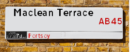
Maclean Terrace is a street located in Portsoy. It uses the postcode AB45 2RQ. The street has a length of approximately 118 metres.
Maclean Terrace is located within the Aberdeenshire Council's jurisdiction. They provide various services, like refuse collection, and manage council tax collection. It's situated in the (pseudo) Scotland region of the UK.
Maclean Terrace is located within the county of Banffshire, situated in the (pseudo) Scotland region of the UK. It's 439.76 miles North from central London., 43.33 miles North West from Aberdeen, 58.76 miles East from Inverness and 85.33 miles North from Dundee.
Maclean Terrace is within the Post Town of BANFF.

Do you know why this road is called Maclean Terrace?
What's it like to live here?
Ask the community a question about Maclean Terrace.
Do you have any questions, memories to share or know any facts about Maclean Terrace? We'd love to know more.
Also on streetlist.co.uk, can you help?
Eldroth Road
15th April 2024
I wondered if anyone has any old pictures of Wenning Bank House in the 1940’s and also Lane Side before of the same era .. we visited today with my Mum in law as she used to live at both these properties. Also any photos of the schools around that time .. thank you.
Can You Help?Napps Way
15th April 2024
Why is the road called Napps Way (belonging to Napp, but minus an
apostrophe as is usual with such nomenclature)? Moreover, who or
what is, or was, “Napp” in the respective, possessive case?
Several years ago, I met an elderly man (probably in his late-eighties)
who lives on Bentham Drive, Liverpool 16, and during a conversation
with him whilst in a Northwest Passenger Transport Ambulance on the
way to the former RLUH (Royal Liverpool University Hospital), he told
me that he could remember (when he was a boy, living in Childwall,
Liverpool 16) that, “Where Napps Way is now, during WW2, there was
a two-man gun emplacement on the, then, open land to protect the
railway line passing over Childwall Valley Road - next to the railway
bridge - when suddenly, as they were loading a live “shell” into the gun’s
breach, the aforementioned “shell” accidentally exploded in the gun’s
breach killing both of the two soldiers, that had been manning the gun,
instantly! (Very sad, of course, but could - perhaps - two ghosts relating
to those two, very unfortunately and prematurely-killed soldiers have
haunted that place of their deaths ever since - and have any residents
of Napps Way - formerly and in its latest incarnation - seen two, WW2
(uniformed) soldiers unexpectedly appear in or near their homes?)
Mauritius Road
15th April 2024
Why is Mauritius Road so called, since when and by whom? Does Greenwich have any particular links with Mauritius? Very interested to know. 🤞🏼
Can You Help?Estate Agents near Maclean Terrace
| Name | Address | Website |
|---|---|---|
| Stewart & Watson | 65 High Street, Banff,AB45 1AN | Visit Website |
We have found 1 postcode for Maclean Terrace
Location Details
| Maclean Terrace | |
|---|---|

| |
| Latitude | 57.682977 |
| Longitude | -2.686165 |
| OS Easting (X): | 359087 |
| OS Northing (Y): | 866082 |
| OS Grid Reference: | NJ591661 |
Ordnance Survey Maps for Maclean Terrace
If you purchase a map through the links below, we may earn an affiliate commission.
| Map Series | link | Ordnance Survey |
| Explorer 1:25,000 425 Huntly and Cullen | Check Price on Amazon | Buy Direct from the Ordnance Survey |
| Landranger 1:50,000 29 Banff & Huntly | Check Price on Amazon | Buy Direct from the Ordnance Survey |
Neighbourhood Policing |
| Police Force: Scotland |
| Find a Local Neighbourhood Watch Scheme |
Frequently asked Questions for Maclean Terrace
What Council (Local Authority) is Maclean Terrace in?
Maclean Terrace is located within the local authority area of Aberdeenshire Council which is a Scottish unitary authority.
What Parish Council is Maclean Terrace in?
Maclean Terrace is in an unparished area.
What Electoral Ward is Maclean Terrace in?
Maclean Terrace is located within the ward of Banff and District.
What County is Maclean Terrace in?
Maclean Terrace is located within the ceremonial county of Banffshire.
What Constituency is Maclean Terrace in?
Maclean Terrace is located within the constituency of Banff and Buchan.
What Part of the UK is Maclean Terrace in?
Maclean Terrace is located within the historic nation of Scotland.
What County Council area is Maclean Terrace in?
Maclean Terrace is not in a County Council area.
What Police Force area is Maclean Terrace in?
Maclean Terrace is located within the Scotland Police area.
Roads that have a Junction with Maclean Terrace
| Street | Junction Type |
|---|---|
| Aird Green | junction |
Sunset and Sunrise times for Maclean Terrace , AB45 2RQ
| Sunrise | 05:30 |
|---|---|
| Sunset | 20:46 |
Latest Weather Conditions for Maclean Terrace, AB45 2RQ
| Observed at Weather Station: | Lossiemouth 25 April 2024 at 04:00 (23.56 miles away) |
|---|---|
| Current Weather: | Overcast |
| Temperature and Humidity: | 4.6°C (75.7%) |
| Wind Direction and Speed: | N (15 mph) |
Population Statistics
| ONS Area Code | S00092125 |
|---|---|
| ONS Area Name | Rural Life |
| LSOA Code: | S01007026 |
|---|---|
| LSOA Name: | Portsoy &Fordyce and Cornhill - 04 |
| SOA Code: | 5e |
| SOA Name: | |
| MSOA Code: | S02001324 |
| MSOA Name: | Portsoy &Fordyce and Cornhill |
Nearest Supermarkets
| Tesco Banff Metro |
|---|
| Carmelite St, Banff, AB45 1AF |
| 0345 677 9028 |
| Distance: 6.27 Miles |
| Directions from Maclean Terrace to Tesco Banff Metro |
| Tesco Buckie Superstore |
|---|
| Highstreet, Buckie, AB56 4AB |
| 0345 026 9628 |
| Distance: 10.15 Miles |
| Directions from Maclean Terrace to Tesco Buckie Superstore |
| Tesco Turriff Superstore |
|---|
| 32 High Steet, Turriff, AB53 4EN |
| 0345 675 7122 |
| Distance: 13.02 Miles |
| Directions from Maclean Terrace to Tesco Turriff Superstore |
| Tesco Keith Moss St Superstore |
|---|
| Moss St, Keith, AB55 5HB |
| 0345 671 9357 |
| Distance: 13.66 Miles |
| Directions from Maclean Terrace to Tesco Keith Moss St Superstore |
Telephone Information
| Area Code |
|---|
| Area Code: 01261 - Banff |
Broadband Information
| Speed | Average Speed | Median Speed | Maximum Speed | Next-generation access (NGA) | Number of Connections |
|---|---|---|---|---|---|
| Greater than 2 Mbps | 6.9 | 7.4 | 8.1 | N | 6 |
Local Government
| Local Council Details |
|---|
| Within the area of Aberdeenshire |
| Visit the Council's Website |
| Woodhill House, Westburn Road, Aberdeen, Aberdeenshire &AB16 5GB |
| Telephone Number: 0845 608 1207 |
| Local Member of Parliament |
|---|
| Within the Westminster Parliamentary Constituency of Banff and Buchan |
| The Member of Parliament is David Duguid |
| Details for the MP David Duguid on parliament.uk |
| Details for the MP David Duguid on theyworkforyou.com |
| In the 2019 General Election David Duguid won with a majority of 4,118 the result was Con hold. The total electorate was 66,655 |
| Wards, Parish Councils and County Councils |
|---|
| Ward: Banff and District Ward |
| Ceremonial County: Banffshire |
Nearest Schools
Scotland Primary Schools
Portsoy School
Address: Portsoy School, Aird Street, Portsoy, BANFFSHIRE, AB45 2RB
Distance: 0.18 miles
Contact: 01261 455785
Nearest Hospitals
| Name | Address | Postcode | Distance | Map |
|---|
Nearest Dentists
Dentists near Maclean Terrace
| Name | Address | Postcode | Distance | Map |
|---|
Nearest GP Surgeries
Doctors near Maclean Terrace
AN CAORANN MEDICAL PRACTICE
Address: PORTSOY SURGERY, 16 SEAFIELD TERRACE, PORTSOY, BANFF, BANFFSHIRE, AB45 2GB
Distance: 0.43 miles
Contact: tel: 03453 379966
MACDUFF MEDICAL PRACTICE
Address: MACDUFF HEALTH CLINIC, FIFE STREET, BANFF, BANFFSHIRE, AB45 1JD
Distance: 5.99 miles
Contact: tel: 03453 379933
ARDACH HEALTH CENTRE
Address: HIGHFIELD ROAD, BUCKIE, BANFFSHIRE, AB56 1JE
Distance: 10.37 miles
Contact: tel: 03450 997200
SEAFIELD & CULLEN MEDICAL GROUP
Address: BARHILL ROAD, BUCKIE, AB56 1FP
Distance: 11.01 miles
Contact: tel: 01542 835577
TURRIFF MEDICAL PRACTICE
Address: TURRIFF HEALTH CENTRE, BALMELLIE ROAD, TURRIFF, ABERDEENSHIRE, AB53 4DQ
Distance: 13.33 miles
Contact: tel: 03453 376320
KEITH MEDICAL GROUP
Address: TURNER STREET, KEITH, BANFFSHIRE, AB55 5DJ
Distance: 13.91 miles
Contact: tel: 03453 379944
Nearest Dispensing Chemists
Pharmacies near Maclean Terrace
| Name | Address | Postcode | Telephone | Map | Distance in Km |
|---|---|---|---|---|---|
| V V & T Ruparelia | 1 Seafield Street, Portsoy | AB45 2QL | 01261 842284 | View Directions | |
| Aberchirder Pharmacy Ltd | 55 Main Street, Aberchirder | AB54 7ST | 01466 780201 | View Directions |
Nearest Opticians
Opticians near Maclean Terrace
BOOTS OPTICIANS (ELGIN)
Address: 169 HIGH STREET, ELGIN, IV30 1DW
Distance: 23.46 miles
Contact: :
COSTCO WHOLESALE UK LTD - MANDELA WAY
Address: COSTCO, ENDEAVOUR DRIVE, ARNHALL BUSINESS PARK, WESTHILL, ABERDEENSHIRE, AB32 6UF
Distance: 39.93 miles
Contact: :
VISION EXPRESS (ABERDEEN)
Address: UNIT 32, BON ACCORD CENTRE, GEORGE STREET, ABERDEEN, ABERDEENSHIRE, AB25 1HZ
Distance: 42.86 miles
Contact: :
BOOTS OPTICIANS (ABERDEEN - BON ACCORD CENTRE)
Address: BON ACCORD CENTRE, GEORGE STREET, ABERDEEN, ABERDEENSHIRE, AB25 1HZ
Distance: 42.86 miles
Contact: :
OPTIMAX LASER EYE CLINIC
Address: 2 GOLDEN SQUARE, ABERDEEN, ABERDEENSHIRE, AB10 1RD
Distance: 42.97 miles
Contact: :
ABERDEEN DOMICILIARY SPECSAVERS LIMITED
Address: 56-58 UNION STREET, ABERDEEN, ABERDEENSHIRE, AB10 1BB
Distance: 43.02 miles
Contact: :
Transport
Nearest Rail Stations
Keith Station is 13.48 miles away.
Address: Keith station, Station Road, Keith, Moray, AB55 3DR
Keith is situated on the Aberdeen to Inverness line and is managed by ScotRail.
Keith Station is staffed on a part time basis.
Huntly Station is 16.83 miles away.
Address: Huntly station, off Bogie St, Huntly, Aberdeenshire, AB54 5HS
Huntly is situated on the Aberdeen to Inverness line and is managed by ScotRail.
Huntly Station is staffed on a part time basis.