Map of Higher Coach Road
| Street Crime (updated 06/04/2024) | ||
|---|---|---|
| Location Note | Central Point of Street - Not Actual Location | |
| MSOA Info | For MSOA E02002200 (Statistical Neighbourhood) | |
| Click Hint | Click on a Circle for a detailed breakdown below map. | |
| Crime Levels |
Green = Very Low Yellow = Low Orange = High Red = Very High |
|
| Postcodes | ||
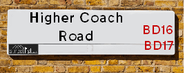
| Icon | Postcodes for Higher Coach Road | |
| Walking Distances | ||
| Distance Info | Green Circle = 10 Minutes Walk (800 metres) | |
About Higher Coach Road
Higher Coach Road is a street located in the town of Baildon and near the city of Bradford. The street has a length of approximately 2,114 metres.
The street is publicly maintained which means that the road is adopted and Bradford is responsible for the repair and upkeep of the highway.
Higher Coach Road is located within the Bradford District (B) Council's jurisdiction. They provide various services, like refuse collection, and manage council tax collection. It's situated in the Yorkshire and The Humber region of the UK.
Higher Coach Road has been assigned the Unique Street Reference Number of 7738010 in the National Street Gazetteer.
Higher Coach Road is located within the county of West Yorkshire, situated in the Yorkshire and The Humber region of the UK. It's 176.86 miles North West from central London., 10.97 miles West from Leeds, 30.48 miles West from York and 31.04 miles North East from Manchester.
Higher Coach Road is within the Post Town of SHIPLEY.

Do you know why this road is called Higher Coach Road?
What's it like to live here?
Ask the community a question about Higher Coach Road.
Do you have any questions, memories to share or know any facts about Higher Coach Road? We'd love to know more.
Also on streetlist.co.uk, can you help?
Eldroth Road
15th April 2024
I wondered if anyone has any old pictures of Wenning Bank House in the 1940’s and also Lane Side before of the same era .. we visited today with my Mum in law as she used to live at both these properties. Also any photos of the schools around that time .. thank you.
Can You Help?Napps Way
15th April 2024
Why is the road called Napps Way (belonging to Napp, but minus an
apostrophe as is usual with such nomenclature)? Moreover, who or
what is, or was, “Napp” in the respective, possessive case?
Several years ago, I met an elderly man (probably in his late-eighties)
who lives on Bentham Drive, Liverpool 16, and during a conversation
with him whilst in a Northwest Passenger Transport Ambulance on the
way to the former RLUH (Royal Liverpool University Hospital), he told
me that he could remember (when he was a boy, living in Childwall,
Liverpool 16) that, “Where Napps Way is now, during WW2, there was
a two-man gun emplacement on the, then, open land to protect the
railway line passing over Childwall Valley Road - next to the railway
bridge - when suddenly, as they were loading a live “shell” into the gun’s
breach, the aforementioned “shell” accidentally exploded in the gun’s
breach killing both of the two soldiers, that had been manning the gun,
instantly! (Very sad, of course, but could - perhaps - two ghosts relating
to those two, very unfortunately and prematurely-killed soldiers have
haunted that place of their deaths ever since - and have any residents
of Napps Way - formerly and in its latest incarnation - seen two, WW2
(uniformed) soldiers unexpectedly appear in or near their homes?)
Mauritius Road
15th April 2024
Why is Mauritius Road so called, since when and by whom? Does Greenwich have any particular links with Mauritius? Very interested to know. 🤞🏼
Can You Help?House Sales in Higher Coach Road
| Year | High | Low | Average | Sales |
|---|---|---|---|---|
| 2010 | £126,000 | £126,000 | £126,000 | 1 |
| 2011 | £62,000 | £129,000 | £95,500 | 2 |
| 2012 | £85,000 | £115,000 | £101,250 | 4 |
| 2014 | £95,000 | £95,000 | £95,000 | 1 |
| 2015 | £109,000 | £109,000 | £109,000 | 1 |
| 2016 | £122,000 | £122,000 | £122,000 | 1 |
| 2017 | £84,950 | £120,000 | £111,633 | 3 |
| 2019 | £135,000 | £135,000 | £135,000 | 1 |
| 2020 | £150,000 | £150,000 | £150,000 | 1 |
| 2022 | £148,000 | £148,000 | £148,000 | 1 |
Contains HM Land Registry data © Crown copyright and database right 2024. This data is licensed under the Open Government Licence v3.0.
Estate Agents near Higher Coach Road
| Name | Address | Website |
|---|---|---|
| Cotson Reddish & Partner | 1 Albert Road Saltaire Shipley BD18 4NR | Visit Website |
| Martin & Co | 1 Daisy Place Saltaire Shipley BD18 4NA | Visit Website |
| Dacre Son & Hartley | 77 Bingley Road, Shipley, BD18 4SB |
We have found 8 postcodes for Higher Coach Road
Location Details
| Higher Coach Road | |
|---|---|

| |
| Latitude | 53.842987 |
| Longitude | -1.800491 |
| OS Easting (X): | 413125 |
| OS Northing (Y): | 438568 |
| OS Grid Reference: | SE131386 |
Neighbourhood Policing |
| Police Force: West Yorkshire |
 View Neighbourhood Crime and Policing View Neighbourhood Crime and Policing |
| Find a Local Neighbourhood Watch Scheme |
Frequently asked Questions for Higher Coach Road
What Council (Local Authority) is Higher Coach Road in?
Higher Coach Road is located within the local authority area of Bradford Council which is a Metropolitan District.
What Parish Council is Higher Coach Road in?
Higher Coach Road is located within the area of Baildon Parish Council.
What Electoral Ward is Higher Coach Road in?
Higher Coach Road is located within the ward of Shipley.
What County is Higher Coach Road in?
Higher Coach Road is located within the ceremonial county of West Yorkshire.
What Constituency is Higher Coach Road in?
Higher Coach Road is located within the constituency of Shipley.
What Part of the UK is Higher Coach Road in?
Higher Coach Road is located within the Yorkshire and The Humber region of the United Kingdom.
What County Council area is Higher Coach Road in?
Higher Coach Road is located within the West Yorkshire Council area.
What Police Force area is Higher Coach Road in?
Higher Coach Road is located within the West Yorkshire Police area.
Roads that have a Junction with Higher Coach Road
| Street | Junction Type |
|---|---|
| Glenwood Avenue | junction |
| Primrose Lane | junction |
| Gorse Avenue | junction |
| Glenwood Avenue | junction |
| Thompson Lane | junction |
| Coach Road | junction |
Sunset and Sunrise times for Higher Coach Road
| Sunrise | 05:44 |
|---|---|
| Sunset | 20:25 |
Latest Weather Conditions for Higher Coach Road
| Observed at Weather Station: | Bingley Samos 23 April 2024 at 19:00 (3.44 miles away) |
|---|---|
| Current Weather: | Overcast |
| Temperature and Humidity: | 6.3°C (71.9%) |
| Wind Direction and Speed: | NE (5 mph) |
Population Statistics
| ONS Area Code | E00053432 & E00053406 |
|---|---|
| ONS Area Name | Ageing Industrious Workers & Multi-Ethnic Hardship |
| Average Age | 39.83 |
| Area Population | 1620.00 |
| Male Population | 815.00 (50%) |
| Female Population | 805.00 (50%) |
| Benefit Claimants | 84 (5%) |
| LSOA Code: | E01010583 |
|---|---|
| LSOA Name: | Bradford 018B |
| SOA Code: | 4c |
| SOA Name: | |
| MSOA Code: | E02002200 |
| MSOA Name: | Bradford 018 |
Nearest Supermarkets
| Asda Shipley |
|---|
| Manor Lane, Shipley, BD18 3RY |
| 01274 589399 |
| Distance: 1.12 Miles |
| Directions from Higher Coach Road to Asda Shipley |
| Iceland Shipley |
|---|
| 30 Market Place, Shipley, West Yorkshire, BD18 3QB |
| 01274557525 |
| Distance: 1.13 Miles |
| Directions from Higher Coach Road to Iceland Shipley |
| Tesco Baildon Express |
|---|
| Otley Rd, Baildon, BD17 7HE |
| 0345 671 9344 |
| Distance: 1.47 Miles |
| Directions from Higher Coach Road to Tesco Baildon Express |
| Sainsburys Bingley Main Street Local |
|---|
| 117 Main Street, Bingley, England, BD16 1AJ |
| 1274552098 |
| Distance: 1.56 Miles |
| Directions from Higher Coach Road to Sainsburys Bingley Main Street Local |
Telephone Information
| Area Code |
|---|
| Area Code: 01274 - Bradford |
| Area Code: 01943 - Guiseley |
| Area Code: 01535 - Keighley |
| Area Code: 01422 - Halifax |
Local Government
| Local Council Details |
|---|
| Within the area of Bradford |
| Visit the Council's Website |
| City Hall, Centenary Square, Bradford &BD1 1HY |
| Telephone Number: 01274 432111 |
| Local Member of Parliament |
|---|
| Within the Westminster Parliamentary Constituency of Shipley |
| The Member of Parliament is Philip Davies |
| Details for the MP Philip Davies on parliament.uk |
| Details for the MP Philip Davies on theyworkforyou.com |
| In the 2019 General Election Philip Davies won with a majority of 6,242 the result was Con hold. The total electorate was 74,029 |
| Wards, Parish Councils and County Councils |
|---|
| Ward: Shipley Ward |
| Parish: Baildon Parish Council |
| Ceremonial County: West Yorkshire |
Nearest Schools
England Primary Schools
Glenaire Primary School
Address: Glenaire Primary School, Thompson Lane, Baildon, Shipley, West Yorkshire, BD17 7LY
Distance: 0.61 miles
Contact:
England Secondary Schools
Titus Salt School
Address: Titus Salt School, Higher Coach Road, Baildon, Shipley, Bradford, West Yorkshire, BD17 5RH
Distance: 0.26 miles
Contact: 01274258969
Nearest Hospitals
| Shipley Hospital |
|---|
| Address: 98 Kirkgate, Shipley, BD18 3LT, |
| NHS Sector |
| Bradford Teaching Hospitals NHS Foundation Trust |
| Telephone: 01274 773390 |
| Distance: 1.41 (miles) |
| Directions from to Shipley Hospital |
| Stoney Ridge Hospital |
|---|
| Address: Stoney Ridge Road, Bingley, BD16 1UL, |
| Independent Sector |
| Bradford District NHS Foundation Trust |
| Distance: 2.55 (miles) |
| Directions from to Stoney Ridge Hospital |
| Lynfield Mount Hospital |
|---|
| Address: Heights Lane, Bradford, BD9 6DP, |
| NHS Sector |
| Bradford District NHS Foundation Trust |
| Telephone: 01274 494194 |
| Visit Hospital Website |
| Distance: 3.71 (miles) |
| Directions from to Lynfield Mount Hospital |
Nearest Dentists
Dentists near Higher Coach Road
SALTAIRE DENTAL PRACTICE
Address: 203 BINGLEY ROAD, SHIPLEY, WEST YORKSHIRE, BD18 4DH
Distance: 0.52 miles
Contact: :
SALTAIRE ORTHODONTICS
Address: 3-4 VICTORIA ROAD, SHIPLEY, WEST YORKSHIRE, BD18 3LA
Distance: 0.61 miles
Contact: :
HONESTY DENTAL CARE LLP
Address: 75 KIRKGATE, SHIPLEY, BD18 3LU
Distance: 0.91 miles
Contact: :
AVONDALE DENTAL PRACTICE
Address: 54 BRADFORD ROAD, SHIPLEY, WEST YORKSHIRE, BD18 3NT
Distance: 0.98 miles
Contact: :
CROWGILL HOUSE
Address: ROSSE STREET, SHIPLEY, BD18 3FB
Distance: 1.03 miles
Contact: :
THE OAKS DENTAL PRACTICE
Address: 192 SWAN AVENUE, BINGLEY, WEST YORKSHIRE, BD16 3PA
Distance: 1.04 miles
Contact: :
Nearest GP Surgeries
Doctors near Higher Coach Road
SALTAIRE MEDICAL PRACTICE
Address: RICHMOND ROAD, SHIPLEY, BD18 4RX
Distance: 0.69 miles
Contact: :
OAK GLEN SURGERY
Address: ELDWICK & GILSTEAD HEALTH CENTRE, 196 SWAN AVENUE, BINGLEY, WEST YORKSHIRE, BD16 3PA
Distance: 1.04 miles
Contact: tel: 01274 566617
SHIPLEY HEALTH CENTRE - COVID LOCAL VACCINATION SERVICE
Address: SHIPLEY MEDICAL PRACTICE, ALEXANDRA ROAD, SHIPLEY, BD18 3EG
Distance: 1.06 miles
Contact: :
SHIPLEY MEDICAL PRACTICE-AFFINITY CARE
Address: SHIPLEY MEDICAL PRACTICE, ALEXANDRA ROAD, SHIPLEY, BD18 3EG
Distance: 1.06 miles
Contact: tel: 01274 531153
SHIPLEY HEALTH CENTRE - COVID LOCAL VACCINATION SERVICE 2
Address: SHIPLEY MEDICAL PRACTICE, ALEXANDRA ROAD, SHIPLEY, BD18 3EG
Distance: 1.06 miles
Contact: :
BINGLEY MEDICAL PRACTICE
Address: CANALSIDE HEALTH CARE CENTRE, 2 KINGSWAY, BINGLEY, WEST YORKSHIRE, BD16 4RP
Distance: 1.15 miles
Contact: tel: 01274 568383
Nearest Dispensing Chemists
Pharmacies near Higher Coach Road
BINGLEY ROAD PHARMACY
Address: 20A BINGLEY ROAD, SALTAIRE, SHIPLEY, BD18 4RS
Distance: 0.68 miles
Contact: tel: 01274 584421
SALTAIRE PHARMACY
Address: 30 BINGLEY ROAD, SHIPLEY, BD18 4RS
Distance: 0.68 miles
Contact: tel: 01274 583535
TAITS PHARMACY
Address: 45 SALTAIRE ROAD, SALTAIRE, BRADFORD, SHIPLEY, WEST YORKSHIRE, BD18 3HZ
Distance: 0.75 miles
Contact: tel: 01274 229004
RAMZY'S PHARMACY
Address: ELDWICK & GILSTEAD HC, 194 SWAN AVENUE, ELDWICK, BINGLEY, BD16 3PA
Distance: 1.04 miles
Contact: tel: 01274 550080
ROWLANDS PHARMACY
Address: ALEXANDRA ROAD, SHIPLEY, WEST YORKSHIRE, BD18 3EG
Distance: 1.06 miles
Contact: tel: 01274 531214
ASDA PHARMACY
Address: MANOR LANE, SHIPLEY, BD18 3RY
Distance: 1.14 miles
Contact: tel: 01274 609410
Nearest Opticians
Opticians near Higher Coach Road
OPTICALL YORKSHIRE
Address: 19 GLEN RISE, BAILDON, SHIPLEY, BD17 5DD
Distance: 0.53 miles
Contact: :
OPTULA OPTICIANS
Address: 71 BINGLEY ROAD, SALTAIRE, SHIPLEY, BRADFORD, WEST YORKSHIRE, BD18 4SB
Distance: 0.62 miles
Contact: :
YORKSHIRE EYECARE (SHIPLEY)
Address: 14 WEST WAY, SHIPLEY, WEST YORKSHIRE, BD18 4HW
Distance: 0.78 miles
Contact: :
ORACLE OPTICIANS (SHIPLEY)
Address: 9 WESTGATE, SHIPLEY, WEST YORKSHIRE, BD18 3QX
Distance: 1.08 miles
Contact: :
SPECSAVERS (SHIPLEY)
Address: 29 MARKET SQUARE, SHIPLEY, WEST YORKSHIRE, BD18 3QJ
Distance: 1.14 miles
Contact: :
4621 SHIPLEY
Address: ASDA STORES LTD, MANOR LANE, SHIPLEY, WEST YORKSHIRE, BD18 3RY
Distance: 1.14 miles
Contact: :
Transport
Nearest Rail Stations
Saltaire Station is 0.46 miles away.
Address: Saltaire station, Victoria Road, Saltaire, West Yorkshire, BD18 3LQ
Saltaire is situated on the Leeds to Morecambe line and is managed by Northern.
Saltaire Station is an unstaffed station.
Shipley (Yorks) Station is 1.32 miles away.
Address: Shipley station, Station Road, Shipley, West Yorkshire, BD18 2JL
Shipley (Yorks) is situated on the Leeds to Morecambe line|Wharfedale Line|Leeds to Bradford lines and is managed by Northern.
Shipley (Yorks) Station is staffed on a full time basis.
Directions from Higher Coach Road to Shipley (Yorks) Rail Station