Map of Mayfield Gardens
| Postcodes | ||
|---|---|---|
| Icon | Postcodes for Mayfield Gardens | |
| Walking Distances | ||
| Distance Info | Green Circle = 10 Minutes Walk (800 metres) | |
About Mayfield Gardens
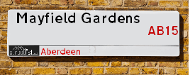
Mayfield Gardens is a street located in Aberdeen. It uses the postcode AB15 7YZ. The street has a length of approximately 181 metres.
Mayfield Gardens is located within the Aberdeen City Council's jurisdiction. They provide various services, like refuse collection, and manage council tax collection. It's situated in the (pseudo) Scotland region of the UK.
Mayfield Gardens is located within the county of City of Aberdeen, situated in the (pseudo) Scotland region of the UK. It's 398.2 miles North from central London., 1.8 miles West from Aberdeen, 56.5 miles North East from Dundee and 81.43 miles East from Inverness.
Mayfield Gardens is within the Post Town of ABERDEEN.

Do you know why this road is called Mayfield Gardens?
What's it like to live here?
Ask the community a question about Mayfield Gardens.
Do you have any questions, memories to share or know any facts about Mayfield Gardens? We'd love to know more.
Also on streetlist.co.uk, can you help?
Eldroth Road
15th April 2024
I wondered if anyone has any old pictures of Wenning Bank House in the 1940’s and also Lane Side before of the same era .. we visited today with my Mum in law as she used to live at both these properties. Also any photos of the schools around that time .. thank you.
Can You Help?Napps Way
15th April 2024
Why is the road called Napps Way (belonging to Napp, but minus an
apostrophe as is usual with such nomenclature)? Moreover, who or
what is, or was, “Napp” in the respective, possessive case?
Several years ago, I met an elderly man (probably in his late-eighties)
who lives on Bentham Drive, Liverpool 16, and during a conversation
with him whilst in a Northwest Passenger Transport Ambulance on the
way to the former RLUH (Royal Liverpool University Hospital), he told
me that he could remember (when he was a boy, living in Childwall,
Liverpool 16) that, “Where Napps Way is now, during WW2, there was
a two-man gun emplacement on the, then, open land to protect the
railway line passing over Childwall Valley Road - next to the railway
bridge - when suddenly, as they were loading a live “shell” into the gun’s
breach, the aforementioned “shell” accidentally exploded in the gun’s
breach killing both of the two soldiers, that had been manning the gun,
instantly! (Very sad, of course, but could - perhaps - two ghosts relating
to those two, very unfortunately and prematurely-killed soldiers have
haunted that place of their deaths ever since - and have any residents
of Napps Way - formerly and in its latest incarnation - seen two, WW2
(uniformed) soldiers unexpectedly appear in or near their homes?)
Mauritius Road
15th April 2024
Why is Mauritius Road so called, since when and by whom? Does Greenwich have any particular links with Mauritius? Very interested to know. 🤞🏼
Can You Help?Estate Agents near Mayfield Gardens
| Name | Address | Website |
|---|---|---|
| Savills | 37 Albyn Place Aberdeen AB10 1YN | Visit Website |
| Stonehouse Lettings | Osborne House 27-30 Carden Place Aberdeen AB10 1UP | Visit Website |
| Savills Rural Lettings | 5 Queens Terrace, Aberdeen, AB10 1XL | Visit Website |
We have found 1 postcode for Mayfield Gardens
Location Details
| Mayfield Gardens | |
|---|---|

| |
| Latitude | 57.136357 |
| Longitude | -2.140524 |
| OS Easting (X): | 391495 |
| OS Northing (Y): | 805038 |
| OS Grid Reference: | NJ915050 |
Neighbourhood Policing |
| Police Force: Scotland |
| Find a Local Neighbourhood Watch Scheme |
Frequently asked Questions for Mayfield Gardens
What Council (Local Authority) is Mayfield Gardens in?
Mayfield Gardens is located within the local authority area of Aberdeen City Council which is a Scottish unitary authority.
What Parish Council is Mayfield Gardens in?
Mayfield Gardens is in an unparished area.
What Electoral Ward is Mayfield Gardens in?
Mayfield Gardens is located within the ward of Hazlehead/Queens Cross/Countesswells.
What County is Mayfield Gardens in?
Mayfield Gardens is located within the ceremonial county of City of Aberdeen.
What Constituency is Mayfield Gardens in?
Mayfield Gardens is located within the constituency of Aberdeen South.
What Part of the UK is Mayfield Gardens in?
Mayfield Gardens is located within the historic nation of Scotland.
What County Council area is Mayfield Gardens in?
Mayfield Gardens is not in a County Council area.
What Police Force area is Mayfield Gardens in?
Mayfield Gardens is located within the Scotland Police area.
Roads that have a Junction with Mayfield Gardens
| Street | Junction Type |
|---|---|
| Seafield Road | junction |
| Seafield Road | junction |
Sunset and Sunrise times for Mayfield Gardens , AB15 7YZ
| Sunrise | 05:33 |
|---|---|
| Sunset | 20:40 |
Latest Weather Conditions for Mayfield Gardens, AB15 7YZ
| Observed at Weather Station: | Aberdeen Airport 24 April 2024 at 02:00 (5.33 miles away) |
|---|---|
| Current Weather: | Cloudy |
| Temperature and Humidity: | 4.4°C (70.0%) |
| Wind Direction and Speed: | NNW (10 mph) |
Population Statistics
| ONS Area Code | S00089346 |
|---|---|
| ONS Area Name | White Suburban Communities |
| LSOA Code: | S01006545 |
|---|---|
| LSOA Name: | Braeside, Mannofield &Broomhill and Seafield North - 04 |
| SOA Code: | 3c |
| SOA Name: | |
| MSOA Code: | S02001242 |
| MSOA Name: | Braeside, Mannofield &Broomhill and Seafield North |
Nearest Supermarkets
| Tesco Great Western Rd Express |
|---|
| 571 Great Western Rd, Aberdeen, AB10 6PA |
| 0345 675 7121 |
| Distance: 0.45 Miles |
| Directions from Mayfield Gardens to Tesco Great Western Rd Express |
| Iceland Aberdeen |
|---|
| 306/308 Holborn Street, Aberdeen, Aberdeenshire, AB10 7GX |
| 01224573770 |
| Distance: 0.94 Miles |
| Directions from Mayfield Gardens to Iceland Aberdeen |
| Tesco Aberdeen Holburn St Express |
|---|
| 207 Holburn St, Aberdeen, AB10 6BL |
| 0345 675 6952 |
| Distance: 1 Miles |
| Directions from Mayfield Gardens to Tesco Aberdeen Holburn St Express |
| Sainsburys Aberdeen Holburn Street Local |
|---|
| 124-130 Holburn Street, Aberdeen, Scotland, AB10 6DA |
| 01224 595859 |
| Distance: 1.01 Miles |
| Directions from Mayfield Gardens to Sainsburys Aberdeen Holburn Street Local |
Telephone Information
| Area Code |
|---|
| Area Code: 01224 - Aberdeen |
Broadband Information
| Speed | Average Speed | Median Speed | Maximum Speed | Next-generation access (NGA) | Number of Connections |
|---|---|---|---|---|---|
| Less than 2 Mbps | 17 | 19.6 | 23 | N | 18 |
Local Government
| Local Council Details |
|---|
| Within the area of Aberdeen City |
| Visit the Council's Website |
| Aberdeen City Council Customer Service Centre, Ground Floor, Marischal College, Broad Street, Aberdeen &AB10 1AB |
| Telephone Number: 0845 608 0910 |
| Local Member of Parliament |
|---|
| Within the Westminster Parliamentary Constituency of Aberdeen South |
| The Member of Parliament is Stephen Flynn |
| Details for the MP Stephen Flynn on parliament.uk |
| Details for the MP Stephen Flynn on theyworkforyou.com |
| In the 2019 General Election Stephen Flynn won with a majority of 3,990 the result was SNP gain from Con. The total electorate was 65,719 |
| Wards, Parish Councils and County Councils |
|---|
| Ward: Hazlehead/Queens Cross/Countesswells Ward |
| Ceremonial County: City of Aberdeen |
Nearest Schools
Scotland Primary Schools
Ferryhill School
Address: Ferryhill School, 31 Caledonian Place, Aberdeen, AB11 6TT
Distance: 1.39 miles
Contact: 01224 586755
Kirkhill School
Address: Kirkhill School, Cairngorm Gardens, Kincorth, ABERDEEN, AB12 5BS
Distance: 1.83 miles
Contact: 01224 874439
Gilcomstoun School
Address: Gilcomstoun School, Skene Street, Aberdeen, AB10 1PG
Distance: 1.36 miles
Contact: 01224 642722
Ashley Road School
Address: Ashley Road School, 45 Ashley Road, Aberdeen, AB10 6RU
Distance: 0.69 miles
Contact: 01224 588732
Kaimhill Primary School
Address: Kaimhill Primary School, Pitmedden Terrace, Aberdeen, AB10 7HR
Distance: 1.00 miles
Contact: 01224 498150
Mile End School
Address: Mile End School, Mid Stocket Road, ABERDEEN, AB15 5LT
Distance: 0.96 miles
Contact: 01224 498140
Broomhill School
Address: Broomhill School, Gray Street, Aberdeen, AB10 6JF
Distance: 0.69 miles
Contact: 01224 315487
Abbotswell School
Address: Abbotswell School, Faulds Gate, Kincorth, ABERDEEN, AB12 5QX
Distance: 1.57 miles
Contact: 01224 872714
St Joseph's RC School
Address: St Joseph's RC School, 5 Queen's Road, Aberdeen, AB15 4YL
Distance: 0.57 miles
Contact: 01224 322730
Cornhill School
Address: Cornhill School, Cornhill Drive, Aberdeen, AB16 5BL
Distance: 1.57 miles
Contact: 01224 483234
Muirfield School
Address: Muirfield School, Mastrick Drive, Aberdeen, AB16 6UE
Distance: 1.39 miles
Contact: 01224 694958
Holy Family RC School
Address: Holy Family RC School, Summerhill Terrace, Aberdeen, AB15 6HE
Distance: 1.01 miles
Contact: 01224 316446
Countesswells School
Address: Countesswells School, Fernielea Road, ABERDEEN, AB15 6GU
Distance: 0.98 miles
Contact: 01224 764676
Hazlehead Primary School
Address: Hazlehead Primary School, Provost Graham Avenue, Aberdeen, AB15 8HB
Distance: 1.14 miles
Contact: 01224 498120
Fernielea School
Address: Fernielea School, Stronsay Place, Aberdeen, AB15 6HD
Distance: 1.11 miles
Contact: 01224 318533
Kingsford School
Address: Kingsford School, Kingsford Road, Aberdeen, AB16 6PQ
Distance: 1.73 miles
Contact: 01224 693554
Airyhall School
Address: Airyhall School, Countesswells Road, Aberdeen, AB15 8AD
Distance: 0.45 miles
Contact: 01224 498050
Scotland Secondary Schools
Aberdeen Grammar School
Address: Aberdeen Grammar School, Skene Street, Aberdeen, AB10 1HT
Distance: 1.18 miles
Contact: 01224 642299
Harlaw Academy
Address: Harlaw Academy, 18/20 Albyn Place, Aberdeen, AB10 1RG
Distance: 0.96 miles
Contact: 01224 589251
Northfield Academy
Address: Northfield Academy, Granitehill Place, Aberdeen, AB16 7AU
Distance: 1.81 miles
Contact: 01224 699715
Hazlehead Academy
Address: Hazlehead Academy, Groat's Road, Aberdeen, AB15 8BE
Distance: 1.53 miles
Contact: 01224 310184
Nearest Hospitals
| Name | Address | Postcode | Distance | Map |
|---|---|---|---|---|
| 375 Great Western Lodge | 375 Great Western Road, Aberdeen | AB10 6NU | 0.77 Km | View Directions |
| Royal Aberdeen Children's Hospital | Westburn Drive, Aberdeen | AB25 2ZG | 1.94 Km | View Directions |
| Aberdeen Royal Infirmary | Foresterhill Road, Aberdeen | AB25 2ZN | 2.00 Km | View Directions |
Nearest Dentists
Dentists near Mayfield Gardens
| Name | Address | Postcode | Distance | Map |
|---|---|---|---|---|
| MYDENTIST | 21 Springfield Road, Aberdeen | AB157RJ | 0.88 Km | View Directions |
| T/A BUPA DENTAL CARE | 14 Queens Road, Aberdeen | AB154ZT | 0.90 Km | View Directions |
| WEST END DENTAL | 189 Great Western Road, Aberdeen | AB106PS | 1.20 Km | View Directions |
Nearest GP Surgeries
Doctors near Mayfield Gardens
HAMILTON MEDICAL GROUP
Address: 4 QUEENS ROAD, ABERDEEN, ABERDEENSHIRE, AB15 4ZT
Distance: 0.56 miles
Contact: tel: 01224 562888
ALBYN MEDICAL PRACTICE
Address: THE ALBYN MEDICAL PRACTICE, 30 ALBYN PLACE, ABERDEEN, ABERDEENSHIRE, AB10 1NW
Distance: 0.82 miles
Contact: tel: 01224 586829
HOLBURN MEDICAL GROUP
Address: 7 ALBYN PLACE, ABERDEEN, ABERDEENSHIRE, AB10 1YE
Distance: 1.07 miles
Contact: tel: 01224 400800
RUBISLAW PLACE MEDICAL GROUP
Address: RUBISLAW MEDICAL GROUP, 7 RUBISLAW PLACE, ABERDEEN, ABERDEENSHIRE, AB10 1QB
Distance: 1.07 miles
Contact: tel: 01224 641968
ELMBANK GROUP PRACTICE
Address: FORESTERHILL HEALTH CENTRE, WESTBURN ROAD, ABERDEEN, ABERDEENSHIRE, AB25 2AY
Distance: 1.15 miles
Contact: tel: 03453 370710
DIABETIC NURSE SERVICE
Address: NURSING DIRECTORATE, GRAMPIAN HEALTH, SUMMERFIELD HOUSE, 2 EDAY ROAD, ABERDEEN, AB15 6RE
Distance: 1.18 miles
Contact: tel: 01224 558427
Nearest Dispensing Chemists
Pharmacies near Mayfield Gardens
| Name | Address | Postcode | Telephone | Map | Distance in Km |
|---|---|---|---|---|---|
| Boots The Chemists Ltd | 475 Gt Western Road, Aberdeen | AB10 6NN | 01224 310158 | View Directions | |
| W Davidson & Son Ltd | 340 Great Western Road, Aberdeen | AB10 6LX | 01224 317092 | View Directions | |
| Anderson & Spence Ltd | 31 Fountainhall Road, Aberdeen | AB15 4EW | 01224 641546 | View Directions |
Nearest Opticians
Opticians near Mayfield Gardens
ASDA OPTICIANS (BRIDGE OF DEE)
Address: ASDA STORES LTD, GARTHDEE ROAD, BRIDGE OF DEE, ABERDEEN, ABERDEENSHIRE, AB10 7QA
Distance: 1.03 miles
Contact: :
OPTIMAX LASER EYE CLINIC
Address: 2 GOLDEN SQUARE, ABERDEEN, ABERDEENSHIRE, AB10 1RD
Distance: 1.51 miles
Contact: :
VISION EXPRESS (ABERDEEN)
Address: UNIT 32, BON ACCORD CENTRE, GEORGE STREET, ABERDEEN, ABERDEENSHIRE, AB25 1HZ
Distance: 1.75 miles
Contact: :
BOOTS OPTICIANS (ABERDEEN - BON ACCORD CENTRE)
Address: BON ACCORD CENTRE, GEORGE STREET, ABERDEEN, ABERDEENSHIRE, AB25 1HZ
Distance: 1.75 miles
Contact: :
ABERDEEN DOMICILIARY SPECSAVERS LIMITED
Address: 56-58 UNION STREET, ABERDEEN, ABERDEENSHIRE, AB10 1BB
Distance: 1.79 miles
Contact: :
4637 PORTLETHEN
Address: ASDA STORES LTD, MUIREND ROAD, PORTLETHEN, ABERDEEN, ABERDEENSHIRE, AB12 4XP
Distance: 4.97 miles
Contact: :
Transport
Nearest Rail Stations
Aberdeen Station is 1.68 miles away.
Address: Aberdeen station, Guild Street, Union Square, Aberdeen, AB11 6LX
Aberdeen is situated on the Aberdeen to Inverness line|Glasgow to Aberdeen line|Edinburgh to Aberdeen line and is managed by ScotRail.
Aberdeen Station is staffed on a part time basis.
Dyce Station is 5.17 miles away.
Address: Dyce station, Station Road, Dyce, Aberdeenshire, AB21 7EQ
Dyce is situated on the Aberdeen to Inverness line|Edinburgh to Aberdeen line and is managed by ScotRail.
Dyce Station is an unstaffed station.