Map of Sherwood Avenue
| Postcodes | ||
|---|---|---|
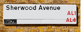
| Icon | Postcodes for Sherwood Avenue | |
| Walking Distances | ||
| Distance Info | Green Circle = 10 Minutes Walk (800 metres) | |
About Sherwood Avenue
Sherwood Avenue is a street located in the city of St Albans. The street has a length of approximately 775 metres.
Sherwood Avenue is located within the St. Albans District (B) Council's jurisdiction. They provide various services, like refuse collection, and manage council tax collection. It's situated in the East of England region of the UK.
Sherwood Avenue has been assigned the Unique Street Reference Number of 37315407 in the National Street Gazetteer.
Sherwood Avenue is located within the county of Hertfordshire, situated in the East of England region of the UK. It's 20.36 miles North West from central London., 1.77 miles North East from St Albans, 8.99 miles South East from Luton and 21.91 miles East from Aylesbury.

Do you know why this road is called Sherwood Avenue?
What's it like to live here?
Ask the community a question about Sherwood Avenue.
Do you have any questions, memories to share or know any facts about Sherwood Avenue? We'd love to know more.
Also on streetlist.co.uk, can you help?
Eldroth Road
15th April 2024
I wondered if anyone has any old pictures of Wenning Bank House in the 1940’s and also Lane Side before of the same era .. we visited today with my Mum in law as she used to live at both these properties. Also any photos of the schools around that time .. thank you.
Can You Help?Napps Way
15th April 2024
Why is the road called Napps Way (belonging to Napp, but minus an
apostrophe as is usual with such nomenclature)? Moreover, who or
what is, or was, “Napp” in the respective, possessive case?
Several years ago, I met an elderly man (probably in his late-eighties)
who lives on Bentham Drive, Liverpool 16, and during a conversation
with him whilst in a Northwest Passenger Transport Ambulance on the
way to the former RLUH (Royal Liverpool University Hospital), he told
me that he could remember (when he was a boy, living in Childwall,
Liverpool 16) that, “Where Napps Way is now, during WW2, there was
a two-man gun emplacement on the, then, open land to protect the
railway line passing over Childwall Valley Road - next to the railway
bridge - when suddenly, as they were loading a live “shell” into the gun’s
breach, the aforementioned “shell” accidentally exploded in the gun’s
breach killing both of the two soldiers, that had been manning the gun,
instantly! (Very sad, of course, but could - perhaps - two ghosts relating
to those two, very unfortunately and prematurely-killed soldiers have
haunted that place of their deaths ever since - and have any residents
of Napps Way - formerly and in its latest incarnation - seen two, WW2
(uniformed) soldiers unexpectedly appear in or near their homes?)
Mauritius Road
15th April 2024
Why is Mauritius Road so called, since when and by whom? Does Greenwich have any particular links with Mauritius? Very interested to know. 🤞🏼
Can You Help?Estate Agents near Sherwood Avenue
| Name | Address | Website |
|---|---|---|
| Connells | 5 Wycombe Place Marshalswick St. Albans AL4 9RH | Visit Website |
| Bradford & Howley | 5 The Quadrant, Marshalswick, St. Albans, AL4 9RA | Visit Website |
| Attewell & Hardwicke Ltd | Unit 4, 19 The Quadrant Marshalswick St Albans Herts AL4 9RB | Visit Website |
We have found 7 postcodes for Sherwood Avenue
Location Details
| Sherwood Avenue | |
|---|---|

| |
| Latitude | 51.767415 |
| Longitude | -0.305998 |
| OS Easting (X): | 516880 |
| OS Northing (Y): | 209045 |
| OS Grid Reference: | TL169090 |
Ordnance Survey Maps for Sherwood Avenue
If you purchase a map through the links below, we may earn an affiliate commission.
| Map Series | link | Ordnance Survey |
| Explorer 1:25,000 182 St. Albans and Hatfield | Check Price on Amazon | |
| Landranger 1:50,000 166 Luton & Hertford | Check Price on Amazon | Buy Direct from the Ordnance Survey |
Neighbourhood Policing |
| Police Force: Hertfordshire |
 View Neighbourhood Crime and Policing View Neighbourhood Crime and Policing |
| Find a Local Neighbourhood Watch Scheme |
Frequently asked Questions for Sherwood Avenue
What Council (Local Authority) is Sherwood Avenue in?
Sherwood Avenue is located within the local authority area of St Albans Council which is a District Council.
What Parish Council is Sherwood Avenue in?
Sherwood Avenue is in an unparished area.
What Electoral Ward is Sherwood Avenue in?
Sherwood Avenue is located within the ward of Marshalswick North.
What County is Sherwood Avenue in?
Sherwood Avenue is located within the ceremonial county of Hertfordshire.
What Constituency is Sherwood Avenue in?
Sherwood Avenue is located within the constituency of St Albans.
What Part of the UK is Sherwood Avenue in?
Sherwood Avenue is located within the East of England region of the United Kingdom.
What County Council area is Sherwood Avenue in?
Sherwood Avenue is located within the Hertfordshire Council area.
What Police Force area is Sherwood Avenue in?
Sherwood Avenue is located within the Hertfordshire Police area.
Roads that have a Junction with Sherwood Avenue
| Street | Junction Type |
|---|---|
| Marshalswick Lane | junction |
| The Quadrant | junction |
| Hughenden Road | junction |
| Kingshill Avenue | junction |
| Hazelmere Road | junction |
| Skys Wood Road | junction |
| Evans Grove | junction |
| Bentsley Close | junction |
| The Ridgeway | junction |
Sunset and Sunrise times for Sherwood Avenue
| Sunrise | 05:40 |
|---|---|
| Sunset | 20:17 |
Latest Weather Conditions for Sherwood Avenue
| Observed at Weather Station: | Rothamsted 25 April 2024 at 08:00 (3.57 miles away) |
|---|---|
| Current Weather: | Clear night |
| Temperature and Humidity: | 6.5°C (73.5%) |
| Wind Direction and Speed: | (0 mph) |
Population Statistics
| ONS Area Code | E00120394 & E00120404 |
|---|---|
| ONS Area Name | Ageing in Suburbia & Multi-Ethnic Suburbia |
| Average Age | 42.53 |
| Area Population | 1564.00 |
| Male Population | 769.00 (49%) |
| Female Population | 795.00 (51%) |
| Benefit Claimants | 10 (1%) |
| LSOA Code: | E01023710 |
|---|---|
| LSOA Name: | St Albans 008B |
| SOA Code: | 8a |
| SOA Name: | |
| MSOA Code: | E02004931 |
| MSOA Name: | St Albans 008 |
Nearest Supermarkets
| Sainsburys Marshalswick Local |
|---|
| 185 Marshalswick Lane, St. Albans, England, AL1 4UZ |
| 01727 834333 |
| Distance: 0.31 Miles |
| Directions from Sherwood Avenue to Sainsburys Marshalswick Local |
| Tesco St Albans Jersey Farm Express |
|---|
| St Bredlades Place, Jersey Farm Estate, St Albans, AL4 9RG |
| 0345 026 9165 |
| Distance: 0.38 Miles |
| Directions from Sherwood Avenue to Tesco St Albans Jersey Farm Express |
| Tesco St Albans Beech Rd Express |
|---|
| 26-30 Beech Rd, St Albans, AL3 5AS |
| 0345 675 7161 |
| Distance: 0.75 Miles |
| Directions from Sherwood Avenue to Tesco St Albans Beech Rd Express |
| Morrisons St Albans |
|---|
| 244 Hatfield Road, St Albans AL1 4SU |
| 01727 834853 |
| Distance: 1.12 Miles |
| Directions from Sherwood Avenue to Morrisons St Albans |
Telephone Information
| Dialling Code | Telephone Exchange | Telephone Cabinet | Fibre to the Cabinet or Fibre to the Premises |
|---|---|---|---|
| 01727 | ST. ALBANS - LNSTB | P111 | FTTC |
Broadband Information
| Speed | Average Speed | Median Speed | Maximum Speed | Next-generation access (NGA) | Number of Connections |
|---|---|---|---|---|---|
| Greater than 2 Mbps | >=30 | >=30 | >=30 | Y | 12 |
Local Government
| Local Council Details |
|---|
| Within the area of St Albans |
| Visit the Council's Website |
| Civic Centre, St Peters Street, St Albans, Hertfordshire &AL1 3JE |
| Send email |
| Telephone Number: 01727 866 100 |
| Local Member of Parliament |
|---|
| Within the Westminster Parliamentary Constituency of St Albans |
| The Member of Parliament is Daisy Cooper |
| Details for the MP Daisy Cooper on parliament.uk |
| Details for the MP Daisy Cooper on theyworkforyou.com |
| In the 2019 General Election Daisy Cooper won with a majority of 6,293 the result was LD gain from Con. The total electorate was 73,727 |
| Wards, Parish Councils and County Councils |
|---|
| Ward: Marshalswick North Ward |
| Ceremonial County: Hertfordshire |
Nearest Schools
England Primary Schools
Camp Primary and Nursery School
Address: Camp Primary and Nursery School, Camp Road, St Albans, Hertfordshire, AL1 5PG
Distance: 1.43 miles
Contact: 01727851056
Fleetville Infant and Nursery School
Address: Fleetville Infant and Nursery School, Royal Road, St Albans, Hertfordshire, AL1 4LX
Distance: 1.05 miles
Contact:
Fleetville Junior School
Address: Fleetville Junior School, 228 Hatfield Road, St Albans, Hertfordshire, AL1 4LW
Distance: 1.13 miles
Contact:
Bernards Heath Junior School
Address: Bernards Heath Junior School, Watson Avenue, St Albans, Hertfordshire, AL3 5HP
Distance: 0.93 miles
Contact: 01727856262
Bernards Heath Infant and Nursery School
Address: Bernards Heath Infant and Nursery School, 154 Sandridge Road, St Albans, Hertfordshire, AL1 4AP
Distance: 1.06 miles
Contact: 01727852106
Garden Fields Junior Mixed and Infant School
Address: Garden Fields Junior Mixed and Infant School, Townsend Drive, St Albans, Hertfordshire, AL3 5RL
Distance: 1.36 miles
Contact:
Sandridge School
Address: Sandridge School, Woodcock Hill, Sandridge, St Albans, Hertfordshire, AL4 9EB
Distance: 1.01 miles
Contact: 01727850576
Oakwood Primary School
Address: Oakwood Primary School, Oakwood Drive, St Albans, Hertfordshire, AL4 0XA
Distance: 0.81 miles
Contact: 01727753930
Skyswood Primary & Nursery School
Address: Skyswood Primary & Nursery School, Chandlers Road, St Albans, Hertfordshire, AL4 9RS
Distance: 0.17 miles
Contact:
St John Fisher Roman Catholic Primary School
Address: St John Fisher Roman Catholic Primary School, Hazelmere Road, St Albans, Hertfordshire, AL4 9RW
Distance: 0.08 miles
Contact:
Fleetville Infant and Nursery School
Address: Fleetville Infant and Nursery School, Royal Road, St Albans, Hertfordshire, AL1 4LX
Distance: 1.05 miles
Contact: 01727519221
Wheatfields Infants' and Nursery School
Address: Wheatfields Infants' and Nursery School, Downes Road, St. Albans, Hertfordshire, AL4 9NT
Distance: 0.31 miles
Contact:
Wheatfields Junior Mixed School
Address: Wheatfields Junior Mixed School, Downes Road, St Albans, Hertfordshire, AL4 9NT
Distance: 0.31 miles
Contact:
Windermere Primary School
Address: Windermere Primary School, Windermere Avenue, St. Albans, Hertfordshire, AL1 5QP
Distance: 1.62 miles
Contact: 01727851176
Fleetville Junior School
Address: Fleetville Junior School, 228 Hatfield Road, St Albans, Hertfordshire, AL1 4LW
Distance: 1.13 miles
Contact: 01727519224
St Alban and St Stephen Roman Catholic Infant and Nursery School
Address: St Alban and St Stephen Roman Catholic Infant and Nursery School, Vanda Crescent, St Albans, Hertfordshire, AL1 5EX
Distance: 1.45 miles
Contact:
St Alban & St Stephen Catholic Primary School & Nursery
Address: St Alban & St Stephen Catholic Primary School & Nursery, St Alban & St Stephen Catholic Primary School, Cecil Road, St Albans, Hertfordshire, AL1 5EG
Distance: 1.36 miles
Contact: 01727866668
Maple Primary School
Address: Maple Primary School, Hall Place Gardens, Maple Primary School, St Albans, Hertfordshire, AL1 3SW
Distance: 1.37 miles
Contact: 01727859053
Alban City School
Address: Alban City School, 7 Hatfield Road, St Albans, Hertfordshire, AL1 3RR
Distance: 1.51 miles
Contact: 01727860304
England Secondary Schools
St Albans Girls' School
Address: St Albans Girls' School, Sandridgebury Lane, St Albans, Hertfordshire, AL3 6DB
Distance: 1.13 miles
Contact: 01727853134
Nicholas Breakspear Catholic School
Address: Nicholas Breakspear Catholic School, Colney Heath Lane, St Albans, Hertfordshire, AL4 0TT
Distance: 1.56 miles
Contact: 01727860079
Beaumont School
Address: Beaumont School, Austen Way, St Albans, Hertfordshire, AL4 0XB
Distance: 0.90 miles
Contact: 01727854726
Verulam School
Address: Verulam School, Brampton Road, St Albans, Hertfordshire, AL1 4PR
Distance: 0.93 miles
Contact: 01727766100
Sandringham School
Address: Sandringham School, The Ridgeway, St Albans, Hertfordshire, AL4 9NX
Distance: 0.24 miles
Contact:
Nearest Hospitals
| Name | Address | Postcode | Distance | Map |
|---|
Nearest Dentists
Dentists near Sherwood Avenue
| Name | Address | Postcode | Distance | Map |
|---|
Nearest GP Surgeries
Doctors near Sherwood Avenue
JERSEY FARM SURGERY
Address: 2 ST. BRELADE'S PLACE, ST. ALBANS, HERTFORDSHIRE, AL4 9RG
Distance: 0.39 miles
Contact: tel: 01727 837498
PARKBURY SURGERY
Address: 18 HOPKINS CRESCENT, SANDRIDGE, ST. ALBANS, HERTFORDSHIRE, AL4 9DB
Distance: 0.83 miles
Contact: tel: 01727 847968
PARKBURY AT SANDRIDGE SURGERY - COVID LOCAL VACCINATION SERVICE
Address: 18 HOPKINS CRESCENT, SANDRIDGE, ST. ALBANS, AL4 9DB
Distance: 0.83 miles
Contact: :
PARKBURY HOUSE SURGERY
Address: ST. PETERS STREET, ST ALBANS, HERTFORDSHIRE, AL1 3HD
Distance: 1.42 miles
Contact: tel: 01727 851589
GRANGE STREET SURGERY
Address: 2 GRANGE STREET, ST. ALBANS, HERTFORDSHIRE, AL3 5NF
Distance: 1.46 miles
Contact: tel: 01727 833550
JACOB COURT
Address: 1 JACOB COURT, 61 RUSSET DRIVE, ST. ALBANS, HERTFORDSHIRE, AL4 0AY
Distance: 1.59 miles
Contact: :
Nearest Dispensing Chemists
Pharmacies near Sherwood Avenue
| Name | Address | Postcode | Telephone | Map | Distance in Km |
|---|
Nearest Opticians
Opticians near Sherwood Avenue
CHARRINGTON,CROSS,LIVERSIDGE & PARTNERS
Address: 47 THE QUADRANT, MARSHALSWICK, ST. ALBANS, HERTFORDSHIRE, AL4 9RB
Distance: 0.22 miles
Contact: :
ENHANCED OPTICIAN SERVICES - ST ALBANS
Address: 209 HATFIELD ROAD, ST. ALBANS, HERTFORDSHIRE, AL1 4SY
Distance: 1.08 miles
Contact: :
FUTURE VISION OPTICIANS (HATFIELD)
Address: 244 HATFIELD ROAD, ST. ALBANS, HERTFORDSHIRE, AL1 4SU
Distance: 1.12 miles
Contact: :
EYECARE AT MORRISONS
Address: 244 HATFIELD ROAD, ST. ALBANS, AL1 4SU
Distance: 1.12 miles
Contact: :
LUXOTTICA RETAIL UK LTD
Address: LEVEL 2, VERULAM POINT, STATION WAY, ST. ALBANS, HERTFORDSHIRE, AL1 5HE
Distance: 1.38 miles
Contact: :
OPTICAL EXPRESS [ST ALBANS]
Address: TRIDENT HOUSE, 42-48 VICTORIA STREET, ST. ALBANS, HERTFORDSHIRE, AL1 3HZ
Distance: 1.70 miles
Contact: :
Transport
Nearest Rail Stations
St Albans City Station is 1.49 miles away.
Address: St Albans station, Station Way, St. Albans, Hertfordshire, AL1 5HE
St Albans City is situated on the East Midland Main Line and is managed by Govia Thameslink Railway (Thameslink).
St Albans City Station is staffed on a full time basis.
Directions from Sherwood Avenue to St Albans City Rail Station
St Albans Abbey Station is 2.21 miles away.
Address: St Albans Abbey station, Holywell Hill, St Albans, Hertfordshire, AL1 2DN
St Albans Abbey is situated on the Abbey Line and is managed by Grand Central North West.
St Albans Abbey Station is an unstaffed station.
Directions from Sherwood Avenue to St Albans Abbey Rail Station