Map of Monica Road
| Postcodes | ||
|---|---|---|
| Icon | Postcodes for Monica Road | |
| Walking Distances | ||
| Distance Info | Green Circle = 10 Minutes Walk (800 metres) | |
About Monica Road
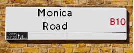
Monica Road is a street located in the city of Birmingham. The street has a length of approximately 999 metres.
Monica Road is located within the Birmingham District (B) Council's jurisdiction. They provide various services, like refuse collection, and manage council tax collection. It's situated in the West Midlands region of the UK.
Monica Road has been assigned the Unique Street Reference Number of 2706226 in the National Street Gazetteer.
Monica Road is located within the county of West Midlands, situated in the West Midlands region of the UK. It's 99.76 miles North West from central London., 2.67 miles East from Birmingham, 14.62 miles West from Coventry and 25 miles North East from Worcester.

Do you know why this road is called Monica Road?
What's it like to live here?
Ask the community a question about Monica Road.
Do you have any questions, memories to share or know any facts about Monica Road? We'd love to know more.
Also on streetlist.co.uk, can you help?
Eldroth Road
15th April 2024
I wondered if anyone has any old pictures of Wenning Bank House in the 1940’s and also Lane Side before of the same era .. we visited today with my Mum in law as she used to live at both these properties. Also any photos of the schools around that time .. thank you.
Can You Help?Napps Way
15th April 2024
Why is the road called Napps Way (belonging to Napp, but minus an
apostrophe as is usual with such nomenclature)? Moreover, who or
what is, or was, “Napp” in the respective, possessive case?
Several years ago, I met an elderly man (probably in his late-eighties)
who lives on Bentham Drive, Liverpool 16, and during a conversation
with him whilst in a Northwest Passenger Transport Ambulance on the
way to the former RLUH (Royal Liverpool University Hospital), he told
me that he could remember (when he was a boy, living in Childwall,
Liverpool 16) that, “Where Napps Way is now, during WW2, there was
a two-man gun emplacement on the, then, open land to protect the
railway line passing over Childwall Valley Road - next to the railway
bridge - when suddenly, as they were loading a live “shell” into the gun’s
breach, the aforementioned “shell” accidentally exploded in the gun’s
breach killing both of the two soldiers, that had been manning the gun,
instantly! (Very sad, of course, but could - perhaps - two ghosts relating
to those two, very unfortunately and prematurely-killed soldiers have
haunted that place of their deaths ever since - and have any residents
of Napps Way - formerly and in its latest incarnation - seen two, WW2
(uniformed) soldiers unexpectedly appear in or near their homes?)
Mauritius Road
15th April 2024
Why is Mauritius Road so called, since when and by whom? Does Greenwich have any particular links with Mauritius? Very interested to know. 🤞🏼
Can You Help?Estate Agents near Monica Road
| Name | Address | Website |
|---|---|---|
| M.T. Properties 4 U Ltd | 554 Green Lane, Bordesley Green, Birmingham,B9 5QQ | Visit Website |
| Golden Estates | 580 Coventry Road, Small Heath, Birmingham,B10 0US | Visit Website |
| Elite Sales & Lettings | 1182 Coventry Road, Yardley, Birmingham,B25 8DA | Visit Website |
We have found 8 postcodes for Monica Road
Hotels near Monica Road
Budget Hotels near Monica Road
| Budget Hotel Name | Distance (miles) |
|---|---|
| 1: Name:Holiday Inn Express Birmingham�South A45 Address:1270 Coventry Road, Yardley Telephone: Visit Site |
0.76 |
| 2: Name:Travelodge Birmingham Yardley Address:1741 Coventry Rd, Birmingham, B26 1DS Telephone:0871 984 6065 Visit Site |
1.63 |
| 3: Name:Travelodge Birmingham Central Bull Ring Address:Upper Dean St, Birmingham, B5 4SG Telephone:0871 984 6468 Visit Site |
2.33 |
| 4: Name:Holiday Inn Express Birmingham Star City Address:Cuckoo Road, Heartlands Parkway Telephone: Visit Site |
2.35 |
| 5: Name:Travelodge Birmingham Central Moor Street Address:Carrs Ln, Birmingham, B4 7SS Telephone:0871 984 6489 Visit Site |
2.37 |
Location Details
| Monica Road | |
|---|---|

| |
| Latitude | 52.469449 |
| Longitude | -1.839982 |
| OS Easting (X): | 410868 |
| OS Northing (Y): | 285776 |
| OS Grid Reference: | SP109858 |
Ordnance Survey Maps for Monica Road
If you purchase a map through the links below, we may earn an affiliate commission.
| Map Series | link | Ordnance Survey |
| Explorer 1:25,000 220 Birmingham, Walsall, Solihull and Redditch | Check Price on Amazon | |
| Landranger 1:50,000 139 Birmingham and Wolverhampton | Check Price on Amazon |
Neighbourhood Policing |
| Police Force: West Midlands |
 View Neighbourhood Crime and Policing View Neighbourhood Crime and Policing |
| Find a Local Neighbourhood Watch Scheme |
Frequently asked Questions for Monica Road
What Council (Local Authority) is Monica Road in?
Monica Road is located within the local authority area of Birmingham Council which is a Metropolitan District.
What Parish Council is Monica Road in?
Monica Road is in an unparished area.
What Electoral Ward is Monica Road in?
Monica Road is located within the ward of Small Heath.
What County is Monica Road in?
Monica Road is located within the ceremonial county of West Midlands.
What Constituency is Monica Road in?
Monica Road is located within the constituency of Birmingham &Hodge Hill.
What Part of the UK is Monica Road in?
Monica Road is located within the West Midlands (England) region of the United Kingdom.
What County Council area is Monica Road in?
Monica Road is located within the West Midlands Council area.
What Police Force area is Monica Road in?
Monica Road is located within the West Midlands Police area.
Roads that have a Junction with Monica Road
| Street | Junction Type |
|---|---|
| Somerville Road | junction |
| Coventry Road | junction |
| Hob Moor Road | junction |
| Kingscliff Road | junction |
| Fosbrooke Road | junction |
| Somerville Road | junction |
Sunset and Sunrise times for Monica Road
| Sunrise | 05:57 |
|---|---|
| Sunset | 20:15 |
Latest Weather Conditions for Monica Road
| Observed at Weather Station: | Coleshill 19 April 2024 at 08:00 (6.40 miles away) |
|---|---|
| Current Weather: | Drizzle |
| Temperature and Humidity: | 9.0°C (90.9%) |
| Wind Direction and Speed: | WNW (9 mph) |
Population Statistics
| ONS Area Code | E00047367, E00047298, E00047315, E00047314, E00047305 & E00047308 |
|---|---|
| ONS Area Name | Pakistani Communities |
| Average Age | 29.02, 30.30 & |
| Area Population | 1797.00, 1882.00 & |
| Male Population | 911.00, 909.00 & (49%) |
| Female Population | 886.00, 973.00 & (51%) |
| Benefit Claimants | 83, 71 & (4%) |
| LSOA Code: | E01009325, E01009335 &E01033642 |
|---|---|
| LSOA Name: | Birmingham 063A, Birmingham 139G &Birmingham 063F |
| SOA Code: | 7b |
| SOA Name: | |
| MSOA Code: | E02001889 &E02006900 |
| MSOA Name: | Birmingham 063 &Birmingham 139 |
Nearest Supermarkets
| Asda Small Heath |
|---|
| 859 Coventry Road, Small Heath, B10 0HH |
| 0121 766 7374 |
| Distance: 0.37 Miles |
| Directions from Monica Road to Asda Small Heath |
| Asda Bordesley Green |
|---|
| 271 Bordesley Green, Birmingham, B9 5EY |
| 0121 480 1800 |
| Distance: 0.68 Miles |
| Directions from Monica Road to Asda Bordesley Green |
| Morrisons Birmingham - Small Heath |
|---|
| 280 Coventry Road, Small Heath, Birmingham B10 0XA |
| 0121 771 2224 |
| Distance: 1.16 Miles |
| Directions from Monica Road to Morrisons Birmingham - Small Heath |
| Tesco Yardley Extra |
|---|
| Swan Shopping Centre, Coventry Rd, Birmingham, B26 1AD |
| 0345 671 9465 |
| Distance: 1.18 Miles |
| Directions from Monica Road to Tesco Yardley Extra |
Telephone Information
| Area Code |
|---|
| Area Code: 0121 - Birmingham |
| Area Code: 01675 - Coleshill |
| Area Code: 01676 - Meriden |
Broadband Information
| Speed | Average Speed | Median Speed | Maximum Speed | Next-generation access (NGA) | Number of Connections |
|---|---|---|---|---|---|
| Greater than 2 Mbps | 17 | 20 | >=30 | Y | 21 |
Local Government
| Local Council Details |
|---|
| Within the area of Birmingham |
| Visit the Council's Website |
| Council House, Victoria Square, Birmingham &B1 1BB |
| Send email |
| Telephone Number: 0121 303 1111 |
| Local Member of Parliament |
|---|
| Within the Westminster Parliamentary Constituency of Birmingham &Hodge Hill |
| The Member of Parliament is Liam Byrne |
| Details for the MP Liam Byrne on parliament.uk |
| Details for the MP Liam Byrne on theyworkforyou.com |
| In the 2019 General Election Liam Byrne won with a majority of 28,655 the result was Lab hold. The total electorate was 78,295 |
| Wards, Parish Councils and County Councils |
|---|
| Ward: Small Heath Ward |
| Ceremonial County: West Midlands |
Nearest Schools
| Name | Address | Postcode | Telephone | Type | Distance (Km) |
|---|
Data accessed from gov.scot 08-08-2019
Nearest Hospitals
| Name | Address | Postcode | Distance | Map |
|---|
Nearest Dentists
Dentists near Monica Road
| Name | Address | Postcode | Distance | Map |
|---|
Nearest GP Surgeries
Doctors near Monica Road
DR KHATTAK SH
Address: THE SURGERY, 182 MANSELL ROAD, SMALL HEATH, BIRMINGHAM, WEST MIDLANDS, B10 9NL
Distance: 0.27 miles
Contact: tel: 01217712218
AUBREY ROAD MEDICAL CENTRE
Address: 726-728 COVENTRY ROAD, SMALL HEATH, BIRMINGHAM, B10 0TU
Distance: 0.35 miles
Contact: tel: 0121 7732094
THE PARK MEDICAL CENTRE
Address: 691 COVENTRY ROAD, SMALL HEATH, BIRMINGHAM, WEST MIDLANDS, B10 0JL
Distance: 0.42 miles
Contact: tel: 0121 7964111
OMNIA PRACTICE
Address: 73 YARDLEY GREEN ROAD, BORDESLEY GREEN, BIRMINGHAM, WEST MIDLANDS, B9 5PU
Distance: 0.43 miles
Contact: tel: 0845 0724618
YARDLEY GREEN MEDICAL CENTRE
Address: 77 YARDLEY GREEN ROAD, BORDESLEY GREEN, BIRMINGHAM, WEST MIDLANDS, B9 5PU
Distance: 0.43 miles
Contact: tel: 0121 7733737
OMNIA MVP PILOT
Address: 73 YARDLEY GREEN ROAD, BORDESLEY GREEN, BIRMINGHAM, B9 5PU
Distance: 0.43 miles
Contact: tel: 01215 062000
Nearest Dispensing Chemists
Pharmacies near Monica Road
| Name | Address | Postcode | Telephone | Map | Distance in Km |
|---|
Nearest Opticians
Opticians near Monica Road
4667 SMALL HEATH
Address: ASDA STORES LTD, 859 COVENTRY ROAD, SMALL HEATH, BIRMINGHAM, WEST MIDLANDS, B10 0HH
Distance: 0.41 miles
Contact: :
EYECARE OPTICIANS (SMALL HEATH)
Address: 1A DORA ROAD, SMALL HEATH, BIRMINGHAM, B10 9RF
Distance: 0.43 miles
Contact: :
VISIONCRAFT
Address: 41 YARDLEY GREEN ROAD, BORDESLEY GREEN, BIRMINGHAM, WEST MIDLANDS, B9 5PU
Distance: 0.43 miles
Contact: :
RIGHTSPEX OPTICIANS
Address: 329 GREEN LANE, SMALL HEATH, BIRMINGHAM, WEST MIDLANDS, B9 5PW
Distance: 0.55 miles
Contact: :
EYESAVERS OPTICIANS LTD
Address: 467 BORDESLEY GREEN, BIRMINGHAM, WEST MIDLANDS, B9 5XF
Distance: 0.62 miles
Contact: :
EYECARE OPTICIANS
Address: 503A COVENTRY ROAD, SMALL HEATH, BIRMINGHAM, WEST MIDLANDS, B10 0LL
Distance: 0.66 miles
Contact: :
Transport
Nearest Rail Stations
Small Heath Station is 0.91 miles away.
Address: Small Heath station, Golden Hillock Road, Small Heath, West Midlands, B10 0DP
Small Heath is situated on the Chiltern Main Line|North Warwickshire (Shakespeare Line) Line.
Small Heath Station is staffed on a part time basis.
Tyseley Station is 1.06 miles away.
Address: Tyseley station, Wharfedale Road, Tyseley, West Midlands, B11 2HH
Tyseley is situated on the Chiltern Main Line|North Warwickshire (Shakespeare Line) Line.
Tyseley Station is staffed on a part time basis.