Map of Kingswood Road
| Postcodes | ||
|---|---|---|
| Icon | Postcodes for Kingswood Road | |
| Walking Distances | ||
| Distance Info | Green Circle = 10 Minutes Walk (800 metres) | |
About Kingswood Road
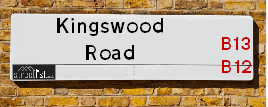
Kingswood Road is a street located in the city of Birmingham. The street has a length of approximately 394 metres.
Kingswood Road is located within the Birmingham District (B) Council's jurisdiction. They provide various services, like refuse collection, and manage council tax collection. It's situated in the West Midlands region of the UK.
Kingswood Road has been assigned the Unique Street Reference Number of 2703360 in the National Street Gazetteer.
Kingswood Road is located within the county of West Midlands, situated in the West Midlands region of the UK. It's 100.34 miles North West from central London., 2.02 miles South East from Birmingham, 16.07 miles West from Coventry and 22.95 miles North East from Worcester.

Do you know why this road is called Kingswood Road?
What's it like to live here?
Ask the community a question about Kingswood Road.
Do you have any questions, memories to share or know any facts about Kingswood Road? We'd love to know more.
Also on streetlist.co.uk, can you help?
Eldroth Road
15th April 2024
I wondered if anyone has any old pictures of Wenning Bank House in the 1940’s and also Lane Side before of the same era .. we visited today with my Mum in law as she used to live at both these properties. Also any photos of the schools around that time .. thank you.
Can You Help?Napps Way
15th April 2024
Why is the road called Napps Way (belonging to Napp, but minus an
apostrophe as is usual with such nomenclature)? Moreover, who or
what is, or was, “Napp” in the respective, possessive case?
Several years ago, I met an elderly man (probably in his late-eighties)
who lives on Bentham Drive, Liverpool 16, and during a conversation
with him whilst in a Northwest Passenger Transport Ambulance on the
way to the former RLUH (Royal Liverpool University Hospital), he told
me that he could remember (when he was a boy, living in Childwall,
Liverpool 16) that, “Where Napps Way is now, during WW2, there was
a two-man gun emplacement on the, then, open land to protect the
railway line passing over Childwall Valley Road - next to the railway
bridge - when suddenly, as they were loading a live “shell” into the gun’s
breach, the aforementioned “shell” accidentally exploded in the gun’s
breach killing both of the two soldiers, that had been manning the gun,
instantly! (Very sad, of course, but could - perhaps - two ghosts relating
to those two, very unfortunately and prematurely-killed soldiers have
haunted that place of their deaths ever since - and have any residents
of Napps Way - formerly and in its latest incarnation - seen two, WW2
(uniformed) soldiers unexpectedly appear in or near their homes?)
Mauritius Road
15th April 2024
Why is Mauritius Road so called, since when and by whom? Does Greenwich have any particular links with Mauritius? Very interested to know. 🤞🏼
Can You Help?Estate Agents near Kingswood Road
| Name | Address | Website |
|---|---|---|
| BNK Properties Ltd | 145-150 Brighton Road, Moseley, Birmingham,B12 8QN | |
| Glenwood Property Services | 412 Ladypool Road, Moseley, Birmingham, B12 8JZ | Visit Website |
| Profectus Estates | 128 Alcester Rd, Moseley, Birmingham,B13 8EE | Visit Website |
Location Details
| Kingswood Road | |
|---|---|

| |
| Latitude | 52.452385 |
| Longitude | -1.882394 |
| OS Easting (X): | 407991 |
| OS Northing (Y): | 283873 |
| OS Grid Reference: | SP080839 |
Ordnance Survey Maps for Kingswood Road
If you purchase a map through the links below, we may earn an affiliate commission.
| Map Series | link | Ordnance Survey |
| Explorer 1:25,000 220 Birmingham, Walsall, Solihull and Redditch | Check Price on Amazon | |
| Landranger 1:50,000 139 Birmingham and Wolverhampton | Check Price on Amazon |
Neighbourhood Policing |
| Police Force: West Midlands |
 View Neighbourhood Crime and Policing View Neighbourhood Crime and Policing |
| Find a Local Neighbourhood Watch Scheme |
Frequently asked Questions for Kingswood Road
What Council (Local Authority) is Kingswood Road in?
Kingswood Road is located within the local authority area of Birmingham Council which is a Metropolitan District.
What Parish Council is Kingswood Road in?
Kingswood Road is in an unparished area.
What Electoral Ward is Kingswood Road in?
Kingswood Road is located within the ward of Moseley.
What County is Kingswood Road in?
Kingswood Road is located within the ceremonial county of West Midlands.
What Constituency is Kingswood Road in?
Kingswood Road is located within the constituency of Birmingham &Hall Green.
What Part of the UK is Kingswood Road in?
Kingswood Road is located within the West Midlands (England) region of the United Kingdom.
What County Council area is Kingswood Road in?
Kingswood Road is located within the West Midlands Council area.
What Police Force area is Kingswood Road in?
Kingswood Road is located within the West Midlands Police area.
Roads that have a Junction with Kingswood Road
| Street | Junction Type |
|---|---|
| Brighton Road | junction |
| Newport Road | junction |
| Chestnut Road | junction |
| Sandford Road | junction |
Sunset and Sunrise times for Kingswood Road
| Sunrise | 05:45 |
|---|---|
| Sunset | 20:25 |
Latest Weather Conditions for Kingswood Road
| Observed at Weather Station: | Coleshill 25 April 2024 at 12:00 (8.36 miles away) |
|---|---|
| Current Weather: | Overcast |
| Temperature and Humidity: | 10.3°C (66.7%) |
| Wind Direction and Speed: | NNW (6 mph) |
Population Statistics
| ONS Area Code | E00047526 & E00047576 |
|---|---|
| ONS Area Name | Asian Terraces and Flats & Pakistani Communities |
| LSOA Code: | E01033648 |
|---|---|
| LSOA Name: | Birmingham 084F |
| SOA Code: | 7b |
| SOA Name: | |
| MSOA Code: | E02001910 |
| MSOA Name: | Birmingham 084 |
Nearest Supermarkets
| Sainsburys Alcester Road Local |
|---|
| 158-162 Alcester Road, Birmingham, England, B13 8HS |
| 1214496499 |
| Distance: 0.41 Miles |
| Directions from Kingswood Road to Sainsburys Alcester Road Local |
| Asda Kings Heath |
|---|
| 99 High Street, Kings Heath, Birmingham, B14 7BW |
| 0121 483 4410 |
| Distance: 1.25 Miles |
| Directions from Kingswood Road to Asda Kings Heath |
| Iceland Kings Heath |
|---|
| Unit 10 Institutes Road, Kings Heath, Birmingham, B14 7EG |
| 01214441862 |
| Distance: 1.33 Miles |
| Directions from Kingswood Road to Iceland Kings Heath |
| Sainsburys Kings Heath |
|---|
| 38-54 Alcester Road South, Birmingham, England, B14 7PT |
| 0121 444 3251 |
| Distance: 1.53 Miles |
| Directions from Kingswood Road to Sainsburys Kings Heath |
Telephone Information
| Area Code |
|---|
| Area Code: 0121 - Birmingham |
| Area Code: 01675 - Coleshill |
| Area Code: 01384 - Dudley |
Broadband Information
| Speed | Average Speed | Median Speed | Maximum Speed | Next-generation access (NGA) | Number of Connections |
|---|---|---|---|---|---|
| Less than 2 Mbps | 17.5 | 11.9 | >=30 | Y | 21 |
Local Government
| Local Council Details |
|---|
| Within the area of Birmingham |
| Visit the Council's Website |
| Council House, Victoria Square, Birmingham &B1 1BB |
| Send email |
| Telephone Number: 0121 303 1111 |
| Local Member of Parliament |
|---|
| Within the Westminster Parliamentary Constituency of Birmingham &Hall Green |
| The Member of Parliament is Tahir Ali |
| Details for the MP Tahir Ali on parliament.uk |
| Details for the MP Tahir Ali on theyworkforyou.com |
| In the 2019 General Election Tahir Ali won with a majority of 28,508 the result was Lab hold. The total electorate was 80,283 |
| Wards, Parish Councils and County Councils |
|---|
| Ward: Moseley Ward |
| Ceremonial County: West Midlands |
Nearest Schools
England Primary Schools
Greet Primary School
Address: Greet Primary School, Percy Road, Sparkhill, Birmingham, West Midlands, B11 3ND
Distance: 1.04 miles
Contact:
English Martyrs' Catholic Primary School
Address: English Martyrs' Catholic Primary School, Evelyn Road, Sparkhill, English Martyrs Rc Junior & Infant School, Birmingham, West Midlands, B11 3JW
Distance: 0.79 miles
Contact: 01214643150
St Bernard's Catholic Primary School
Address: St Bernard's Catholic Primary School, Wake Green Road, Moseley, Birmingham, West Midlands, B13 9QE
Distance: 1.30 miles
Contact: 01214643795
Anderton Park Primary School
Address: Anderton Park Primary School, Dennis Road, Sparkhill, Birmingham, West Midlands, B12 8BL
Distance: 0.34 miles
Contact: 01214641581
Arden Primary School
Address: Arden Primary School, Baker Street, Sparkhill, Birmingham, West Midlands, B11 4SF
Distance: 0.83 miles
Contact: 01216757702
Conway Primary School
Address: Conway Primary School, Conway Road, Sparkbrook, Birmingham, West Midlands, B11 1NS
Distance: 0.80 miles
Contact:
Christ Church CofE Controlled Primary School and Nursery
Address: Christ Church CofE Controlled Primary School and Nursery, Claremont Road, Sparkbrook, Birmingham, West Midlands, B11 1LF
Distance: 0.86 miles
Contact: 01216755121
St John and Monica Catholic Primary School
Address: St John and Monica Catholic Primary School, Chantry Road, Moseley, Birmingham, West Midlands, B13 8DW
Distance: 0.50 miles
Contact: 01214645868
St Martin de Porres Catholic Primary School
Address: St Martin de Porres Catholic Primary School, Oakland Road, Moseley, Birmingham, West Midlands, B13 9DN
Distance: 0.33 miles
Contact: 01214645500
Moseley Church of England Primary School
Address: Moseley Church of England Primary School, Oxford Road, Moseley, Birmingham, West Midlands, B13 9EH
Distance: 0.59 miles
Contact: 01214490441
Nelson Mandela School
Address: Nelson Mandela School, Colville Road, Sparkbrook, Nelson Mandela Community School, Birmingham, West Midlands, B12 8EH
Distance: 0.45 miles
Contact: 01217723055
Ladypool Primary School
Address: Ladypool Primary School, Stratford Road, Sparkbrook, Birmingham, West Midlands, B11 1QT
Distance: 0.69 miles
Contact: 01214647002
King David Primary School
Address: King David Primary School, Alcester Road, Moseley, Birmingham, West Midlands, B13 8EY
Distance: 0.60 miles
Contact: 01214493364
St Anne's Catholic Primary School
Address: St Anne's Catholic Primary School, Lowe Street, Camp Hill, Birmingham, West Midlands, B12 0ER
Distance: 1.22 miles
Contact: 01216755037
Park Hill Primary School
Address: Park Hill Primary School, Alcester Road, Birmingham, West Midlands, B13 8BB
Distance: 0.22 miles
Contact: 01214493004
Heath Mount Primary School
Address: Heath Mount Primary School, Knutsford Street, Balsall Heath, BIRMINGHAM, West Midlands, B12 9SR
Distance: 0.63 miles
Contact:
Chandos Primary School
Address: Chandos Primary School, Vaughton Street South, Highgate, Birmingham, West Midlands, B12 0YN
Distance: 1.16 miles
Contact:
Montgomery Primary Academy
Address: Montgomery Primary Academy, White Road, Sparkbrook, Birmingham, West Midlands, B11 1EH
Distance: 1.01 miles
Contact: 01214649115
Harper Bell Seventh-day Adventist School
Address: Harper Bell Seventh-day Adventist School, 29 Ravenhurst Street, Camp Hill, Birmingham, West Midlands, B12 0EJ
Distance: 1.19 miles
Contact: 01216937742
Conway Primary School
Address: Conway Primary School, Conway Road, Sparkbrook, Birmingham, West Midlands, B11 1NS
Distance: 0.80 miles
Contact: 01216750622
Ark Tindal Primary Academy
Address: Ark Tindal Primary Academy, Tindal Street, Balsall Heath, Birmingham, West Midlands, B12 9QS
Distance: 0.37 miles
Contact: 01214643049
Chandos Primary School
Address: Chandos Primary School, Vaughton Street South, Highgate, Birmingham, West Midlands, B12 0YN
Distance: 1.16 miles
Contact: 01214643881
Percy Shurmer Academy
Address: Percy Shurmer Academy, Longmore Street, Balsall Heath, Birmingham, West Midlands, B12 9ED
Distance: 0.89 miles
Contact: 01214643431
Greet Primary School
Address: Greet Primary School, Percy Road, Sparkhill, Birmingham, West Midlands, B11 3ND
Distance: 1.04 miles
Contact: 01214643360
St John's CofE Primary School
Address: St John's CofE Primary School, Stratford Road, Sparkhill, Birmingham, West Midlands, B11 4EA
Distance: 0.78 miles
Contact: 01216751469
Springfield Primary Academy
Address: Springfield Primary Academy, Springfield Road, Moseley, Birmingham, West Midlands, B13 9NY
Distance: 1.13 miles
Contact: 01214643618
Springfield Primary School
Address: Springfield Primary School, Springfield Road, Moseley, Birmingham, West Midlands, B13 9NY
Distance: 1.13 miles
Contact:
Clifton Primary School
Address: Clifton Primary School, Brunswick Road, Balsall Heath, Birmingham, West Midlands, B12 8NX
Distance: 0.34 miles
Contact: 01214642926
Kings Heath Primary School
Address: Kings Heath Primary School, Valentine Road, Kings Heath, Birmingham, West Midlands, B14 7AJ
Distance: 1.05 miles
Contact: 01214649202
England Secondary Schools
Moseley School and Sixth Form
Address: Moseley School and Sixth Form, Wake Green Road, Moseley, Birmingham, West Midlands, B13 9UU
Distance: 1.18 miles
Contact: 01215666444
Queensbridge School
Address: Queensbridge School, Queensbridge Road, Moseley, Birmingham, West Midlands, B13 8QB
Distance: 1.04 miles
Contact: 01214645566
Ark Boulton Academy
Address: Ark Boulton Academy, Golden Hillock Road, Sparkhill, Birmingham, West Midlands, B11 2QG
Distance: 1.01 miles
Contact: 01217738156
Ark St Alban's Academy
Address: Ark St Alban's Academy, Conybere Street, Birmingham, West Midlands, B12 0YH
Distance: 0.93 miles
Contact: 01214461300
England Higher Schools
Joseph Chamberlain Sixth Form College
Address: Joseph Chamberlain Sixth Form College, Belgrave Road, Highgate, Birmingham, West Midlands, B12 9FF
Distance: 0.70 miles
Contact: 01214462223
Nearest Hospitals
| Name | Address | Postcode | Distance | Map |
|---|
Nearest Dentists
Dentists near Kingswood Road
| Name | Address | Postcode | Distance | Map |
|---|
Nearest GP Surgeries
Doctors near Kingswood Road
NEWPORT MEDICAL GROUP
Address: NEWPORT MEDICAL PRACTICE, 1 NEWPORT ROAD, BIRMINGHAM, B12 8QE
Distance: 0.12 miles
Contact: tel: 0121 4491327
STONEY LANE SURGERY (NEWPORT MEDICAL PRACTICE) - COVID LOCAL VACCINATION SERVICE 2
Address: 234 STONEY LANE, BALSALL HEATH, BIRMINGHAM, B12 8AW
Distance: 0.41 miles
Contact: :
DR AHMED B
Address: 234 STONEY LANE, BALSALL HEATH, BIRMINGHAM, WEST MIDLANDS, B12 8AW
Distance: 0.41 miles
Contact: tel: 01214491327
FIRSTCARE PRACTICE
Address: BALSALL HEATH HEALTH CENTRE, 43 EDWARD ROAD, BALSALL HEATH, BIRMINGHAM, B12 9LP
Distance: 0.42 miles
Contact: tel: 0121 4404666
DR WALJI AND COLLEAGUES
Address: BALSALL HEATH HEALTH CTR, 43 EDWARD ROAD, BIRMINGHAM, WEST MIDLANDS, B12 9LP
Distance: 0.42 miles
Contact: tel: 0121 2893037
BALSALL HEATH HEALTH CENTRE (S)
Address: BALSALL HEATH HEALTH CENTRE, 43 EDWARD ROAD, BALSALL HEATH, BIRMINGHAM, WEST MIDLANDS, B12 9LP
Distance: 0.42 miles
Contact: tel: 0121 4110345
Nearest Dispensing Chemists
Pharmacies near Kingswood Road
| Name | Address | Postcode | Telephone | Map | Distance in Km |
|---|
Nearest Opticians
Opticians near Kingswood Road
EYE SIGHT OPTICIAN
Address: 385 LADYPOOL ROAD, BIRMINGHAM, WEST MIDLANDS, B12 8LA
Distance: 0.15 miles
Contact: :
BIRMINGHAM OPTICAL GROUP LTD
Address: 583 MOSELEY ROAD, BIRMINGHAM, WEST MIDLANDS, B12 9BL
Distance: 0.25 miles
Contact: :
URBAN OPTICIAN
Address: 563 MOSELEY ROAD, BALSALL HEATH, BIRMINGHAM, WEST MIDLANDS, B12 9AE
Distance: 0.29 miles
Contact: :
URBAN OPTICALS
Address: 536 MOSELEY ROAD, BIRMINGHAM, B12 9AE
Distance: 0.29 miles
Contact: :
SHIFA EYE CLINIC LIMITED
Address: 512 - 514 MOSELEY ROAD, BIRMINGHAM, WEST MIDLANDS, B12 9AH
Distance: 0.34 miles
Contact: :
EYECON
Address: 259 STONEY LANE, BALSALL HEATH, BIRMINGHAM, WEST MIDLANDS, B12 8AR
Distance: 0.38 miles
Contact: :
Transport
Nearest Rail Stations
Small Heath Station is 1.25 miles away.
Address: Small Heath station, Golden Hillock Road, Small Heath, West Midlands, B10 0DP
Small Heath is situated on the Chiltern Main Line|North Warwickshire (Shakespeare Line) Line.
Small Heath Station is staffed on a part time basis.
Bordesley Station is 1.36 miles away.
Address: Bordesley station, Coventry Road, Camp Hill, Birmingham, B9 4HF
Bordesley is situated on the Chiltern Main Line|North Warwickshire (Shakespeare Line) Line.
Bordesley Station is an unstaffed station.