Map of Clifton Road
| Postcodes | ||
|---|---|---|
| Icon | Postcodes for Clifton Road | |
| Walking Distances | ||
| Distance Info | Green Circle = 10 Minutes Walk (800 metres) | |
About Clifton Road
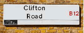
Clifton Road is a street located in the city of Birmingham. The street has a length of approximately 935 metres.
Clifton Road is located within the Birmingham District (B) Council's jurisdiction. They provide various services, like refuse collection, and manage council tax collection. It's situated in the West Midlands region of the UK.
Clifton Road has been assigned the Unique Street Reference Number of 2703136 in the National Street Gazetteer.
Clifton Road is located within the county of West Midlands, situated in the West Midlands region of the UK. It's 100.38 miles North West from central London., 1.89 miles South East from Birmingham, 16 miles West from Coventry and 23.17 miles North East from Worcester.

Do you know why this road is called Clifton Road?
What's it like to live here?
Ask the community a question about Clifton Road.
Do you have any questions, memories to share or know any facts about Clifton Road? We'd love to know more.
Also on streetlist.co.uk, can you help?
Eldroth Road
15th April 2024
I wondered if anyone has any old pictures of Wenning Bank House in the 1940’s and also Lane Side before of the same era .. we visited today with my Mum in law as she used to live at both these properties. Also any photos of the schools around that time .. thank you.
Can You Help?Napps Way
15th April 2024
Why is the road called Napps Way (belonging to Napp, but minus an
apostrophe as is usual with such nomenclature)? Moreover, who or
what is, or was, “Napp” in the respective, possessive case?
Several years ago, I met an elderly man (probably in his late-eighties)
who lives on Bentham Drive, Liverpool 16, and during a conversation
with him whilst in a Northwest Passenger Transport Ambulance on the
way to the former RLUH (Royal Liverpool University Hospital), he told
me that he could remember (when he was a boy, living in Childwall,
Liverpool 16) that, “Where Napps Way is now, during WW2, there was
a two-man gun emplacement on the, then, open land to protect the
railway line passing over Childwall Valley Road - next to the railway
bridge - when suddenly, as they were loading a live “shell” into the gun’s
breach, the aforementioned “shell” accidentally exploded in the gun’s
breach killing both of the two soldiers, that had been manning the gun,
instantly! (Very sad, of course, but could - perhaps - two ghosts relating
to those two, very unfortunately and prematurely-killed soldiers have
haunted that place of their deaths ever since - and have any residents
of Napps Way - formerly and in its latest incarnation - seen two, WW2
(uniformed) soldiers unexpectedly appear in or near their homes?)
Mauritius Road
15th April 2024
Why is Mauritius Road so called, since when and by whom? Does Greenwich have any particular links with Mauritius? Very interested to know. 🤞🏼
Can You Help?Estate Agents near Clifton Road
| Name | Address | Website |
|---|---|---|
| BNK Properties Ltd | 145-150 Brighton Road, Moseley, Birmingham,B12 8QN | |
| Glenwood Property Services | 412 Ladypool Road, Moseley, Birmingham, B12 8JZ | Visit Website |
| Midland Housing Ltd | 81 Stoney Lane, Birmingham, B12 8EQ | Visit Website |
We have found 12 postcodes for Clifton Road
Hotels near Clifton Road
Budget Hotels near Clifton Road
| Budget Hotel Name | Distance (miles) |
|---|---|
| 1: Name:ibis budget Birmingham Centre Address:Great Colmore Street Telephone: Visit Site |
1.42 |
| 2: Name:Travelodge Birmingham Central Bull Ring Address:Upper Dean St, Birmingham, B5 4SG Telephone:0871 984 6468 Visit Site |
1.51 |
| 3: Name:easyHotel Birmingham Address:81 John Bright Street Telephone: Visit Site |
1.76 |
| 4: Name:Premier Inn Birmingham City Centre - New Street Address:Birmingham Exchange Buildings, Stephenson Place Telephone: Visit Site |
1.80 |
| 5: Name:Travelodge Birmingham Central Moor Street Address:Carrs Ln, Birmingham, B4 7SS Telephone:0871 984 6489 Visit Site |
1.80 |
Location Details
| Clifton Road | |
|---|---|

| |
| Latitude | 52.455226 |
| Longitude | -1.879732 |
| OS Easting (X): | 408171 |
| OS Northing (Y): | 284189 |
| OS Grid Reference: | SP082842 |
Ordnance Survey Maps for Clifton Road
If you purchase a map through the links below, we may earn an affiliate commission.
| Map Series | link | Ordnance Survey |
| Explorer 1:25,000 220 Birmingham, Walsall, Solihull and Redditch | Check Price on Amazon | |
| Landranger 1:50,000 139 Birmingham and Wolverhampton | Check Price on Amazon |
Neighbourhood Policing |
| Police Force: West Midlands |
 View Neighbourhood Crime and Policing View Neighbourhood Crime and Policing |
| Find a Local Neighbourhood Watch Scheme |
Frequently asked Questions for Clifton Road
What Council (Local Authority) is Clifton Road in?
Clifton Road is located within the local authority area of Birmingham Council which is a Metropolitan District.
What Parish Council is Clifton Road in?
Clifton Road is in an unparished area.
What Electoral Ward is Clifton Road in?
Clifton Road is located within the ward of Sparkbrook & Balsall Heath East &Sparkhill.
What County is Clifton Road in?
Clifton Road is located within the ceremonial county of West Midlands.
What Constituency is Clifton Road in?
Clifton Road is located within the constituency of Birmingham &Hall Green.
What Part of the UK is Clifton Road in?
Clifton Road is located within the West Midlands (England) region of the United Kingdom.
What County Council area is Clifton Road in?
Clifton Road is located within the West Midlands Council area.
What Police Force area is Clifton Road in?
Clifton Road is located within the West Midlands Police area.
Roads that have a Junction with Clifton Road
| Street | Junction Type |
|---|---|
| Roshven Road | junction |
| Ladypool Road | junction |
| White Street | junction |
| Copperbeech Drive | junction |
| Brunel Close | junction |
| Hertford Street | junction |
| Malvern Street | junction |
| Lime Grove | junction |
| Moseley Road (A435) | junction |
Sunset and Sunrise times for Clifton Road
| Sunrise | 05:55 |
|---|---|
| Sunset | 20:17 |
Latest Weather Conditions for Clifton Road
| Observed at Weather Station: | Coleshill 20 April 2024 at 12:00 (8.21 miles away) |
|---|---|
| Current Weather: | Overcast |
| Temperature and Humidity: | 9.6°C (55.4%) |
| Wind Direction and Speed: | N (9 mph) |
Population Statistics
| ONS Area Code | E00047558, E00047565, E00047564, E00047516 & E00175749 |
|---|---|
| ONS Area Name | Pakistani Communities & Asian Terraces and Flats |
| Average Age | 28.18, 29.09 & 29.61 |
| Area Population | 1590.00, 1370.00 & 1932.00 |
| Male Population | 809.00, 687.00 & 972.00 (50%) |
| Female Population | 781.00, 683.00 & 960.00 (50%) |
| Benefit Claimants | 76, 103 & 91 (6%) |
| LSOA Code: | E01009399, E01009377 &E01009375 |
|---|---|
| LSOA Name: | Birmingham 083E, Birmingham 083C &Birmingham 083B |
| SOA Code: | 7b |
| SOA Name: | |
| MSOA Code: | E02001909 |
| MSOA Name: | Birmingham 083 |
Nearest Supermarkets
| Sainsburys Alcester Road Local |
|---|
| 158-162 Alcester Road, Birmingham, England, B13 8HS |
| 1214496499 |
| Distance: 0.63 Miles |
| Directions from Clifton Road to Sainsburys Alcester Road Local |
| Iceland Birmingham St Andrews |
|---|
| Unit 5 St Andrews Shp Prk, 270 Coventry Road, Birmingham, B10 0XA |
| 01217738537 |
| Distance: 1.41 Miles |
| Directions from Clifton Road to Iceland Birmingham St Andrews |
| Morrisons Birmingham - Small Heath |
|---|
| 280 Coventry Road, Small Heath, Birmingham B10 0XA |
| 0121 771 2224 |
| Distance: 1.44 Miles |
| Directions from Clifton Road to Morrisons Birmingham - Small Heath |
| Tesco Birmingham Hurst St Express |
|---|
| Hurst St, Birmingham, B5 4TP |
| 0345 675 7021 |
| Distance: 1.45 Miles |
| Directions from Clifton Road to Tesco Birmingham Hurst St Express |
Telephone Information
| Area Code |
|---|
| Area Code: 0121 - Birmingham |
| Area Code: 01675 - Coleshill |
| Area Code: 01384 - Dudley |
Broadband Information
| Speed | Average Speed | Median Speed | Maximum Speed | Next-generation access (NGA) | Number of Connections |
|---|---|---|---|---|---|
| Greater than 2 Mbps | 12.9 | 13.5 | 14.2 | N | 3 |
Local Government
| Local Council Details |
|---|
| Within the area of Birmingham |
| Visit the Council's Website |
| Council House, Victoria Square, Birmingham &B1 1BB |
| Send email |
| Telephone Number: 0121 303 1111 |
| Local Member of Parliament |
|---|
| Within the Westminster Parliamentary Constituency of Birmingham &Hall Green |
| The Member of Parliament is Tahir Ali |
| Details for the MP Tahir Ali on parliament.uk |
| Details for the MP Tahir Ali on theyworkforyou.com |
| In the 2019 General Election Tahir Ali won with a majority of 28,508 the result was Lab hold. The total electorate was 80,283 |
| Wards, Parish Councils and County Councils |
|---|
| Ward: Sparkbrook & Balsall Heath East &Sparkhill Ward |
| Ceremonial County: West Midlands |
Nearest Schools
| Name | Address | Postcode | Telephone | Type | Distance (Km) |
|---|
Data accessed from gov.scot 08-08-2019
Nearest Hospitals
| Name | Address | Postcode | Distance | Map |
|---|
Nearest Dentists
Dentists near Clifton Road
| Name | Address | Postcode | Distance | Map |
|---|
Nearest GP Surgeries
Doctors near Clifton Road
NEWPORT MEDICAL GROUP
Address: NEWPORT MEDICAL PRACTICE, 1 NEWPORT ROAD, BIRMINGHAM, B12 8QE
Distance: 0.21 miles
Contact: tel: 0121 4491327
FIRSTCARE PRACTICE
Address: BALSALL HEATH HEALTH CENTRE, 43 EDWARD ROAD, BALSALL HEATH, BIRMINGHAM, B12 9LP
Distance: 0.38 miles
Contact: tel: 0121 4404666
DR WALJI AND COLLEAGUES
Address: BALSALL HEATH HEALTH CTR, 43 EDWARD ROAD, BIRMINGHAM, WEST MIDLANDS, B12 9LP
Distance: 0.38 miles
Contact: tel: 0121 2893037
BALSALL HEATH HEALTH CENTRE (S)
Address: BALSALL HEATH HEALTH CENTRE, 43 EDWARD ROAD, BALSALL HEATH, BIRMINGHAM, WEST MIDLANDS, B12 9LP
Distance: 0.38 miles
Contact: tel: 0121 4110345
STONEY LANE SURGERY (NEWPORT MEDICAL PRACTICE) - COVID LOCAL VACCINATION SERVICE 2
Address: 234 STONEY LANE, BALSALL HEATH, BIRMINGHAM, B12 8AW
Distance: 0.39 miles
Contact: :
DR AHMED B
Address: 234 STONEY LANE, BALSALL HEATH, BIRMINGHAM, WEST MIDLANDS, B12 8AW
Distance: 0.39 miles
Contact: tel: 01214491327
Nearest Dispensing Chemists
Pharmacies near Clifton Road
| Name | Address | Postcode | Telephone | Map | Distance in Km |
|---|
Nearest Opticians
Opticians near Clifton Road
EYE SIGHT OPTICIAN
Address: 385 LADYPOOL ROAD, BIRMINGHAM, WEST MIDLANDS, B12 8LA
Distance: 0.20 miles
Contact: :
OPTICARE (SPARKBROOK)
Address: 150A LADYPOOL ROAD, SPARKBROOK, BIRMINGHAM, WEST MIDLANDS, B12 8JS
Distance: 0.22 miles
Contact: :
URBAN OPTICIAN
Address: 563 MOSELEY ROAD, BALSALL HEATH, BIRMINGHAM, WEST MIDLANDS, B12 9AE
Distance: 0.26 miles
Contact: :
URBAN OPTICALS
Address: 536 MOSELEY ROAD, BIRMINGHAM, B12 9AE
Distance: 0.26 miles
Contact: :
SHIFA EYE CLINIC LIMITED
Address: 512 - 514 MOSELEY ROAD, BIRMINGHAM, WEST MIDLANDS, B12 9AH
Distance: 0.27 miles
Contact: :
BIRMINGHAM OPTICAL GROUP LTD
Address: 583 MOSELEY ROAD, BIRMINGHAM, WEST MIDLANDS, B12 9BL
Distance: 0.34 miles
Contact: :
Transport
Nearest Rail Stations
Small Heath Station is 1.04 miles away.
Address: Small Heath station, Golden Hillock Road, Small Heath, West Midlands, B10 0DP
Small Heath is situated on the Chiltern Main Line|North Warwickshire (Shakespeare Line) Line.
Small Heath Station is staffed on a part time basis.
Bordesley Station is 1.15 miles away.
Address: Bordesley station, Coventry Road, Camp Hill, Birmingham, B9 4HF
Bordesley is situated on the Chiltern Main Line|North Warwickshire (Shakespeare Line) Line.
Bordesley Station is an unstaffed station.