Map of Hagley Road
| Postcodes | ||
|---|---|---|
| Icon | Postcodes for Hagley Road | |
| Walking Distances | ||
| Distance Info | Green Circle = 10 Minutes Walk (800 metres) | |
About Hagley Road
Hagley Road is a street located in the city of Birmingham. The street has a length of approximately 4,380 metres.
Hagley Road is located within the Birmingham District (B) and Sandwell District (B) Council's jurisdiction. They provide various services, like refuse collection, and manage council tax collection. It's situated in the West Midlands region of the UK.
Hagley Road has been assigned the Unique Street Reference Numbers of 2735904, 2735905, 2701741, 2709445, 2759190 and 33621540 in the National Street Gazetteer.
Hagley Road is located within the county of West Midlands, situated in the West Midlands region of the UK. It's 103.12 miles North West from central London., 1.74 miles West from Birmingham, 18.78 miles West from Coventry and 22.66 miles North East from Worcester.

Do you know why this road is called Hagley Road?
What's it like to live here?
Ask the community a question about Hagley Road.
Do you have any questions, memories to share or know any facts about Hagley Road? We'd love to know more.
Also on streetlist.co.uk, can you help?
Eldroth Road
15th April 2024
I wondered if anyone has any old pictures of Wenning Bank House in the 1940’s and also Lane Side before of the same era .. we visited today with my Mum in law as she used to live at both these properties. Also any photos of the schools around that time .. thank you.
Can You Help?Napps Way
15th April 2024
Why is the road called Napps Way (belonging to Napp, but minus an
apostrophe as is usual with such nomenclature)? Moreover, who or
what is, or was, “Napp” in the respective, possessive case?
Several years ago, I met an elderly man (probably in his late-eighties)
who lives on Bentham Drive, Liverpool 16, and during a conversation
with him whilst in a Northwest Passenger Transport Ambulance on the
way to the former RLUH (Royal Liverpool University Hospital), he told
me that he could remember (when he was a boy, living in Childwall,
Liverpool 16) that, “Where Napps Way is now, during WW2, there was
a two-man gun emplacement on the, then, open land to protect the
railway line passing over Childwall Valley Road - next to the railway
bridge - when suddenly, as they were loading a live “shell” into the gun’s
breach, the aforementioned “shell” accidentally exploded in the gun’s
breach killing both of the two soldiers, that had been manning the gun,
instantly! (Very sad, of course, but could - perhaps - two ghosts relating
to those two, very unfortunately and prematurely-killed soldiers have
haunted that place of their deaths ever since - and have any residents
of Napps Way - formerly and in its latest incarnation - seen two, WW2
(uniformed) soldiers unexpectedly appear in or near their homes?)
Mauritius Road
15th April 2024
Why is Mauritius Road so called, since when and by whom? Does Greenwich have any particular links with Mauritius? Very interested to know. 🤞🏼
Can You Help?Estate Agents near Hagley Road
| Name | Address | Website |
|---|---|---|
| Let Prestige Ltd | The Ciba Building 146 Hagley Road, Birmingham,B16 9NX | Visit Website |
| James Laurence Sales and Lettings | 5 Chad Square Birmingham, B15 3TQ | Visit Website |
| Premier Student Homes | 1 Harold Road, Ladywood, Birmingham, B16 9DN | Visit Website |
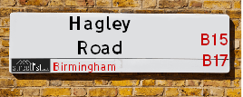
We have found 65 postcodes for Hagley Road
Hotels near Hagley Road
Budget Hotels near Hagley Road
| Budget Hotel Name | Distance (miles) |
|---|---|
| 1: Name:Premier Inn Birmingham Central Hagley Road Address:176 - 184 Hagley Road Telephone: Visit Site |
0.09 |
| 2: Name:Travelodge Birmingham Central Broadway Plaza Address:220 Ladywood Middleway, Birmingham, B16 8LP Telephone:0871 984 6325 Visit Site |
0.82 |
| 3: Name:Premier Inn Birmingham City Centre Broad Street Address:Essington Street Telephone: Visit Site |
1.10 |
| 4: Name:Premier Inn Birmingham Broad Street Brindley Place Address:Essington Street Telephone: Visit Site |
1.10 |
| 5: Name:Travelodge Birmingham Central Address:230 Broad St, Birmingham, B15 1AY Telephone:0871 984 6064 Visit Site |
1.22 |
Location Details
| Hagley Road | |
|---|---|

| |
| Latitude | 52.472336 |
| Longitude | -1.940940 |
| OS Easting (X): | 404011 |
| OS Northing (Y): | 286087 |
| OS Grid Reference: | SP040861 |
Ordnance Survey Maps for Hagley Road
If you purchase a map through the links below, we may earn an affiliate commission.
| Map Series | link | Ordnance Survey |
| Explorer 1:25,000 220 Birmingham, Walsall, Solihull and Redditch | Check Price on Amazon | |
| Landranger 1:50,000 139 Birmingham and Wolverhampton | Check Price on Amazon |
Neighbourhood Policing |
| Police Force: West Midlands |
 View Neighbourhood Crime and Policing View Neighbourhood Crime and Policing |
| Find a Local Neighbourhood Watch Scheme |
Frequently asked Questions for Hagley Road
What Council (Local Authority) is Hagley Road in?
Hagley Road is located within the local authority area of Birmingham &Sandwell Council which is a Metropolitan District.
What Parish Council is Hagley Road in?
Hagley Road is in an unparished area.
What Electoral Ward is Hagley Road in?
Hagley Road is located within the ward of Ladywood, Edgbaston, North Edgbaston, Harborne &Abbey.
What County is Hagley Road in?
Hagley Road is located within the ceremonial county of West Midlands.
What Constituency is Hagley Road in?
Hagley Road is located within the constituency of Birmingham, Ladywood, Birmingham, Edgbaston &Warley.
What Part of the UK is Hagley Road in?
Hagley Road is located within the West Midlands (England) region of the United Kingdom.
What County Council area is Hagley Road in?
Hagley Road is located within the West Midlands Council area.
What Police Force area is Hagley Road in?
Hagley Road is located within the West Midlands Police area.
Roads that have a Junction with Hagley Road
| Street | Junction Type |
|---|---|
| Lordswood Road (A4040) | junction |
| Barnsley Road (A4040) | junction |
| Sandon Road (B4182) | junction |
| Sandon Road (B4182) | junction |
| Fountain Road | junction |
| Marsland Close | junction |
| Hermitage Road | junction |
| Gillott Road | junction |
| Westfield Road | junction |
| Holly Road | junction |
| Manor Road | junction |
| St Augustine's Road | junction |
| Rotton Park Road (B4129) | junction |
| Portland Road (B4125) | junction |
| Stirling Road | junction |
| Wyndham Road | junction |
| Chad Road (B4124) | junction |
| Monument Road (B4124) | junction |
| Vicarage Road | junction |
| Plough And Harrow Road (B4532) | junction |
| Francis Road | junction |
| Broad Street | pseudo node |
Sunset and Sunrise times for Hagley Road
| Sunrise | 05:55 |
|---|---|
| Sunset | 20:17 |
Latest Weather Conditions for Hagley Road
| Observed at Weather Station: | Coleshill 19 April 2024 at 23:00 (10.62 miles away) |
|---|---|
| Current Weather: | Overcast |
| Temperature and Humidity: | 4.4°C (66.9%) |
| Wind Direction and Speed: | NNE (6 mph) |
Population Statistics
| ONS Area Code | E00046398, E00175717, E00045610, E00045609, E00045607, E00045606, E00045604, E00045608, E00045584, E00045612, E00045599, E00045602, E00045600, E00046038, E00046040, E00046402, E00046039, E00046406, E00046403 & E00050217 |
|---|---|
| ONS Area Name | Multi-Ethnic Professional Service Workers, Young Families and Students, New EU Tech Workers, Communal Retirement, Migrant Families, Urban Cultural Mix, Student Communal Living, Achieving Minorities, Inner City Ethnic Mix, Constrained Neighbourhoods, Indian Tech Achievers & Social Renting New Arrivals |
| Average Age | , 32.75, 34.12, 38.90, 37.73, 39.05, 43.74, 34.96, 43.39, 37.15, 38.57, 34.09 & 36.82 |
| Male Population | , 758.00, 1132.00, 533.00, 849.00, 933.00, 732.00, 964.00, 746.00, 908.00, 885.00, 1031.00 & 797.00 (52%) |
| Female Population | , 661.00, 905.00, 638.00, 846.00, 809.00, 783.00, 837.00, 762.00, 775.00, 831.00, 950.00 & 767.00 (48%) |
| Benefit Claimants | , 154, 108, #, 36, 86, 8, 77, 24, 114, 59, 64 & 44 (4%) |
| LSOA Code: | E01033639, E01009143, E01008988, E01008990, E01008994, E01008989, E01008991, E01008986, E01009066, E01009147, E01009065, E01009145 &E01009927 |
|---|---|
| LSOA Name: | Birmingham 136D, Birmingham 136A, Birmingham 064C, Birmingham 064E, Birmingham 074B, Birmingham 064D, Birmingham 064F, Birmingham 064A, Birmingham 073A, Birmingham 060E, Birmingham 075A, Birmingham 060D &Sandwell 034F |
| SOA Code: | 6a, 3c, 1a, 3b, 7b &7a |
| SOA Name: | |
| MSOA Code: | E02006897, E02001890, E02001900, E02001899, E02001886, E02001901 &E02002076 |
| MSOA Name: | Birmingham 136, Birmingham 064, Birmingham 074, Birmingham 073, Birmingham 060, Birmingham 075 &Sandwell 034 |
Nearest Supermarkets
| Tesco Edgbaston Hagley Rd Express |
|---|
| Hagley Rd, Birmingham, B17 8DJ |
| 0345 675 7057 |
| Distance: 0.68 Miles |
| Directions from Hagley Road to Tesco Edgbaston Hagley Rd Express |
| Iceland Harborne |
|---|
| 61 High Street, Harborne, Birmingham, B17 9NS |
| 01214264466 |
| Distance: 0.85 Miles |
| Directions from Hagley Road to Iceland Harborne |
| Sainsburys Harborne High Street Local |
|---|
| 77a-79a High Street, Harborne, Birmingham, England, B17 9NS |
| 0121 428 2876 |
| Distance: 0.87 Miles |
| Directions from Hagley Road to Sainsburys Harborne High Street Local |
| Morrisons Edgbaston |
|---|
| 30 Hagley Road, Birmingham B15 1TR |
| 0121 456 1492 |
| Distance: 0.96 Miles |
| Directions from Hagley Road to Morrisons Edgbaston |
Telephone Information
| Area Code |
|---|
| Area Code: 0121 - Birmingham |
| Area Code: 01384 - Dudley |
| Area Code: 01922 - Walsall |
Broadband Information
| Speed | Average Speed | Median Speed | Maximum Speed | Next-generation access (NGA) | Number of Connections |
|---|---|---|---|---|---|
| Greater than 2 Mbps | 16.1 | 16.8 | 21.4 | N | 10 |
Local Government
| Local Council Details |
|---|
| Within the area of Birmingham &Sandwell |
| Visit the Council's Website |
| Visit the Council's Website |
| Council House, Victoria Square, Birmingham, B1 1BB, Sandwell Council House, PO Box 2374, Oldbury, West Midlands &B69 3DE |
| Send email |
| Telephone Number: 0121 303 1111 &0845 358 2200 |
| Local Member of Parliament |
|---|
| Within the Westminster Parliamentary Constituency of Birmingham, Ladywood, Birmingham, Edgbaston &Warley |
| The Member of Parliament is Shabana Mahmood, Preet Kaur Gill &John Spellar |
| Details for the MP Shabana Mahmood, Preet Kaur Gill &John Spellar on parliament.uk |
| Details for the MP Shabana Mahmood, Preet Kaur Gill &John Spellar on theyworkforyou.com |
| In the 2019 General Election Shabana Mahmood, Preet Kaur Gill &John Spellar won with a majority of 28,582 the result was Lab hold. The total electorate was 74,912 |
| Wards, Parish Councils and County Councils |
|---|
| Ward: Ladywood, Edgbaston, North Edgbaston, Harborne &Abbey Ward |
| Ceremonial County: West Midlands |
Nearest Schools
| Name | Address | Postcode | Telephone | Type | Distance (Km) |
|---|
Data accessed from gov.scot 08-08-2019
Nearest Hospitals
| Name | Address | Postcode | Distance | Map |
|---|
Nearest Dentists
Dentists near Hagley Road
| Name | Address | Postcode | Distance | Map |
|---|
Nearest GP Surgeries
Doctors near Hagley Road
KARIS MEDICAL CENTRE
Address: WATERWORKS ROAD, EDGBASTON, BIRMINGHAM, WEST MIDLANDS, B16 9AL
Distance: 0.42 miles
Contact: tel: 0121 4550542
ROTTON PARK MEDICAL CENTRE
Address: 264 ROTTON PARK ROAD, EDGBASTON, BIRMINGHAM, WEST MIDLANDS, B16 0LU
Distance: 0.73 miles
Contact: tel: 0121 4292683
SHERWOOD HOUSE MEDICAL PRACTICE
Address: 9 SANDON ROAD, EDGBASTON, BIRMINGHAM, WEST MIDLANDS, B17 8DP
Distance: 0.79 miles
Contact: tel: 0121 4200100
CITY HEALTH CENTRE
Address: 449 CITY ROAD, EDGBASTON, BIRMINGHAM, WEST MIDLANDS, B17 8LG
Distance: 0.79 miles
Contact: tel: 0845 0730394
CITY ROAD MEDICAL CENTRE
Address: 5 CITY ROAD, EDGBASTON, BIRMINGHAM, WEST MIDLANDS, B16 0HH
Distance: 0.92 miles
Contact: tel: 0121 4563322
DRUID GROUP - EMC SURGERY
Address: 2A CAVENDISH ROAD, EDGBASTON, BIRMINGHAM, B16 0HZ
Distance: 0.94 miles
Contact: tel: 0121 4556170
Nearest Dispensing Chemists
Pharmacies near Hagley Road
| Name | Address | Postcode | Telephone | Map | Distance in Km |
|---|
Nearest Opticians
Opticians near Hagley Road
BOOTS OPTICIANS T/A AB OPTICAL
Address: 235-237 HAGLEY ROAD, EDGBASTON, BIRMINGHAM, WEST MIDLANDS, B16 9RR
Distance: 0.05 miles
Contact: :
EDGBASTON EYE CLINIC - 38 HARBORNE ROAD
Address: 38 HARBORNE ROAD, EDGBASTON, BIRMINGHAM, WEST MIDLANDS, B15 3HE
Distance: 0.62 miles
Contact: :
BAINBRIDGE OPTOMETRISTS LTD
Address: 93A HIGH STREET, HARBORNE, BIRMINGHAM, B17 9NR
Distance: 0.90 miles
Contact: :
BRITTAIN OPTICIANS
Address: 97 HIGH STREET, HARBORNE, BIRMINGHAM, WEST MIDLANDS, B17 9NR
Distance: 0.90 miles
Contact: :
JAMES EARNEST OPTOMETRY
Address: 26 THE CIRCLE, BIRMINGHAM, WEST MIDLANDS, B17 9DY
Distance: 0.93 miles
Contact: :
SPECSAVERS (HARBORNE)
Address: 136 HIGH STREET, HARBORNE, BIRMINGHAM, WEST MIDLANDS, B17 9NN
Distance: 0.95 miles
Contact: :
Transport
Nearest Rail Stations
Five Ways Station is 1.18 miles away.
Address: Five Ways station, Islington Row, Edgbaston, West Midlands, B15 1SF
Five Ways is situated on the Bristol to Brimingham Line.
Five Ways Station is staffed on a part time basis.
University (Birmingham) Station is 1.47 miles away.
Address: University station, University Road West, Edgbaston, West Midlands, B15 2FB
University (Birmingham) is situated on the Bristol to Brimingham Line.
University (Birmingham) Station is staffed on a part time basis.
Directions from Hagley Road to University (Birmingham) Rail Station