Map of Upper William Street
| Postcodes | ||
|---|---|---|
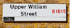
| Icon | Postcodes for Upper William Street | |
| Walking Distances | ||
| Distance Info | Green Circle = 10 Minutes Walk (800 metres) | |
About Upper William Street
Upper William Street is a street located in the city of Birmingham. It uses the postcode B1 2LL. The street has a length of approximately 50 metres.
Upper William Street is located within the Birmingham District (B) Council's jurisdiction. They provide various services, like refuse collection, and manage council tax collection. It's situated in the West Midlands region of the UK.
Upper William Street has been assigned the Unique Street Reference Number of 2702419 in the National Street Gazetteer.
Upper William Street is located within the county of West Midlands, situated in the West Midlands region of the UK. It's 102.28 miles North West from central London., 0.47 miles South West from Birmingham, 17.59 miles West from Coventry and 23.54 miles North East from Worcester.

Do you know why this road is called Upper William Street?
What's it like to live here?
Ask the community a question about Upper William Street.
Do you have any questions, memories to share or know any facts about Upper William Street? We'd love to know more.
Also on streetlist.co.uk, can you help?
Eldroth Road
15th April 2024
I wondered if anyone has any old pictures of Wenning Bank House in the 1940’s and also Lane Side before of the same era .. we visited today with my Mum in law as she used to live at both these properties. Also any photos of the schools around that time .. thank you.
Can You Help?Napps Way
15th April 2024
Why is the road called Napps Way (belonging to Napp, but minus an
apostrophe as is usual with such nomenclature)? Moreover, who or
what is, or was, “Napp” in the respective, possessive case?
Several years ago, I met an elderly man (probably in his late-eighties)
who lives on Bentham Drive, Liverpool 16, and during a conversation
with him whilst in a Northwest Passenger Transport Ambulance on the
way to the former RLUH (Royal Liverpool University Hospital), he told
me that he could remember (when he was a boy, living in Childwall,
Liverpool 16) that, “Where Napps Way is now, during WW2, there was
a two-man gun emplacement on the, then, open land to protect the
railway line passing over Childwall Valley Road - next to the railway
bridge - when suddenly, as they were loading a live “shell” into the gun’s
breach, the aforementioned “shell” accidentally exploded in the gun’s
breach killing both of the two soldiers, that had been manning the gun,
instantly! (Very sad, of course, but could - perhaps - two ghosts relating
to those two, very unfortunately and prematurely-killed soldiers have
haunted that place of their deaths ever since - and have any residents
of Napps Way - formerly and in its latest incarnation - seen two, WW2
(uniformed) soldiers unexpectedly appear in or near their homes?)
Mauritius Road
15th April 2024
Why is Mauritius Road so called, since when and by whom? Does Greenwich have any particular links with Mauritius? Very interested to know. 🤞🏼
Can You Help?Estate Agents near Upper William Street
| Name | Address | Website |
|---|---|---|
| Tudors Estates | 6 Ridley Street, Birmingham, B1 1SA | Visit Website |
| Midland Heart Managing Agents for Cygnet | Bath Row, Birmingham, B15 1LZ | |
| Places | 5 BRINDLEY PLACE, BIRMINGHAM, B1 2JB | Visit Website |
We have found 1 postcode for Upper William Street
Location Details
| Upper William Street | |
|---|---|

| |
| Latitude | 52.475520 |
| Longitude | -1.910425 |
| OS Easting (X): | 406083 |
| OS Northing (Y): | 286443 |
| OS Grid Reference: | SP061864 |
Neighbourhood Policing |
| Police Force: West Midlands |
 View Neighbourhood Crime and Policing View Neighbourhood Crime and Policing |
| Find a Local Neighbourhood Watch Scheme |
Frequently asked Questions for Upper William Street
What Council (Local Authority) is Upper William Street in?
Upper William Street is located within the local authority area of Birmingham Council which is a Metropolitan District.
What Parish Council is Upper William Street in?
Upper William Street is in an unparished area.
What Electoral Ward is Upper William Street in?
Upper William Street is located within the ward of Ladywood.
What County is Upper William Street in?
Upper William Street is located within the ceremonial county of West Midlands.
What Constituency is Upper William Street in?
Upper William Street is located within the constituency of Birmingham &Ladywood.
What Part of the UK is Upper William Street in?
Upper William Street is located within the West Midlands (England) region of the United Kingdom.
What County Council area is Upper William Street in?
Upper William Street is located within the West Midlands Council area.
What Police Force area is Upper William Street in?
Upper William Street is located within the West Midlands Police area.
Roads that have a Junction with Upper William Street
| Street | Junction Type |
|---|---|
| Granville Street | junction |
Sunset and Sunrise times for Upper William Street , B1 2LL
| Sunrise | 05:49 |
|---|---|
| Sunset | 20:22 |
Latest Weather Conditions for Upper William Street, B1 2LL
| Observed at Weather Station: | Coleshill 23 April 2024 at 06:00 (9.32 miles away) |
|---|---|
| Current Weather: | Overcast |
| Temperature and Humidity: | 5.8°C (83.1%) |
| Wind Direction and Speed: | N (6 mph) |
Population Statistics
| ONS Area Code | E00046379 |
|---|---|
| ONS Area Name | Constrained Neighbourhoods |
| Average Age | 32.12 |
| Area Population | 1923.00 |
| Male Population | 1098.00 (57%) |
| Female Population | 825.00 (43%) |
| Benefit Claimants | 220 (11%) |
| LSOA Code: | E01009146 |
|---|---|
| LSOA Name: | Birmingham 136B |
| SOA Code: | 1a |
| SOA Name: | |
| MSOA Code: | E02006897 |
| MSOA Name: | Birmingham 136 |
Nearest Supermarkets
| Sainsburys Brindley Place Local |
|---|
| 10 Brindley Place, Birmingham, England, B1 2JB |
| 1216436132 |
| Distance: 0.12 Miles |
| Directions from Upper William Street to Sainsburys Brindley Place Local |
| Tesco Birmingham Mailbox Express |
|---|
| 150 Wharfside St, The Mailbox, Birmingham, B1 1XL |
| 0345 026 9115 |
| Distance: 0.2 Miles |
| Directions from Upper William Street to Tesco Birmingham Mailbox Express |
| Tesco Bath Row Birmingham Express |
|---|
| 165 Granville St, Birmingham, B1 1JW |
| 0345 675 7103 |
| Distance: 0.22 Miles |
| Directions from Upper William Street to Tesco Bath Row Birmingham Express |
| Sainsburys Birmingham Navigation Street Local |
|---|
| 89 Navigation Street, Birmingham, England, B5 4AX |
| 0121 632 6156 |
| Distance: 0.38 Miles |
| Directions from Upper William Street to Sainsburys Birmingham Navigation Street Local |
Telephone Information
| Area Code |
|---|
| Area Code: 0121 - Birmingham |
| Area Code: 01384 - Dudley |
| Area Code: 01922 - Walsall |
| Area Code: 01675 - Coleshill |
Broadband Information
| Speed | Average Speed | Median Speed | Maximum Speed | Next-generation access (NGA) | Number of Connections |
|---|---|---|---|---|---|
| Greater than 2 Mbps | 12.1 | 13.2 | 17.6 | N | 11 |
Local Government
| Local Council Details |
|---|
| Within the area of Birmingham |
| Visit the Council's Website |
| Council House, Victoria Square, Birmingham &B1 1BB |
| Send email |
| Telephone Number: 0121 303 1111 |
| Local Member of Parliament |
|---|
| Within the Westminster Parliamentary Constituency of Birmingham &Ladywood |
| The Member of Parliament is Shabana Mahmood |
| Details for the MP Shabana Mahmood on parliament.uk |
| Details for the MP Shabana Mahmood on theyworkforyou.com |
| In the 2019 General Election Shabana Mahmood won with a majority of 28,582 the result was Lab hold. The total electorate was 74,912 |
| Wards, Parish Councils and County Councils |
|---|
| Ward: Ladywood Ward |
| Ceremonial County: West Midlands |
Nearest Schools
England Primary Schools
St Anne's Catholic Primary School
Address: St Anne's Catholic Primary School, Lowe Street, Camp Hill, Birmingham, West Midlands, B12 0ER
Distance: 1.37 miles
Contact: 01216755037
Heath Mount Primary School
Address: Heath Mount Primary School, Knutsford Street, Balsall Heath, BIRMINGHAM, West Midlands, B12 9SR
Distance: 1.37 miles
Contact:
Chandos Primary School
Address: Chandos Primary School, Vaughton Street South, Highgate, Birmingham, West Midlands, B12 0YN
Distance: 0.92 miles
Contact:
St Catherine of Siena Catholic Primary School
Address: St Catherine of Siena Catholic Primary School, Great Colmore Street, Lee Bank, Birmingham, West Midlands, B15 2AY
Distance: 0.45 miles
Contact: 01216921051
St Thomas' Church of England VA Primary School
Address: St Thomas' Church of England VA Primary School, Great Colmore Street, Birmingham, West Midlands, B15 2AT
Distance: 0.42 miles
Contact:
Brookfields Primary School
Address: Brookfields Primary School, 2 Hingeston Street, Hockley, Birmingham, West Midlands, B18 6PU
Distance: 1.03 miles
Contact:
Nelson Junior and Infant School
Address: Nelson Junior and Infant School, King Edward's Road, Ladywood, Birmingham, West Midlands, B1 2PJ
Distance: 0.47 miles
Contact: 01214642201
The Oratory Roman Catholic Primary School
Address: The Oratory Roman Catholic Primary School, Oliver Road, Ladywood, Birmingham, West Midlands, B16 9ER
Distance: 0.81 miles
Contact: 01214540600
St Edmund's Catholic Primary School
Address: St Edmund's Catholic Primary School, Rosebery Street, Springhill, Birmingham, West Midlands, B18 7PA
Distance: 0.96 miles
Contact:
St Patrick and St Edmund's Catholic Primary School
Address: St Patrick and St Edmund's Catholic Primary School, Dudley Road, Birmingham, West Midlands, B18 7QW
Distance: 1.16 miles
Contact: 01212473947
Barford Primary School
Address: Barford Primary School, Barford Road, Ladywood, Birmingham, West Midlands, B16 0EF
Distance: 1.18 miles
Contact: 01214643765
Summerfield Primary School
Address: Summerfield Primary School, Cuthbert Road, Winson Green, Birmingham, West Midlands, B18 4AH
Distance: 1.56 miles
Contact: 01216752355
Cape Primary School
Address: Cape Primary School, Cape Hill, Smethwick, West Midlands, B66 4SH
Distance: 1.99 miles
Contact: 01215581667
George Dixon Primary School
Address: George Dixon Primary School, City Road, Edgbaston, Birmingham, West Midlands, B17 8LE
Distance: 1.95 miles
Contact: 01216752775
Chandos Primary School
Address: Chandos Primary School, Vaughton Street South, Highgate, Birmingham, West Midlands, B12 0YN
Distance: 0.92 miles
Contact: 01214643881
Percy Shurmer Academy
Address: Percy Shurmer Academy, Longmore Street, Balsall Heath, Birmingham, West Midlands, B12 9ED
Distance: 1.13 miles
Contact: 01214643431
Oasis Academy Woodview
Address: Oasis Academy Woodview, Woodview Drive, Edgbaston, Birmingham, West Midlands, B15 2HU
Distance: 0.61 miles
Contact: 01214404202
St John's & St Peter's CofE Academy
Address: St John's & St Peter's CofE Academy, St Vincent Street West, Ladywood, Birmingham, West Midlands, B16 8RN
Distance: 0.53 miles
Contact: 01216751398
St George's Church of England Primary School
Address: St George's Church of England Primary School, Beaufort Road, Edgbaston, Birmingham, West Midlands, B16 8HY
Distance: 0.77 miles
Contact: 01214642789
Oasis Academy Foundry
Address: Oasis Academy Foundry, Foundry Road, Birmingham, West Midlands, B18 4LP
Distance: 1.84 miles
Contact: 01212508850
City Road Primary School
Address: City Road Primary School, Cavendish Road, Rotton Park, Birmingham, West Midlands, B16 0HL
Distance: 1.54 miles
Contact:
England Secondary Schools
St Paul's School for Girls
Address: St Paul's School for Girls, Vernon Road, Edgbaston, Birmingham, West Midlands, B16 9SL
Distance: 1.29 miles
Contact: 01214540895
Ark St Alban's Academy
Address: Ark St Alban's Academy, Conybere Street, Birmingham, West Midlands, B12 0YH
Distance: 1.20 miles
Contact: 01214461300
Central Academy
Address: Central Academy, Newhall Street, Ladywood, Birmingham, West Midlands, B3 1SJ
Distance: 0.60 miles
Contact:
City Academy Birmingham
Address: City Academy Birmingham, 23 Langley Walk, Ladywood, Birmingham, West Midlands, B15 2EF
Distance: 0.30 miles
Contact:
Jewellery Quarter Academy
Address: Jewellery Quarter Academy, St George's Court, 1 Albion Street, Birmingham, West Midlands, B1 3AA
Distance: 0.62 miles
Contact: 01217297220
Harborne Academy
Address: Harborne Academy, Harborne Road, Edgbaston, Birmingham, West Midlands, B15 3JL
Distance: 1.50 miles
Contact: 01214642737
George Dixon Academy
Address: George Dixon Academy, Portland Road, Edgbaston, Birmingham, West Midlands, B16 9GD
Distance: 1.89 miles
Contact: 01215666565
England Higher Schools
Joseph Chamberlain Sixth Form College
Address: Joseph Chamberlain Sixth Form College, Belgrave Road, Highgate, Birmingham, West Midlands, B12 9FF
Distance: 1.38 miles
Contact: 01214462223
Nearest Hospitals
| Name | Address | Postcode | Distance | Map |
|---|
Nearest Dentists
Dentists near Upper William Street
| Name | Address | Postcode | Distance | Map |
|---|
Nearest GP Surgeries
Doctors near Upper William Street
MODALITY ATTWOOD GREEN
Address: ATTWOOD GREEN HEALTH CENTRE, 30 BATH ROW, BIRMINGHAM, WEST MIDLANDS, B15 1LZ
Distance: 0.22 miles
Contact: :
BATH ROW MEDICAL PRACTICE - COVID LOCAL VACCINATION SERVICE 2
Address: 30 BATH ROW, BIRMINGHAM, B15 1LZ
Distance: 0.22 miles
Contact: :
BATH ROW MEDICAL PRACTICE
Address: FIRST FLOOR, COLSTON SUITE, ATTWOOD GREENN HC, 30 BATH ROW, EDGBASTON, BIRMINGHAM, WEST MIDLANDS, B15 1LZ
Distance: 0.22 miles
Contact: tel: 0121 6224846
HALCYON MEDICAL
Address: UNIT 8, 24 MARTINEAU PLACE, BIRMINGHAM, B2 4UH
Distance: 0.71 miles
Contact: tel: 01212 039999
HOCKLEY MEDICAL PRACTICE
Address: 60 LION COURT, CARVER STREET, BIRMINGHAM, WEST MIDLANDS, B1 3AL
Distance: 0.75 miles
Contact: tel: 0121 5541757
BROADWAY HEALTH CENTRE
Address: COPE STREET, BIRMINGHAM, WEST MIDLANDS, B18 7BA
Distance: 0.76 miles
Contact: tel: 0121 2506105
Nearest Dispensing Chemists
Pharmacies near Upper William Street
| Name | Address | Postcode | Telephone | Map | Distance in Km |
|---|
Nearest Opticians
Opticians near Upper William Street
EYE Q OPTICIANS
Address: 5 THE WATERS EDGE, BRIDLEYPLACE, BIRMINGHAM, WEST MIDLANDS, B1 2HL
Distance: 0.20 miles
Contact: :
SCRIVENS OPTICIANS (EDGBASTON)
Address: SCRIVENS HOUSE, 60 ISLINGTON ROW MIDDLEWAY, EDGBASTON, BIRMINGHAM, WEST MIDLANDS, B15 1PH
Distance: 0.31 miles
Contact: :
EYE OPTICIANS - EDGBASTON
Address: ISLINGTON ROW, EDGBASTON, BIRMINGHAM, WEST MIDLANDS, B15 1LD
Distance: 0.37 miles
Contact: :
PICCADILLY OPTICIANS
Address: 13 PICCADILLY ARCADE, BIRMINGHAM, WEST MIDLANDS, B2 4HD
Distance: 0.50 miles
Contact: :
THE CONTACT LENS PRACTICE
Address: 5 LOWER TEMPLE STREET, BIRMINGHAM, WEST MIDLANDS, B2 4JD
Distance: 0.52 miles
Contact: :
MYOPTICS OPTICIANS
Address: 44 RYLAND ROAD, EDGBASTON, BIRMINGHAM, B15 2BN
Distance: 0.53 miles
Contact: :
Transport
Nearest Rail Stations
Five Ways Station is 0.32 miles away.
Address: Five Ways station, Islington Row, Edgbaston, West Midlands, B15 1SF
Five Ways is situated on the Bristol to Brimingham Line.
Five Ways Station is staffed on a part time basis.
Directions from Upper William Street to Five Ways Rail Station
Birmingham New Street Station is 0.54 miles away.
Address: Birmingham New Street station, Station Street, Birmingham, West Midlands, B2 4QA
Birmingham New Street is situated on the Chiltern Main Line|Birmingham to Peterborough Line|Bristol to Brimingham Line|Chase Line|Rugby�Birmingham�Stafford line|West Coast Main Line.
Birmingham New Street Station is staffed on a full time basis.
Directions from Upper William Street to Birmingham New Street Rail Station