Map of Boundary Place
| Street Crime (updated 06/04/2024) | ||
|---|---|---|
| Location Note | Central Point of Street - Not Actual Location | |
| MSOA Info | For MSOA E02001862 (Statistical Neighbourhood) | |
| Click Hint | Click on a Circle for a detailed breakdown below map. | |
| Crime Levels |
Green = Very Low Yellow = Low Orange = High Red = Very High |
|
| Postcodes | ||
| Icon | Postcodes for Boundary Place | |
| Walking Distances | ||
| Distance Info | Green Circle = 10 Minutes Walk (800 metres) | |
About Boundary Place
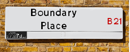
Boundary Place is a street located in the city of Birmingham. It uses the postcode B21 0AB. The street has a length of approximately 89 metres.
The street is not publicly maintained and is unadopted which means that a private body or even the householder could be responsible for the repair and upkeep of the highway. Check the status with your local council or enquire if the street is covered by a PUSWA (public utilities street works act).
Boundary Place is located within the Birmingham District (B) Council's jurisdiction. They provide various services, like refuse collection, and manage council tax collection. It's situated in the West Midlands region of the UK.
Boundary Place has been assigned the Unique Street Reference Number of 2708507 in the National Street Gazetteer.
Boundary Place is located within the county of West Midlands, situated in the West Midlands region of the UK. It's 105.32 miles North West from central London., 3.17 miles North West from Birmingham, 20.2 miles West from Coventry and 24.59 miles North East from Worcester.
Boundary Place is within the Post Town of BIRMINGHAM.

Do you know why this road is called Boundary Place?
What's it like to live here?
Ask the community a question about Boundary Place.
Do you have any questions, memories to share or know any facts about Boundary Place? We'd love to know more.
Also on streetlist.co.uk, can you help?
Eldroth Road
15th April 2024
I wondered if anyone has any old pictures of Wenning Bank House in the 1940’s and also Lane Side before of the same era .. we visited today with my Mum in law as she used to live at both these properties. Also any photos of the schools around that time .. thank you.
Can You Help?Napps Way
15th April 2024
Why is the road called Napps Way (belonging to Napp, but minus an
apostrophe as is usual with such nomenclature)? Moreover, who or
what is, or was, “Napp” in the respective, possessive case?
Several years ago, I met an elderly man (probably in his late-eighties)
who lives on Bentham Drive, Liverpool 16, and during a conversation
with him whilst in a Northwest Passenger Transport Ambulance on the
way to the former RLUH (Royal Liverpool University Hospital), he told
me that he could remember (when he was a boy, living in Childwall,
Liverpool 16) that, “Where Napps Way is now, during WW2, there was
a two-man gun emplacement on the, then, open land to protect the
railway line passing over Childwall Valley Road - next to the railway
bridge - when suddenly, as they were loading a live “shell” into the gun’s
breach, the aforementioned “shell” accidentally exploded in the gun’s
breach killing both of the two soldiers, that had been manning the gun,
instantly! (Very sad, of course, but could - perhaps - two ghosts relating
to those two, very unfortunately and prematurely-killed soldiers have
haunted that place of their deaths ever since - and have any residents
of Napps Way - formerly and in its latest incarnation - seen two, WW2
(uniformed) soldiers unexpectedly appear in or near their homes?)
Mauritius Road
15th April 2024
Why is Mauritius Road so called, since when and by whom? Does Greenwich have any particular links with Mauritius? Very interested to know. 🤞🏼
Can You Help?Estate Agents near Boundary Place
| Name | Address | Website |
|---|---|---|
| Plz Buy My Home | Willow Drive, Birmingham,B21 8JZ | Visit Website |
| Pam Estates | 187 Rookery Road, Handsworth, Birmingham,B21 9QZ | Visit Website |
| Angel Estates | 251-253 Rookery Road, Handsworth, Birmingham, B21 9PU | Visit Website |
We have found 1 postcode for Boundary Place
Location Details
| Boundary Place | |
|---|---|

| |
| Latitude | 52.509865 |
| Longitude | -1.957197 |
| OS Easting (X): | 402904 |
| OS Northing (Y): | 290260 |
| OS Grid Reference: | SP029903 |
Neighbourhood Policing |
| Police Force: West Midlands |
 View Neighbourhood Crime and Policing View Neighbourhood Crime and Policing |
| Find a Local Neighbourhood Watch Scheme |
Frequently asked Questions for Boundary Place
What Council (Local Authority) is Boundary Place in?
Boundary Place is located within the local authority area of Birmingham Council which is a Metropolitan District.
What Parish Council is Boundary Place in?
Boundary Place is in an unparished area.
What Electoral Ward is Boundary Place in?
Boundary Place is located within the ward of Handsworth Wood.
What County is Boundary Place in?
Boundary Place is located within the ceremonial county of West Midlands.
What Constituency is Boundary Place in?
Boundary Place is located within the constituency of Birmingham &Perry Barr.
What Part of the UK is Boundary Place in?
Boundary Place is located within the West Midlands (England) region of the United Kingdom.
What County Council area is Boundary Place in?
Boundary Place is located within the West Midlands Council area.
What Police Force area is Boundary Place in?
Boundary Place is located within the West Midlands Police area.
Roads that have a Junction with Boundary Place
| Street | Junction Type |
|---|---|
| Holyhead Road (A41) | junction |
Sunset and Sunrise times for Boundary Place , B21 0AB
| Sunrise | 05:47 |
|---|---|
| Sunset | 20:24 |
Latest Weather Conditions for Boundary Place, B21 0AB
| Observed at Weather Station: | Coleshill 23 April 2024 at 23:00 (11.47 miles away) |
|---|---|
| Current Weather: | Overcast |
| Temperature and Humidity: | 6.3°C (80.3%) |
| Wind Direction and Speed: | WNW (2 mph) |
Population Statistics
| ONS Area Code | E00046974 |
|---|---|
| ONS Area Name | Asian Terraces and Flats |
| Average Age | 33.97 |
| Area Population | 1401.00 |
| Male Population | 643.00 (46%) |
| Female Population | 758.00 (54%) |
| Benefit Claimants | 74 (5%) |
| LSOA Code: | E01009272 |
|---|---|
| LSOA Name: | Birmingham 036B |
| SOA Code: | 7b |
| SOA Name: | |
| MSOA Code: | E02001862 |
| MSOA Name: | Birmingham 036 |
Nearest Supermarkets
| Tesco Handsworth Oxhill Rd Express |
|---|
| Oxhill Rd, Handsworth, Birmingham, B21 9RR |
| 0345 671 9537 |
| Distance: 0.87 Miles |
| Directions from Boundary Place to Tesco Handsworth Oxhill Rd Express |
| Iceland Handsworth |
|---|
| 210/214 Soho Road, Handsworth, Birmingham, B21 9LR |
| 01215515881 |
| Distance: 1 Miles |
| Directions from Boundary Place to Iceland Handsworth |
| Asda Cape Hill |
|---|
| Off Windmill Lane - Smethwick, Birmingham, B66 3EN |
| 0121 555 1520 |
| Distance: 1.47 Miles |
| Directions from Boundary Place to Asda Cape Hill |
| Iceland Smethwick |
|---|
| Unit3 Windmill Shpng Prk, Smethwick, Birmingham, B66 3PR |
| 01215652477 |
| Distance: 1.51 Miles |
| Directions from Boundary Place to Iceland Smethwick |
Telephone Information
| Area Code |
|---|
| Area Code: 0121 - Birmingham |
| Area Code: 01384 - Dudley |
| Area Code: 01922 - Walsall |
| Area Code: 01902 - Wolverhampton |
Broadband Information
| Speed | Average Speed | Median Speed | Maximum Speed | Next-generation access (NGA) | Number of Connections |
|---|---|---|---|---|---|
| Less than 2 Mbps | 29.3 | 2.6 | >=30 | Y | 5 |
Local Government
| Local Council Details |
|---|
| Within the area of Birmingham |
| Visit the Council's Website |
| Council House, Victoria Square, Birmingham &B1 1BB |
| Send email |
| Telephone Number: 0121 303 1111 |
| Local Member of Parliament |
|---|
| Within the Westminster Parliamentary Constituency of Birmingham &Perry Barr |
| The Member of Parliament is Khalid Mahmood |
| Details for the MP Khalid Mahmood on parliament.uk |
| Details for the MP Khalid Mahmood on theyworkforyou.com |
| In the 2019 General Election Khalid Mahmood won with a majority of 15,317 the result was Lab hold. The total electorate was 72,006 |
| Wards, Parish Councils and County Councils |
|---|
| Ward: Handsworth Wood Ward |
| Parish: Unparished area |
| Ceremonial County: West Midlands |
Nearest Schools
England Primary Schools
St Teresa's Catholic Primary School
Address: St Teresa's Catholic Primary School, Butlers Road, Handsworth Wood, Birmingham, West Midlands, B20 2NY
Distance: 1.56 miles
Contact: 01215549581
Benson Community School
Address: Benson Community School, Benson Road, Hockley, Birmingham, West Midlands, B18 5TD
Distance: 1.44 miles
Contact: 01215544913
William Murdoch Primary School
Address: William Murdoch Primary School, Antrobus Road, Handsworth, Birmingham, West Midlands, B21 9NT
Distance: 0.92 miles
Contact: 01215540999
Wilkes Green Infant School (NC)
Address: Wilkes Green Infant School (NC), Antrobus Road, Handsworth, Birmingham, West Midlands, B21 9NT
Distance: 0.92 miles
Contact:
Grove School
Address: Grove School, Dawson Road, Handsworth, Birmingham, West Midlands, B21 9HB
Distance: 1.04 miles
Contact: 01214644669
St Augustine's Catholic Primary School
Address: St Augustine's Catholic Primary School, Avenue Road, Handsworth, Birmingham, West Midlands, B21 8ED
Distance: 0.62 miles
Contact: 01215545069
Summerfield Primary School
Address: Summerfield Primary School, Cuthbert Road, Winson Green, Birmingham, West Midlands, B18 4AH
Distance: 1.63 miles
Contact: 01216752355
Cape Primary School
Address: Cape Primary School, Cape Hill, Smethwick, West Midlands, B66 4SH
Distance: 1.56 miles
Contact: 01215581667
St James Church of England Primary School, Handsworth
Address: St James Church of England Primary School, Handsworth, Sandwell Road, Birmingham, West Midlands, B21 8NH
Distance: 0.34 miles
Contact: 01215235861
Victoria Park Primary
Address: Victoria Park Primary, Ballot Street, Smethwick, West Midlands, B66 3HH
Distance: 1.30 miles
Contact:
St Matthew's CofE Primary School
Address: St Matthew's CofE Primary School, Windmill Lane, Smethwick, West Midlands, B66 3LX
Distance: 1.31 miles
Contact: 01215581651
Crocketts Community Primary School
Address: Crocketts Community Primary School, Coopers Lane, Smethwick, West Midlands, B67 7DW
Distance: 1.37 miles
Contact: 01215581659
Devonshire Infant School
Address: Devonshire Infant School, Auckland Road, Smethwick, West Midlands, B67 7AT
Distance: 1.49 miles
Contact:
St Mary Magdalene CofE Voluntary Controlled Primary School
Address: St Mary Magdalene CofE Voluntary Controlled Primary School, Stanway Road, West Bromwich, West Midlands, B71 1RP
Distance: 2.03 miles
Contact: 01215882371
St Marys C of E Primary and Nursery, Academy, Handsworth
Address: St Marys C of E Primary and Nursery, Academy, Handsworth, Hamstead Road, Handsworth, Birmingham, West Midlands, B20 2RW
Distance: 1.59 miles
Contact: 01215543751
Grestone Academy
Address: Grestone Academy, Grestone Avenue, Handsworth Wood, Birmingham, West Midlands, B20 1ND
Distance: 1.14 miles
Contact: 01216756787
St Michael's CofE Primary Academy, Handsworth
Address: St Michael's CofE Primary Academy, Handsworth, Piers Road, Handsworth, Birmingham, West Midlands, B21 0UX
Distance: 1.49 miles
Contact: 01215547818
Nishkam Primary School Birmingham
Address: Nishkam Primary School Birmingham, 3-11 Soho Road, Handsworth, Birmingham, West Midlands, B21 9SN
Distance: 1.50 miles
Contact: 01216476890
Oasis Academy Foundry
Address: Oasis Academy Foundry, Foundry Road, Birmingham, West Midlands, B18 4LP
Distance: 1.26 miles
Contact: 01212508850
Rookery School
Address: Rookery School, Rookery Road, Handsworth, Birmingham, West Midlands, B21 9PY
Distance: 0.78 miles
Contact: 01214644221
Oasis Academy Boulton
Address: Oasis Academy Boulton, Boulton Road, Handsworth, Birmingham, West Midlands, B21 0RE
Distance: 1.03 miles
Contact: 01214644228
James Watt Primary School
Address: James Watt Primary School, Boulton Road, Soho, Birmingham, West Midlands, B21 0RE
Distance: 1.03 miles
Contact: 01214644736
Shireland Hall Primary Academy
Address: Shireland Hall Primary Academy, Montague Road, Smethwick, West Midlands, B66 4PW
Distance: 1.71 miles
Contact: 01215586331
Wattville Primary School
Address: Wattville Primary School, Wattville Road, Handsworth, Birmingham, West Midlands, B21 0DP
Distance: 0.35 miles
Contact: 01215542768
St Philip's Catholic Primary School
Address: St Philip's Catholic Primary School, Messenger Road, Smethwick, West Midlands, B66 3DU
Distance: 1.03 miles
Contact: 01215581643
Victoria Park Primary
Address: Victoria Park Primary, Ballot Street, Smethwick, West Midlands, B66 3HH
Distance: 1.30 miles
Contact: 01215588701
Galton Valley Primary School
Address: Galton Valley Primary School, Brasshouse Lane, Smethwick, West Midlands, B66 1BA
Distance: 0.83 miles
Contact: 01215581690
King George V Primary School
Address: King George V Primary School, Beeches Road, West Bromwich, West Midlands, B70 6JA
Distance: 1.37 miles
Contact: 01215530060
Devonshire Junior Academy
Address: Devonshire Junior Academy, Auckland Road, Smethwick, West Midlands, B67 7AT
Distance: 1.49 miles
Contact: 01215581654
Lyng Primary School
Address: Lyng Primary School, Horton Street, West Bromwich, West Midlands, B70 7SQ
Distance: 1.79 miles
Contact: 01215531480
Holy Trinity CofE Primary School
Address: Holy Trinity CofE Primary School, Trinity Road South, West Bromwich, West Midlands, B70 6NF
Distance: 1.34 miles
Contact: 01215531573
All Saints CofE Primary School
Address: All Saints CofE Primary School, Wilford Road, West Bromwich, West Midlands, B71 1QN
Distance: 2.07 miles
Contact: 01215670033
England Secondary Schools
Handsworth Grammar School
Address: Handsworth Grammar School, Grove Lane, Handsworth, Birmingham, West Midlands, B21 9ET
Distance: 1.06 miles
Contact:
St John Wall Catholic School
Address: St John Wall Catholic School, Oxhill Road, Handsworth, Birmingham, West Midlands, B21 8HH
Distance: 0.49 miles
Contact: 01215541825
Holly Lodge High School College of Science
Address: Holly Lodge High School College of Science, Holly Lane, Smethwick, West Midlands, B67 7JG
Distance: 1.48 miles
Contact: 01215580691
King Edward VI Handsworth Wood Girls' Academy
Address: King Edward VI Handsworth Wood Girls' Academy, Church Lane, Handsworth, Birmingham, West Midlands, B20 2HL
Distance: 1.22 miles
Contact: 01215548122
King Edward VI Handsworth School
Address: King Edward VI Handsworth School, Rose Hill Road, Birmingham, West Midlands, B21 9AR
Distance: 1.51 miles
Contact: 01215542342
King Edward VI Handsworth Grammar School for Boys
Address: King Edward VI Handsworth Grammar School for Boys, Grove Lane, Handsworth, Birmingham, West Midlands, B21 9ET
Distance: 1.06 miles
Contact: 01215542794
Holyhead School
Address: Holyhead School, Milestone Lane, Handsworth, Birmingham, West Midlands, B21 0HN
Distance: 0.51 miles
Contact: 01215231960
Sandwell Academy
Address: Sandwell Academy, Halfords Lane, West Bromwich, West Midlands, B71 4LG
Distance: 0.46 miles
Contact: 01215251700
Shireland Biomedical Utc
Address: Shireland Biomedical Utc, 350 High Street, West Bromwich, West Midlands, B70 8DJ
Distance: 1.89 miles
Contact: 01218281123
England Higher Schools
Sandwell College
Address: Sandwell College, 1 Spon Lane, West Bromwich, West Midlands, B70 6AW
Distance: 1.51 miles
Contact: 01216675000
Nearest Hospitals
| Ashcroft |
|---|
| Address: Ashcroft Complex Care Unit, The Moorings, Hockley, Birmingham, B18 5SD, |
| NHS Sector |
| Birmingham and Solihull Mental Health NHS Foundation Trust |
| Telephone: 0121 301 6140 |
| Visit Hospital Website |
| Distance: 2.64 (miles) |
| Directions from to Ashcroft |
| Mary Seacole House |
|---|
| Address: Lodge Road, Winson Green, Birmingham, B18 5SD, |
| NHS Sector |
| Birmingham and Solihull Mental Health NHS Foundation Trust |
| Telephone: 0121 301 6100 |
| Visit Hospital Website |
| Distance: 2.64 (miles) |
| Directions from to Mary Seacole House |
| Hallam Street Hospital |
|---|
| Address: Hallam Street, Hallam Street, West Bromwich, |
| NHS Sector |
| Black Country Partnership NHS Foundation Trust |
| Telephone: 0121 612 8628 |
| Visit Hospital Website |
| Distance: 2.81 (miles) |
| Directions from to Hallam Street Hospital |
Nearest Dentists
Dentists near Boundary Place
HANDSWORTH DENTAL CARE
Address: 119 HOLYHEAD ROAD, BIRMINGHAM, WEST MIDLANDS, B21 0HH
Distance: 0.36 miles
Contact: :
DENTAL SURGERY
Address: 276 ROOKERY ROAD, HANDSWORTH, BIRMINGHAM, WEST MIDLANDS, B21 9QG
Distance: 0.80 miles
Contact: :
DENTAL SURGERY
Address: 220 ROOKERY ROAD, HANDSWORTH, BIRMINGHAM, WEST MIDLANDS, B21 9QG
Distance: 0.80 miles
Contact: :
DENTAL SURGERY
Address: 271 SOHO ROAD, BIRMINGHAM, WEST MIDLANDS, B21 9SA
Distance: 0.97 miles
Contact: :
247-251
Address: SOHO ROAD, BIRMINGHAM, WEST MIDLANDS, B21 9RY
Distance: 1.05 miles
Contact: :
GROVE LANE DENTAL SURGERY
Address: 105 GROVE LANE, HANDSWORTH, BIRMINGHAM, WEST MIDLANDS, B21 9HF
Distance: 1.07 miles
Contact: :
Nearest GP Surgeries
Doctors near Boundary Place
HOLYHEAD PRIMARY HEALTH CARE CENTRE
Address: 1 ST JAMES'S ROAD, HANDSWORTH, BIRMINGHAM, B21 0HL
Distance: 0.47 miles
Contact: tel: 0121 5548516
MODALITY ST JAMES
Address: 85 CROCKETTS ROAD, BIRMINGHAM, WEST MIDLANDS, B21 0HR
Distance: 0.49 miles
Contact: :
HAWTHORNS MEDICAL CENTRE
Address: 94 LEWISHAM ROAD, WARLEY, SMETHWICK, WEST MIDLANDS, B66 2DD
Distance: 0.72 miles
Contact: tel: 0121 5555635
HANDSWORTH MEDICAL PRACT.
Address: 4 TRAFALGAR ROAD, HANDSWORTH, BIRMINGHAM, WEST MIDLANDS, B21 9NH
Distance: 0.73 miles
Contact: tel: 0121 5514220
BRASSHOUSE COMMUNITY CENTRE - COVID LOCAL VACCINATION SERVICE 2
Address: BRASSHOUSE LANE, SMETHWICK, B66 1BA
Distance: 0.83 miles
Contact: :
KIRPAL MEDICAL PRACTICE
Address: 251 SOHO ROAD, HANDSWORTH, BIRMINGHAM, WEST MIDLANDS, B21 9RY
Distance: 1.05 miles
Contact: tel: 0121 4654620
Nearest Dispensing Chemists
Pharmacies near Boundary Place
HANDSWORTH PHARMACY
Address: 87 HOLYHEAD ROAD, HANDSWORTH, BIRMINGHAM, B21 0HH
Distance: 0.36 miles
Contact: tel: 01215 541854
RK PHARMACY
Address: 90 LEWISHAM ROAD, WARLEY, SMETHWICK, WEST MIDLANDS, B66 2DD
Distance: 0.72 miles
Contact: tel: 0121 5556123
CLICK4PRESCRIPTIONS
Address: 2 TRAFALGAR ROAD, HANDSWORTH, BIRMINGHAM, B21 9NH
Distance: 0.73 miles
Contact: tel: 01215 543150
GILL PHARMACY
Address: 341 ROOKERY ROAD, HANDSWORTH, BIRMINGHAM, WEST MIDLANDS, B21 9PP
Distance: 0.80 miles
Contact: tel: 0121 5542487
DEU-CHEM LTD
Address: 269 SOHO ROAD, HANDSWORTH, BIRMINGHAM, WEST MIDLANDS, B21 9SA
Distance: 0.97 miles
Contact: tel: 0121 5234127
SOHO PHARMACY
Address: 249 SOHO ROAD, HANDSWORTH, BIRMINGHAM, B21 9RY
Distance: 1.05 miles
Contact: tel: 01215 231500
Nearest Opticians
Opticians near Boundary Place
VS5 LIMITED - HANDSWORTH
Address: 127 HOLYHEAD ROAD, HANDSWORTH, BIRMINGHAM, B21 0HH
Distance: 0.36 miles
Contact: :
CLEAR VISION OPTICAL LTD (HANDSWORTH)
Address: 81 ROOKERY ROAD, HANDSWORTH, BIRMINGHAM, WEST MIDLANDS, B21 9QX
Distance: 0.69 miles
Contact: :
HAWTHORNS EYE CARE
Address: 93 LEWISHAM ROAD, SMETHWICK, WEST MIDLANDS, B66 2DD
Distance: 0.72 miles
Contact: :
BANSAL OPTICIANS
Address: 381 SOHO ROAD, HANDSWORTH, BIRMINGHAM, WEST MIDLANDS, B21 9SF
Distance: 0.77 miles
Contact: :
EUROSPEX OPTICIANS (HANDSWORTH)
Address: 332 SOHO ROAD, HANDSWORTH, BIRMINGHAM, WEST MIDLANDS, B21 9NA
Distance: 0.81 miles
Contact: :
K G MILES
Address: 349A SOHO ROAD, HANDSWORTH, BIRMINGHAM, WEST MIDLANDS, B21 9SE
Distance: 0.83 miles
Contact: :
Transport
Nearest Rail Stations
The Hawthorns Station is 0.42 miles away.
Address: The Hawthorns station, Halfords Lane, West Bromwich, West Midlands, B66 2HB
The Hawthorns is situated on the Birmingham to Worcester via Kidderminster line.
The Hawthorns Station is staffed on a part time basis.
Directions from Boundary Place to The Hawthorns Rail Station
Smethwick Rolfe Street Station is 1.09 miles away.
Address: Smethwick Rolfe Street station, Rolfe Street, Smethwick, West Midlands, B66 2AF
Smethwick Rolfe Street is situated on the Rugby�Birmingham�Stafford line|West Coast Main Line.
Smethwick Rolfe Street Station is staffed on a part time basis.
Directions from Boundary Place to Smethwick Rolfe Street Rail Station