Map of Hollifast Lane
| Street Crime (updated 06/04/2024) | ||
|---|---|---|
| Location Note | Central Point of Street - Not Actual Location | |
| MSOA Info | For MSOA E02001851 (Statistical Neighbourhood) | |
| Click Hint | Click on a Circle for a detailed breakdown below map. | |
| Crime Levels |
Green = Very Low Yellow = Low Orange = High Red = Very High |
|
| Postcodes | ||
| Icon | Postcodes for Hollifast Lane | |
| Walking Distances | ||
| Distance Info | Green Circle = 10 Minutes Walk (800 metres) | |
About Hollifast Lane
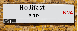
Hollifast Lane is a street located in the city of Birmingham. It uses the postcode B24 0JE. The street has a length of approximately 92 metres.
The street is not publicly maintained and is unadopted which means that a private body or even the householder could be responsible for the repair and upkeep of the highway. Check the status with your local council or enquire if the street is covered by a PUSWA (public utilities street works act).
Hollifast Lane is located within the Birmingham District (B) Council's jurisdiction. They provide various services, like refuse collection, and manage council tax collection. It's situated in the West Midlands region of the UK.
Hollifast Lane has been assigned the Unique Street Reference Number of 2753394 in the National Street Gazetteer.
Hollifast Lane is located within the county of West Midlands, situated in the West Midlands region of the UK. It's 101.98 miles North West from central London., 5.11 miles North East from Birmingham, 15.58 miles North West from Coventry and 29.02 miles North East from Worcester.
Hollifast Lane is within the Post Town of BIRMINGHAM.

Do you know why this road is called Hollifast Lane?
What's it like to live here?
Ask the community a question about Hollifast Lane.
Do you have any questions, memories to share or know any facts about Hollifast Lane? We'd love to know more.
Also on streetlist.co.uk, can you help?
Eldroth Road
15th April 2024
I wondered if anyone has any old pictures of Wenning Bank House in the 1940’s and also Lane Side before of the same era .. we visited today with my Mum in law as she used to live at both these properties. Also any photos of the schools around that time .. thank you.
Can You Help?Napps Way
15th April 2024
Why is the road called Napps Way (belonging to Napp, but minus an
apostrophe as is usual with such nomenclature)? Moreover, who or
what is, or was, “Napp” in the respective, possessive case?
Several years ago, I met an elderly man (probably in his late-eighties)
who lives on Bentham Drive, Liverpool 16, and during a conversation
with him whilst in a Northwest Passenger Transport Ambulance on the
way to the former RLUH (Royal Liverpool University Hospital), he told
me that he could remember (when he was a boy, living in Childwall,
Liverpool 16) that, “Where Napps Way is now, during WW2, there was
a two-man gun emplacement on the, then, open land to protect the
railway line passing over Childwall Valley Road - next to the railway
bridge - when suddenly, as they were loading a live “shell” into the gun’s
breach, the aforementioned “shell” accidentally exploded in the gun’s
breach killing both of the two soldiers, that had been manning the gun,
instantly! (Very sad, of course, but could - perhaps - two ghosts relating
to those two, very unfortunately and prematurely-killed soldiers have
haunted that place of their deaths ever since - and have any residents
of Napps Way - formerly and in its latest incarnation - seen two, WW2
(uniformed) soldiers unexpectedly appear in or near their homes?)
Mauritius Road
15th April 2024
Why is Mauritius Road so called, since when and by whom? Does Greenwich have any particular links with Mauritius? Very interested to know. 🤞🏼
Can You Help?House Sales in Hollifast Lane
| Year | High | Low | Average | Sales |
|---|---|---|---|---|
| 2014 | £147,995 | £147,995 | £147,995 | 2 |
| 2015 | £184,995 | £179,995 | £182,495 | 2 |
| 2017 | £179,000 | £179,000 | £179,000 | 1 |
| 2020 | £190,000 | £190,000 | £190,000 | 1 |
Contains HM Land Registry data © Crown copyright and database right 2024. This data is licensed under the Open Government Licence v3.0.
Estate Agents near Hollifast Lane
| Name | Address | Website |
|---|---|---|
| Acres | 417 Birmingham Road, Wylde Green, Sutton Coldfield, B72 1AU | Visit Website |
| Acres | 49 Walmley Road, Walmley, Sutton Coldfield, West Midlands, B76 1NP | Visit Website |
| Green & Company | 34 Walmley Road, Walmley Sutton Coldfield, B76 1QN | Visit Website |
We have found 1 postcode for Hollifast Lane
Location Details
| Hollifast Lane | |
|---|---|

| |
| Latitude | 52.532240 |
| Longitude | -1.816770 |
| OS Easting (X): | 412427 |
| OS Northing (Y): | 292764 |
| OS Grid Reference: | SP124928 |
Neighbourhood Policing |
| Police Force: West Midlands |
 View Neighbourhood Crime and Policing View Neighbourhood Crime and Policing |
| Find a Local Neighbourhood Watch Scheme |
Frequently asked Questions for Hollifast Lane
What Council (Local Authority) is Hollifast Lane in?
Hollifast Lane is located within the local authority area of Birmingham Council which is a Metropolitan District.
What Parish Council is Hollifast Lane in?
Hollifast Lane is in an unparished area.
What Electoral Ward is Hollifast Lane in?
Hollifast Lane is located within the ward of Erdington.
What County is Hollifast Lane in?
Hollifast Lane is located within the ceremonial county of West Midlands.
What Constituency is Hollifast Lane in?
Hollifast Lane is located within the constituency of Birmingham &Erdington.
What Part of the UK is Hollifast Lane in?
Hollifast Lane is located within the West Midlands (England) region of the United Kingdom.
What County Council area is Hollifast Lane in?
Hollifast Lane is located within the West Midlands Council area.
What Police Force area is Hollifast Lane in?
Hollifast Lane is located within the West Midlands Police area.
Roads that have a Junction with Hollifast Lane
| Street | Junction Type |
|---|---|
| Elphinstone End | junction |
| Chase Grove | junction |
Sunset and Sunrise times for Hollifast Lane , B24 0JE
| Sunrise | 05:46 |
|---|---|
| Sunset | 20:23 |
Latest Weather Conditions for Hollifast Lane, B24 0JE
| Observed at Weather Station: | Coleshill 23 April 2024 at 23:00 (6.47 miles away) |
|---|---|
| Current Weather: | Overcast |
| Temperature and Humidity: | 6.3°C (80.3%) |
| Wind Direction and Speed: | WNW (2 mph) |
Population Statistics
| ONS Area Code | E00045729 |
|---|---|
| ONS Area Name | Hard-Pressed Ethnic Mix |
| Average Age | 43.17 |
| Area Population | 1336.00 |
| Male Population | 670.00 (50%) |
| Female Population | 666.00 (50%) |
| Benefit Claimants | 31 (2%) |
| LSOA Code: | E01009005 |
|---|---|
| LSOA Name: | Birmingham 025A |
| SOA Code: | 3d |
| SOA Name: | |
| MSOA Code: | E02001851 |
| MSOA Name: | Birmingham 025 |
Nearest Supermarkets
| Tesco Erdington Esso Express |
|---|
| 125 Sutton Rd, Erdington, Birmingham, B23 5TW |
| 0345 677 9781 |
| Distance: 0.49 Miles |
| Directions from Hollifast Lane to Tesco Erdington Esso Express |
| Sainsburys Wylde Green Local |
|---|
| 346 Birmingham Road, Sutton Coldfield, England, B72 1YH |
| 1213824675 |
| Distance: 0.54 Miles |
| Directions from Hollifast Lane to Sainsburys Wylde Green Local |
| Iceland Erdington High St |
|---|
| 194/198 High Street, Erdington, Birmingham, B23 6SJ |
| 01213828515 |
| Distance: 1.19 Miles |
| Directions from Hollifast Lane to Iceland Erdington High St |
| Sainsburys Castle Vale |
|---|
| Castle Vale Retail Park, Chester Road, Castle Vale, Birmingham, England, B35 6HB |
| 0121 776 7425 |
| Distance: 1.33 Miles |
| Directions from Hollifast Lane to Sainsburys Castle Vale |
Telephone Information
| Area Code |
|---|
| Area Code: 0121 - Birmingham |
| Area Code: 01675 - Coleshill |
| Area Code: 01922 - Walsall |
| Area Code: 01827 - Tamworth |
Local Government
| Local Council Details |
|---|
| Within the area of Birmingham |
| Visit the Council's Website |
| Council House, Victoria Square, Birmingham &B1 1BB |
| Send email |
| Telephone Number: 0121 303 1111 |
| Local Member of Parliament |
|---|
| Within the Westminster Parliamentary Constituency of Birmingham &Erdington |
| The Member of Parliament is Jack Dromey |
| Details for the MP Jack Dromey on parliament.uk |
| Details for the MP Jack Dromey on theyworkforyou.com |
| In the 2019 General Election Jack Dromey won with a majority of 3,601 the result was Lab hold. The total electorate was 66,148 |
| Wards, Parish Councils and County Councils |
|---|
| Ward: Erdington Ward |
| Parish: Unparished area |
| Ceremonial County: West Midlands |
Nearest Schools
England Primary Schools
Walmley Infant School
Address: Walmley Infant School, Walmley Ash Road, Walmley, Sutton Coldfield, West Midlands, B76 1JB
Distance: 1.11 miles
Contact: 01213511355
Walmley Junior School
Address: Walmley Junior School, Walmley Ash Road, Sutton Coldfield, West Midlands, B76 1JB
Distance: 1.11 miles
Contact: 01213511346
Topcliffe Primary School
Address: Topcliffe Primary School, Hawkinge Drive, Castle Vale, Birmingham, West Midlands, B35 6BS
Distance: 1.25 miles
Contact:
Paget Primary School
Address: Paget Primary School, Paget Road, Pype Hayes, Birmingham, West Midlands, B24 0JP
Distance: 0.63 miles
Contact: 01214643902
Gunter Primary School
Address: Gunter Primary School, Gunter Road, Birmingham, West Midlands, B24 0RU
Distance: 0.86 miles
Contact: 01214642367
Penns Primary School
Address: Penns Primary School, Berwood Road, Sutton Coldfield, West Midlands, B72 1BS
Distance: 0.13 miles
Contact: 01214648014
St Peter and St Paul RC Junior and Infant School
Address: St Peter and St Paul RC Junior and Infant School, Kingsbury Road, Erdington, Birmingham, West Midlands, B24 9ND
Distance: 1.05 miles
Contact:
Saint Barnabas Church of England Primary School
Address: Saint Barnabas Church of England Primary School, Spring Lane, Erdington, Birmingham, West Midlands, B24 9BY
Distance: 1.03 miles
Contact:
Wylde Green Primary School
Address: Wylde Green Primary School, Green Lanes, Sutton Coldfield, West Midlands, B73 5JL
Distance: 0.70 miles
Contact: 01213732691
Birches Green Infant School
Address: Birches Green Infant School, Birches Green Road, Erdington, Birmingham, West Midlands, B24 9SR
Distance: 1.17 miles
Contact:
Birches Green Junior School
Address: Birches Green Junior School, Birches Green Road, Erdington, Birmingham, West Midlands, B24 9SR
Distance: 1.17 miles
Contact:
Abbey Catholic Primary School
Address: Abbey Catholic Primary School, Sutton Road, Erdington, Birmingham, West Midlands, B23 6QL
Distance: 0.83 miles
Contact:
Boldmere Infant School and Nursery
Address: Boldmere Infant School and Nursery, Cofield Road, Sutton Coldfield, West Midlands, B73 5SD
Distance: 1.39 miles
Contact: 01214642338
Boldmere Junior School
Address: Boldmere Junior School, Cofield Road, Boldmere, Sutton Coldfield, West Midlands, B73 5SD
Distance: 1.39 miles
Contact: 01214643656
Osborne Primary School
Address: Osborne Primary School, Osborne Road, Erdington, Birmingham, West Midlands, B23 6TY
Distance: 1.01 miles
Contact:
St Nicholas Catholic Primary School
Address: St Nicholas Catholic Primary School, Jockey Road, Sutton Coldfield, West Midlands, B73 5US
Distance: 1.58 miles
Contact:
Featherstone Primary School
Address: Featherstone Primary School, Glenville Drive, Birmingham, West Midlands, B23 6PR
Distance: 1.50 miles
Contact: 01216759740
The Deanery Church of England Primary School
Address: The Deanery Church of England Primary School, Fox Hollies Road, Walmley, Sutton Coldfield, West Midlands, B76 2RD
Distance: 1.20 miles
Contact: 01213516441
Chivenor Primary School
Address: Chivenor Primary School, Farnborough Road, Castle Vale, Birmingham, West Midlands, B35 7JA
Distance: 1.57 miles
Contact: 01216759833
Topcliffe Primary School
Address: Topcliffe Primary School, Hawkinge Drive, Castle Vale, Birmingham, West Midlands, B35 6BS
Distance: 1.25 miles
Contact: 01216756296
Yenton Primary School
Address: Yenton Primary School, Chester Road, Erdington, Birmingham, West Midlands, B24 0ED
Distance: 0.33 miles
Contact:
St Nicholas Catholic Primary School
Address: St Nicholas Catholic Primary School, Jockey Road, Sutton Coldfield, West Midlands, B73 5US
Distance: 1.58 miles
Contact: 01213552649
England Secondary Schools
St Edmund Campion Catholic School & Sixth Form Centre
Address: St Edmund Campion Catholic School & Sixth Form Centre, Sutton Road, Erdington, Birmingham, West Midlands, B23 5XA
Distance: 0.60 miles
Contact:
Nearest Hospitals
| Ardenleigh |
|---|
| Address: 385 Kingsbury Road, Erdington, Birmingham, B24 9SA, |
| NHS Sector |
| Birmingham and Solihull Mental Health NHS Foundation Trust |
| Telephone: 0121 301 4411 |
| Visit Hospital Website |
| Distance: 2.04 (miles) |
| Directions from to Ardenleigh |
| Endeavour Court |
|---|
| Address: 210 Reservoir Road, Erdington, Birmingham, B23 6DJ, |
| NHS Sector |
| Birmingham and Solihull Mental Health NHS Foundation Trust |
| Telephone: 0121 301 7350 |
| Visit Hospital Website |
| Distance: 2.89 (miles) |
| Directions from to Endeavour Court |
| Reservoir Court |
|---|
| Address: 220 Reservoir Road, Erdington, Birmingham, B23 6DJ, |
| NHS Sector |
| Birmingham and Solihull Mental Health NHS Foundation Trust |
| Telephone: 0121 301 7333 |
| Visit Hospital Website |
| Distance: 2.89 (miles) |
| Directions from to Reservoir Court |
Nearest Dentists
Dentists near Hollifast Lane
MIDLAND ORTHODONTISTS
Address: 7 PENNS LANE, WYLDE GREEN, SUTTON COLDFIELD, WEST MIDLANDS, B72 1AY
Distance: 0.41 miles
Contact: :
DENTAL SURGERY
Address: DENBIGH HOUSE, 117 SUTTON ROAD, BIRMINGHAM, WEST MIDLANDS, B23 5XB
Distance: 0.54 miles
Contact: :
WALMLEY DENTAL SURGERY
Address: 1-2 WALMLEY CHAMBERS, 3 WALMLEY CLOSE, SUTTON COLDFIELD, WEST MIDLANDS, B76 1NQ
Distance: 0.87 miles
Contact: :
DENTAL SURGERY
Address: 321 WYLDE GREEN ROAD, SUTTON COLDFIELD, WEST MIDLANDS, B76 1RF
Distance: 0.95 miles
Contact: :
DENTAL SURGERY
Address: 32 SUMMER ROAD, ERDINGTON, BIRMINGHAM, WEST MIDLANDS, B23 6XA
Distance: 1.32 miles
Contact: :
CASTLE DENTAL CARE
Address: TANGMERE SQUARE, CASTLE VALE, BIRMINGHAM, WEST MIDLANDS, B35 6DL
Distance: 1.36 miles
Contact: :
Nearest GP Surgeries
Doctors near Hollifast Lane
SUTTON ROAD SURGERY
Address: 122 SUTTON ROAD, ERDINGTON, BIRMINGHAM, WEST MIDLANDS, B23 5TJ
Distance: 0.52 miles
Contact: tel: 0121 3730056
THE HAWTHORNS SURGERY - COVID LOCAL VACCINATION SERVICE
Address: THE HAWTHORNS SURGERY, 331 BIRMINGHAM ROAD, SUTTON COLDFIELD, B72 1DL
Distance: 0.59 miles
Contact: :
THE HAWTHORNS SURGERY
Address: 331 BIRMINGHAM ROAD, SUTTON COLDFIELD, B72 1DL
Distance: 0.59 miles
Contact: tel: 0121 3732211
DR SN CLAY AND PARTNERS
Address: 17 HOLLY LANE, ERDINGTON, BIRMINGHAM, WEST MIDLANDS, B24 9JN
Distance: 0.69 miles
Contact: tel: 0121 3772133
POPLARS SURGERY - COVID LOCAL VACCINATION SERVICE 2
Address: HOLLY LANE, ERDINGTON, BIRMINGHAM, B24 9JN
Distance: 0.69 miles
Contact: :
MIDLANDS MEDICAL PARTNERSHIP
Address: EATON WOOD MEDICAL CENTRE, 1128 TYBURN ROAD, ERDINGTON, BIRMINGHAM, WEST MIDLANDS, B24 0SY
Distance: 0.87 miles
Contact: tel: 0121 3730959
Nearest Dispensing Chemists
Pharmacies near Hollifast Lane
WYLDE GREEN CHEMIST
Address: 441 BIRMINGHAM ROAD, WYLDE GREEN, SUTTON COLDFIELD, WEST MIDLANDS, B72 1AX
Distance: 0.48 miles
Contact: tel: 0121 3820460
HEALTHCARE PHARMACY & TRAVEL CLINIC
Address: 416 BIRMINGHAM ROAD, WYLDE GREEN, SUTTON COLDFIELD, B72 1YJ
Distance: 0.51 miles
Contact: tel: 01213 737992
BOOTS
Address: 352-354 BIRMINGHAM ROAD, WYLDE GREEN, SUTTON COLDFIELD, WEST MIDLANDS, B72 1YH
Distance: 0.52 miles
Contact: tel: 0121 3731355
JHOOTS PHARMACY
Address: POPLARS SURGERY, 17 HOLLY LANE, ERDINGTON, BIRMINGHAM, B24 9JN
Distance: 0.69 miles
Contact: tel: 01213 732796
PRINJA PHARMACY
Address: 1097 CHESTER ROAD, PYPE HAYES, BIRMINGHAM, WEST MIDLANDS, B24 0PP
Distance: 0.87 miles
Contact: tel: 01213 733321
WALMLEY PHARMACY
Address: 5 WALMLEY CLOSE, SUTTON COLDFIELD, B76 1NQ
Distance: 0.87 miles
Contact: tel: 0121 3132725
Nearest Opticians
Opticians near Hollifast Lane
A B OPTICS LTD (SUTTON COLDFIELD)
Address: 358 BIRMINGHAM ROAD, WYLDE GREEN, SUTTON COLDFIELD, WEST MIDLANDS, B72 1YH
Distance: 0.52 miles
Contact: :
A B OPTICS LTD (WYLDE GREEN)
Address: 360 BIRMINGHAM ROAD, WYLDE GREEN, SUTTON COLDFIELD, WEST MIDLANDS, B72 1YH
Distance: 0.52 miles
Contact: :
LAD & TURNER OPTICIANS
Address: 8 THE LANES SHOPPING CENTRE, BIRMINGHAM ROAD, SUTTON COLDFIELD, WEST MIDLANDS, B72 1YG
Distance: 0.57 miles
Contact: :
CHARLES MORRIS OPTICIANS
Address: 28 WALMLEY ROAD, SUTTON COLDFIELD, WEST MIDLANDS, B76 1QN
Distance: 0.92 miles
Contact: :
WARD LTD
Address: 202 SUTTON NEW ROAD, ERDINGTON, BIRMINGHAM, WEST MIDLANDS, B23 6QU
Distance: 0.96 miles
Contact: :
C. CACOULLIS OPTICIANS - SUTTON COLDFIELD
Address: 573 CHESTER ROAD, SUTTON COLDFIELD, WEST MIDLANDS, B73 5HU
Distance: 0.97 miles
Contact: :
Transport
Nearest Rail Stations
Chester Road Station is 0.70 miles away.
Address: Chester Road station, Station Approach, Chester Road, Sutton Coldfield, B73 5JS
Chester Road is situated on the Bristol to Brimingham Line.
Chester Road Station is staffed on a part time basis.
Erdington Station is 0.98 miles away.
Address: Erdington station, Station Road, Erdington, West Midlands, B23 6UB
Erdington is situated on the Bristol to Brimingham Line.
Erdington Station is staffed on a part time basis.