Map of Mill Pool Way
| Postcodes | ||
|---|---|---|
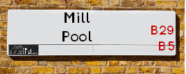
| Icon | Postcodes for Mill Pool Way | |
| Walking Distances | ||
| Distance Info | Green Circle = 10 Minutes Walk (800 metres) | |
About Mill Pool Way
Mill Pool Way is a street located in the city of Birmingham. It uses the postcode B5 7EG. The street has a length of approximately 451 metres.
Mill Pool Way is located within the Birmingham District (B) Council's jurisdiction. They provide various services, like refuse collection, and manage council tax collection. It's situated in the West Midlands region of the UK.
Mill Pool Way has been assigned the Unique Street Reference Number of 2753435 in the National Street Gazetteer.
Mill Pool Way is located within the county of West Midlands, situated in the West Midlands region of the UK. It's 101.31 miles North West from central London., 2.07 miles South from Birmingham, 17.41 miles West from Coventry and 22.01 miles North East from Worcester.

Do you know why this road is called Mill Pool Way?
What's it like to live here?
Ask the community a question about Mill Pool Way.
Do you have any questions, memories to share or know any facts about Mill Pool Way? We'd love to know more.
Also on streetlist.co.uk, can you help?
Eldroth Road
15th April 2024
I wondered if anyone has any old pictures of Wenning Bank House in the 1940’s and also Lane Side before of the same era .. we visited today with my Mum in law as she used to live at both these properties. Also any photos of the schools around that time .. thank you.
Can You Help?Napps Way
15th April 2024
Why is the road called Napps Way (belonging to Napp, but minus an
apostrophe as is usual with such nomenclature)? Moreover, who or
what is, or was, “Napp” in the respective, possessive case?
Several years ago, I met an elderly man (probably in his late-eighties)
who lives on Bentham Drive, Liverpool 16, and during a conversation
with him whilst in a Northwest Passenger Transport Ambulance on the
way to the former RLUH (Royal Liverpool University Hospital), he told
me that he could remember (when he was a boy, living in Childwall,
Liverpool 16) that, “Where Napps Way is now, during WW2, there was
a two-man gun emplacement on the, then, open land to protect the
railway line passing over Childwall Valley Road - next to the railway
bridge - when suddenly, as they were loading a live “shell” into the gun’s
breach, the aforementioned “shell” accidentally exploded in the gun’s
breach killing both of the two soldiers, that had been manning the gun,
instantly! (Very sad, of course, but could - perhaps - two ghosts relating
to those two, very unfortunately and prematurely-killed soldiers have
haunted that place of their deaths ever since - and have any residents
of Napps Way - formerly and in its latest incarnation - seen two, WW2
(uniformed) soldiers unexpectedly appear in or near their homes?)
Mauritius Road
15th April 2024
Why is Mauritius Road so called, since when and by whom? Does Greenwich have any particular links with Mauritius? Very interested to know. 🤞🏼
Can You Help?Estate Agents near Mill Pool Way
| Name | Address | Website |
|---|---|---|
| Optivo Homes Ltd | Sherlock Street, Birmingham, B5 7EG | Visit Website |
| JR Estates | 596-598 Pershore Road Selly Park Birmingham B29 7HQ | Visit Website |
| Metropolitan Group | 612 Pershore Road, Selly Park, Birmingham, B29 7HQ | Visit Website |
We have found 1 postcode for Mill Pool Way
Location Details
| Mill Pool Way | |
|---|---|

| |
| Latitude | 52.450498 |
| Longitude | -1.915090 |
| OS Easting (X): | 405769 |
| OS Northing (Y): | 283660 |
| OS Grid Reference: | SP058837 |
Ordnance Survey Maps for Mill Pool Way
If you purchase a map through the links below, we may earn an affiliate commission.
| Map Series | link | Ordnance Survey |
| Explorer 1:25,000 220 Birmingham, Walsall, Solihull and Redditch | Check Price on Amazon | |
| Landranger 1:50,000 139 Birmingham and Wolverhampton | Check Price on Amazon |
Neighbourhood Policing |
| Police Force: West Midlands |
 View Neighbourhood Crime and Policing View Neighbourhood Crime and Policing |
| Find a Local Neighbourhood Watch Scheme |
Frequently asked Questions for Mill Pool Way
What Council (Local Authority) is Mill Pool Way in?
Mill Pool Way is located within the local authority area of Birmingham Council which is a Metropolitan District.
What Parish Council is Mill Pool Way in?
Mill Pool Way is in an unparished area.
What Electoral Ward is Mill Pool Way in?
Mill Pool Way is located within the ward of Edgbaston.
What County is Mill Pool Way in?
Mill Pool Way is located within the ceremonial county of West Midlands.
What Constituency is Mill Pool Way in?
Mill Pool Way is located within the constituency of Birmingham &Edgbaston.
What Part of the UK is Mill Pool Way in?
Mill Pool Way is located within the West Midlands (England) region of the United Kingdom.
What County Council area is Mill Pool Way in?
Mill Pool Way is located within the West Midlands Council area.
What Police Force area is Mill Pool Way in?
Mill Pool Way is located within the West Midlands Police area.
Roads that have a Junction with Mill Pool Way
| Street | Junction Type |
|---|---|
| Pebble Mill Road (A4029) | junction |
| Bristol Road (A38) | junction |
Sunset and Sunrise times for Mill Pool Way , B5 7EG
| Sunrise | 05:45 |
|---|---|
| Sunset | 20:25 |
Latest Weather Conditions for Mill Pool Way, B5 7EG
| Observed at Weather Station: | Coleshill 25 April 2024 at 07:00 (9.73 miles away) |
|---|---|
| Current Weather: | Cloudy |
| Temperature and Humidity: | 6.3°C (75.0%) |
| Wind Direction and Speed: | SSW (5 mph) |
Population Statistics
| ONS Area Code | E00045648 |
|---|---|
| ONS Area Name | Students and Professionals |
| LSOA Code: | E01033631 |
|---|---|
| LSOA Name: | Birmingham 079F |
| SOA Code: | 1a |
| SOA Name: | |
| MSOA Code: | E02001905 |
| MSOA Name: | Birmingham 079 |
Nearest Supermarkets
| Tesco Selly Oak Bristol Rd Esso Express |
|---|
| 479 Bristol Rd, Bournbrook, B29 6BA |
| 0345 675 7156 |
| Distance: 0.71 Miles |
| Directions from Mill Pool Way to Tesco Selly Oak Bristol Rd Esso Express |
| Sainsburys Selly Oak Bristol Road Local |
|---|
| 535 Bristol Road, Selly Oak, England, B29 6BD |
| 1214712485 |
| Distance: 0.77 Miles |
| Directions from Mill Pool Way to Sainsburys Selly Oak Bristol Road Local |
| Tesco Birmingham Bristol Rd Express |
|---|
| 581 Bristol Rd, Kingston Park, Birmingham, B29 6BE |
| 0345 671 9572 |
| Distance: 0.88 Miles |
| Directions from Mill Pool Way to Tesco Birmingham Bristol Rd Express |
| Sainsburys Selly Oak Boulevard |
|---|
| 19 Selly Oak Shopping Park, Aston Webb Boulevard, Birmingham, England, B29 6SJ |
| 0121 623 7040 |
| Distance: 1.13 Miles |
| Directions from Mill Pool Way to Sainsburys Selly Oak Boulevard |
Telephone Information
| Area Code |
|---|
| Area Code: 0121 - Birmingham |
| Area Code: 01384 - Dudley |
Local Government
| Local Council Details |
|---|
| Within the area of Birmingham |
| Visit the Council's Website |
| Council House, Victoria Square, Birmingham &B1 1BB |
| Send email |
| Telephone Number: 0121 303 1111 |
| Local Member of Parliament |
|---|
| Within the Westminster Parliamentary Constituency of Birmingham &Edgbaston |
| The Member of Parliament is Preet Kaur Gill |
| Details for the MP Preet Kaur Gill on parliament.uk |
| Details for the MP Preet Kaur Gill on theyworkforyou.com |
| In the 2019 General Election Preet Kaur Gill won with a majority of 5,614 the result was Lab hold. The total electorate was 68,828 |
| Wards, Parish Councils and County Councils |
|---|
| Ward: Edgbaston Ward |
| Ceremonial County: West Midlands |
Nearest Schools
England Primary Schools
King David Primary School
Address: King David Primary School, Alcester Road, Moseley, Birmingham, West Midlands, B13 8EY
Distance: 1.14 miles
Contact: 01214493364
Park Hill Primary School
Address: Park Hill Primary School, Alcester Road, Birmingham, West Midlands, B13 8BB
Distance: 1.16 miles
Contact: 01214493004
Heath Mount Primary School
Address: Heath Mount Primary School, Knutsford Street, Balsall Heath, BIRMINGHAM, West Midlands, B12 9SR
Distance: 1.26 miles
Contact:
Chandos Primary School
Address: Chandos Primary School, Vaughton Street South, Highgate, Birmingham, West Midlands, B12 0YN
Distance: 1.54 miles
Contact:
St Edward's Catholic Primary School
Address: St Edward's Catholic Primary School, Greenland Road, Selly Park, Birmingham, West Midlands, B29 7PN
Distance: 0.81 miles
Contact: 01214641730
St Catherine of Siena Catholic Primary School
Address: St Catherine of Siena Catholic Primary School, Great Colmore Street, Lee Bank, Birmingham, West Midlands, B15 2AY
Distance: 1.55 miles
Contact: 01216921051
Raddlebarn Primary School
Address: Raddlebarn Primary School, Gristhorpe Road, Selly Oak, Birmingham, West Midlands, B29 7TD
Distance: 1.07 miles
Contact: 01214720062
Water Mill Primary School
Address: Water Mill Primary School, Water Mill Close, Selly Oak, Birmingham, West Midlands, B29 6TS
Distance: 1.43 miles
Contact: 01214647769
St Mary's Church of England Primary School
Address: St Mary's Church of England Primary School, Lodge Hill Road, Selly Oak, Birmingham, West Midlands, B29 6NU
Distance: 1.45 miles
Contact: 01216751729
Ark Tindal Primary Academy
Address: Ark Tindal Primary Academy, Tindal Street, Balsall Heath, Birmingham, West Midlands, B12 9QS
Distance: 1.14 miles
Contact: 01214643049
Chandos Primary School
Address: Chandos Primary School, Vaughton Street South, Highgate, Birmingham, West Midlands, B12 0YN
Distance: 1.54 miles
Contact: 01214643881
Percy Shurmer Academy
Address: Percy Shurmer Academy, Longmore Street, Balsall Heath, Birmingham, West Midlands, B12 9ED
Distance: 1.35 miles
Contact: 01214643431
Oasis Academy Woodview
Address: Oasis Academy Woodview, Woodview Drive, Edgbaston, Birmingham, West Midlands, B15 2HU
Distance: 1.21 miles
Contact: 01214404202
St George's Church of England Primary School
Address: St George's Church of England Primary School, Beaufort Road, Edgbaston, Birmingham, West Midlands, B16 8HY
Distance: 1.68 miles
Contact: 01214642789
Moor Green Primary Academy
Address: Moor Green Primary Academy, Moor Green Lane, Moseley, Birmingham, B13 8QP
Distance: 0.89 miles
Contact: 01214645662
Tiverton Academy
Address: Tiverton Academy, Tiverton Road, Selly Oak, Birmingham, West Midlands, B29 6BW
Distance: 0.88 miles
Contact: 01214643125
England Secondary Schools
Selly Park Girls' School
Address: Selly Park Girls' School, 5 Selly Park Road, Selly Park, Birmingham, West Midlands, B29 7PH
Distance: 0.88 miles
Contact: 01214721238
Nearest Hospitals
| Name | Address | Postcode | Distance | Map |
|---|
Nearest Dentists
Dentists near Mill Pool Way
| Name | Address | Postcode | Distance | Map |
|---|
Nearest GP Surgeries
Doctors near Mill Pool Way
SELLY PARK SURGERY
Address: 2 REAVIEW DRIVE, SELLY PARK, BIRMINGHAM, WEST MIDLANDS, B29 7NT
Distance: 0.45 miles
Contact: tel: 0121 4720187
BOURNBROOK VARSITY MEDICAL CENTRE
Address: 1A ALTON ROAD, SELLY OAK, BIRMINGHAM, WEST MIDLANDS, B29 7DU
Distance: 0.71 miles
Contact: tel: 0121 4720129
MOOR GREEN LANE MEDICAL CENTRE
Address: 339 MOOR GREEN LANE, BIRMINGHAM, WEST MIDLANDS, B13 8QS
Distance: 0.87 miles
Contact: tel: 0121 4110393
STRENSHAM ROAD SURGERY
Address: 4 STRENSHAM ROAD, BALSALL HEATH, BIRMINGHAM, WEST MIDLANDS, B12 9RR
Distance: 0.98 miles
Contact: tel: 0845 0730396
UNIVERSITY MEDICAL PRACTICE
Address: 5 PRITCHATTS ROAD, EDGBASTON, BIRMINGHAM, WEST MIDLANDS, B15 2QU
Distance: 1.03 miles
Contact: tel: 0121 6873055
MOSELEY MEDICAL CENTRE
Address: 21 SALISBURY ROAD, MOSELEY, BIRMINGHAM, WEST MIDLANDS, B13 8JS
Distance: 1.10 miles
Contact: tel: 0121 4490122
Nearest Dispensing Chemists
Pharmacies near Mill Pool Way
| Name | Address | Postcode | Telephone | Map | Distance in Km |
|---|
Nearest Opticians
Opticians near Mill Pool Way
SW OPTICS
Address: UNIVERSITY OF BIRMINGHAM, EDGBASTON, BIRMINGHAM, WEST MIDLANDS, B15 2TT
Distance: 0.57 miles
Contact: :
RJ EYE CENTRE
Address: 204 EDWARD ROAD, BALSALL HEATH, BIRMINGHAM, WEST MIDLANDS, B12 9LY
Distance: 0.95 miles
Contact: :
OPTIMAX LASER EYE CLINIC (BIRMINGHAM)
Address: 96 BRISTOL ROAD, BIRMINGHAM, WEST MIDLANDS, B5 7XJ
Distance: 0.97 miles
Contact: :
THE EYE COLLECTIVE - SELLY OAK
Address: 14 SELLY OAK SHOPPING PARK, ASTON WEBB BOULEVARD, SELLY OAK, BIRMINGHAM, B29 6SQ
Distance: 1.09 miles
Contact: :
SPECSAVERS (SELLY OAK)
Address: SAINSBURYS, 19 SELLY OAK SHOPPING PARK, CHAPEL LANE, BIRMINGHAM, B29 6SJ
Distance: 1.16 miles
Contact: :
BIRMINGHAM OPTICAL GROUP LTD
Address: 583 MOSELEY ROAD, BIRMINGHAM, WEST MIDLANDS, B12 9BL
Distance: 1.19 miles
Contact: :
Transport
Nearest Rail Stations
University (Birmingham) Station is 0.91 miles away.
Address: University station, University Road West, Edgbaston, West Midlands, B15 2FB
University (Birmingham) is situated on the Bristol to Brimingham Line.
University (Birmingham) Station is staffed on a part time basis.
Directions from Mill Pool Way to University (Birmingham) Rail Station
Selly Oak Station is 1.05 miles away.
Address: Selly Oak station, Bristol Road, Selly Oak, West Midlands, B29 6DW
Selly Oak is situated on the Bristol to Brimingham Line.
Selly Oak Station is staffed on a part time basis.