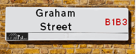
Map of Graham Street
| Postcodes | ||
|---|---|---|
| Icon | Postcodes for Graham Street | |
| Walking Distances | ||
| Distance Info | Green Circle = 10 Minutes Walk (800 metres) | |
About Graham Street
Graham Street is a street located in the city of Birmingham. The street has a length of approximately 210 metres.
Graham Street is located within the Birmingham District (B) Council's jurisdiction. They provide various services, like refuse collection, and manage council tax collection. It's situated in the West Midlands region of the UK.
Graham Street has been assigned the Unique Street Reference Number of 2701697 in the National Street Gazetteer.
Graham Street is located within the county of West Midlands, situated in the West Midlands region of the UK. It's 102.66 miles North West from central London., 0.51 miles North West from Birmingham, 17.74 miles West from Coventry and 24.07 miles North East from Worcester.

Do you know why this road is called Graham Street?
What's it like to live here?
Ask the community a question about Graham Street.
Do you have any questions, memories to share or know any facts about Graham Street? We'd love to know more.
Also on streetlist.co.uk, can you help?
Eldroth Road
15th April 2024
I wondered if anyone has any old pictures of Wenning Bank House in the 1940’s and also Lane Side before of the same era .. we visited today with my Mum in law as she used to live at both these properties. Also any photos of the schools around that time .. thank you.
Can You Help?Napps Way
15th April 2024
Why is the road called Napps Way (belonging to Napp, but minus an
apostrophe as is usual with such nomenclature)? Moreover, who or
what is, or was, “Napp” in the respective, possessive case?
Several years ago, I met an elderly man (probably in his late-eighties)
who lives on Bentham Drive, Liverpool 16, and during a conversation
with him whilst in a Northwest Passenger Transport Ambulance on the
way to the former RLUH (Royal Liverpool University Hospital), he told
me that he could remember (when he was a boy, living in Childwall,
Liverpool 16) that, “Where Napps Way is now, during WW2, there was
a two-man gun emplacement on the, then, open land to protect the
railway line passing over Childwall Valley Road - next to the railway
bridge - when suddenly, as they were loading a live “shell” into the gun’s
breach, the aforementioned “shell” accidentally exploded in the gun’s
breach killing both of the two soldiers, that had been manning the gun,
instantly! (Very sad, of course, but could - perhaps - two ghosts relating
to those two, very unfortunately and prematurely-killed soldiers have
haunted that place of their deaths ever since - and have any residents
of Napps Way - formerly and in its latest incarnation - seen two, WW2
(uniformed) soldiers unexpectedly appear in or near their homes?)
Mauritius Road
15th April 2024
Why is Mauritius Road so called, since when and by whom? Does Greenwich have any particular links with Mauritius? Very interested to know. 🤞🏼
Can You Help?Estate Agents near Graham Street
| Name | Address | Website |
|---|---|---|
| The Online Property Agency | Sovereign Court Graham Street, Birmingham, B1 3JR | |
| Maguire Jackson | 33 George Street, Birmingham,B3 1QA | Visit Website |
| Arkade Property | 41 Vittoria Street Hockley Birmingham B1 3ND | Visit Website |
Hotels near Graham Street
Budget Hotels near Graham Street
| Budget Hotel Name | Distance (miles) |
|---|---|
| 1: Name:Travelodge Birmingham Central Newhall Street Address:Charlotte St, Birmingham, B3 1PW Telephone:0871 984 6377 Visit Site |
0.14 |
| 2: Name:Premier Inn Birmingham City - Waterloo St Address:3-6 Waterloo Street, Telephone: Visit Site |
0.50 |
| 3: Name:Premier Inn Birmingham Broad Street - Canal Side Address:Bridge Street Telephone: Visit Site |
0.54 |
| 4: Name:Premier Inn Birmingham City Centre Bridge Street Address:20 Bridge Street Telephone: Visit Site |
0.55 |
| 5: Name:Travelodge Birmingham Central Address:230 Broad St, Birmingham, B15 1AY Telephone:0871 984 6064 Visit Site |
0.59 |
Location Details
| Graham Street | |
|---|---|

| |
| Latitude | 52.484476 |
| Longitude | -1.909835 |
| OS Easting (X): | 406122 |
| OS Northing (Y): | 287439 |
| OS Grid Reference: | SP061874 |
Ordnance Survey Maps for Graham Street
If you purchase a map through the links below, we may earn an affiliate commission.
| Map Series | link | Ordnance Survey |
| Explorer 1:25,000 220 Birmingham, Walsall, Solihull and Redditch | Check Price on Amazon | |
| Landranger 1:50,000 139 Birmingham and Wolverhampton | Check Price on Amazon |
Neighbourhood Policing |
| Police Force: West Midlands |
 View Neighbourhood Crime and Policing View Neighbourhood Crime and Policing |
| Find a Local Neighbourhood Watch Scheme |
Frequently asked Questions for Graham Street
What Council (Local Authority) is Graham Street in?
Graham Street is located within the local authority area of Birmingham Council which is a Metropolitan District.
What Parish Council is Graham Street in?
Graham Street is in an unparished area.
What Electoral Ward is Graham Street in?
Graham Street is located within the ward of Soho & Jewellery Quarter.
What County is Graham Street in?
Graham Street is located within the ceremonial county of West Midlands.
What Constituency is Graham Street in?
Graham Street is located within the constituency of Birmingham &Ladywood.
What Part of the UK is Graham Street in?
Graham Street is located within the West Midlands (England) region of the United Kingdom.
What County Council area is Graham Street in?
Graham Street is located within the West Midlands Council area.
What Police Force area is Graham Street in?
Graham Street is located within the West Midlands Police area.
Roads that have a Junction with Graham Street
| Street | Junction Type |
|---|---|
| Frederick Street | junction |
| Vittoria Street | junction |
| Newhall Street | pseudo node |
Sunset and Sunrise times for Graham Street
| Sunrise | 05:59 |
|---|---|
| Sunset | 20:13 |
Latest Weather Conditions for Graham Street
| Observed at Weather Station: | Coleshill 18 April 2024 at 02:00 (9.30 miles away) |
|---|---|
| Current Weather: | Partly cloudy (night) |
| Temperature and Humidity: | 2.2°C (92.3%) |
| Wind Direction and Speed: | N (5 mph) |
Population Statistics
| ONS Area Code | E00175780 & E00175655 |
|---|---|
| ONS Area Name | Multicultural Student Neighbourhoods |
| LSOA Code: | E01033623 &E01033565 |
|---|---|
| LSOA Name: | Birmingham 138C &Birmingham 137B |
| SOA Code: | 1a |
| SOA Name: | |
| MSOA Code: | E02006899 &E02006898 |
| MSOA Name: | Birmingham 138 &Birmingham 137 |
Nearest Supermarkets
| Tesco Birmingham Jewellery Quarter Express |
|---|
| 36 Frederick St, Birmingham, B1 3HN |
| 0345 674 6502 |
| Distance: 0.2 Miles |
| Directions from Graham Street to Tesco Birmingham Jewellery Quarter Express |
| Tesco Birmingham Hockley Express |
|---|
| 10 Hall St, Birmingham, B18 6BB |
| 0345 026 9822 |
| Distance: 0.32 Miles |
| Directions from Graham Street to Tesco Birmingham Hockley Express |
| Tesco Birmingham Springhill Superstore |
|---|
| Camden St, Hockley, B18 7BH |
| 0345 026 9623 |
| Distance: 0.43 Miles |
| Directions from Graham Street to Tesco Birmingham Springhill Superstore |
| Little Waitrose Birmingham, Colmore Row |
|---|
| 1 Colmore Row, Birmingham, Birmingham, B3 2BJ |
| 01212 003244 |
| Distance: 0.5 Miles |
| Directions from Graham Street to Little Waitrose Birmingham, Colmore Row |
Telephone Information
| Area Code |
|---|
| Area Code: 0121 - Birmingham |
| Area Code: 01384 - Dudley |
| Area Code: 01922 - Walsall |
| Area Code: 01675 - Coleshill |
Local Government
| Local Council Details |
|---|
| Within the area of Birmingham |
| Visit the Council's Website |
| Council House, Victoria Square, Birmingham &B1 1BB |
| Send email |
| Telephone Number: 0121 303 1111 |
| Local Member of Parliament |
|---|
| Within the Westminster Parliamentary Constituency of Birmingham &Ladywood |
| The Member of Parliament is Shabana Mahmood |
| Details for the MP Shabana Mahmood on parliament.uk |
| Details for the MP Shabana Mahmood on theyworkforyou.com |
| In the 2019 General Election Shabana Mahmood won with a majority of 28,582 the result was Lab hold. The total electorate was 74,912 |
| Wards, Parish Councils and County Councils |
|---|
| Ward: Soho & Jewellery Quarter Ward |
| Ceremonial County: West Midlands |
Nearest Schools
| Name | Address | Postcode | Telephone | Type | Distance (Km) |
|---|
Data accessed from gov.scot 08-08-2019
Nearest Hospitals
| Name | Address | Postcode | Distance | Map |
|---|
Nearest Dentists
Dentists near Graham Street
| Name | Address | Postcode | Distance | Map |
|---|
Nearest GP Surgeries
Doctors near Graham Street
HOCKLEY MEDICAL PRACTICE
Address: 60 LION COURT, CARVER STREET, BIRMINGHAM, WEST MIDLANDS, B1 3AL
Distance: 0.26 miles
Contact: tel: 0121 5541757
THE HEALTH XCHANGE
Address: WILLIAM BOOTH LANE, BIRMINGHAM, WEST MIDLANDS, B4 6HJ
Distance: 0.44 miles
Contact: tel: 0121 4653965
BROADWAY HEALTH CENTRE
Address: COPE STREET, BIRMINGHAM, WEST MIDLANDS, B18 7BA
Distance: 0.61 miles
Contact: tel: 0121 2506105
HALCYON MEDICAL
Address: UNIT 8, 24 MARTINEAU PLACE, BIRMINGHAM, B2 4UH
Distance: 0.65 miles
Contact: tel: 01212 039999
ASTON UNIVERSITY STUDENT HEALTH CENTRE
Address: VISION SCIENCES BUILDING, ASTON UNIVERSITY, THE ASTON TRIANGLE, BIRMINGHAM, WEST MIDLANDS, B4 7ET
Distance: 0.81 miles
Contact: :
MODALITY ATTWOOD GREEN
Address: ATTWOOD GREEN HEALTH CENTRE, 30 BATH ROW, BIRMINGHAM, WEST MIDLANDS, B15 1LZ
Distance: 0.82 miles
Contact: :
Nearest Dispensing Chemists
Pharmacies near Graham Street
| Name | Address | Postcode | Telephone | Map | Distance in Km |
|---|
Nearest Opticians
Opticians near Graham Street
EYE Q OPTICIANS
Address: 5 THE WATERS EDGE, BRIDLEYPLACE, BIRMINGHAM, WEST MIDLANDS, B1 2HL
Distance: 0.44 miles
Contact: :
PICCADILLY OPTICIANS
Address: 13 PICCADILLY ARCADE, BIRMINGHAM, WEST MIDLANDS, B2 4HD
Distance: 0.56 miles
Contact: :
OPTICAL EXPRESS (BIRMINGHAM)
Address: IMPERIAL HOUSE, 31 TEMPLE STREET, BIRMINGHAM, B2 5DB
Distance: 0.56 miles
Contact: :
THE CONTACT LENS PRACTICE
Address: 5 LOWER TEMPLE STREET, BIRMINGHAM, WEST MIDLANDS, B2 4JD
Distance: 0.59 miles
Contact: :
SCRIVENS OPTICIANS (CORPORATION ST, B'HAM)
Address: 41 CORPORATION STREET, BIRMINGHAM, B2 4UG
Distance: 0.62 miles
Contact: :
VISION EXPRESS (BIRMINGHAM)
Address: UNIT 5/6, THE PALLASADES, BIRMINGHAM, WEST MIDLANDS, B2 4XA
Distance: 0.64 miles
Contact: :
Transport
Nearest Rail Stations
Jewellery Quarter Station is 0.37 miles away.
Address: Jewellery Quarter station, Vyse Street, Birmingham, West Midlands, B18 6LE
Jewellery Quarter is situated on the Birmingham to Worcester via Kidderminster line.
Jewellery Quarter Station is staffed on a part time basis.
Directions from Graham Street to Jewellery Quarter Rail Station
Birmingham Snow Hill Station is 0.43 miles away.
Address: Birmingham Snow Hill station, Colmore Row, Birmingham, West Midlands, B3 2BJ
Birmingham Snow Hill is situated on the Chiltern Main Line|Birmingham to Worcester via Kidderminster line.
Birmingham Snow Hill Station is staffed on a part time basis.
Directions from Graham Street to Birmingham Snow Hill Rail Station