Map of Harborne Road
| Postcodes | ||
|---|---|---|
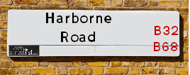
| Icon | Postcodes for Harborne Road | |
| Walking Distances | ||
| Distance Info | Green Circle = 10 Minutes Walk (800 metres) | |
About Harborne Road
Harborne Road is a street located in the town of Oldbury and in the town of Smethwick. The street has a length of approximately 1,190 metres.
Harborne Road is located within the Sandwell District (B) Council's jurisdiction. They provide various services, like refuse collection, and manage council tax collection. It's situated in the West Midlands region of the UK.
Harborne Road has been assigned the Unique Street Reference Number of 33622360 in the National Street Gazetteer.
Harborne Road is located within the county of West Midlands, situated in the West Midlands region of the UK. It's 104.5 miles North West from central London., 3.65 miles West from Birmingham, 20.62 miles West from Coventry and 21.57 miles North East from Worcester.

Do you know why this road is called Harborne Road?
What's it like to live here?
Ask the community a question about Harborne Road.
Do you have any questions, memories to share or know any facts about Harborne Road? We'd love to know more.
Also on streetlist.co.uk, can you help?
Eldroth Road
15th April 2024
I wondered if anyone has any old pictures of Wenning Bank House in the 1940’s and also Lane Side before of the same era .. we visited today with my Mum in law as she used to live at both these properties. Also any photos of the schools around that time .. thank you.
Can You Help?Napps Way
15th April 2024
Why is the road called Napps Way (belonging to Napp, but minus an
apostrophe as is usual with such nomenclature)? Moreover, who or
what is, or was, “Napp” in the respective, possessive case?
Several years ago, I met an elderly man (probably in his late-eighties)
who lives on Bentham Drive, Liverpool 16, and during a conversation
with him whilst in a Northwest Passenger Transport Ambulance on the
way to the former RLUH (Royal Liverpool University Hospital), he told
me that he could remember (when he was a boy, living in Childwall,
Liverpool 16) that, “Where Napps Way is now, during WW2, there was
a two-man gun emplacement on the, then, open land to protect the
railway line passing over Childwall Valley Road - next to the railway
bridge - when suddenly, as they were loading a live “shell” into the gun’s
breach, the aforementioned “shell” accidentally exploded in the gun’s
breach killing both of the two soldiers, that had been manning the gun,
instantly! (Very sad, of course, but could - perhaps - two ghosts relating
to those two, very unfortunately and prematurely-killed soldiers have
haunted that place of their deaths ever since - and have any residents
of Napps Way - formerly and in its latest incarnation - seen two, WW2
(uniformed) soldiers unexpectedly appear in or near their homes?)
Mauritius Road
15th April 2024
Why is Mauritius Road so called, since when and by whom? Does Greenwich have any particular links with Mauritius? Very interested to know. 🤞🏼
Can You Help?Estate Agents near Harborne Road
| Name | Address | Website |
|---|---|---|
| Legal Property Services | 371-373 Hagley Road West, Quinton, Birmingham, B32 2AL | |
| Dixons | 508 Hagley Road West, Oldbury, West Midlands, B68 0BZ | |
| Dixons Lettings | 508 Hagley Road West Quinton Oldbury West Midlands B68 0BZ | Visit Website |
We have found 8 postcodes for Harborne Road
Hotels near Harborne Road
Budget Hotels near Harborne Road
| Budget Hotel Name | Distance (miles) |
|---|---|
| 1: Name:Premier Inn Birmingham Central Hagley Road Address:176 - 184 Hagley Road Telephone: Visit Site |
1.93 |
| 2: Name:Holiday Inn Express Birmingham Oldbury M5, Jct.2 Address:Birchley Park, Oldbury Telephone: Visit Site |
2.24 |
| 3: Name:Travelodge Birmingham Central Broadway Plaza Address:220 Ladywood Middleway, Birmingham, B16 8LP Telephone:0871 984 6325 Visit Site |
2.75 |
| 4: Name:Travelodge Birmingham Oldbury Address:Wolverhampton Rd, Oldbury, B69 2BH Telephone:0871 984 6095 Visit Site |
2.77 |
| 5: Name:Travelodge Birmingham Halesowen Address:Whitehall Rd, Birmingham, B63 3HY Telephone:0871 984 6488 Visit Site |
2.81 |
Location Details
| Harborne Road | |
|---|---|

| |
| Latitude | 52.470004 |
| Longitude | -1.986437 |
| OS Easting (X): | 400921 |
| OS Northing (Y): | 285826 |
| OS Grid Reference: | SP009858 |
Ordnance Survey Maps for Harborne Road
If you purchase a map through the links below, we may earn an affiliate commission.
| Map Series | link | Ordnance Survey |
| Explorer 1:25,000 220 Birmingham, Walsall, Solihull and Redditch | Check Price on Amazon | |
| Landranger 1:50,000 139 Birmingham and Wolverhampton | Check Price on Amazon |
Neighbourhood Policing |
| Police Force: West Midlands |
 View Neighbourhood Crime and Policing View Neighbourhood Crime and Policing |
| Find a Local Neighbourhood Watch Scheme |
Frequently asked Questions for Harborne Road
What Council (Local Authority) is Harborne Road in?
Harborne Road is located within the local authority area of Sandwell Council which is a Metropolitan District.
What Parish Council is Harborne Road in?
Harborne Road is in an unparished area.
What Electoral Ward is Harborne Road in?
Harborne Road is located within the ward of Abbey &Old Warley.
What County is Harborne Road in?
Harborne Road is located within the ceremonial county of West Midlands.
What Constituency is Harborne Road in?
Harborne Road is located within the constituency of Warley.
What Part of the UK is Harborne Road in?
Harborne Road is located within the West Midlands (England) region of the United Kingdom.
What County Council area is Harborne Road in?
Harborne Road is located within the West Midlands Council area.
What Police Force area is Harborne Road in?
Harborne Road is located within the West Midlands Police area.
Roads that have a Junction with Harborne Road
| Street | Junction Type |
|---|---|
| Abbey Road | junction |
| Pottery Road | junction |
| Grove Road | junction |
| Lenwade Road | junction |
| Castle Road East | junction |
| Lightwoods Hill | junction |
| Warley Croft | junction |
| Monmouth Road | junction |
| Devon Road | junction |
| Hagley Road West (A456) | junction |
Sunset and Sunrise times for Harborne Road
| Sunrise | 06:00 |
|---|---|
| Sunset | 20:14 |
Latest Weather Conditions for Harborne Road
| Observed at Weather Station: | Coleshill 18 April 2024 at 15:00 (12.54 miles away) |
|---|---|
| Current Weather: | Overcast |
| Temperature and Humidity: | 11.6°C (53.4%) |
| Wind Direction and Speed: | WSW (9 mph) |
Population Statistics
| ONS Area Code | E00050220, E00050716, E00050207, E00050711, E00050705 & E00050206 |
|---|---|
| ONS Area Name | Multi-Ethnic Professionals with Families, Achieving Minorities, Multi-Ethnic Suburbia, Indian Tech Achievers & Private Renting Young Families |
| Average Age | 39.76, 42.04 & 42.24 |
| Area Population | 1349.00, 1519.00 & 1446.00 |
| Male Population | 653.00, 746.00 & 700.00 (49%) |
| Female Population | 696.00, 773.00 & 746.00 (51%) |
| Benefit Claimants | 18, 16 & 22 (1%) |
| LSOA Code: | E01009925, E01010027 &E01009923 |
|---|---|
| LSOA Name: | Sandwell 034D, Sandwell 036D &Sandwell 036A |
| SOA Code: | 3b |
| SOA Name: | |
| MSOA Code: | E02002076 &E02002078 |
| MSOA Name: | Sandwell 034 &Sandwell 036 |
Nearest Supermarkets
| Iceland Bearwood |
|---|
| 548/552 Bearwood Road, Smethwick, Warley West Midlands, B66 4BT |
| 01214203345 |
| Distance: 0.78 Miles |
| Directions from Harborne Road to Iceland Bearwood |
| Tesco Quinton Superstore |
|---|
| Ridgacre Rd, Quinton, Birmingham, B32 1EG |
| 0345 026 9520 |
| Distance: 0.91 Miles |
| Directions from Harborne Road to Tesco Quinton Superstore |
| Tesco Birmingham Bristnall Express |
|---|
| Bristnall Hall Rd, Oldbury, Birmingham, B68 9TX |
| 0345 674 6406 |
| Distance: 0.96 Miles |
| Directions from Harborne Road to Tesco Birmingham Bristnall Express |
| Asda Quinton |
|---|
| Hagley Road West, Quinton, Birmingham, B32 1AD |
| 0121 600 4620 |
| Distance: 1.21 Miles |
| Directions from Harborne Road to Asda Quinton |
Telephone Information
| Area Code |
|---|
| Area Code: 0121 - Birmingham |
| Area Code: 01384 - Dudley |
| Area Code: 01922 - Walsall |
Broadband Information
| Speed | Average Speed | Median Speed | Maximum Speed | Next-generation access (NGA) | Number of Connections |
|---|---|---|---|---|---|
| Less than 2 Mbps | 6.9 | 7.9 | 12.6 | N | 9 |
Local Government
| Local Council Details |
|---|
| Within the area of Sandwell |
| Visit the Council's Website |
| Sandwell Council House, PO Box 2374, Oldbury, West Midlands &B69 3DE |
| Send email |
| Telephone Number: 0845 358 2200 |
| Local Member of Parliament |
|---|
| Within the Westminster Parliamentary Constituency of Warley |
| The Member of Parliament is John Spellar |
| Details for the MP John Spellar on parliament.uk |
| Details for the MP John Spellar on theyworkforyou.com |
| In the 2019 General Election John Spellar won with a majority of 11,511 the result was Lab hold. The total electorate was 62,357 |
| Wards, Parish Councils and County Councils |
|---|
| Ward: Abbey &Old Warley Ward |
| Ceremonial County: West Midlands |
Nearest Schools
| Name | Address | Postcode | Telephone | Type | Distance (Km) |
|---|
Data accessed from gov.scot 08-08-2019
Nearest Hospitals
| Name | Address | Postcode | Distance | Map |
|---|
Nearest Dentists
Dentists near Harborne Road
| Name | Address | Postcode | Distance | Map |
|---|
Nearest GP Surgeries
Doctors near Harborne Road
HOLLY BUSH
Address: THE HOLLY BUSH MEDICAL CENTRE, 435 HAGLEY ROAD WEST, QUINTON, BIRMINGHAM, WEST MIDLANDS, B32 2AD
Distance: 0.39 miles
Contact: tel: 01214231205
THE DOVECOTE SURGERY
Address: 464 HAGLEY ROAD WEST, OLDBURY, B68 0DJ
Distance: 0.54 miles
Contact: :
NORMAN ROAD SURGERY
Address: 110 NORMAN ROAD, SMETHWICK, WEST MIDLANDS, B67 5PU
Distance: 0.63 miles
Contact: tel: 01214291373
RIDGACRE HOUSE SURGERY
Address: 83 RIDGACRE ROAD, QUINTON, BIRMINGHAM, WEST MIDLANDS, B32 2TJ
Distance: 0.65 miles
Contact: tel: 0121 4223111
BEARWOOD MEDICAL CENTRE
Address: 176 MILCOTE ROAD, WARLEY, SMETHWICK, WEST MIDLANDS, B67 5BP
Distance: 0.73 miles
Contact: tel: 0121 4291572
RIDGACRE ANNEX
Address: 127 WHITE ROAD, QUINTON, BIRMINGHAM, WEST MIDLANDS, B32 2SX
Distance: 0.73 miles
Contact: :
Nearest Dispensing Chemists
Pharmacies near Harborne Road
| Name | Address | Postcode | Telephone | Map | Distance in Km |
|---|
Nearest Opticians
Opticians near Harborne Road
SCRIVENS OPTICIANS (QUINTON)
Address: 496 HAGLEY ROAD WEST, QUINTON, WARLEY, OLDBURY, WEST MIDLANDS, B68 0DJ
Distance: 0.54 miles
Contact: :
QUINTON LANE CARE CENTRE
Address: 27 QUINTON LANE, BIRMINGHAM, WEST MIDLANDS, B32 2TR
Distance: 0.59 miles
Contact: :
EYEPOD OPTICIANS LIMITED
Address: 2 HAZELEY CLOSE, HARBORNE, BIRMINGHAM, WEST MIDLANDS, B17 8AY
Distance: 0.71 miles
Contact: :
OCEAN OPTICAL (BEARWOOD)
Address: 641 BEARWOOD ROAD, BEARWOOD, SMETHWICK, WEST MIDLANDS, B66 4BL
Distance: 0.79 miles
Contact: :
SPECSAVERS (BEARWOOD)
Address: 599 BEARWOOD ROAD, SMETHWICK, WEST MIDLANDS, B66 4BJ
Distance: 0.79 miles
Contact: :
SCRIVENS OPTICIANS (BEARWOOD)
Address: BEARWOOD SHOPPING CENTRE, 575 BEARWOOD ROAD, SMETHWICK, WEST MIDLANDS, B66 4BH
Distance: 0.80 miles
Contact: :
Transport
Nearest Rail Stations
Langley Green Station is 1.82 miles away.
Address: Langley Green station, Western Road, Langley Green, West Midlands, B69 4LZ
Langley Green is situated on the Birmingham to Worcester via Kidderminster line.
Langley Green Station is staffed on a part time basis.
Rowley Regis Station is 1.94 miles away.
Address: Rowley Regis station, Station Road, Rowley Regis, West Midlands, B65 0LJ
Rowley Regis is situated on the Birmingham to Worcester via Kidderminster line.
Rowley Regis Station is staffed on a part time basis.