Map of Branch Road
| Postcodes | ||
|---|---|---|
| Icon | Postcodes for Branch Road | |
| Walking Distances | ||
| Distance Info | Green Circle = 10 Minutes Walk (800 metres) | |
About Branch Road
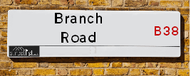
Branch Road is a street located in the city of Birmingham. It uses the postcode B38 9DP. The street has a length of approximately 157 metres.
Branch Road is located within the Birmingham District (B) Council's jurisdiction. They provide various services, like refuse collection, and manage council tax collection. It's situated in the West Midlands region of the UK.
Branch Road has been assigned the Unique Street Reference Number of 2700696 and 2700485 in the National Street Gazetteer.
Branch Road is located within the county of West Midlands, situated in the West Midlands region of the UK. It's 99.91 miles North West from central London., 5.9 miles South from Birmingham, 18.31 miles West from Coventry and 18.42 miles North East from Worcester.

Do you know why this road is called Branch Road?
What's it like to live here?
Ask the community a question about Branch Road.
Do you have any questions, memories to share or know any facts about Branch Road? We'd love to know more.
Also on streetlist.co.uk, can you help?
Eldroth Road
15th April 2024
I wondered if anyone has any old pictures of Wenning Bank House in the 1940’s and also Lane Side before of the same era .. we visited today with my Mum in law as she used to live at both these properties. Also any photos of the schools around that time .. thank you.
Can You Help?Napps Way
15th April 2024
Why is the road called Napps Way (belonging to Napp, but minus an
apostrophe as is usual with such nomenclature)? Moreover, who or
what is, or was, “Napp” in the respective, possessive case?
Several years ago, I met an elderly man (probably in his late-eighties)
who lives on Bentham Drive, Liverpool 16, and during a conversation
with him whilst in a Northwest Passenger Transport Ambulance on the
way to the former RLUH (Royal Liverpool University Hospital), he told
me that he could remember (when he was a boy, living in Childwall,
Liverpool 16) that, “Where Napps Way is now, during WW2, there was
a two-man gun emplacement on the, then, open land to protect the
railway line passing over Childwall Valley Road - next to the railway
bridge - when suddenly, as they were loading a live “shell” into the gun’s
breach, the aforementioned “shell” accidentally exploded in the gun’s
breach killing both of the two soldiers, that had been manning the gun,
instantly! (Very sad, of course, but could - perhaps - two ghosts relating
to those two, very unfortunately and prematurely-killed soldiers have
haunted that place of their deaths ever since - and have any residents
of Napps Way - formerly and in its latest incarnation - seen two, WW2
(uniformed) soldiers unexpectedly appear in or near their homes?)
Mauritius Road
15th April 2024
Why is Mauritius Road so called, since when and by whom? Does Greenwich have any particular links with Mauritius? Very interested to know. 🤞🏼
Can You Help?Estate Agents near Branch Road
| Name | Address | Website |
|---|---|---|
| Ashley Borne Sales and Lettings | 11A Alvechurch Road, West Heath, Birmingham, B31 3JW | Visit Website |
| Dixons | 72 The Green, Kings Norton, Birmingham, West Midlands, B38 8RU | |
| Evans Estate Agents | 1 The Green, Kings Norton, Birmingham, B38 8SD | Visit Website |
We have found 1 postcode for Branch Road
Hotels near Branch Road
Budget Hotels near Branch Road
| Budget Hotel Name | Distance (miles) |
|---|---|
| 1: Name:Premier Inn Birmingham South Longbridge Station Address:1 High Street Telephone: Visit Site |
1.80 |
| 2: Name:Travelodge Birmingham Maypole Address:Maypole Lane, Birmingham, B14 5JF Telephone:0871 559 1896 Visit Site |
2.41 |
| 3: Name:Premier Inn Birmingham South Rubery Address:Great Park Telephone: Visit Site |
2.81 |
| 4: Name:Travelodge Birmingham Frankley M5 Southbound Address:Moto Service Area, Illey Ln, M5 Motorway, Frankley, Birmingham, B32 4AR Telephone:0871 984 6067 Visit Site |
3.86 |
| 5: Name:Premier Inn Birmingham South Hall Green Address:Stratford Road Telephone: Visit Site |
4.75 |
Location Details
| Branch Road | |
|---|---|

| |
| Latitude | 52.397529 |
| Longitude | -1.941989 |
| OS Easting (X): | 403946 |
| OS Northing (Y): | 277767 |
| OS Grid Reference: | SP039778 |
Ordnance Survey Maps for Branch Road
If you purchase a map through the links below, we may earn an affiliate commission.
| Map Series | link | Ordnance Survey |
| Explorer 1:25,000 220 Birmingham, Walsall, Solihull and Redditch | Check Price on Amazon | |
| Landranger 1:50,000 139 Birmingham and Wolverhampton | Check Price on Amazon |
Neighbourhood Policing |
| Police Force: West Midlands |
 View Neighbourhood Crime and Policing View Neighbourhood Crime and Policing |
| Find a Local Neighbourhood Watch Scheme |
Frequently asked Questions for Branch Road
What Council (Local Authority) is Branch Road in?
Branch Road is located within the local authority area of Birmingham Council which is a Metropolitan District.
What Parish Council is Branch Road in?
Branch Road is in an unparished area.
What Electoral Ward is Branch Road in?
Branch Road is located within the ward of King's Norton North.
What County is Branch Road in?
Branch Road is located within the ceremonial county of West Midlands.
What Constituency is Branch Road in?
Branch Road is located within the constituency of Birmingham &Northfield.
What Part of the UK is Branch Road in?
Branch Road is located within the West Midlands (England) region of the United Kingdom.
What County Council area is Branch Road in?
Branch Road is located within the West Midlands Council area.
What Police Force area is Branch Road in?
Branch Road is located within the West Midlands Police area.
Roads that have a Junction with Branch Road
| Street | Junction Type |
|---|---|
| Green Lane | junction |
| Green Lane | junction |
| Longdales Road | junction |
| Redditch Road (A441) | junction |
Sunset and Sunrise times for Branch Road , B38 9DP
| Sunrise | 05:58 |
|---|---|
| Sunset | 20:15 |
Latest Weather Conditions for Branch Road, B38 9DP
| Observed at Weather Station: | Coleshill 19 April 2024 at 21:00 (12.08 miles away) |
|---|---|
| Current Weather: | Light rain |
| Temperature and Humidity: | 7.4°C (78.7%) |
| Wind Direction and Speed: | NE (11 mph) |
Population Statistics
| ONS Area Code | E00046205 |
|---|---|
| ONS Area Name | Private Renting Young Families |
| Average Age | 39.67 |
| Area Population | 1571.00 |
| Male Population | 748.00 (48%) |
| Female Population | 823.00 (52%) |
| Benefit Claimants | 53 (3%) |
| LSOA Code: | E01009114 |
|---|---|
| LSOA Name: | Birmingham 128D |
| SOA Code: | 4c |
| SOA Name: | |
| MSOA Code: | E02001954 |
| MSOA Name: | Birmingham 128 |
Nearest Supermarkets
| Tesco West Heath Birmingham Express |
|---|
| 6 Redhill Rd, Birmingham, B31 3LD |
| 0345 675 6907 |
| Distance: 0.81 Miles |
| Directions from Branch Road to Tesco West Heath Birmingham Express |
| Sainsburys Northfield |
|---|
| Frankley Beeches Road, Birmingham, England, B31 5AA |
| 0121 476 9133 |
| Distance: 1.72 Miles |
| Directions from Branch Road to Sainsburys Northfield |
| Iceland Northfield G |
|---|
| Unit 12 Grosvenor Centre, Northfield, Birmingham, B31 2JU |
| 01214780890 |
| Distance: 1.73 Miles |
| Directions from Branch Road to Iceland Northfield G |
| Sainsburys Longbridge |
|---|
| Longbridge Lane, Birmingham, England, B31 2TW |
| 0121 623 7030 |
| Distance: 1.75 Miles |
| Directions from Branch Road to Sainsburys Longbridge |
Telephone Information
| Area Code |
|---|
| Area Code: 01527 - Redditch |
| Area Code: 0121 - Birmingham |
| Area Code: 01564 - Lapworth |
Local Government
| Local Council Details |
|---|
| Within the area of Birmingham |
| Visit the Council's Website |
| Council House, Victoria Square, Birmingham &B1 1BB |
| Send email |
| Telephone Number: 0121 303 1111 |
| Local Member of Parliament |
|---|
| Within the Westminster Parliamentary Constituency of Birmingham &Northfield |
| The Member of Parliament is Gary Sambrook |
| Details for the MP Gary Sambrook on parliament.uk |
| Details for the MP Gary Sambrook on theyworkforyou.com |
| In the 2019 General Election Gary Sambrook won with a majority of 1,640 the result was Con gain from Lab. The total electorate was 73,694 |
| Wards, Parish Councils and County Councils |
|---|
| Ward: King's Norton North Ward |
| Ceremonial County: West Midlands |
Nearest Schools
| Name | Address | Postcode | Telephone | Type | Distance (Km) |
|---|
Data accessed from gov.scot 08-08-2019
Nearest Hospitals
| Name | Address | Postcode | Distance | Map |
|---|
Nearest Dentists
Dentists near Branch Road
| Name | Address | Postcode | Distance | Map |
|---|
Nearest GP Surgeries
Doctors near Branch Road
GRANGE HILL SURGERY
Address: 41 GRANGE HILL ROAD, KINGS NORTON, BIRMINGHAM, WEST MIDLANDS, B38 8RF
Distance: 0.23 miles
Contact: :
HAWKESLEY MEDICAL PRACTICE
Address: 375 SHANNON ROAD, KINGS NORTON, BIRMINGHAM, WEST MIDLANDS, B38 9TJ
Distance: 0.24 miles
Contact: tel: 0121 4864200
WEST HEATH PRIMARY C CTR
Address: WEST HEATH PRIMARY C.CTR, 481 REDNAL ROAD, KINGS NORTON, BIRMINGHAM, WEST MIDLANDS, B38 8AX
Distance: 0.50 miles
Contact: tel: 0121 4658188
KINGS NORTON SURGERY
Address: 66 REDDITCH ROAD, KINGS NORTON, BIRMINGHAM, WEST MIDLANDS, B38 8QS
Distance: 0.68 miles
Contact: tel: 0121 4582550
WEST HEATH SURGERY - COVID LOCAL VACCINATION SERVICE 2
Address: 196 WEST HEATH ROAD, NORTHFIELD, BIRMINGHAM, B31 3HB
Distance: 0.89 miles
Contact: :
WEST HEATH SURGERY
Address: 196 WEST HEATH ROAD, NORTHFIELD, BIRMINGHAM, WEST MIDLANDS, B31 3HB
Distance: 0.89 miles
Contact: tel: 0121 4761135
Nearest Dispensing Chemists
Pharmacies near Branch Road
| Name | Address | Postcode | Telephone | Map | Distance in Km |
|---|
Nearest Opticians
Opticians near Branch Road
THE EYE COLLECTIVE (WEST HEATH) LTD
Address: 3 ALVECHURCH ROAD, BIRMINGHAM, B31 3JW
Distance: 0.80 miles
Contact: :
J & D MASON OPTICIANS (KINGS NORTON)
Address: 2 THE GREEN, KINGS NORTON, BIRMINGHAM, WEST MIDLANDS, B38 8SD
Distance: 0.84 miles
Contact: tel: 0121 451 3485
SCRIVENS OPTICIANS (COTTERIDGE)
Address: 37 PERSHORE ROAD SOUTH, BIRMINGHAM, WEST MIDLANDS, B30 3EG
Distance: 1.29 miles
Contact: :
KINGS PHARMACY AND OPTICIANS
Address: 1-3 PERSHORE ROAD SOUTH, COTTERIDGE, BIRMINGHAM, WEST MIDLANDS, B30 3EE
Distance: 1.35 miles
Contact: :
EYECARE MOBILE OPTICIANS
Address: 16 WATFORD ROAD, BIRMINGHAM, WEST MIDLANDS, B30 1JA
Distance: 1.40 miles
Contact: :
EYEWORLD OPTICAL SERVICES
Address: 1863 PERSHORE ROAD, KINGS NORTON, BIRMINGHAM, WEST MIDLANDS, B30 3DJ
Distance: 1.42 miles
Contact: :
Transport
Nearest Rail Stations
Kings Norton Station is 1.16 miles away.
Address: Kings Norton station, Pershore Road South, Kings Norton, West Midlands, B30 3EG
Kings Norton is situated on the Bristol to Brimingham Line.
Kings Norton Station is staffed on a part time basis.
Northfield Station is 1.25 miles away.
Address: Northfield station, Quarry Lane, Northfield, West Midlands, B31 2PY
Northfield is situated on the Bristol to Brimingham Line.
Northfield Station is staffed on a part time basis.